
 |
 |
 |
 |
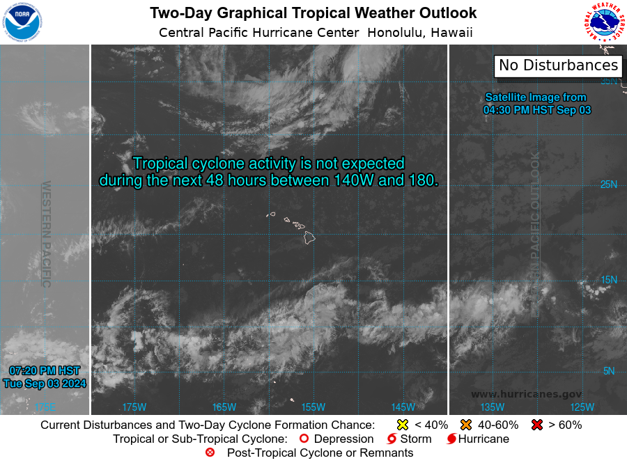
The images above shows any current global tropical cyclone activity for the Indian, Pacific, and Atlantic basins. Tropical activity for the Western Pacific (WPAC) and Indian Ocean basins appear under the responsibility of the US Navy JTWC, or "Joint Typhoon Warning Center" (from www.metoc.navy.mil/jtwc/jtwc.html). You can click on either links for the western Pacific (JTWC) to jump to the JTWC activity and forecast page. The central / eastern Pacific and Atlantic is under the responsibility of the National Hurricane Center (NHC). The NHC forecasts tropical activity for the Central Pacific (CPAC), Eastern Pacific (EPAC), and North Atlantic (NATL) basins, and is updated most frequently during the normal hurricane seasons for each (CPAC and EPAC is May 15 through November 30 and NATL is from June 1 through November 30). Click the images above to go to the NHC site for the 2-day (48 hour) outlooks on tropical activity for each of these three basins (NHC). For the NHC 5-day (120 hour) outlook, click on the link below the images for each of these three basins (NHC). This data has been provided by the National Hurricane Center (from www.nhc.noaa.gov). Please note that these images and links are directed to websites NOT maintained by this web site and are subject to availability!
 Worldwide Tropical Cyclone Satellite "Floater" Images
The link above is for satellite images of any tropical weather currently being monitored worldwide. It is an external link to the NOAA GOES-16 Satellite Services (available at www.star.nesdis.noaa.gov/GOES/floater_index.php) and may be subject to availability. Only active tropical cyclones will be shown on this special page.
The table below shows a list of storm names for the 2024 North Atlantic hurricane season. This list is maintained during the normal hurricane season (June 1st through November 30th) for the North Atlantic, or when conditions warrant. Please note the color-coded table / legend above the list of names that denotes the storm name (used or not), and whether a chase-log is available for that storm.
|
|
|
|
| 2024 NORTH ATLANTIC TROPICAL CYCLONE NAMES |
| Alberto | Gordon | Milton | Tony | |
| Beryl | Helene | Nadine | Valerie | |
| Chris | Isaac | Oscar | William | |
| Debby | Joyce | Patty | ||
| Ernesto | Kirk | Rafael | ||
| Francine | Leslie | Sara |
Note: The first named storm of the Atlantic hurricane season was Alberto which formed on June 19 and dissipated late the following day. The last storm, as of December 1, was Sara, which formed on November 11 and dissipated over Central America on the 17th.
| 2025 NORTH ATLANTIC TROPICAL CYCLONE NAMES |
| Andrea | Gabrielle | Melissa | Tanya | |
| Barry | Humberto | Nestor | Van | |
| Chantal | Imelda | Olga | Wendy | |
| Dexter | Jerry | Pablo | ||
| Erin | Karen | Rebekah | ||
| Fernand | Lorenzo | Sebastien |
Note: The names above are for the 2025 Atlantic hurricane season.
The North Atlantic Hurricane Season officially starts on June 1 and runs until November 30. Sometimes, tropical activity can (and has) formed outside these dates. This page is updated during this time frame (June 1 through November 30 of each year), which is the official North Atlantic Hurricane season, or in the cases where extra-seasonal activity warrants ... If you do not know much about tropical cyclones, be sure to read my tutorial on these interesting storms HERE!
Refer to the table below for any tropical activity in the North Atlantic basin for the current time. The table is updated in a timely fashion and shows current tropical cyclone activity as well as any tropical cyclone / hurricane chasing plans. This table will not be updated outside of the normal North Atlantic hurricane season (June through November) unless there is activity. Entries with a ![]() (fish icon) in the intercept-plans column means the storm is expected to remain over open water (such as when a system recurves) and a chase is not possible.
(fish icon) in the intercept-plans column means the storm is expected to remain over open water (such as when a system recurves) and a chase is not possible.
| STORM ACTIVITY AND INTERCEPT PLANS (UPDATED 12-01-2024) |
| STORM-NAME | LOCATION | INTENSITY | TREND | INTERCEPT-PLANS |
| No Tropical Systems At This Time - Season Ended Nov 30 | N/A | N/A | N/A | None |
The 2024 Hurricane season for the North Atlantic basin started on June 1, 2024 and continued until November 30, 2024. The 2024 North Atlantic hurricane season was an above-average season, with 18 named storms, 11 of which were hurricanes - With 5 of those reaching major hurricane strength. Always have a disaster or hurricane plan! Updates will be posted during any Atlantic tropical activity.
HTML File "tropics.htm" - Developed By Chris Collura

My Contact Information Is Given In The Graphic Above
To Prevent SPAM And Abuse - The EMAIL Banner Above Only Links To My Information Page
For My EMAIL - You Will Need To Take It Down And Enter It In Your EMAIL Package
To Return To The HOME Page Of This Site Click The "INDEX.HTM" Link Here!