VIDEO FOOTAGE OF HURRICANE DENNIS AVAILABLE

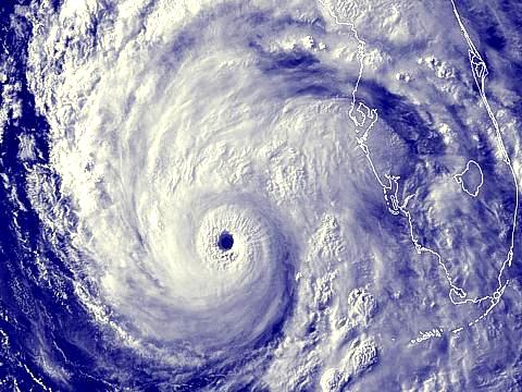
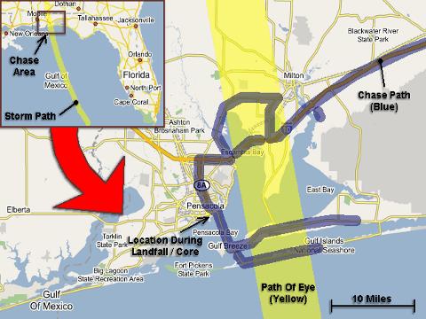
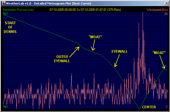
| This area shows pictures taken from the observations of category-three hurricane Dennis in Pensacola Florida. The storm, originally an unusually early tropical disturbance that moved off Africa, formed in the Caribbean Sea, devasted Cuba during its crossing of that island, then moved northwestwards into the Florida panhandle. At one point, the storm was an intense 150-MPH category-four storm prior to crossing Cuba, then weakened over Cuba before re-intensifying as it emerged back over the Gulf of Mexico to a 155-MPH category-four hurricane! This is extremely rare for early July. This hurricane became very small with a tight wind core but weakened to 115-MPH as it made landfall on Sunday, July 10, 2005 in Pensacola, Florida. The central pressure at time of hurricane core interception was measured at about 965 MB with an eye so small only a wind shift was observed. The entire chase was from July 9 through July 10, with about 1,100 total miles logged. Note - This page may take a while to load on some SLOWER connections! |
| CHASER NAME | HOME CITY | CALLSIGN | OCCUPATION |
| CHRIS COLLURA | MIRAMAR, FL | KG4PJN | COMPUTER ANALYST |
| JEFF GAMMONS | WPB, FL | KG4PGA | PHOTOGRAPHER |
| JIM EDDS | FLORIDA KEYS | KG4TBE | PHOTOGRAPHER |
Both STOCK Footage and DVD video of hurricane Dennis is available in the SPECIAL OFFERS section of this web site. You can visit that area by clicking either the image above or the link HERE!
|
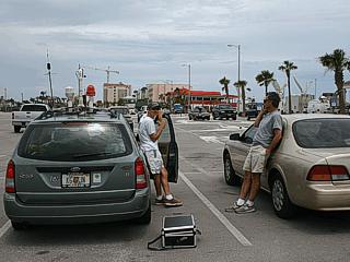
Here is a picture of my chase vehicle with the Weatherlab mobile weather station set up and chase partner Jeff Gammons (KG4PGA) along side Jim Edds (KG4TBE) and his vehicle to the right. This picture was taken at Pensacola Beach just after arriving in Pensacola on July 9. |

|
This is a picture of all the news media at Pensacola Beach on July 9. Many media and news firms have chase vehicles for intercepting hurricanes. This is basically a "hurricane chaser convergence". The larger satellite trucks and company vehicles often do not penetrate the hurricane's core due to liability. |
|
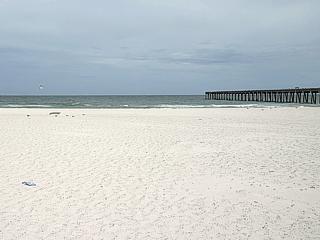
A tranquil Gulf of Mexico at Pensacola Beach denotes the "calm before the storm" less than 24 hours before hurricane Dennis makes landfall at this exact spot! Note the hurricane swell waves have not even arrived yet. |
|
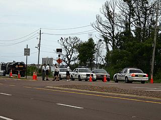
There were many police roadblocks and check points before and after hurricane Dennis all around Pensacola. On July 9, anyone without the proper authority to be on the road were turned away as a curfew went into effect. Law enforcement did a great job in keeping order before and after hurricane Dennis. |
|
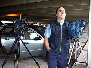
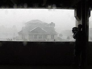
A parking garage in downtown Pensacola becomes the observation point for the core of hurricane Dennis on July 10. The cameras besides me are ready to document the hurricane and can shoot HD video. |
|
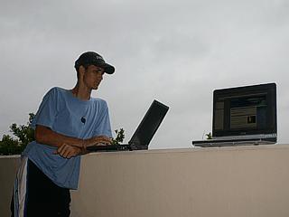
Jeff Gammons (KG4PGA) checks data on his laptop computer at the parking garage in downtown Pensacola. Both laptops are connected to the Internet and able to send and receive wireless data. |
|
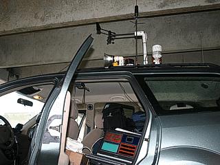
This picture shows my vehicle with the laptop computer receiving weather information from the roof mounted weather station (weatherlab). This became a crucial tool for plotting barometric pressure as the eye of the hurricane passes by. |

|
Jim Edds (KG4TBE) reporting a wind and pressure measurement to the National Hurricane Center from his laptop while the storm closes in on us in the parking garage in Pensacola. |
|
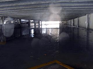
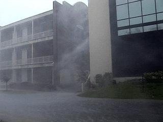
As the hurricane eyewall closes in, torrential rains driven by fierce winds cause fresh water flooding of the parking garage. |
|
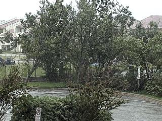
Some trees in front of the parking garage lean and fall over during the onset of the hurricane forced winds of Dennis. Note the rain soaked ground causing the tree's roots to become weakened. |
|
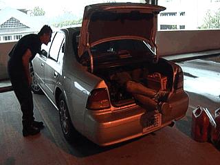
With no AAA and all of us on our own, Jim Edds (KG4TBE) accidentally locks his keys in his car. Breaking the lock on the trunk and entering the vehicle by cutting through the back seat was the only way to get back in. Note Jeff Gammons (KG4PGA) in the trunk with his legs sticking out as he was the only one small enough to reach the door lock through the hole cut in the rear seat. |
|
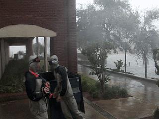
Here is a view from inside the parking garage as the eyewall of hurricane Dennis arrives at our location. Jeff Gammons (KG4PGA) is standing to the right with the camera. |
|
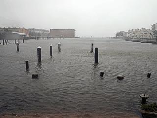
Storm surge causes a rapid increase in water level near the area of strongest winds in hurricane Dennis. This is an abandoned marina flooded by tides nearly 8 feet above normal. Note that only the tops of the poles can be seen. There are also submerged docks that normally are 3 feet above the normal water level. |
|
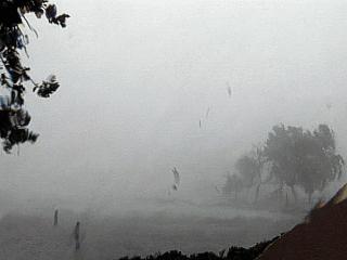
Horizontal violent rain and winds rapidly shift to a northwesterly direction in the left eyewall of hurricane Dennis. Note the rising water in the screet. |
|
The eyewall weather of hurricane Dennis taken from the abandoned marina. Note the airborne debris. Winds here gusted to 115-MPH for a short while. |
|
A group of hurricane chasers / photographers from Tennessee also documents hurricane Dennis at the abandoned marine. Note the wind and how the people have to lean into the wind. |
|
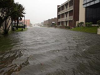
The street in front of the parking garage becomes flooded with storm surge water just after the height of the storm's strongest winds. |
|
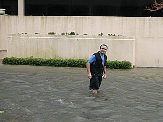
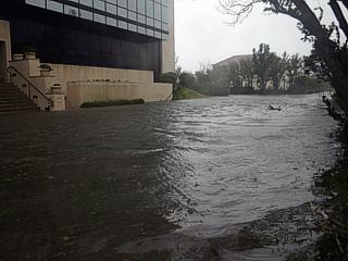
Here is a picture of myself wading across the flooded street between the UBS Paine Weber building and parking garage in downtown Pensacola. The water is beginning to recede here towards the end of the storm. |
|
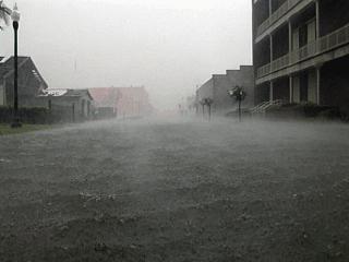
Here is a lower view of the severely flooded street in front of the parking garage being whipped by the strongest winds in hurricane Dennis. |
|
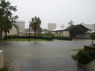
Here is another picture of the flooded street after the passage of the core winds of hurricane Dennis. |
|
Here is some more flooding and wind damage after 115-MPH winds and the passage of the hurricane core. Some damage to the right was from Ivan in 2004 but a lot is new. Note the receding surge waters on the east side of the parking garage. |
|
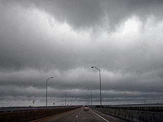
Impresive banding of the low level clouds can be seen looking northward on the south side of the hurricane roughly 50 to 75 miles south of the storm center. The clouds here were racing from left to right. |
|
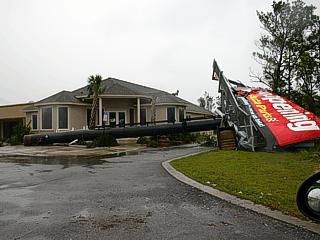
A large toppled billboard sign just missed a business between Nevarre Beach and Pensacola along highway 98. The owner of this store showed up and was so happy his building was not destroyed. |
|
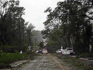
Here is a view up the scenic road in Pensacola, Florida. Many trees and powerlines were felled by hurricane Dennis. Jim Edds (KG4TBE) has family living in this area and this is the second time this has happened in only a year since hurricane Ivan in 2004. |
|
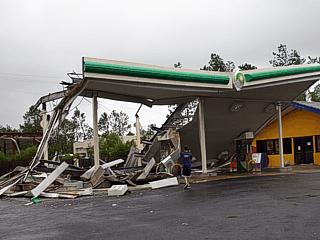
This is a picture of a destroyed gas station along highway 281 north of Interstate 10 and east of Escambia Bay. Gas stations are extremely dangerous during a hurricane. |
|
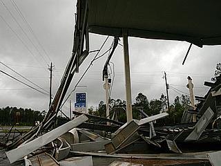
Here is another view of the destroyed gas station north of Interstate 10. |
|
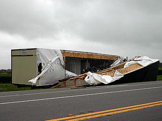
A prefabricted home alongside highway 281 is tossed and mangled by hurricane Dennis. |
|
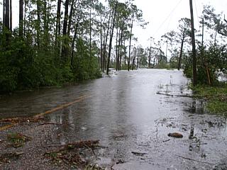
This is a picture of a severely flooded residential area south of Interstate 10 on the northestern side Blackwater Bay. Storm surge often causes water to "pile up" in such bay estuaries, even well away from the Gulf of Mexico. |
|
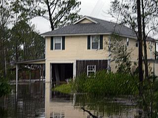
Here is a picture of a damaged and flooded residence near the northeastern side of Blackwater Bay south of Interstate 10. |
|
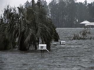
Here is another picture the street in front of a damaged and flooded residence near the northeastern side of Blackwater Bay south of Interstate 10. Note the water level compared to the mailboxes! |
HTML File "denn05.htm" - Developed By Chris Collura
To Return To The HOME Page Of This Site Click The "INDEX.HTM" Link Here!