
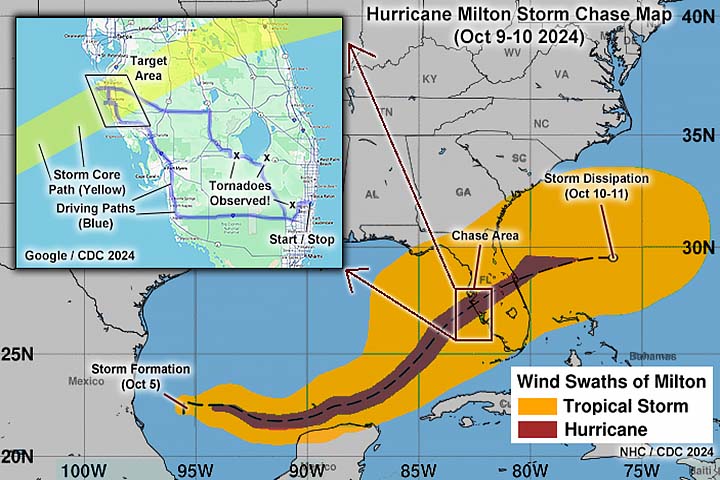
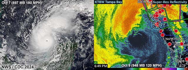
| This is a storm chasing log and analysis of hurricane Milton, a category 3 hurricane that affected the Florida west coast near Sarasota on October 9-10, 2024. This was the third major hurricane to hit that area in just over a year (Idalia 2023 and Helene in 2024), and the third hurricane (after Helene in September 2024) to affect close to the same area in 2024. Milton began as a tropical disturbance off Mexico and in the southwestern Gulf of Mexico around October 5 and becoming a tropical storm late that day as it began drifting eastward. From October 6th through the 8th, Milton became a hurricane and began extreme / explosive intensification. The storm became a rare category-five hurricane while north of the Yucatan Peninsula. Pressure in the storm center fell as low as a staggering 897 MB with sustained winds of 180 MPH surrounding a well-defined "pin-hole" eye. Fortunately, no land was affected by the small core of the storm during this time, and Hurricane Milton began accelerating east and northeast, taking aim on Florida, of all places. By October 9, less than idea atmospheric conditions (some shear and drier mid-level air) began to slowly weaken hurricane Milton, but the same trough steered it northeastward into the Florida west coast. During the evening of October 9, major hurricane Milton made landfall just north of Siesta Key, and passed directly over Sarasota, Florida with sustained winds of 120 MPH and a central pressure as low as 952 MB. Damage in Florida was extensive, and, even worse, included a rare tornado outbreak ahead of the storm over east and southeastern Florida. The storm continued northeast to east-northeast, and re-emerged into the Atlantic Ocean just south of Cape Canaveral as a category-one hurricane with 85 MPH winds on October 10. During the late period of October 10, and into the 11th, hurricane Milton quickly weakened and became an extra-tropical low, and eventually dissipated. Damage estimates are in excess of 85 billion dollars with at least 35 people killed. Note - This page may take a while to load on some SLOWER connections! |
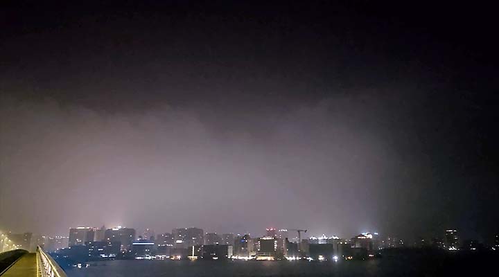
HURRICANE MILTON - BRIEF AND EERIE CALM IN SARASOTA - EYE OF STORM
| CHASER NAME | HOME CITY | CALLSIGN | OCCUPATION |
| CHRIS COLLURA | DEERFIELD BEACH, FL | KG4PJN | COMPUTER ANALYST |
|
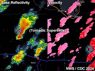
Radar images (base reflectivity to the left, and Doppler velocity to the right) during the early to mid afternoon of October 9, 2024. Numerous supercell storms are forming over SE Florida and moving northward. This was part of a significant tornado outbreak well ahead of the hurricane. Strong wind shear and surface heating provided the dynamics for tornadic supercells - Extremely rare for south Florida. |
|
View of tornado over the Florida Everglades in W Broward County at the western bend of the Sawgrass Expressway. The view is looking west. This is the storm that was originally spotted near Weston, Florida earlier. |
|
View of backside of a powerful supercell storm just as a tornado has striking Pahokee, Florida. The view is to the northeast from John Stretch park pumping station. The tornado is extremely low contrast, and would be in the lower-center of the picture. |
|
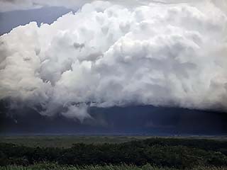
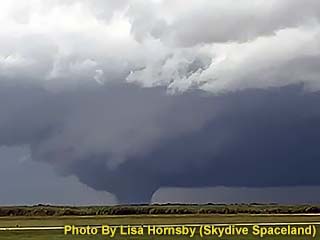
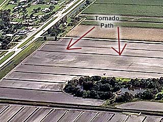
Absolutely impressive photograph (from video) of a large wedge tornado passing west of Clewiston, Florida. Lisa Hornsby, co-owner of Skydive Space Center, took this amazing picture of the storm while surveying damage from a previous tornado at Airglades Airport during the afternoon of October 9. The view is west and southwest. |
|
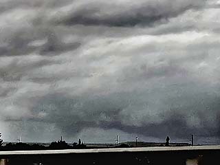
Former Clewiston / Airglades Airport wedge tornado weakens and lifts northwest of Moore-Haven, Florida. The view is to the northwest. |
|
View of partially scoured sugar cane fields near Clewiston, Florida. Taken from C-208 skydiving aircraft over-flying the area on October 12. |
|
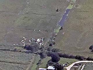
View (from Skydive aircraft) of damaged structures east of Clewiston, Florida. |
|
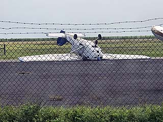
Flipped aircraft at Airglades airport (21S) on October 12. |
|
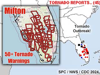
Severe Storm Predictions Center (SPC) / National Weather Service (NWS) warnings and reports for eastern and southeastern Florida on October 9. Is this FLORIDA or OKLAHOMA in May (???) |
|
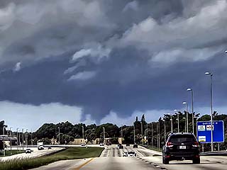
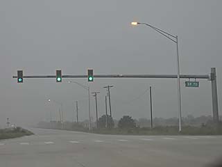
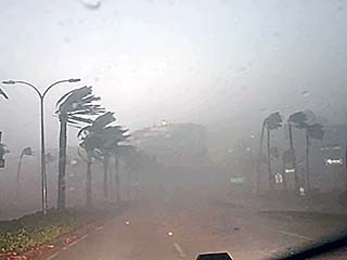
Approaching Highway 70 south of Lake Placid, Florida during the mid afternoon of October 9. A large rain-wrapped tornado is on-going north of me. |
|
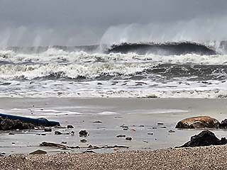
Large waves batter Bradenton Beach, Florida as hurricane Milton approaches from the southwest. Damage in this area was severe due to the effects of hurricane Helene just 2 weeks prior. |
|
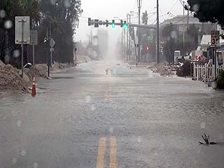
Flooding in Bradenton Beach, Florida. Sand and debris in road is NOT from Milton, but from hurricane Helene just 2 weeks prior :( |
|
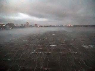
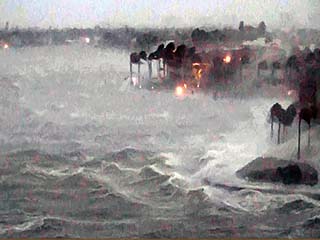
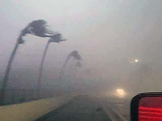
First half of storm core and eyewall strikes Sarasota during the late afternoon of October 9. The John Ringling Causeway would be the major observation point for most of this storm. Note the streaking of the spray and foam in Sarasota bay. |

|
Other storm chasers on the causeway bridge braving winds gusting near 114 MPH (measured). |

|
Myself (dash cam) braving and leaning forward into the 100+ MPH winds. |
|
Homes and docks on the south side of Bird Key being buffeted by strong winds and waves. Winds hammering from the southeast at this point. |
|
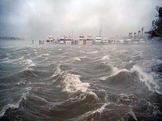
Marina on east side of Bird Key. |
|
Power flashes looking to the east and southeast as maximum winds arrive near dusk on October 9. |
|
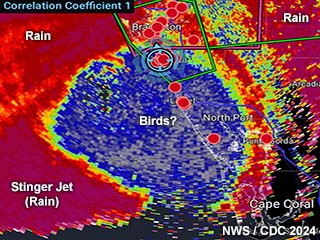
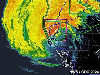
Interesting view of the KTBW radar "correlation coefficient" product just as the eye of Milton is about to make landfall. Like with strong tornadoes, blue on the CC product denotes any airborne "stuff" that is NOT rain or hail. In this case, the eye of the storm is all blue - Probably debris, bugs, dirt, and, most likely, birds inside the eye! Also, not the approaching "stinger jet" to the lower left (southwest). That will be a major problem for Sarasota later. |
|
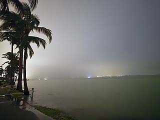
Winds tail off, and we are in the calm eye. A warm (temperature upper 70s) and foggy mist hangs in the air as winds drop to light and variable during the late evening of October 9. |

|
View looking up into calm eye, with "stadium effect" to our east with the low-topped eyewall clouds. Temperature now in lower 80s. |
|
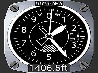
Radar (base reflectivity from KTBW) image of my GPS position (blue cross-hairs) - Right in the storm center - A great place to be! |
|
Pressure measured in the calm center of the eye was just over 962 MB. NHC had 952 at landfall. Either storm storm was filling in (due to land effects / drag) or the dead pressure center missed my location. |
|
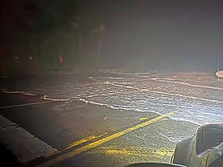
The second half of hurricane Milton was much worse than expected. Winds go right back to previous speeds - If not worse - Than the first half. They begin howling from the northwest (opposed to southeast before the eye) and begin pushing water ashore. |
|
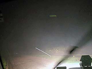
Debris flies overhead (note streak mid-top of picture) as the second half of hurricane Milton affects Sarasota. The second half of the hurricane was worse because of the "stinger jet" - Where dry air in the mid levels forms a downdraft and allows the maximum winds to mix down to the surface. |
|
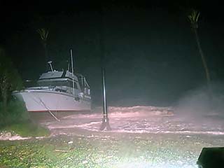
Motor-yacht washing ashore and storm surge on the western side of the John Ringling causeway and east side of Bird Key. |
|
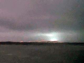
Power-flash (green hue) lights up the sky as power is knocked out to downtown Sarasota, Florida. |
|
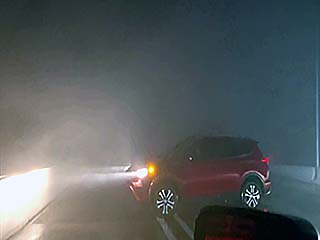
Another vehicle (storm chaser?) braving the brute force of the backside or hurricane Milton. Horizontal rain and spray causes my car horn to lock on for 5 minutes (relay got wet). |
|
Power-flash / lightning. |

|
Winds gusted to 120 MPH on the backside of the hurricane - Forcing me to ride it out on the causeway! |
|
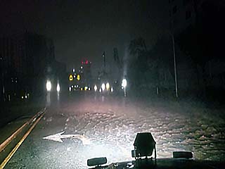
Hurricane Milton finally moves onward, leaving storm surge flooding in Sarasota. I needed to wait, and finally made it out of the after after midnight on October 11. |
HTML File "milt24.htm" - Developed By Chris Collura
To Return To The HOME Page Of This Site Click The "INDEX.HTM" Link Here!