
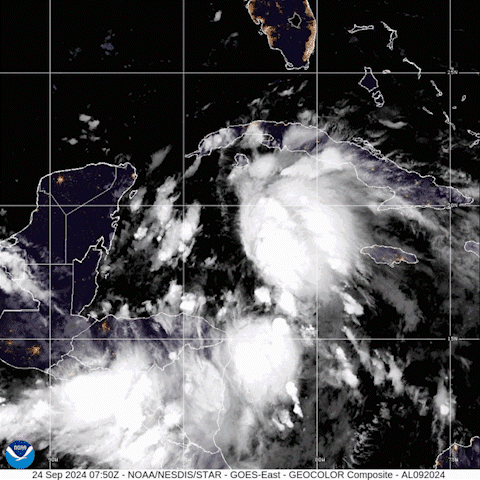
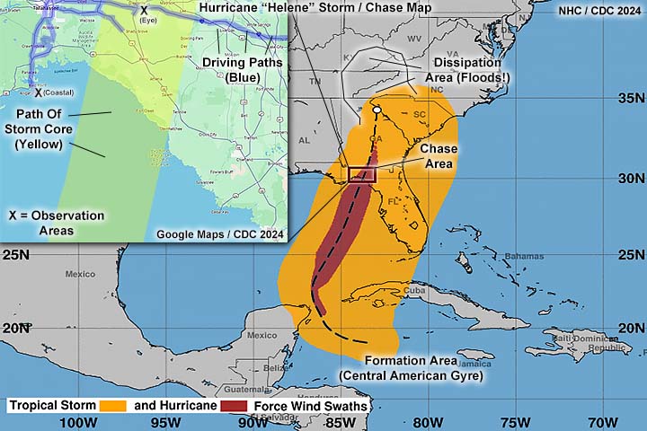
| This is a storm chasing log and analysis of hurricane Helene, a category 4 hurricane that affected the Florida "Big Bend" area on September 26-27, 2024. This was the second major hurricane to hit that area in just over a year (Idalia 2023), and the second hurricane (after Debby in August 2024) to affect the same area in 2024. Helene was the strongest hurricane to hit the Florida Big Bend area in history, with a devastating swatch of 140 MPH winds, and a central pressure of 938 mb at landfall. Hurricane Helene began as a tropical disturbance moving NW within the CAG (Central American Gyre) and developed into a tropical storm southeast of the Yucatan (Mexico) by September 24. From there the storm rapidly intensified, and continued to rapidly (or even explosively) intensify as it re-curved to the north and northeast, and made landfall in the Florida "Big Bend" (Nature Coast) area during the overnight of September 26 and 27. After striking Florida, the storm accelerated into Georgia and reached the southern Appalachians by September 27 and 28, while weakening to a tropical storm. The weakening storm became absorbed into an upper level low pressure system and low pressure trough (systems even doing a "Fujiwara interaction"). Although Helene weakened and became extra-tropical on September 28 (over the Tennessee valley), it caused devastating flash flooding in the area - Especially around the western parts of North Carolina, Kentucky, and Tennessee. Hurricane Helene caused at least 88 billion dollars in damage, and killed at least 233 people. Note - This page may take a while to load on some SLOWER connections! |
HURRICANE HELENE - DISASTEROUS REPEAT IN THE FLORIDA BIG-BEND
| CHASER NAME | HOME CITY | CALLSIGN | OCCUPATION |
| CHRIS COLLURA | DEERFIELD BEACH, FL | KG4PJN | COMPUTER ANALYST |
|
View looking south from South Florida on September 24, 2024 - The high altitude cirrus clouds are streaming overhead from right to left, with the low clouds from the opposite direction. This is depicting a developing upper-level anticyclone in which will provide the upper level support for future hurricane Helene - Which was a tropical depression east of Mexico at the time. |
|
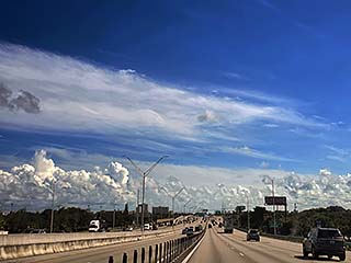
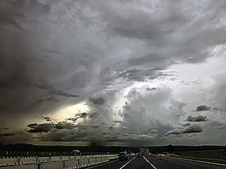
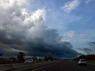
View looking west and northwest from west of Orlando, Florida during the afternoon of September 25. Numerous showers and strong thunderstorms extended well to the east of now tropical storm Helene, still southwest of the area in the southern Gulf of Mexico. |
|
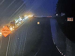
I-10 headed west and east of Tallahassee, Florida, during the evening of Sept 25. Evacuation traffic is on the east-bound lanes (left side), with almost no one heading west towards the expected storm impact area. |
|
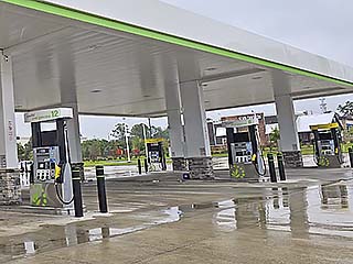
Closed gas station (pumps bagged up) in Tallahassee, Florida, during the morning of Sept 26. Even Waffle House - Noted to stay open in many disasters - Was closed. Not good. |
|
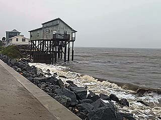
Gulf of Mexico beachfront houses in Alligator Point, Florida and south of Panacea late on September 26. This is the exact same place category-one hurricane Hermine struck in 2016. Fortunately, Helene would veer east and spare this area from utter devastation. An eerie "calm before the storm" prevails under a steel colored gray sky, with rather small waves lapping against the rocks with above-normal tides. |
|
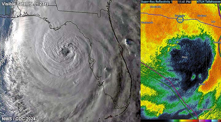
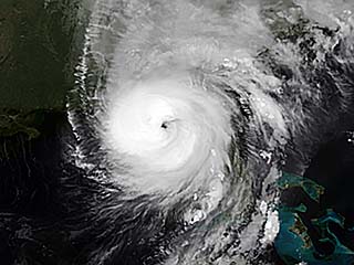
This a satellite image of hurricane Helene, at maximum intensity - With 140 MPH winds and a central pressure of 938 mb - Just about to come ashore near Keaton Beach, Florida during the late night of September 26. |
|
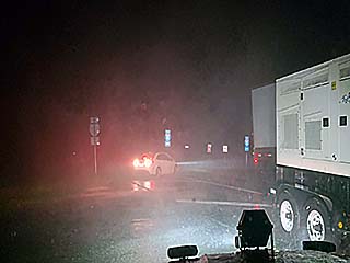
Riding out the brute-forced eyewall of hurricane Helene under an overpass for I-10 south of Greenville, Florida and north of Perry. Strong winds and whiteout conditions were encountered just before midnight from September 26 to 27. |
|
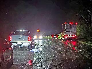
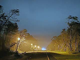
The rain and wind let up, and the western part of hurricane Helene's eye passed over and east of Greenville after taking a direct hit on Perry to the south. I headed east on I-10, and entered the calm eye, coming across other storm chasers and numerous downed trees blocking the interstate. |
|
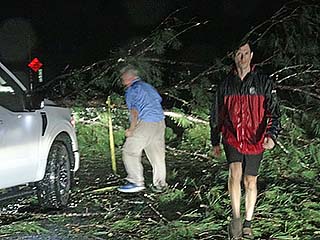
Jeff Piowtrowski (left) and a few other storm chasers helping move downed trees while in the calm eye of hurricane Helene. Brief view of stars overhead, with occasional lightning, at the time. |
|
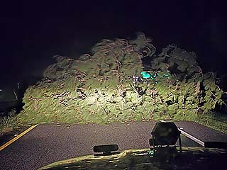
View of one of many downed trees covering I-10 south of Madison, Florida after midnight on September 27. |
|
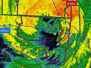
Radar image of collapsing eye (storm now over land) of hurricane Helene, with my GPS position (blue cross hairs) in the center of the calm eye. |
|
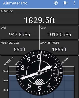
Screen shots of the Altimeter Pro app on my Samsung phone. This is driven by barometric pressure. I am NOT in an airplane approaching 2,000 feet - But the altimeter (driven by air pressure) doesn't know that. All it measures is the pressure deficit, and inside the eye of a hurricane, thousands of feet of the lower portions of the air column are simply not there! Pressure here is just over 947 mb, associated with the pressure center of the eye, in dead-calm wind conditions. |
|
The second half of hurricane Helene approaches, with a powerful WSW wind (after blowing hard from the east and southeast before the eye), albeit drier conditions. Here leaves and twigs are whipped across I-10 while under an overpass during the wee hours of September 27. |
|
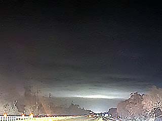
View looking east on I-10 after passing Madison and approaching the eastern eyewall again. A large complex / factory on generator power illuminated the solid cloud base of the eastern eyewall inner-edge. Beyond that is heavy rain in the darker area. Power flashes also noted. |
|
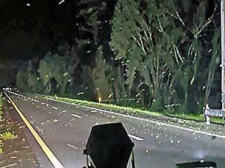
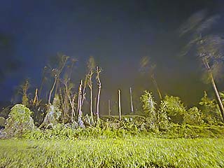
Shredded trees along I-10. |
|
Eerie view looking west with the second half of hurricane Helene hammering me with powerful SW winds. |

|
Once out of the area, and farther east, I slept in the car for several hours early on September 27 at a truck stop south of Gainesville, Florida. |
|
View of one of the outer feeder bands while passing through Martin and Palm Beach county, Florida, during the early afternoon of September 27. |
HTML File "hele24.htm" - Developed By Chris Collura
To Return To The HOME Page Of This Site Click The "INDEX.HTM" Link Here!