
| This is my picture based log by chronological order of some select pictures of storm chases and observations conducted during the period from year 2000 to 2009. This log is separate from any storm chase expeditions to the US plains or Midwest, and does NOT include tropical cyclone interceptions. These other chase logs are available as separate logs from the main storm chasing section. This log is for most "home" chases in the state of Florida or for other miscellaneous storm or coastal observations. Keep in mind that this log is scientific evidence and portrays my on-going storm chasing research. It has been placed on this page for easy reference and meteorological interests. Please do not plagiorize or copy this document to other sites for distribution. Feel free to browse through my main storm chasing picture section. Note - This page may take a while to load on some SLOWER connections! |
TABLE OF CONTENTS - CLICK TO GO TO PAGE
|
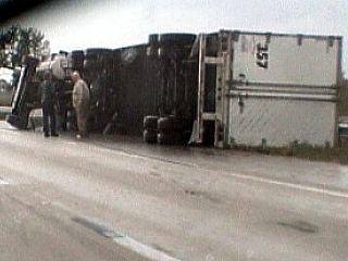
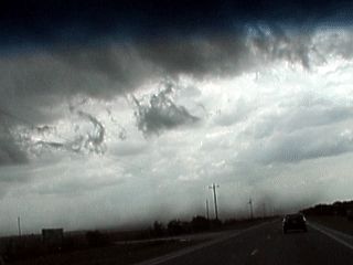
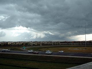
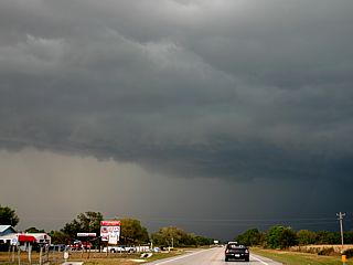
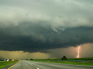
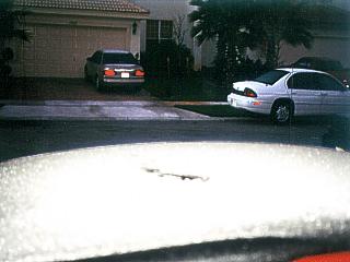
Straight-line winds associated with a powerful squall line blow over a semi truck along highway 27 in western sections of Palm Beach County, Florida on January 24, 2000. Winds gusted over 60 MPH as the line of severe thunderstorms passed. |
|
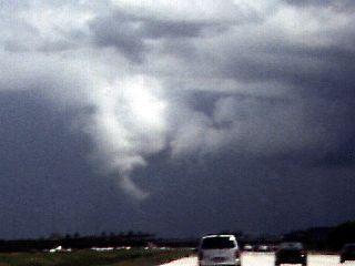
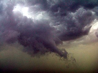
A funnel cloud and wall cloud on the rear side of a thunderstorm near Miramar, Florida on July 29, 2000. This entire cloud feature was rotating but did not extend completely to the ground. The parent thunderstorm did produce severe wind gusts and hail. |
|
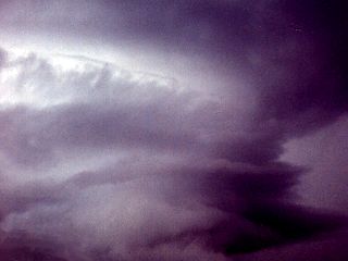
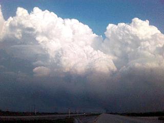
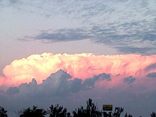
A small HP supercell storm develops west of highway 27 in western Broward County, Florida on September 29, 2000. The storm developed ahead of a tropical disturbance moving north from Cuba interacting with favorable upper-air conditions. Slight rotation and shear on this persistant thunderstorm cell was sufficient to create this beautiful striated mid-level structure. |
|
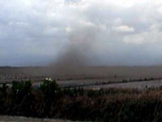
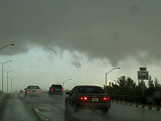
This is a picture of a gustnado developing along a gust front in Okeechobee County, Florida on March 4, 2001. The gust front had dry winds gusting near 50 MPH and some tornado like vortices developed ahead of the outflow boundary associated with a line of strong and severe thunderstorms. Very dry conditions allow the dust to be kicked up and the vortices become visible. |
|
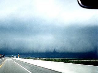
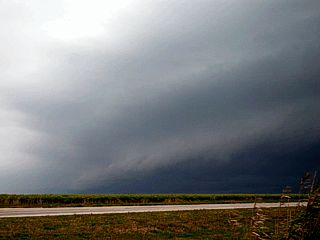
A gust front with 50 MPH winds pushes out ahead of a squall line of strong and severe thunderstorms in Osceola County, Florida just west of Yeehaw Junction on March 4, 2001. The gust front kicks up dust along the ground as it moves over the dry farmland. Note the shelf cloud as well as some pretty interesting vortex like filaments along the boundary. |

|
A very unusual sight in Florida. A dust storm is kicked up by dry thunderstorm outflow winds ahead of a squall line of strong and severe thunderstorms blasts the chase team in Okeechobee County, Florida on March 4, 2001. Jeff Gammons with the former "Weathervine" storm chasing team is standing in the foreground. The excessive dust is due to a severe drought that occurred in this region. This dust was very irritating. It got in your eyes, nose, under your fingernails, in your car, and turned my white shirt brown! |
|
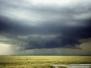
The wall cloud on the southern side of an HP supercell thunderstorm along Highway 27 in western Palm Beach County, Florida on March 19, 2001. The lower cloud in the foreground was moving to the right while the second lowering behind it was moving to the left denoting a strong low level mesocyclone. The precipitation core to the right also wrapped around the wall cloud and slammed us with 55 MPH winds and dime sized hail. This was the late mature stage of the high precipitation supercell thunderstorm. |
|
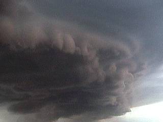
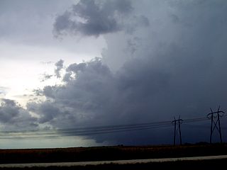
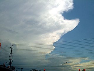
The famous "horse shoe" shaped updraft region of a high precipitation supercell thunderstorm. This storm was encountered near Highway 27 in western Palm Beach County, Florida on March 19, 2001. A strong mid and low level mesocyclone causes the heavy precipitation core to the left to wrap around it forming an occlusion of the main updraft. The other precipitation core of this storm is to the right of the updraft, somewhat lighter but containing large hail. The region of rotation is between and behind the left and right precipitation cores. The precipitation core to the left wrapping around causes the "hollow" region forming the horse shoe type updraft. A large inflow band also extends to the left of this picture. The view is to the northwest. |
|
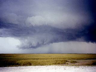
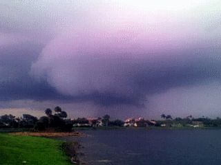
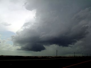
Viewed on the south side of a high precipitation supercell thunderstorm during its late mature stage, a powerful gust front and shelf cloud develop as the main updraft begins to collapse. The still rotating updraft base, now being undercut with cooler outflow air can be seen in the center-right of this picture. The storm is over the Florida Everglades near Highway 27 in Western Palm Beach County. Pea to dime sized hail was falling as this picture was taken. Note the beautiful multi-tiered structure of the storm and shelf cloud. |
|
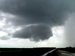
While being pelted with dime to nickel sized hail, the view above reveals a multi-tiered shelf cloud conforming to the broad rotation of a low level mesocyclone from an HP supercell storm near Highway 27 in Palm Beach County, Florida. The storm here is in its late mature stage and is quickly becoming outflow dominant. The storm core, which contined large hail, 65 MPh winds, and torrential rains, is to the right. This picture was taken on March 19, 2001 and is looking to the south and southwest. Note the curved structure with striations above the shelf cloud. |
|
A small low level mesocyclone develops on the south side of a developing supercell thunderstorm over Highway 27 in Palm Beach County, Florida on March 19, 2001. This region of the cloud had a visible rotation and even produced a funnel cloud which made it 1/3 way to the ground. In this picture, a pronounced counter-clockwise rotation is visible. Note the lighter areas in the cloud base that tend to wrap around and spiral inward to the darker center of the mesocyclone when viewed from directly underneath. The funnel cloud is in the very center of this cloud feature. |
|
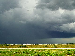
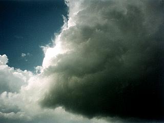
Viewed from the western side of Highway 27 in Western Palm Beach County, Florida on March 19, 2001, the mature stage of an HP supercell looms over the Everglades. The storm here is at is precipitation peak and was producing large hail and severe winds. The updraft base, still intact and slowly rotating, is slowly being undercut by cooler air and eventually will evolve into a squall line. Pea to dime sized hail even began to fall well ahead of this storm. The view is to the northwest. Note the multiple tiers of the supercell low-level structure. |
|
Members of the former "Weathervine" storm intercept team show off their exitement southeast of an HP supercell in Glades County, Florida on March 19, 2001. Jeff Gammons is to the left and the main updraft of the storm is above him. This storm previously produced a tornado in Lee County just west of this area. A small funnel, barely visible, is just to the right of Jeff's head nearly embedded in the precipitation core to the far right. |
|
A closeup of a beaver's tail cloud to the east of a weakening HP supercell moving into Glades County, Florida on March 19, 2001. The supercell storm produced a tornado in Lee County about 20 minutes earlier. The beaver's tail cloud is an inflow cloud that develops above where the inflow air bucks up against another boundary, such as outflow or a flanking line. Note the laminar and smooth appearance of the beaver's tail cloud. |
|
A beaver's tail cloud east of a tornadic HP supercell near Glades County, Florida on March 19, 2001. The cloud develops along a boundary where fast moving inflow air to the supercell's main updraft rides along other boundaries around the storm. It is most common on the east side of a supercell. The supercell producing this cloud is out of sight to the left and was producing a tornado in the next county, Lee, to our west. Note the smooth and laminar shape of the cloud as well as its distinct shape of the famous "beaver's tail". |
|
A small funnel develops on the south side of a developing HP supercell thunderstorm near Highway 27 in western Palm Beach County, Florida on March 19, 2001. This funnel made it 1/3 way to the ground. The updraft base is obvious in this picture, and even had a tight little low level mesocyclone associated with it. The picture was taken from inside the developing precipitation core just when exiting the cell from the north, to avoid ensuing frequent lightning, hail, and high winds. The view in this picture is to the south. |
|
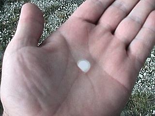
During observation of an HP supercell thunderstorm near Highway 27 in western Palm Beach County, Florida on March 19, 2001, pea to dime sized hail begins falling ahead of the storm. I hold one of the pieces of hail after it landed in the back of my pickup truck. |
|
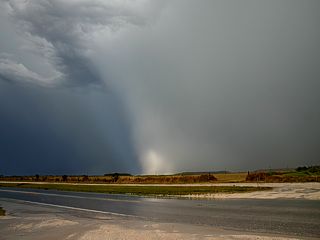
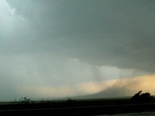
This is a picture of a shelf cloud on the southeastern side of a cluster of severe thunderstorms near Canal Point, Florida on March 29, 2001. This was a storm system that produced waterspouts over Lake Okeechobee as well as several gustnadoes over land east of the lake. |
|
This is a picture of a small "spinup" on the ground along the gust front and under the shelf cloud on the southeast side of a severe thunderstorm east of Canal Point, Florida on March 29, 2001. This is called a "gustnado" and is a small but intense vortex caused by shear and temperature contrasts at and ahead of the gust front boundary. |
|
This picture shows a dust plume associated with a dry microburst along and behind a severe thunderstorm gust front in western Palm Beach County, Florida, on March 29, 2001. This area was on the southeastern side of the severe thunderstorm cluster as the storms "gusted out" with winds near 60 MPH. |
|
This is a picture of a severe thunderstorm, with HP supercell characteristics, developing north of Krome Avenue in extreme western Miami-Dade county on March 26, 2002. The storm here is 15 miles away over the everglades, to my northwest, moving southeast. |
|
The same thunderstorm moved farther southeast on March 26, 2002 and develops more enhanced inflow structure and begins broad, but weak rotation. In this picture, a large wall cloud is developing, with small inflow features on each side. This storm also had hail up to quarter sized. |
|
Just before occluding and evolving into a cluster of severe thunderstorms, the same HP supercell-like storm on March 26, 2002 moves closer with a well-developed wall cloud. Note the clear-air "slot" in front of the wall cloud. |
|
This is the first of four pictures on a line of thunderstorms near Belle Glade, Florida on April 2, 2002 that evolved into a small supercell as they encountered strong vertical wind shear due to a short-wave disturbance moving in aloft. In this picture, the thunderstorms are clearly linear in fashion, however, just to the left of the precipitation shaft can be seen a slight "swirl" in the cloud base. |
|
About a half hour later, the line of storms moves off to the northeast. The cell at the southern end of the line of storms moves southeast, separating from the rest of the storms (deviant motion). This cell begins developing a nice wall cloud and its base darkens. Note that the storm base is "round" in nature and not linear anymore as rotation begins in the storm's updraft. A well developed precipitation core has also developed with a rain "foot" and updraft-downdraft interface. This was northeast of Belle Glade, Florida on April 2, 2002. The view is to the west. |
|
This is a picture of a small landspout type tornado developing under the main updraft and wall-cloud region of the small supercell like storm near Belle Glade on April 2, 2002. This occurred shortly after the last picture above was taken. The total lifespan of this small classic type supercell was about 2 and a half hours. |
|
The same storm as in the last three pictures during its peak of the supercell mode. In this picture we can see a wall cloud and rain-free base to the lower left, a beavers tail inflow band extending to the upper-right, and a hail / rain core in the "vault" region to the right of the storm updraft. This storm, northeast of Belle Glade, Florida on April 2, 2002, is unusual in Florida, except when conditions are correct as in this case. |
|
This is a picture of Jeff Gammons (KG4PGA) waiting for a line of strong and severe thunderstorms to approach our location in inland Palm Beach county, Florida on April 3, 2002. A retreating short-wave disturbance is causing the storms. Note the darkening sky to the west in the background as well as some mammatus overhead. |
|
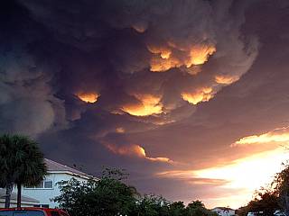
A spectacular field of mammatus clouds appears overhead while in a corn field awaiting the arrival of a line of thunderstorms to approach western Palm Beach county, Florida on April 3, 2002. |
|
The gust front and leading edge of a line of severe thunderstorms finally arrives in Palm Beach county, Florida on April 3, 2002. The intensifying rain-free base of one of the severe cells in this thunderstorm line can be seen in this picture. The view is to the northwest. |
|
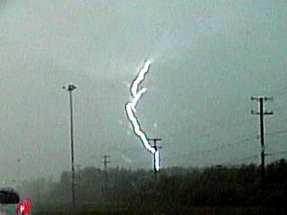
A nice shot (video frame-grab) of reverse-lightning is captured during the passage of strong and severe thunderstorms in Palm Beach county, Florida on April 3, 2002. The term "reverse" lightning means the flow of electricity begins from the ground rather than the cloud base first (positive charge instead of negative). The straight trunk of the bolt here is along a radio tower 5 miles to the southwest of my location and not the pole along the road. |
|
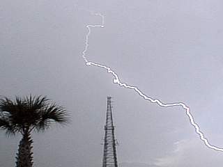
Here is a picture (video frame grab) of a bolt of lightning near a radio tower on March 16, 2003 in Palm Beach, Florida during the SE Storm Chaser Picnic at Wellington Park. |
|
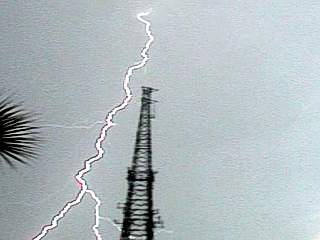
Here is another a bolt of lightning (video frame grab) near the same radio tower on March 16, 2003 in Palm Beach, Florida during the SE Storm Chaser Picnic at Wellington Park. |
|
This is a picture of cloud to cloud lightning (video frame grab) on the backside of a line of severe thunderstorms moving across Broward County, Florida on March 17, 2003. |
|
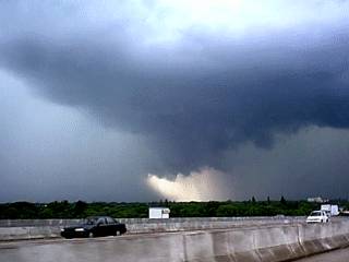
On March 27, 2003 a complex of severe thunderstorms affected southern Florida, with at least two tornadic supercell thunderstorms. One in Maimi-Dade county, producing an F2 tornado that killed a person and another in western Palm Beach county. The Palm Beach storm can be seen here just after development, west of Highway 27, with a developing rain-free base, wall cloud, and hail core. |
|
The March 27 storm quickly develops a large wall cloud as it intensifies west of Highway 27 in Palm Beach county, Florida. This storm lasted over two hours and continued towards the east into the Palm Beach metro areas. Hail up to one inch was reported by this storm. |
|
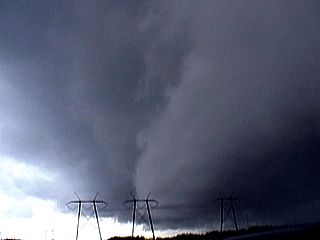
A lowered bowl-shaped base and funnel cloud / brief tornado develops under the wall cloud of the HP supercell storm On March 27, 2003 near Highway 27. |
|
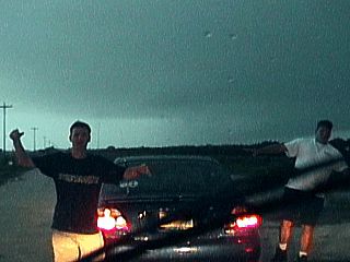
This is a picture of the gust-front of an approaching line segment of strong and severe thunderstorms in western Palm Beach county, Florida on August 9, 2003. Jeff Gammons (KG4PGA), chase partner is in the foreground taking pictures. |
|
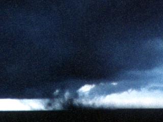
In this picture, a shear funnel develops in a developing cumulus cloud ahead of a line of severe thunderstorms on August 9, 2003 in western Palm Beach county, Florida. |
|
The line of severe thunderstorms in western Palm Beach county on August 9, 2003 produces cloud to ground (CG) lightning as Jeff Gammons (KG4PGA) takes pictures of the storm in the foreground. Wind gusts near 50-MPH were encountered with these storms. |
|
This picture shows a large wall cloud that occured as the same complex of storms moved into Broward county, Florida on August 9, 2003. The storm here producing this wall cloud also produced winds of about 55-MPH and hail up to nickel sized. |
|
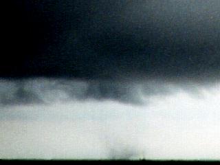
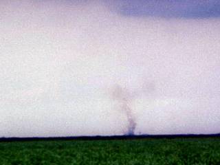
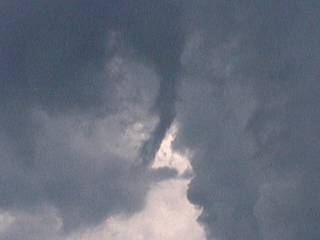
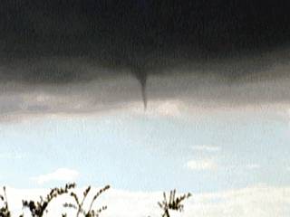
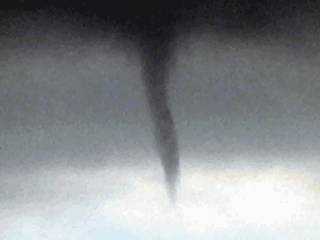
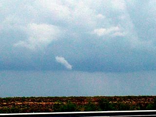
This picture shows a cold-air type funnel cloud developing beneath a low-topped cumulus cloud near Miramar, Florida on October 13, 2003. The storm producing the funnel was not severe otherwise. |
|
This picture is a closeup of the cold-air type funnel in the picture above. This occurred west of Miramar, Florida on October 13, 2003. At one point, the vortex extended 1/3 way from the cloud base to the ground. |
|
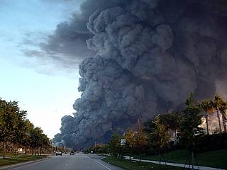
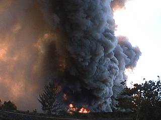
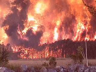
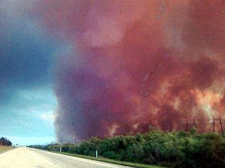
This is the first picture of seven spectacular brush fire pictures. Here we see the black smoke plume from a 100 acre brush fire burning near Miramar, Florida on march 18, 2004. This is the Florida "dry season" where brush fires are common. This one, however hit pretty close to my home residence, and did threaten some property. I am about two miles from the fire in this picture. The smoke plume is over 4,000 feet high and spreads out due to a temperature inversion aloft. |
|
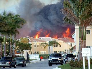
Here is a wide angle shot of the fire and smoke plume. The fire can be seen burning dangerously close to the residences in the lower portion of the picture. This was taken from the I-75 overpass just south of Miramar, Parkway on March 18, 2004 around 7 PM during the peak of the fire, initiated by a carelessly discarded cigarette. |
|
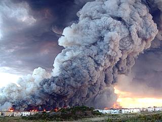
Looking towards the end of Dykes road in Miramar, Florida, the 100 foot plus flames loom over the rooftops of the Silver Shores residences! The houses are not actually burning, it is the forest behind them across a canal near the FL Turnpike that is on fire. Still, this picture is dramatic. I am about a mile away from the fire here. |
|
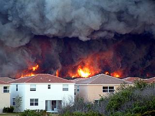
Here is another terrifying view of the brush fire behind the housing development from the I-75 overpass in Miramar, Florida on March 18, 2004. The fire department finally contained the fire before it affected any property. About 100 acres were on fire simultaneously, with nearly 1,000 acres burned. The fire lasted nearly 8 hours. From here, about a mile away, you could actually feel a slight radiant heating! |
|
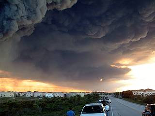
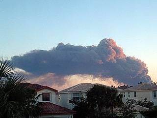
Being gently wafted westward by the prevaling low-level easterly winds, the smoke plume streaks westward across most of south Florida to the west coast and blocks out the sun. The dark plume, over 4,000 feet high, hits a temperature inversion and spreads out just like a thunderstorm anvil, only lower in altitude. You can even see some "mammatus" like features! |
|
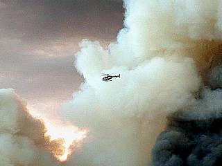
A local news helicopter hovers close to the billowing smoke and ash plume from the Miramar fire. Note the white clouds, containing water, that have also developed. These are known as PYROCUMULUS clouds. |
|
During the late stages of the fire, just before burning out, the smoke plume has obscured most of the sky and darkened the late afternoon. The "mammatus" like pyrocumulus becomes underlit by the setting sun and glows bright against the darker portions of the smoke and ash plume. |
|
Here is an ominous smoke plume above yet another brush fire off Highway 27 in NW Miami-Dade County, Florida on April 2, 2004. The dark ash and smoke plume was actually rotating in this video frame-grab. Note the red fire to the lower left. The fire was started by a carelessly discarded cigarette off Krome Avenue. During the start of this year 2004, two "fire chases" were already done, however, no "storm chases"! Abnormally dry weather causes "fire storms" instead. |
|
The leading edge of the brush fire, wafted by strong WNW winds, approaches the tree line off Highway 27 in NW Miami-Dade County, Florida on April 2, 2004. Flames as high as 100 feet can be seen in this picture (video frame-grab). |
|
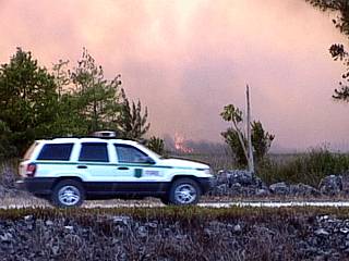
Miami-Dade fire rescue vehicles patrol the fire-break trail off Highway 27, closed at the time, as fire and smoke approach in the background. The area was currently being evacuated and Highway 27 was closed from Krome Avenue down to the Florida Turnpike. |
|
Here is a frame-grab of the highpoint of the brush fire off Highway 27. The fire has finally reached the tree line and evolved into a mini "fire storm". The sky turns a reddish color and you begin to feel the heat on your face and arms, even at a mile away from the fire front! The trees being burned in this picture are 50 to 75 feet high ... How high are the flames? |
|
A day after the last four fire pictures were taken, the out of control fire SW of Highway 27 near Miami-Dade is still burning. The smoke plume, shown near sunset in this picture, is about 4,000 feet high (the spreading out / "mushroom" structure of the plume top is caused by a temperature inversion at that height) making it visible from my home in Miramar, FL, about 25 miles away from the fire! The smoke plume is being blown to the southeast by a WNW flow (note the tilting of the rising smoke). The fire consumed more that 1,000 acres of Florida forest. |
|
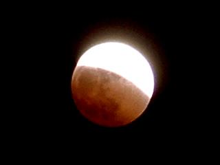
This is a digital picture of the lunar eclipse at about 9:45 PM EDT on October 27, 2004 viewed from Miramar in South Florida. Note the red color as the edge of the earth's shadow covers about two-thirds of the moon face. This reached totality, where the full moon became completely covered by about 10:15 PM. |
|
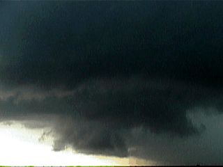
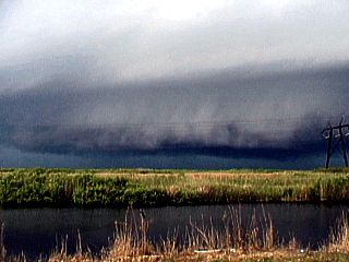
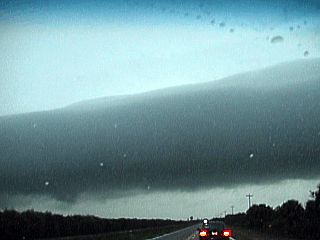
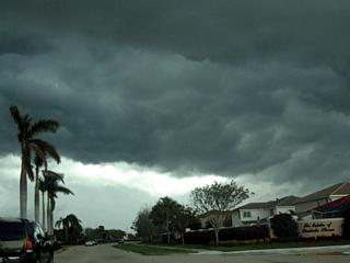
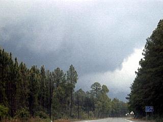
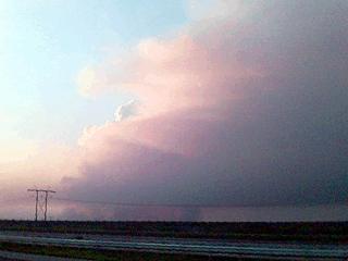
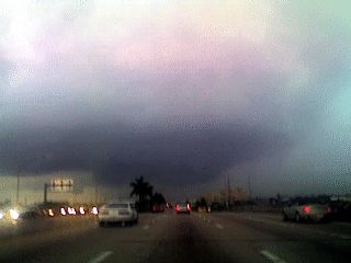
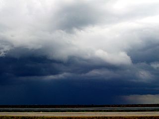
This is a picture of a passage of a squall line of strong and severe thunderstorms on February 4, 2006 in Broward County, Florida. The outflow dominant storms produced an impressive shelf cloud and gust front, which can be seen passing overhead in this picture. The view is to the north. |
|
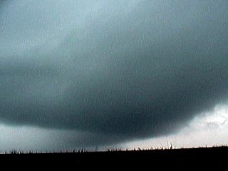
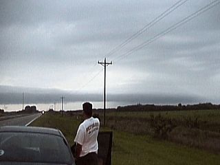
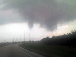
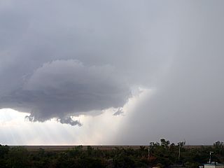
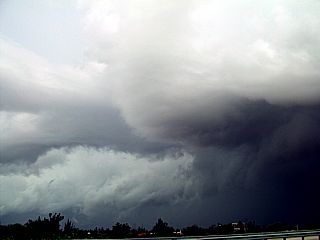
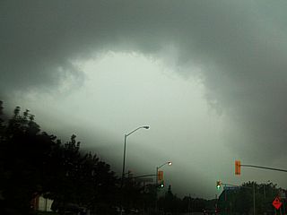
A region of weak rotation develops within the squall line (a weak embedded mesocyclone) on February 4, 2006. The view in this picture is to the northeast from an overpass on Interstate 75 in western Pembroke Pines, FL. Note the "kink" in the gust front to the far right (inflow notch), and clear subsidance hole (RFD?) extending from the left to the center of the picture. Between these two features, a wall cloud like lowering appears. |
|
Here is a picture of a mesocyclone embedded in an intense squall line southwest of Fargo, Georgia near the FL / GA border and north of Columbia County, FL on April 8, 2006. The key features to look at in this view to the north is the inflow notch (just lower and right of center of picture) to the north of the lowering in the foreground (center). The lowering is a rotating portion of the squall line (embedded low-level mesocyclone). |
|
About a minute later on the same storm on April 8, 2006, a weak low-level RFD-like down draft pushes from left to right below the lowering. Looking north, this downdraft can be seen forming a "bowed" gust front (left-center in picture). |
|
This is the roating portion of the low-level mesocyclone on the severe storm in Columbia County, FL on April 8, 2006. Visually, in real time, the entire feature was rotating hard with tagging scud and counter-clockwise motion in the cloud base. I did take video of this, and in the video, to rotation is much easier to see. |
|
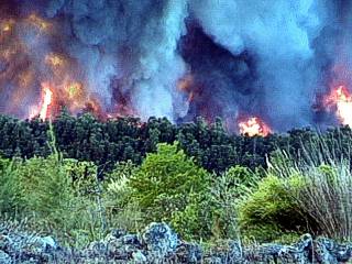
The picture here is looking south on some very intense, rock-hard convection in Palm Beach County, Florida along Highway 27. However, the forcing mechanism here is not the sun's heating, but a large brush fire in the Florida Everglades. Since the air above the fire is moist and unsatable, pryo-cumulus develops, and in the late afternoon, pyro-cumulonimbus. Note the cloud is nearly entirely updraft dominant and stained grey and yellow by the smoke particles carried to high altitudes. Rain from these storms eventually put out the fire that created them, naturally, despite several days of failed eforts by fire fighters! |
|
In this picture the actual fire is to the right (west) of Highway 27 just north of the Broward / Palm Beach County border in inland south Florida. Hot smoke and ash stain the sky a dark tan color. This is about directly under the dark pyro-cumulus cap cloud seen in the last picture. |
|
Here is another view looking northwest at the brush fire and cloud formations on top of the smoke plume. On this side of the fire, we can see much more smoke, but a towering cloud can be seen towards the left side of the picture. |
|
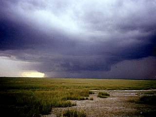
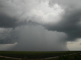
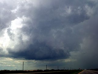
This is a small thunderstorm cell developing south of South Bay, Florida ahead of a cold front and squall line in late December 2006. The heavy precipitation core of this storm cell can be seen spreading out near the ground due to downdrafts within it. The view is to the northeast. |
|
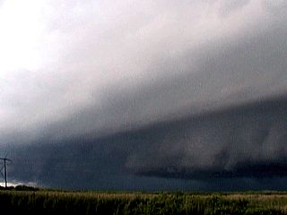
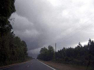
This is a view of the gust front on the leading edge of a squall line pushing through wetern Palm Beach County east of Bell Glade, Florida in late December 2006. The cooler air associated with the storm gust front causes this could structure and striated appearance of the shelf cloud. The view is to the southwest. |
|
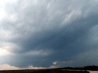
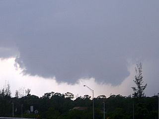
A rather interesting storm develops in west-central Broward County, Florida west of Pembroke Pines in late January 2007. This storm contained weak rotation (a small mesocyclone), and produces a wall cloud. The view is to the west. |
|
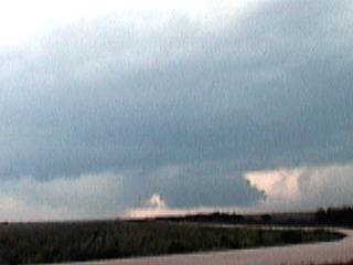
This same storm in Late January 2007 moved farther northeast near Interstate 75 and Griffith Road. The small storm spawns some small funnel clouds with weak rotation. These did not touch down. The view is to the northwest. |
|
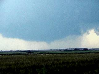
Here is another view of the same small, but now HP supercell-like storm looking west on Broward Boulevard in Fort Lauderdale, Florida in late January 2007. The view is to the west. This storm eventually continued to the northeast into coastal waters and offshore. |
|
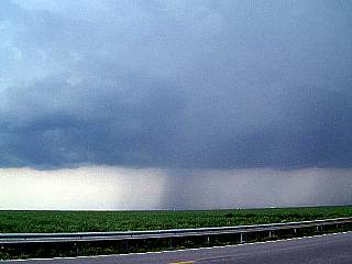
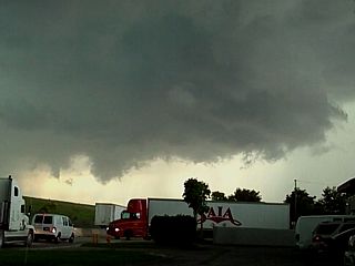
A strong and severe thunderstorm cluster can be seen here (on it's neading edge) pushing through Okeechobee and St Lucie counties in east-central Florida in mid February 2007. The view is to the north at the leading edge of the linear line of thunderstorms. |
|
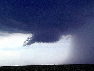
This is a view, looking northeast, at a hail shaft (bright streak, lit by the sun angle close to the ground) on the backside of the cluster of severe thunderstorms north of Okeechobee, Florida in mid February 2007. The storm contained 60 MPH winds and dime to quarter-sized hail. The hail falling from the storm appears much lighter compared to the darker rain in the storm precipitation core. |
|
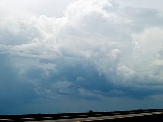
Here is a developing isolated (and discrete) supercell storm, still in its cumulus stage, well to the southeast of a cluster of storms in mid February 2007. This storm is yet to move to the east and into more unstable air associated with the East-coast sea-breeze boundary, backed-winds, and warm, moist marine air offshore. The view is to the southeast. |
|
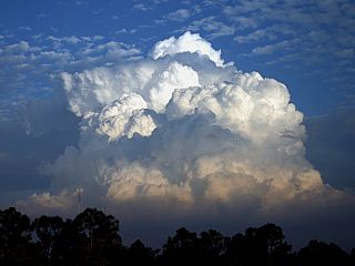
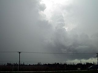
The same storm, once in the marine environment, undergoes explosive development off Martin County, Florida in mid February 2007. The rock-hard "cauliflower like" appearance of the updraft suggest storm severity. You can literally see the upward "billowing" of the violent updraft in the middle of the picture. RFD (mid-level air sinking forming the Rear Flank Downdraft) can also be seen to the right of the stormmain updraft. The view is to the east. |
|
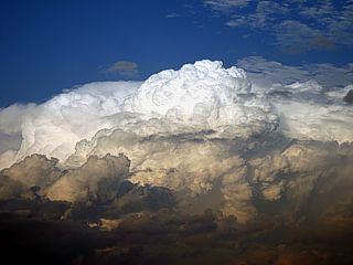
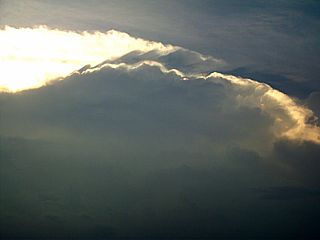
In the twilight of sunset, the top of the marine supercell storm is still illuminated off Martin County, Florida in mid February 2007. Note the backsheared anvil, overshooting top, and dusk terminator (earth's shadow) on the lower portions of the supercell. The view is to the northeast. |
|
A suprise hail storm of small hail 1/4" to 1/2" (pea to dime sized) hits a portion of Dayton, Ohio on April 14, 2007. The small storm was actually embedded in a region of light rain and snow on the back side of an intensifying low pressure system. |
|
A small supercell storm develops in Broward County, FL on May 6, 2007. This storm also was tornado warned at the time the picture was taken. Note the wall cloud and RFD clear slot (lower left), heavy precipitation and vault to the right, and rotating updraft above and left of it. This is a rather rare sight (a classic supercell storm) in South Florida. |
|
The May 6, 2007 supercell storm in Broward County in South Florida also produced a large wall cloud. |
|
During the weakening phase of the small supercell storm on May 7, 2007 in South Florida, a rotating wall cloud persists. This is what was reported by some people as a tornado. I would call it a funnel cloud / wall cloud at best. |
|
The storms in South Florida on May 6, 2007 evolved into a large MCS (cluster of strong and severe thunderstorms) and passed from Broward into Miami-Dade County by early evening. In this picture, torrential rains, frequent lightning, small hail, and winds gusting over 65-MPH strikes Miami International Airport. |
|
Interesting little cell south of South Bay, FL in Palm Beach County (2 PM) on May 20, 2009. |
|
Small (shear) funnel (just right of center of picture) on sheared updraft in western Palm Beach County, FL (2:15 PM) on May 20, 2009. |
|
Multicell severe storm about the time it was producing 58 MPH (measured) winds near Belle Glade, FL (just before 2 PM) on May 20, 2009. |
|
Not sure what this is (2:10 PM) looking east towards back-side of storm updraft in Palm Beach County, FL on May 20, 2009. |
|
Tornado warned (radar-indicated) storm moving southward (back-building) from Broward county into N-Central Dade county. Note RFD slot-like feature from center to lower left. View is North (May 24, 2009). |
|
Same storm in N-Central Dade county looking to the NE. Storm producing Nickel-sized hail (to the left of updraft). Meso is in center of picture. View is ENE (May 24, 2009). |
|
Smaller "mini-supercell" storm over western Broward county moving NE along outflow boundary. View is WNW (May 24, 2009). |
|
Smaller interesting "mini super cell" developing along outflow boundary in central Palm Beach county. View is NW (May 24, 2009). |
|
Close-up of wall cloud from "mini" meso in central Palm Beach county with most-likely the ONLY rotation in any T-Storm for this day in the US (May 24, 2009). |
|
Severe cell updraft-downdraft interface (looking NE) just about the time it was being severe-warned with golfball-sized hail on May 25, 2009. |
|
Small funnel (right of center of image near street lamp) in rotating portion of storm (view is ESE under the short-lived "meso") on May 25, 2009. |
|
Interesting rotating storm NW of Miami with wall-cloud and brief funnels - This entire feature (meso) was rotating with the the funnel (left of center) under it (May 26, 2009). |
|
Close-up of funnel beneath rotating updraft just before being under-cut by 60-Knots+ outflow on May 26, 2009. |
|
Anvil of intense multi-cell severe thunderstorm south of Belle Glade / Central Palm Beach Couty, FL (along Highway 27) on June 18, 2009. |
|
Intense updraft with lightning strike associated with multi-cell severe thunderstorm looking to the north along Highway 27 in Central Palm Beach Couty, FL on June 18, 2009. |
|
Interesting funnel develops on the updraft base just as it is getting under-cut with 60 to 70-MPH outflow near Highway 27 in Central Palm Beach Couty, FL on June 18, 2009. |
|
Intense outflow winds (60 to 70-MPH) and microburst impact stage (with dust plume) east of Highway 27 in Central Palm Beach Couty, FL on June 18, 2009. |
|
The next several pictures were from a small chase / observation of strong and severe thunderstorms while traveling abroad to soutern Ontario in Canada on July 26, 2009. In this picture, taken in Missasauga, Ontario (south of Highway 401) west of Toronto, a strong thunderstorm / squall line pushes into town. The storm had frequent lightning, 40 MPH winds, heavy rains, and small hail. |
|
Here is a view of the backside and anvil of an intense thunderstorm cell associated with a squall line west of Toronto in southern Ontario, Canada, on July 26, 2009. |
|
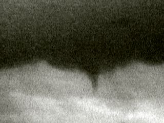
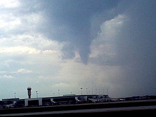
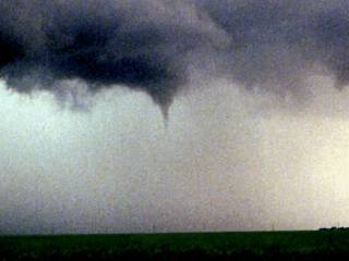
This is a rather large funnel cloud, about half-way to the ground from a high-based severe storm to the west of Toronto in southern Ontario, Canada, on July 26, 2009. The view is to the southwest, and was taken from an aircraft departing Toronto's Pearson International Airport (YTC). |
|
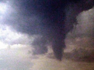
Here is an enhanced, and close-up of the funnel cloud west of Toronto in southern Ontario, Canada, on July 26, 2009, taken from an aircraft departing Toronto's Pearson International Airport (YTC). |
|
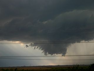
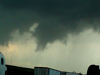
A developing mini-supercell storm in the Florida Everglades sports a cork-screwed appearance on its upwind / development side. This picture shows the southwestern side of a developing severe thunderstorm that produced hail and high winds. The cloud updraft column rotates as the storm evolves into a small supercell. The rotation causes striations on the updraft column like the stripes in a "barber pole". Visually, you could see this thing rotating! |
|
This is a picture taken early in 2001 during a killer frost in South Florida. The white foreground is the hood of my black pickup truck. I scratched the center of it removing some of the frost. In the background, the cars across the street are also frost-covered as well as the sidewalk. Note the PALM TREES in the background, this is Miramar in South Florida, and the temperature here is only 30 degrees at 7 AM, very unusual for this part of the US. This type of cold "snaps" often kill plants and animals that cannot adapt to cold climates, hence the name "killer frost". |
|
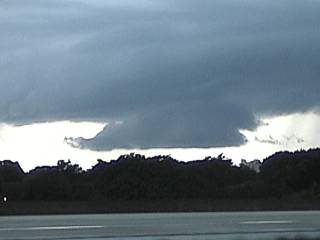
This is a picture of a severe thunderstorm near Fort Lauderdale, Florida in July of 2002. The storm briefly acquired HP supercell characteristics before occlusion of the weak RFD and inflow "notch", which can be seen in this picture. The view is to the northwest. |
|
This is a picture of what is called a "rotating head" portion of a bow / line segment of thunderstorms. It developed on the north side of a line of thunderstorms with strong westerly outflow winds to the south of our location, where this picture was taken. The resulting low-level vorticity from the strong winds in the center of the line segment and lighter winds to the north allows a low-level mesocyclone to develop in the thunderstorm cell in the northernmost portion of that line. In this picture, a striated, rotating cloud looms over Wellington, Florida in August 2003. |
|
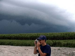
A small funnel cloud develops out of a severe thunderstorm well inland in the central portions of south Florida in summer of 2002. This funnel did not touch down but persisted for about 10 minutes near a sugar refinery. |
|
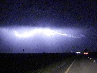
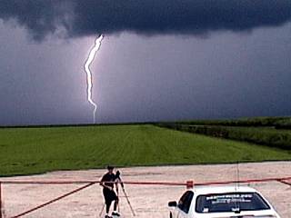
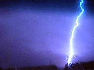
A powerful strike of CG (Cloud to Ground) lightning pierces the sky during an electrically active severe thunderstorm over Weston, Florida in November of 2002. This storm had frequent lightning and winds over 60 MPH. Note that there are no lights on the side of the road (power is out). The lightning bolt here is about a half-mile away. |
|
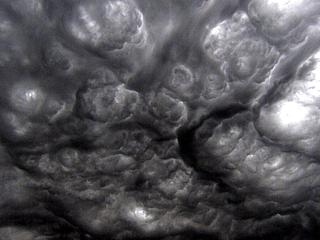
Here is a pretty bizarre formation of clouds preceding a line of severe thunderstorms over Lakeland, FL in March of 2005. This is not true mammatus clouds, but a layer of altocumulus (undulatus asperatus) that happens to be within a region of severe turbulence aloft. The new term for these clouds is called "undulatus asperatus" and these cloud formations are quite rare. Directional wind shear and convection caused these conditions to form these clouds. Any aircraft flying in this region will most likely experience severe turbulence. |
|
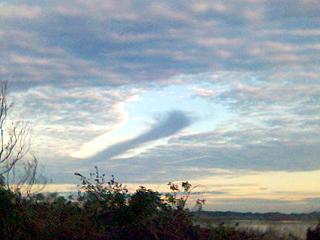
Another interesting cloud formation also appeared over Lakeland, FL in January of 2006. In this picture, a "hole punch" effect (caused by a subsident parcel of air) in an altocumulus cloud deck can be seen. Even more interesting, the "hole" in the cloud was caused by cloud droplets / ice crystals that did not only evaporate but also condensed / froze into a small "tail" of precipitation / ice crystals in the center of the "hole". The sinking air most likely was triggered by the passage of a jet airliner ascending or descending through the cloud deck, which was roughly 16,000 feet above ground level. |
HTML File "stplog3.htm" - Developed By Chris Collura
To Return To The HOME Page Of This Site Click The "INDEX.HTM" Link Here!