
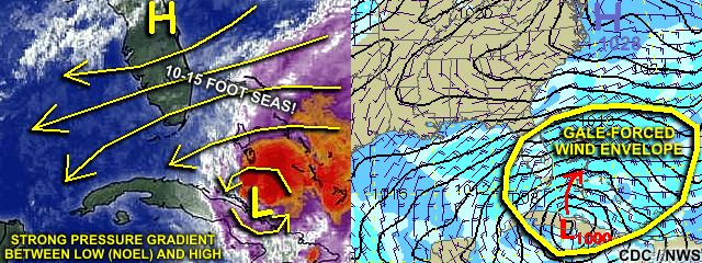
| This area shows pictures taken from the coastal observations and "fringe effects" of tropical storm Noel in South Florida. The storm began as a tropical disturbance near Puerto Rico and crossed Hispanola. Moving slowly northwestward, the system reached tropical storm status, and became named as tropical storm "Noel". Tropical storm Noel moved northwestward over Cuba then across the Bahamas before becoming a hurricane then an intense extratropical system east of Florida. The wind effects of Noel were felt far from its actual center, due to the interation with a high pressure area well to the north and west of the tropical storm. Mainly the coastal effects of this system was observed on October 31, 2007 during its point of closest approach to southern Florida. Beach erosion, gale-forced winds gusting over 40-MPH, and very high waves (15 feet or more) were observed with these effects of tropical storm Noel. |
| CHASER NAME | HOME CITY | CALLSIGN | OCCUPATION |
| CHRIS COLLURA | MIRAMAR, FL | KG4PJN | COMPUTER ANALYST |
![]() Video Clips Coming Soon!
Video Clips Coming Soon!
|
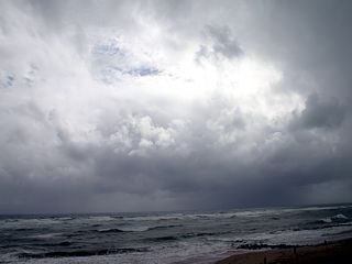
The sky takes on a stormy appearance during tropical storm Noel's closest approach to southern Florida above an extremely agiatated ocean near Boynton Beach, Florida. |
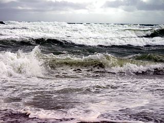
|
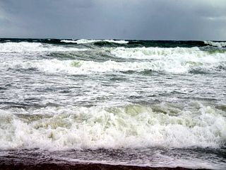
Waves as high as 12-15 feet batter the area near Deerfield beach, Florida with winds from the northeast gusting over 35-MPH. |
|
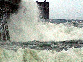
Here is a picture of the Deerfield Beach fishing pier with large breaking waves. The bottom of the pier is at least 15 feet above mean sea level. The larger waves are reaching the bottom of the pier. |
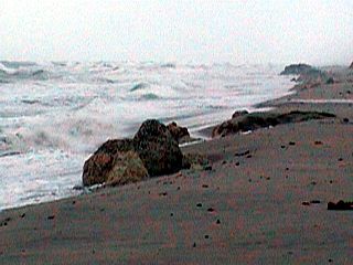
|
The large waves and wind have taken a toll on the beach in Deerfield Beach by eroding at least 20-30 feet of beach compared to a day earlier. The rock clusters, fully convered by sand a day earlier, are now completely exposed. |
|
In Boynton Beach, Florida, wind-driven waves exceed 15 feet with winds from the northeast gusting near 45-MPH. |
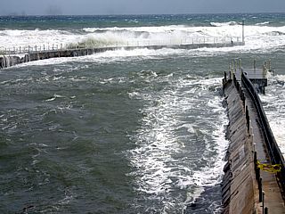
|
The Boynton Beach inlet is extremely rough during tropical storm Noel's passage east of the area. |
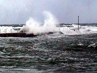
|
Here is another view of the northern jetty / seawall of Boynton Beach inlet during tropical storm Noel's effects. A large wave slams into the seawall and sends spray at least 50 feet into the air. |
|
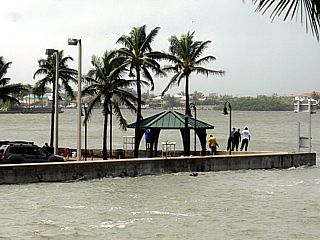
The water level is very high at Boynton Beach inlet. In this picture, notice that the water level is well above normal (2 feet or so above noemal tide), especially when you compare the level of the parking lot to that of the water on the other side of the inlet bulkhead. |
|
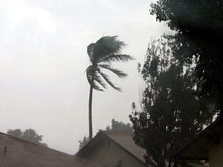
Inland, and away from the coast, a rain squall (outer feeder band) passes through and heavy rains with winds gusting over 40-MPH affects Deerfield Beach, Florida. |
|
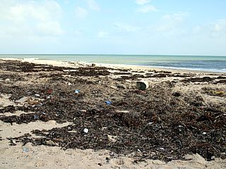
As tropical storm Noel moves away, the winds and seas calm down but the previously high tides leave a debris line of flotsam and seaweed along the beach just north of Boynton Inlet in Boynton Beach / Manalapan Florida. |
|
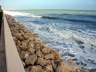
The beach is completely eroded away and only the line of rocks against the seawall remains north of the Breakers Hotel in West Palm Beach, Florida. |
HTML File "noel07.htm" - Developed By Chris Collura
To Return To The HOME Page Of This Site Click The "INDEX.HTM" Link Here!