
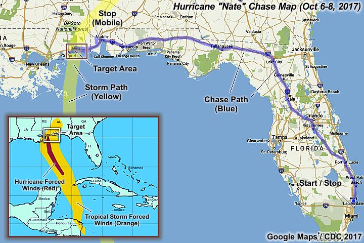
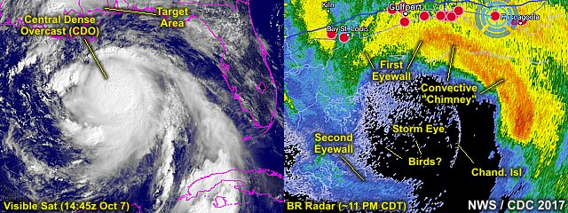
| This area shows pictures taken from the interception and observation of category-one hurricane Nate in southern Mississippi near Ocean Springs and Biloxi (Harrison County) along Highway 90 late on October 7, 2017. This hurricane was a small and compact storm, and came in with winds weakening from 90 to 85 MPH. Nate was a storm that intensified in the SW Caribbean around October 5, crossing near Nicaragua and Honduras at that time. After getting away from land, it intensified SE of the Yucatan Peninsula early on the 6th, and became a hurricane in the southern Gulf of Mexico. Moving quickly north, hurricane Nate slowly strengthened up to its first USA landfall at the mouth of the Mississippi River during the early evening of October 7. Continuing north, and then recurving northeast, the storm came ashore a second and final time, near Biloxi, Mississippi as a category one hurricane. The storm packed a storm surge from 5-8 feet, mainly ahead and to the right of where the eye came in. A brief period of hurricane forced wind gusts and horizontal rain was encountered in this area, followed by the calm eye. A significant storm surge was also documented affecting the Golden Nugget Casino in Biloxi, with Highway 90 severely flooded. The storm passed on by midnight and early morning of October 8, and quickly weakened to a tropical storm over Alabama, then dissipated a day later over the Ohio Valley area of the United States on October 9. Damage was mainly powerlines, trees, and signs - But storm surge flooding along the path of Nates core was significant. At least 45 people were killed by Nate (mainly in Central America) and damages amounted to almost 3 billion dollars. The total mileage for this portion of the chase was 1638 miles. Note - This page may take a while to load on some SLOWER connections! |
| CHASER NAME | HOME CITY | CALLSIGN | OCCUPATION |
| CHRIS COLLURA | DEERFIELD BEACH, FL | KG4PJN | COMPUTER CONSULTANT |
| DEREK SIBLEY | MOBILE, AL | N/A | METEOROLOGY STUDENT |
|
Looking southward from I-10 near Mobile, Alabama, the edge of hurricane Nate can be seen creeping over the horizon. Weather rapidly changed during the afternoon of October 7 because hurricane Nate was moving north at up to 25 MPH. |
|
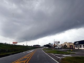
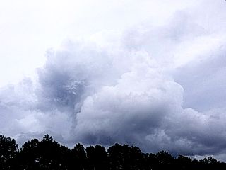
A tropical supercell storm looms over Mobile, Alabama as outer rain bands push ashore during the late afternoon of October 7. This is the remains of a convective cell that produced waterspouts earlier near Mobile Bay. |
|
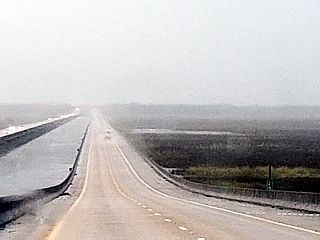
This is the view of I-10 looking west during the late afternoon of October 7 near Pascagoula, Mississippi in the outer rain bands of hurricane Nate. |
|
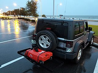
This is my vehicle, a 2016 Jeep Wrangler, between Gulfport and Biloxi, Mississippi during the early evening of October 7. |
|
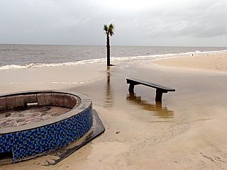
The "calm before the storm" at the beach between Biloxi and Gulfport during the afternoon of October 7. Hurricane Nate is lurking no more than 200 miles to our south, and rapidly approaching. With light ENE winds and nearly calm conditions, the only sign a storm is coming is the tides slightly above normal and the grey skies / light rain. |
|
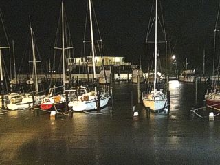
Here is a flooded marina near Ocean Springs, Mississippi on the east side of Biloxi Bay as storm surge rises. |
|
Here is another view of the Ocean Springs marina during the late evening of October 7. The docks are submerged by rising storm surge. |
|
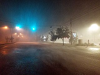
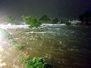
Strong winds and horizontal rains battering Ocean Springs, Mississippi around 10:30 PM CDT. This was the forward-right side of the eyewall segment (primary convective cell). Winds here are gusting up to 80 MPH with violent (horizontal) rain. |
|
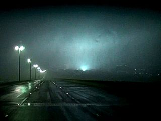
Power flashes visible while crossing Biloxi Bay via the causeway back into Biloxi. Most likely the eyewall winds knocking out power, or flooding from storm surge causing an electrical short. |
|
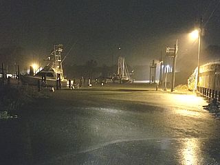
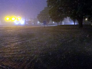
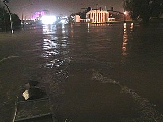
Storm surge flooding covering the west side of Biloxi Bay across Highway 90 just before the eye of hurricane Nate arrives. |
|
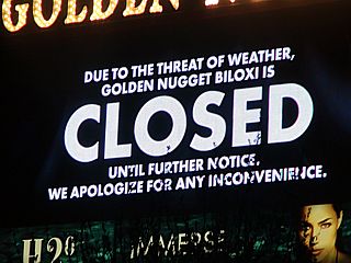
Sign saying that the "Golden Nugget Casino is closed". No kidding. |
|
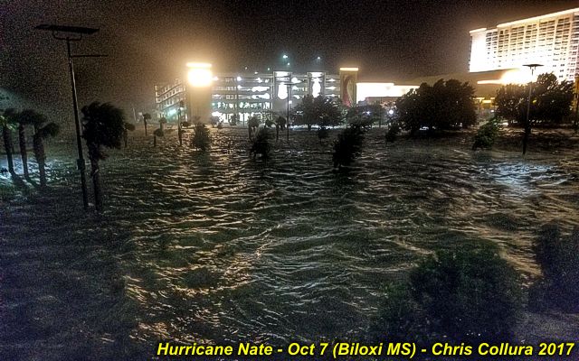
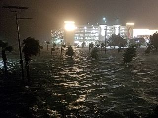
Destructive waves and raging storm surge coming into the parking area of the Golden Nugget Casino off Biloxi Bay late on October 7. |
|
Storm surge flooding at the Golden Nugget Casino as the calm eye of hurricane Nate approaches the area before midnight on October 7. |
|
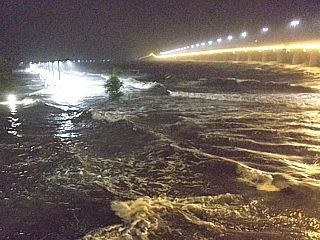
View of Biloxi Bay causeway and storm surge / waves coming onto land around midnight on October 7 / 8. |
|
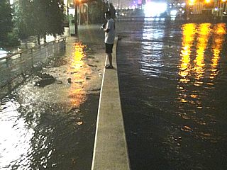
Chaser Derek Sibley standing on a crosswalk barrier with Highway 90 flooded in the calm eye of Hurricane Nate. |
|
Highway 90 flooded with storm surge, but in nearly calm winds, inside the eye of hurricane Nate around midnight of October 8 in Biloxi. |
|
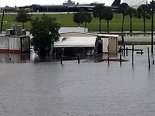
Receding storm surge south of I-10 east of Mobile, Alabama during the morning of October 8 with flooded dock areas. |
|
Small supercell storm east of tropical storm Nate as it moved inland on October 8. |
|
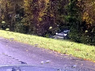
View of one of many accidents eastbound on I-10 in the Florida panhandle late on October 8. Two cars spun out in the rain, with one crashing into the trees. |

|
This is the brand new ASUS laptop that stopped working during the middle of the hurricane. Never powered up again. Here I have it opened to try to recover data from the hard disk drive before sending it out for repairs. |
HTML File "nate17.htm" - Developed By Chris Collura
To Return To The HOME Page Of This Site Click The "INDEX.HTM" Link Here!