
| The storm chase expedition to the US Great Plains for 2002 is completed with a total of 15 travel days. Seven of these days were great chase days with sixteen storm interceptions. My portion of this storm chase expedition was from May 13 to May 27, with fourteen days available for chasing. The main "Weathervine" storm intercept team left for Dallas, Texas on May 12, 2002 and chased until May 27, 2002. This is my third trip dedicated to severe thunderstorm research in this area, which includes the Great Plains and the Midwestern United States. Keep in mind that this chase log is scientific evidence and portrays my on-going storm chasing research. It has been placed on this page for easy reference and meteorological interests. Please do not plagiarize or copy this document to other sites for distribution. Note - This page may take a while to load on some SLOWER connections! |
| CHASER NAME | HOME CITY | CALLSIGN | CHASE DATES | OCCUPATION |
| AMOS MAGLIOCCO | DENTON, TX | KC5VPD | 5-23 TO 5-24 | WRITER |
| CHRIS COLLURA | MIRAMAR, FL | KG4PJN | 5-13 TO 5-27 | COMPUTER ANALYST |
| JASON FOSTER | BALTIMORE, MD | N3PRZ | 5-17 TO 5-27 | ARCHITECT |
| JEFF GAMMONS | WPB, FL | KG4PGA | 5-12 TO 5-27 | WEB DESIGNER |
The participants below are not from the "Weathervine" chase team but did actively participate in our storm research efforts and deserve appreciation for their great help and severe weather expertise.
| CHASER NAME | HOME CITY | CALLSIGN | OCCUPATION |
| ERIC NGUYEN | NORMAN, OK | KD5HPZ | OU STUDENT |
| BLAKE MICHALESKI | MONROE, LA | KD5MWK | STUDENT |
| JASON PERSOFF | JACKSONVILLE, FL | KB0YJW | DOCTOR |
| JEFF LAWSON | DENTON, TX | KD5LBL | STUDENT |
| ROBERT HALL | DENTON, TX | KD5KRI | STUDENT |
| SCOTT BLAIR | FORT SMITH, AR | KD5KOW | STUDENT |
Please note that several other chasers may have caravaned or "converged" with us. David Cornwell could not join the "Weathervine" chase team due to some personal responsibilities.
The following entries are all storm chases and interceptions performed in the Midwest United States from May 13, 2002 to May 27, 2002. This log is based on a joint effort of a storm chasing team. Members were myself - Chris Collura (Florida Skywarn storm spotter code B036 - KG4PJN), Jeff Gammons (Florida - KG4PJA), and Jason Foster (Maryland - N3PRZ) for the main chase team. This is jointly with the Weather Information Network or "Weathervine". The main chase vehicle was a 2002 Chevy Blazer SUV. Total mileage was over 6,200 miles!
Communications employed were HF and VHF HAM radio, FRS hand-held radios, and cellular phones and / or modems. Extensive camera and video equipment was also on board along with GPS and a laptop computer for navigation. The main chase duties were shifts in navigation using the GPS, radio communications, driving many miles, and preparing forecast data. A portable weather station also was developed by myself to be used in this chase trip. I flew into Dallas, Texas on May 13, 2002 to pick up my SUV rental and meet with Jeff. Jason flew in on May 16 to join us. The chase involved large expanses of the US Great Plains sometimes in the worst driving conditions imaginable, in very remote regions.
All chases and observations are in chronological order and a chase number is assigned to each entry. Please bear in mind that all observations adhere to modern storm analysis standards and do not include all storms that occurred in a given area for a particular chase period. The chase log is also augmented with a small chart at the conclusion the log showing types of observations.
Any kind of storm such as a thunderstorm, tornado, waterspout, tropical cyclone, and extratropical storm can be chased or observed. I have tried to keep this log of any storms that I have observed as accurate as possible, while using terms and expressions to abide by those used by most meteorologists and storm spotters today.
Storm chasing and observation can be extremely dangerous and may result in serious injury or death. I have received intermediate and advanced training for storm spotting in 1996. I strongly urge anyone who is to try their hand at storm spotting to get training before doing so. You must also have a good understanding of meteorology and storm dynamics. "If you don't know what you're doing, Don't do it!" Contact your local National Weather Service office for information on storm spotting and about training to become a Skywarn storm Spotter. It is also advised that chasing in the Great Plains is to be done only be experienced people as a group.
May 13 - Off day. Arrived in Dallas, Texas and spent the day in Denton, Texas. The portable weather station and all equipment was set up on the 2002 Chevy Blazer chase vehicle.
May 14 - Off day. Left Denton, Texas for Amarillo in late afternoon with possible target in Liberal, Kansas. Met with Amos Magliocco, Rob Hall, Scott Blair, and Eric Nguyen who will join us for chasing the next day.
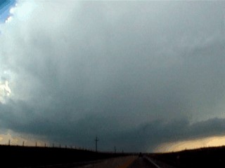
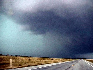
May 15 - This day had two major thunderstorm intercepts, the first was an elevated multicell cluster of strong thunderstorms near Meade, Kansas. The second was a much more severe LP / Classic supercell type storm about 10 miles west of Pratt, Kansas. This storm developed after sunset but was illuminated by lightning to reveal an impressive structure. Hail 2.5 inches in diameter was found in this storm!
May 16 - Three thunderstorms, all supercells, and one producing a tornado were intercepted today. The chase track left Pratt, Kansas and passed through Springfield, Colorado with a primary target in Trinidad. Midway between Springfield and Trinidad, elevated convection was encountered with dropping dewpoints. This convection was in conjunction with a powerful shortwave trough coming out of the Rocky Mountains. The chase turned back to the east then south, and the first supercell was encountered near Campo, Colorado. The second supercell was farther south near Guymon, Oklahoma and produced prolific amounts of large hail and a weak tornado. The third supercell was intercepted in extreme northern Texas after dark, but was in its weakening phase.
May 17 - Off day. Front passed all the way through Texas and scoured out our unstable airmass. We went back to Denton, Texas and joined up with Jason Foster. He dropped his rental car off in DFW (after arriving May 16) and will join us until May 27. We decided to go caving in Carlesbad Caverns and positioned ourselves in Big Spring, Texas shortly after midnight.
May 18 - Off day. Moisture has not rebounded yet so we went spelunking in Carlsbad Caverns in New Mexico. We left Big Spring, Texas for Carlsbad, New Mexico and arrived there at 2:30 PM MST. After a day of caving and photography of the New Nexico desert, we headed back into Texas after dark. We stayed the night in Plainview, Texas and are anticipating a target area soon to our north.
May 19 - Off day. Things got pretty scary with a nast high-pressure ridge setting up over the central United States, not a good thing for storm chasers. We managed to pass through Amarillo, Texas after making some quick repairs on a power cable for the weather station. We stayed in Clayton, New Mexico for some photography in Canyon Country. Our target was very uncertain for this day.
May 20 - Yet another off day. We left Clayton and headed north to Cheyenne Wyoming anticipating some convection the next day ahead of a vigorous low pressure system moving in from the Pacific Northwest.
May 21 - Squall line / multicell type elevated severe thunderstorms encountered in Eastern Wyoming from Casper to Torrington. This long chase started in Cheyenne and traveled up and down Interstate 25 to near Casper. Storms were followed southward from their point of origin down I 25 to highway 26, then eastward into Nebraska.
May 22 - Three thunderstorms, two of which supercells, were encountered today in North Central Kansas. The first storm was encountered near Lebanon, Kansas and the second supercell further south past Osborne, Kansas. Both storms were well-developed HP supercells with rapid rotation. The third thunderstorm was a multicell type storm that approached severe limits. This chase day ended nearly running out of gas until a gas station owner in Natoma, Kansas was kind enough to open and let us fuel up. We ended the day in Hays, Kansas.
May 23 - Three supercells were encountered today, all of which produced tornadoes. Two tornadoes from two supercell thunderstorms were observed. The chase began leaving Hays, Kansas southward to get ahead of a stalled frontal boundary. Initiation began in the warm sector of the system near Gage, Oklahoma. We drove west into Texas Panhandle on highway 15 to intercept our first thunderstorm, which became a supercell and produced a small tornado near Lipscomb, Texas. The second supercell was encountered further southwest near Spearman, Texas and dropped another brief, rain-wrapped tornado. The third supercell was an HP monster north of Pampa, Texas and was VIOLENTLY rotating. This storm had inflow over 50 knots and produced another tornado that was not intercepted. This same storm dropped "gorilla" hail. The chase ended after midnight and we stayed in Elk City, Oklahoma.
May 24 - Three thunderstorms were observed today, two of which supercells. A moderate risk was issued today with a 15 percent chance of tornadoes. We left Elk City, Oklahoma for Childress, Texas. Initiation occurred near 3:30 PM in this area and a cell fired northeast of Childress. This cell became supercellular but lost its characteristics as other cells developed around it. We decided to head through Quanah, Texas and west on highway 287 penetrating a linear sever storm. We headed south to near Guthrie, Texas then east on highway 82. Another large supercell storm was encountered northeast of Benjamin, Texas. This cell also became outflow dominant rather quickly. There were few other storms worth chasing so we concluded our chase day in Wichita Falls, Texas.May 25 - Off Day. Convection possibilities were confined to far southern and central Texas, and with nearly non-existant mid-level winds and a poorly defined dryline, we decided to position for possible convection in the Texas Panhandle area for May 26. We stayed in Amarillo, Texas anticipating a possible dryline setup the following day.
May 26 - Severe elevated multicell thundetstorms were encountered today in SW Kansas near Hugoton and Liberal. These storms were multicell un nature and did not develop into true supercells. After completing our chase, we headed back into Texas and spent the night in Denton, Texas. Equipment was disassembled from the rental SUV and packup completed for tomorrows travel day./
May 27 - Off Day. This day was a travel day and included turning in the rental vehicle and leaving from DFW.
1). May 15, 3:30 PM - Penetration and observation of strong thunderstorms near Santana, Kansas along highway 56. These storms were an elevated multicell cluster of thunderstorms, and produced winds near 40 MPH, small hail, heavy rains, and frequent lightning. Jeff Gammons and myself conducted the chase in a 2002 Chevy Blazer SUV. The storms were caused by an upper-air disturbance and surface heating. Documentation was still photos and a camcorder.
2). May 15, 9:00 PM - Direct penetration and observation of an extremely severe thunderstorm to the west and northwest of Pratt, Kansas along and north of highway 54. The storm was a well developed LP supercell which actually evolved to the classic mode for some time. The storm occurred after night but contained frequent lightning which revealed a "stack of saucers" structure to the storm. North of this well-developed mesocyclone, hail up to 2.5 inches was found! This storm also produced some small funnel clouds and a large wall cloud. Only light to moderate rains was found with this storm. The storm also produced winds up to 60 MPH and frequent lightning with some close hits. Jeff Gammons and I conducted the chase in a 2002 Chevy Blazer SUV. Scott Blair and myself sampled the hail core in his 1996 Ford Taurus, which got a cracked windshield from the core punch. Documentation was still photos and video. A strong upper-air disturbance, surface heating, and approaching dryline caused the storms in an atmosphere of directional mid-level shear. A severe thunderstorm watch was also issued for this area.
3). May 16, 7:00 PM - Direct penetration of an extremely severe thunderstorm near Campo, Colorado. This storm had winds over 50 MPH but hail to 2 inches in diameter. Frequent lightning with heavy rains were also encountered with this storm. A region of rotation was noted on the SW side of this supercell storm with copious amounts of dust being picked up. Jeff Gammons and myself chase the storms in a 2002 Chevy Blazer SUV. Documentation was still photos and a camcorder. The storm was caused by surface heating, a stalled front to the north with a triple point on the dryline to the southwest. A vigorous shortwave trough provided the upper air support and shear for the supercell storm. Scott Blair, Eric Nguyen, Robert Hall, and Jeff Lawson also chased with us on this storm in separate vehicles.
4). May 16, 8:30 PM - Direct penetration of an extremely severe thunderstorm near Guymon, Oklahoma. This storm was a cyclic supercell that evolved through HP and classic supercell modes during its journey from the Oklahoma panhandle into far northern Texas. The storm was first encountered from the rear near guymon, and 2 inch hail was found (larger than golfballs). Hail left an accumulation in some areas, turning the ground white. South of Guymon, the same storm wen through an updraft cycle and produced a brief F1 tornado marked by a tornadic dust whirl under a rotating wall cloud. The storm cycled once more after that and began drawing in tremendous amounts of air from the east and southeast. Inflow was measured at over 55 MPH. The dust kicked up reduced visibility and even obscured the storm base entirely. The chase team and myself immediately went south to get out of the "bears cage" of this storm. Again, between Guymon and Spearman, Texas, hail was encountered, this time as large as tennis balls (2.5 inches). This caused damage to the chase vehicles involved. The storm also produced torrential rains, frequent lightning, and winds over 60 MPH. Jeff Gammons and myself chase the storms in a 2002 Chevy Blazer SUV. Documentation was still photos and a camcorder. The storm was caused by surface heating, a stalled front to the north with a triple point on the dryline to the southwest. A vigorous shortwave trough provided the upper air support and shear for the supercell storm. Scott Blair, Eric Nguyen, Robert Hall, and Jeff Lawson also chased with us on this storm in separate vehicles. A severe thunderstorm watch was also issued for this area.
5). May 16, 10:30 PM - Direct penetration of a severe thunderstorm in northern Texas well east of Texahoma, Texas. This storm was a supercell thunderstorm and was intercepted during its gust-out or weakening stages. Hail up to dime / nickel size was encountered with extremely heavy rains and winds near 50 MPH. This storm was another giant hail producer, and produced grapefruit sized hail earlier near Texahoma. The storm weakened considerable at time of interception. Jeff Gammons and myself chase the storms in a 2002 Chevy Blazer SUV. Documentation was still photos and a camcorder. The storm was caused by surface heating, a stalled front to the north with a triple point on the dryline to the southwest. A vigorous shortwave trough provided the upper air support and shear for the supercell storm. Scott Blair, Eric Nguyen, Robert Hall, and Jeff Lawson also chased with us on this storm in separate vehicles.
6). May 21, 8:00 PM - Observation and penetration of severe thunderstorms in Eastern Wyoming. The storms developed east of the Rocky Mountains front range near Casper as elevated multicell thunderstorms. There were some bow line segments observed with some of these cells initially. The storms then evolved into a rather strong squall line along a very strong cold front. Precipitation was rather light to moderate with this line, but severe winds were observed. One 73 MPH gust was measured as a gustnado type vortex passed right across highway 26 near Torrington, Wyoming. These storms were caused by surface heating in very low dewpoints forced by a strong cold front. A 2002 Chevy Blazer SUV was used to chase the storms. Documentation was still photos and a camcorder. A severe thunderstorm watch was also in effect for this area.
7). May 22, 6:00 PM - Observation of a severe thunderstorm and funnel cloud near Lebanon, Kansas west of highway 24. The storm was an HP supercell that developed in a line of severe thunderstorms. The storm was observed from its southestern side and produced a large rotating wall cloud after some time. The storm weakened before a tornado could develop. Light rains and 40 MPH inflow winds were observed this region away from the storm core. A 2002 Chevy Blazer was used to observe the storms. Eric Nguyen, Amos Magliocco, and Scott Blair also were chasing with us in a caravan for the storms. Documentation was still photos and a camcorder. A weak frontal boundary, surface heating, and advancing dryline produced the storms under strong shearing winds aloft. A severe thunderstorm watch was also in effect for the area.
8). May 22, 8:00 PM - Direct penetration of a large severe thunderstorm southwest of Osborne, Kansas west of highway 24. The storm was an HP supercell thunderstorm and the chase track passed through the southern core of the storm. The RFD winds blasted out of the west during the core punch at over 65 MPH with torrential rains. The storm also had frequent lightning. A 2002 Chevy Blazer was used to observe the storms. Eric Nguyen and Scott Blair also were chasing with us in a caravan for the storms. Documentation was still photos, audio, and a camcorder. A weak frontal boundary, surface heating, and advancing dryline produced the storms under strong shearing winds aloft. A severe thunderstorm watch was also in effect for the area.
9). May 22, 9:00 PM - Penetration of a very strong to possible severe thunderstorm neat Alton, Kansas west of highway 24. This storm had 40 MPH winds and hail at least dime sized. The thunderstorm was along a line of strong and severe thunderstorms. A 2002 Chevy Blazer was used to observe the storms. Eric Nguyen, Amos Magliocco, and Scott Blair also were chasing with us in a caravan for the storms. Documentation was still photos and a camcorder. A weak frontal boundary, surface heating, and advancing dryline produced the storms under strong shearing winds aloft. A severe thunderstorm watch was also in effect for the area.
10). May 23, 5:00 PM - Observation of a severe and tornadic thunderstorm near Lipscomb, Texas near Highway 15 and Highway 305. The storm was a classic supercell and produced frequent lightning and large hail (up to quarter sized) in the areas observed. The storm produced a brief tornado and was followed for 2 hours before the supercell dissipated. After the tornado, the storm still produced several large wall clouds and funnels. Documentation was still photos and a camcorder. A 2002 Chevy Blazer was used to chase the storms, which were caused by surface heating, an upper air disturbance / jet stream, stalled frontal boundary, and advancing dryline. A severe thunderstorm watch was also in effect for this area.
11). May 23, 8:00 PM - Observation of a very severe and tornadic thunderstorm near Spearman, Texas near Highway 70. The storm was a classic supercell and produced frequent lightning and a very large wall cloud. Hail up to nickel sized with strong winds to 50 MPH and heavy rains were also observed with these storms. The storm produced a brief rain-wrapped tornado before its powerful mesocyclone occluded. Documentation was still photos and a camcorder. A 2002 Chevy Blazer was used to chase the storms, which were caused by surface heating, an upper air disturbance / jet stream, stalled frontal boundary, and advancing dryline. A severe thunderstorm watch was also in effect for this area.
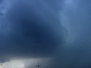
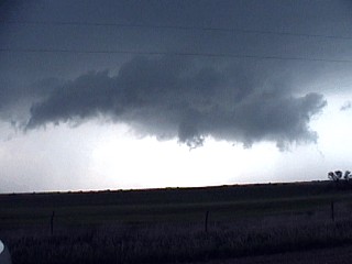
12). May 23, 9:30 PM - Observation and direct penetration of an extremely severe thunderstorm north of Pampa, Texas near highway 70. This storm was a violently rotating HP supercell with one of the most incredible and defined mesocyclones I ever seen. Lightning was continuous, and viewing the storm structure was no problem because of it. The storm was onserved from Pampa to Miami, Texas during its very long lifecycle. On its southeast side, inflow winds 50 to 60 MPH were observed. The storm had a well developed vault region, wall cloud, hail core, and beavers tails extending out to the NE, SE and flaking to the SW. The entire updraft base was "liberty bell" shaped with many "stacked plates" in the mid-levels. The storm may have produced a large tornado, but it was not observed. A 2002 Chevy Blazer was used to chase the storm. At 10:30 PM, I rode with Scott Blair in a 1996 Ford Taurus into the hail core on this cell. Frequent lightning with numerous close hits, torrential rains, baseball sized hail, and 80 MPH winds were found in the core. The car was knocked off the road and had its front windshield shattered by hail 3 inches, or more, in diameter! The Ford Taurus suffered numerous cratering to its body panels from the hail. This storm was caused by surface heating, an upper air disturbance / jet stream, stalled frontal boundary, and retreating dryline. A severe thunderstorm watch was also in effect for this area.
13). May 24, 5:00 PM - Observation of a severe thunderstorm northeast of Childress, Texas. The storm was one of the first cells to initiate after 3:30 PM. The storm rapidly developed and became a supercell storm with inflow tails, notch, precipitiation core, and vault. The storm persisted for a while as it was observed from a distance of a few miles. Only 20 MPH inflow winds and light rain with lightning was observed with this storm from its vantage point. As other weaker cells developed around the supercell, it evolved to LP mode and gradually dissipated. The supercell updraft did have a stacked plate striated appearance for a while before the storm dissipated. A 2002 Chevy Blazer SUV was used to chase the storm, which was caused by surface heating, an upper air disturbance, Gulf moisture, and a triple point of a dryline and cold front to the north. Documentation was still photos and a camcorder. A tornado watch was also issued for the area.
14). May 24, 6:00 PM - Penetration of a severe thunderstorm west of Quanah, Texas along highway 62. This storm was part a multicell portion of thunderstorms ahead of the advancing dryline. While passing through the storm, torrential rains, 45 MPH winds, frequent lightning, and dime to nickel sized hail was encountered. A 2002 Chevy Blazer SUV was used to chase the storm, which was caused by surface heating, an upper air disturbance, Gulf moisture, and a triple point of a dryline and cold front to the north. Documentation was still photos and a camcorder. A tornado watch was also issued for the area.
15). May 24, 8:00 PM - Observation of an extremely severe thunderstorm northeast of Benjamin, Texas in King County from along highway 82. The chase track approached the storm from the west and passed just south of a very severe hail core under the rain-free base. 30 to 40 MPH inflow and outflow winds were encountered with this storm. The hail core had hail to grapefruit size but was not penetrated. This storm showed a TVS on radar, and visually had an RFD "slot" that quickly wrapped around the mesocyclone core and occluded the storm. The radar also indicated 79 VIL and 74 DBz base reflectivity with this cell! The storm was not penetrated, and gusted out to a linear feature north of Seymour, Texas. A 2002 Chevy Blazer SUV was used to chase the storm, which was caused by surface heating, an upper air disturbance, Gulf moisture, and a triple point of a dryline and cold front to the north. Documentation was still photos and a camcorder. A tornado watch was also issued for the area.
16). May 26, 7:00 PM - Penetration of severe thunderstorms near Hugoton and Liberal, Kansas. These storms were part of a multicell cluster of elevated (high based) strong and severe thunderstorms. When penetrating the storms near Liberal and Hugoton, moderate to heavy rains, 50 to 60 MPH winds, and nickel sized hail were encountered along with frequent lightning. The storms were caused by a region of convergence ahead of a weak dryline, an upper air disturbance, and surface heating. A 2002 Chevy Blazer SUV was used to chase these storms. Documentation was still photos and a camcorder. A severe thunderstorm watch was also issued for the area.
This concludes the Midwestern United States Chase Log. The summary includes a total of 15 severe thunderstorms and 3 well-documented tornadoes. The main chase vehicle conducting all chases was a 2002 Chevy Blazer. Three other vehicles were used in some chases, a 1998 Toyota 4-Runner (Amos Magliocco), a 1996 Ford Taurus (Scott Blair), and a 1999 Dodge Regency van (Eric Nguyen). All vehicles received hail damage during this expedition, the most severe being to the 1996 Ford Taurus owned by Scott Blair. The tornadoes observed ranged from F0 to F1 on the Fujita scale. This information was prepared exclusively for the National Weather service and the team of Skywarn storm spotters.
|
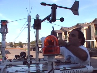
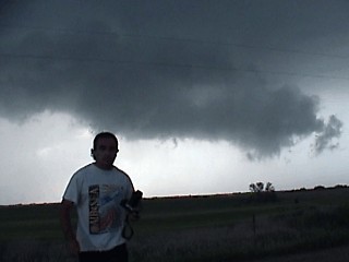
This picture shows myself setting up the chase vehicle, a 2002 Chevy Blazer rental SUV, with the portable weather station. This was my arrival day and there were no storms in the chase areas. The afternoon was spent with Amos Magliocco, Jeff Gammons, and Jeff Lawson in Denton, Texas. |
|
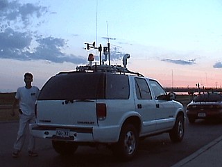
This picture shows the 2002 Chevy Blazer at a rest stop enroute to Amarillo, Texas. Jeff Gammons is standing to the left. |
|
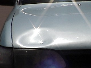
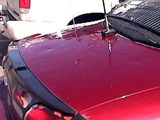
This picture shows the hood of Robert Hall's chase vehicle after a damaging encounter with baseball sized hail from a storm on May 4, 2002. The large dent here was caused by a grapefruit sized piece of hail (4 1/2 inches in diameter)! Damage to the vehicle was up to $10,000. |
|
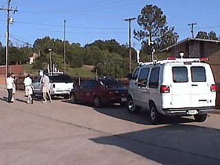
This picture shows the group of storm chasers in the Pizza Hut parking lot in Wichita Falls, Texas. There is Jeff Gammons, Rob Hall, Jeff Lawson, Eric Nguyen, and Scott Blair. The chase vehicles, with instrumentation, can be seen to the right. |
|
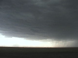
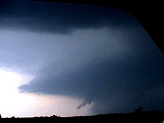
This is a picture of the rain-free base of an elevated thunderstorm in SW Kansas on May 15, 2002. |
|
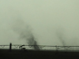
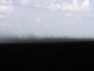
This picture shows two gustnadoes developing along a gust front in SW Kansas on May 15, 2002. |
|
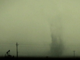
This picture shows a large gustnado developing along a gust front in SW Kansas on May 15, 2002. |
|
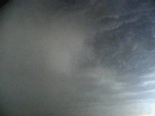
This picture shows a hail shaft falling from an elevated thunderstorm in SW Kansas on May 15, 2002. |
|
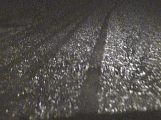
This picture shows hail covering the roadway during a supercell core-punch near Pratt, Kansas on May 15, 2002. |
|
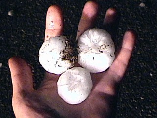
This picture shows large hailstones up to 2.5 inches being held by myself in the wake of a supercell near Pratt, Kansas on May 15, 2002. |
|
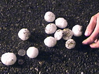
This picture shows large hailstones piled in the road to be photographed after the passage of a supercell near Pratt, Kansas on May 15, 2002. The coins in the picture are a nickel and quarter for comparison. |
|
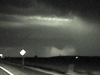
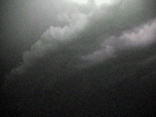
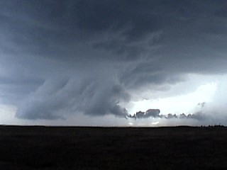
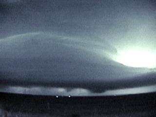
This picture shows a large lowering on the SW side of a supercell thunderstorm west of Pratt, Kansas on May 15, 2002. The picture was taken via night vision and shows a small funnel cloud with the precipitation core to the right. |
|
This picture shows some clouds wrapping into the SE side of a powerful mesocyclone from a supercell thunderstorm west of Pratt, Kansas on May 15, 2002. Lightning provided the light for this video capture. |
|
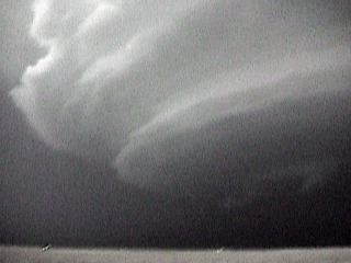
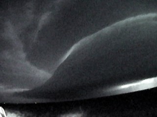
This picture shows the spectacular structure and banding associated with a powerful mesocyclone from a supercell thunderstorm west of Pratt, Kansas on May 15, 2002. Lightning provided the light for this video capture. |
|
This picture shows striations on the side of a powerful mesocyclone from a supercell thunderstorm west of Pratt, Kansas on May 15, 2002. Lightning provided the light for this video capture. |
|
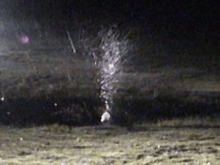
This picture shows giant hail splashing in a supercell thunderstorm west of Pratt, Kansas on May 15, 2002. A spotlight on Eric Nguyen's chase vehicle provided the light for this video capture. Large hail can make quite a splash when hitting water! |
|
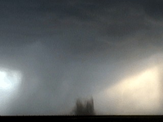
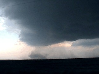
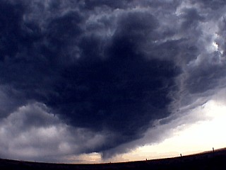
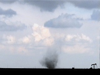
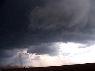
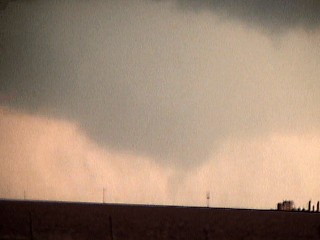
This is a picture of the rain free base and tornadic dust whirl / debris cloud on the SW side of a supercell thunderstorm near Guym0n, Oklahoma on May 16, 2002. Note the hail and rain behind the touchdown area forming the "hook" we see on radar. The tornado is probably rated F1 and is not visible to the cloud base because of dry air under the storm. |
|
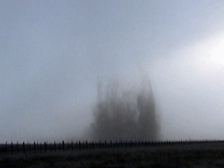
This picture shows the tornado touchdown with the swirling dust and debris cloud at the contact point with the ground. This was a weak tornado developing near Guymon, Oklahoma on May 16, 2002. |
|
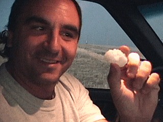
Here is a picture of myself holding a fragment of a hail stone up to 2.5 inches between Guymon, Oklahoma and Spearman, Texas in the extreme northern Texas Panhandle. A supercell thunderstorm was producing the giant hail on May 16, 2002. This piece was part of a 2.5 inch stone that shattered in my face after it hit my mirror on my open car window. Note the hail laying on the ground in the background. |
|
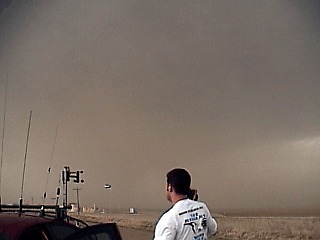
This picture shows the updraft side of a powerful supercell thunderstorm near Guymon, Oklahoma on May 16, 2002. Inflow winds were clocked at over 50 Knots, and kicked up enough dust to completely obscure the cloud rain free base. The brown dust can esaily be seen flowing from the right and into the storm core. Scott Blair is the storm chaser in the foreground. |
|
This picture shows a small dust plume on the SW side of a supercell thunderstorm near Guymon, Oklahoma on May 16, 2002. The slowly rotating dust plume was quite possibly a gustnado along the RFD (Rear Flank Downdraft) but rotated clockwise. |
|
This picture shows the rock-hard side of a supercell's updraft as it explodes upward over the Texas panhandle on May 16, 2002. |
|
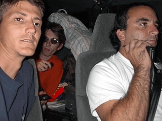
This picture shows us going from Dallas to Big Springs, Texas. I am navigating in the right seat, Jeff Gammons is driving, and Jason Foster is taking this picture with a digital camera. This was an off day, but busy because we drove from Amarillo to Denton, Texas, then to Dallas (DFW Airport) for Jason to drop off his rental vehicle. Jason then rode with us to Big Springs, Texas to plan for a caving trip at Carlsbad caverns in New Mexico. |
|
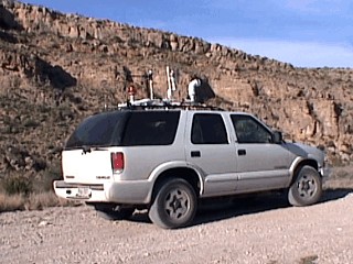
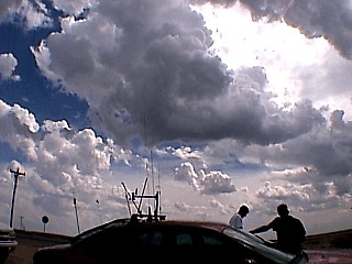
This picture was taken in a beautiful canyon in the New Mexico desert near Carlsbad Caverns. The Chevy Blazer SUV chase vehicle is shown with its mini "antenna farm" consisting of a 1/4 wave 2m, 5/8 wave 2m, 108 to 1300 MHz groundplane, and ATAS100 self tuning HF antenna. The "Weatherlab" portable weather station still stands atop the vehicle after being pounded with giant hail just a few days earlier. |
|
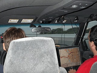
This picture was taken by Jeff Gammons (KG4PJN) to the left and also shows myself to the right and Jason Foster (N3PRZ) in the middle. We are crossing the west Texas / New Mexico border headed east on highway 62 at about 10 PM on May 18, 2002. We are using all types of HAM radio equipment including a 2m 25 watt rig, 5 watt quad (6m, 2m, 70cm, and 23cm), and best of all, a mobile HF rig Yaesu FT100a. Jason in the center is actually making a contact on 20m with Russia! There are a total of 4 antennas in addition to the weather equipment on the top of our chase vehicle. I am talking simplex (146.520 MHz) on my 2m Icom T81a. Note the gear, sleeping bag, and electronics equipment in the car ... Where is the room for the people? |
|
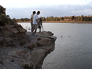
This picture shows Jeff Gammons, Jason Foster, and Scott Blair standing on a cliff overlooking a lake for an attempt at ligthning photography at a national park near Clayton, New Mexico. |
|
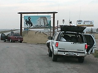
This picture shows the chase vehicles pulled off the side of the road near the Colorado / Wyoming border on May 20, 2002. |
|
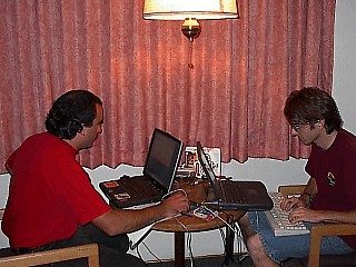
This picture shows myself and Jason Foster working on our laptop computers doing web-site updates and forecasting for the days ahead during the evening May 20, 2002 at a motel in Cheyenne, Wyoming. |
|
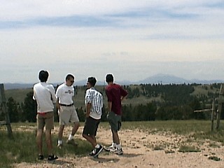
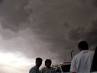
This picture shows Jeff Gammons, Eric Nguyen, Scott Blair, and Jason Foster waiting for storms to develop and watching the skies atop a hill in Eastern Wyoming just west of Interstate 25 on May 21, 2002. |
|
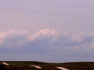
This is a picture of towering cumulus clouds just beginning to develop west of Orin, Wyoming on May 21, 2002. These small clouds are the development stages of a line of strong and severe thunderstorms along and ahead of a very strong cold front. |
|
This picture shows a developing cluster of elevated strong thunderstorms east of Casper, Wyoming on May 21, 2002. View is to the west. |
|
This picture shows a "bow echo" segment of a cluster of elevated strong and severe thunderstorms east of Casper, Wyoming on May 21, 2002. View is to the North. |
|
This picture shows a small but rotating area on the south end of an elevated bow segment of thunderstorms. The feature is rotating clockwise and is called an anticyclonic meso. The clockwise rotation is due to stronger cloud motions to the north of the south end of the cluster of storms. The storms are east of Casper, Wyoming on May 21, 2002. View is to the north. |
|
Storm chasers watch the skies in Eastern Wyoming off highway 26 while a small mesocyclone develops in the mid-levels overhead. The chasers in this picture are Jeff Gammons, Eric Nguyen, and Jason Foster. The storms developed ahead of a strong cold front on May 21, 2002. |
|
A curvy and narrow inflow band issues into a developing severe thunderstorm east of a strong cold front in Eastern Wyoming off highway 26 on May 21, 2002. |
|
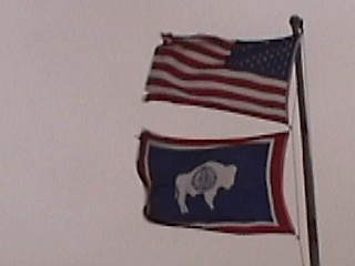
In this picture, 35 to 40 MPH sustained winds whip flags near Torrington in Eastern Wyoming off highway 26 on May 21, 2002. These winds were ahead of a powerful cold front and gusted over 60 MPH from the south. The highest measured gust was 73 MPH with the passage of the front and associated squall line. |
|
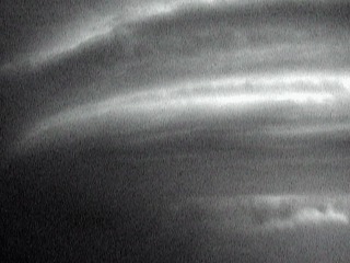
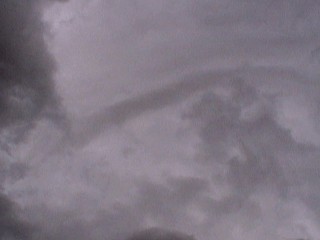
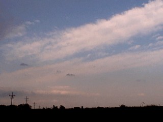
This picture shows cloud formations that may not appear important to an inexperienced observer. The higher layer of clouds is in the upper airflow of the jet stream and is racing to the northeast. The lower cloud bands in the lower left portion of this picture are racing to the northwest. This denotes an environment of strong directional wind shear that is required for supercells. The backed SE surface winds are also necessary for advecting moisture into the system for this area of the US. This picture was taken near Osborne, Kansas on May 22, 2002, before an outbreak of supercell thunderstorms. |
|
Headed north out of Osborne, Kansas, storms begin to rapidly develop in our "target" area causing a caravan of chasers to surge towards them. The storm here in the distance will soon grow into a supercell thunderstorm. View is to the north on May 22, 2002. |
|
This picture shows the round shape of a developing mesocyclone near Lebanon, Kansas on May 22, 2002. The updraft becomes less rain filled and takes on a round shape with striations as the storm system reaches HP supercell mode. Note the small wall cloud and needle funnel in the extreme lower left side of this picture. View is to the west. |
|
This picture shows a rapidly rotating wall cloud associated with an HP supercell thunderstorm near Lebanon, Kansas on May 22, 2002. The HP supercell was rotating hard but did not produce a tornado. |
|
This picture shows myself standing in front of a rotating wall cloud associated with an HP supercell thunderstorm near Lebanon, Kansas on May 22, 2002. The wall cloud was rapidly rotating but did not produce a tornado. |
|
This picture shows the northeastern side of a large HP supercell thunderstorm southwest of Osborne, Kansas on May 22, 2002. Note the inflow tail and clear air "slot" produced by the rapid inflow east of the supercell core. |
|
On the north side of a large HP supercell storm south and west of Osborne, Kansas, the updraft base and vault region becomes clearly visible. Note the curved appearance of the edge of the updraft base. The bright area behind it is hail to tennis ball size. The center of rotation is to the left and not visible. Eric Nguyen's chase vehicle is to the far lower left. The picture was taken on May 22, 2002. View is to the northwest. |
|
This picture shows the southern side of a large HP supercell storm south and west of Osborne, Kansas on May 22, 2002. Note the RFD outflow gust front to the lower left and striated appearance of the vertical structure of the supercell updraft. |
|
This picture shows a thunderstorm cell that has just began to acquire supercell characteristics. This storm already has developed a beavers tail to the right and vault region, and eventually produced a tornado near Lipscomb, Texas on May 23, 2002. |
|
This picture shows a strong inflow jet on the west side of a developing tornado near Lipscomb, Texas on May 23, 2002. The tornado is developing to the far left and not visible in this shot. The air is flowing fast from right to left into the storm and kicks up dust. |
|
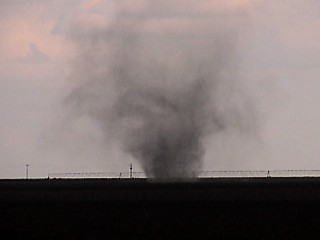
This is a picture of a small tornado near Lipscomb, Texas on May 23, 2002 near highway 305 and highway 15. |
|
This is a closeup picture of a small tornado near Lipscomb, Texas on May 23, 2002 near highway 305 and highway 15. |
|
This is a picture of a large rotating wall cloud near Lipscomb, Texas on May 23, 2002. |
|
A rapidly rotating mesocyclone and wall cloud spins up dust near Lipscomb, Texas under the SW side of a supercell thunderstorm on May 23, 2002. |
|
This is a picture of a dying supercell storm that produced a tornado near Lipscomb, Texas on May 23, 2002. The storm has evolved to an LP storm but still is rotating and has a vault, beavers tail, and small wall cloud. |
|
This picture shows the rain-free vault and supercell updraft region with large wall cloud near Spearman, Texas on May 24, 2002. The developing tornado is the lowest point to the ground between the two power poles in the center and slightly left of the picture. |
|
This picture shows a brief tornado near Spearman, Texas west of highway 70 on May 23, 2002. The tornado is wrapped in rain and hail. |
|
This picture shows the mesocyclone region of a powerful supercell storm near Spearman, Texas on May 23, 2002. The developing tornado is just to the left of the pole in the ground in the center of this picture, and is partially rain-wrapped. |
|
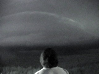
This picture shows myself observing an HP supercell off highway 70 north of Pampa, Texas on May 23, 2002. The picture was taken using only the light of the frequent lightning of the storm in night vision. Note the structure of the supercell and mesocyclone. |
|
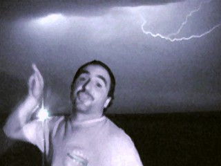
This is a video capture of myself pointing at a violent HP supercell near Pampa, Texas on May 23, 2002 near highway 70 as lightning cracks overhead. |
|
Using only the light produced by lightning, a violent HP supercell reveals itself after dark north of Pampa, Texas on May 23, 2002. |
|
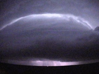
This picture is a wide true color shot of a violently rotating HP supercell after dark north of Pampa, Texas on May 23, 2002. Lightning provides the light for the video frame. Inflow winds were around 50 knots blowing TOWARDS this storm near highway 70. Note the mesocyclone structure. |
|
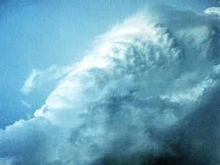
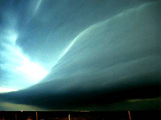
This is a time exposure, true-color picture of the southern side a large and vigorously rotating HP supercell near Highway 70 about 10 miles north of Pampa, Texas on May 23, 2002. The main inflow into the storm extends from the left into the main updraft of the storm to the right. Winds here are over 50 MPH blowing right into the storm! The yellow "glow" in the far lower left is the lights from Pampa, Texas. Twilight (9 PM) and lightning provided the rest of the light for this exposure. Note the "bell shaped" flared out updraft base and interesting "clear ring" where the top of the "bell" mates with the upper structures of the storm. Note the distinct banding. |
|
This is a poor contrast picture from a night-vision video grab of a dissapating tornado in the notch area of the Pampa Texas HP supercell on May 23, 2002. This was just seconds after a brief tornado touchdown. View is due west. |
|
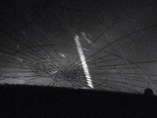
This is a video grab from a night vision / lightning-illuminated frame of the northern side of a large HP supercell near Pampa, Texas on May 23, 2002. Note the large inflow band, called a "Beaver's Tail" extending to the right of the storm updraft. The bright area to the right is lightning illuminating the hail-infested vault region of this rapidly rotating supercell. Note the wall cloud just left of the small light to the right of the picture and a large funnel cloud between the two larger lights in the center of the picture. This storm had just finished putting down a brief tornado as this picture was taken. Note the incredible banding of the storm updraft tower. |
|
This picture was taken from the front seat of Scott Blair's car during a core punch of a major HP supercell north of Pampa, Texas on May 23, 2002. A baseball sized hailstone smashes the front windshield. The streak in the picture is a hailstone whizzing by the window at blinding speeds and smashing into the hood of the car! |
|
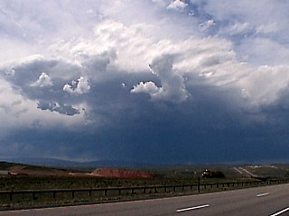
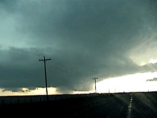
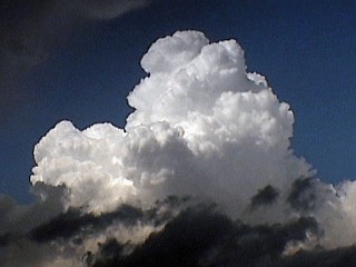
A rapidly developing cumulus congestus tower explodes northeast of Childress, Texas on May 24, 2002. |
|
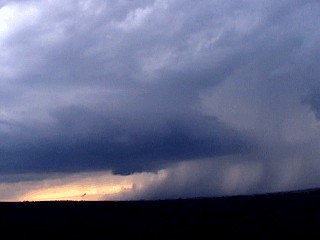
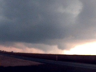
This is a picture of a developing LP supercell type storm along the dryline near Guthrie, Texas on May 24, 2002. Note the main updraft to the left becoming more dominant as a wall cloud develops at its base. This eventaully developed into a tornadic supercell as it moved further east. |
|
This picture shows a supercell thunderstorm's hail core near King County, Texas northeast of Benjamin, Texas on May 24, 2002. The picture quality is poor because it was very dark near this storm for a good video grab. The hail core is to the left of this picture, and contains hail up to 4 inches (grapefruit sized). This was a 74 DBz and 79 VIL storm on radar with a stout hook as this picture was taken. The updraft base is to the right. The hail core is wrapping strongly from left to right as an RFD develops and occludes a mesocyclone inflow notch. This storm also flagged a TVS on radar. |

|
This is a picture of myself driving at near 90 MPH to pass to the south of an extremely dangerous and tornadic supercell northeast of Benjamin, Texas on May 24, 2002. The hail core, containing baseball to grapefruit sized hail is just over my left shoulder out the window. (view is to the north and I am driving east on highway 62). Note the updraft base to the right out my windshield. Radar indicated a tornado with this storm at the time. |
|
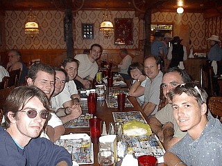
The Weathervine chase team and several other chase teams enjoys dinner at the Big Texan restaurant in Amarillo, Texas. This is a world famous Texas steakhouse complete with a country band, casino, and horseback riding. The restaurant also will give away a 72 ounce steak for free as long as you can eat it in 60 minutes or less! In this picture we see myself, Jason Foster, Jeff Gammons, Scott Blair, Bill Reid, Jason Persoff, Chris Kridler, and a few others spending the night in Amarillo anticipating some magic along the dryline the next day. |
|
This is a picture of the rear of Scott Blair's chase vehicle, a 1996 Ford Taurus, after penetrating the hail core of a supercell north of Pampa, Texas on May 23, 2002. The Back of the vehicle has cratering and smashed tail lights. The grill across the back window is for hail protection because the back window costs $1500 dollars to replace. Hail was more than 3 inches in diameter driven by 80 MPH winds. |
|
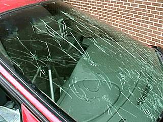
This is a picture of the windshield of Scott Blair's chase vehicle after penetrating the hail core of the monster HP supercell north of Pampa, Texas on May 23, 2002. Baseball sized hail has shattered the windshield during the core punch as I was riding along with Scott in this vehicle while Jeff Gammons and the other chasers fell back. |
|
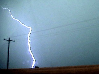
A brilliant CG (cloud to ground) lightning bolt hits the ground during a severe thunderstorm near Hugoton and Liberal Kansas on May 26, 2002. |
|
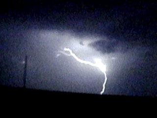
This picture shows a POSITIVE cloud to ground (CG) lightning strike over Texas during the night of May 26, 2002. Note the single bolt on the ground that branches upwards towards the high cloud base. This is opposite to negative lightning becasue the strike goes up from the ground to the cloud then back rather than from the cloud to ground first. |
|
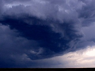
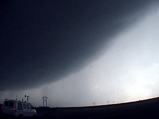
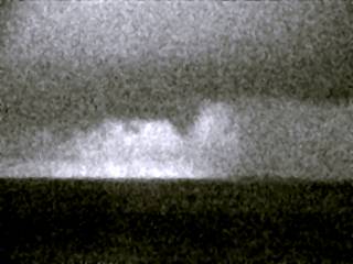
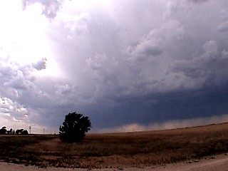
This picture shows a cluster of developing elevated severe thunderstorms near the dryline in southwestern Kansas west of Boise City on May 26, 2002. The term "elevated" means that the updraft is not drawing air in from near the ground but from an unstable, moist layer higher up. This causes a base to be at least 6,000 feet abover ground level, sometimes higher. The main threat from elevated storms is dry lightning, wind, and hail. |
|
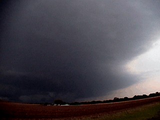
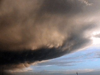
This is a picture of some mammatus clouds on the backside of a multicell cluster of strong and severe storms near the Caprock area of Texas on May 26, 2002. The dryline is the clearer air to the right of this picture. View is to the south. |
|
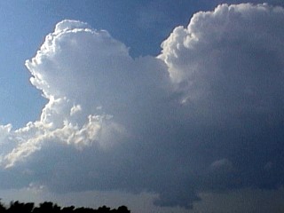
This picture shows a wide angle shot of towering cumulus developing ahead of the dryline near Boise City, Kansas on May 26, 2002. Note the large tower in the center and upper portion of the picture, the tower base has both a clockwise and counter clockwise "curl" at its base. |
|
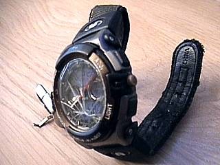
My "lucky strike". Every trip ends with a great souvenir to bring back with you. In this case, a golfball sized, or larger, struck my hand in the wrist during a hailstorm on May 16, 2002. The sting was intense and left a welt on my arm. Low and behond, I discovered the shattered face of my watch, which supposed to be "shock resistant", the following evening! Note the time the watch stopped at, about 8:40 PM, which correlates with the chase log for that day! |
HTML File "mwcl2002.htm" - Developed By Chris Collura
To Return To The HOME Page Of This Site Click The "INDEX.HTM" Link Here!