
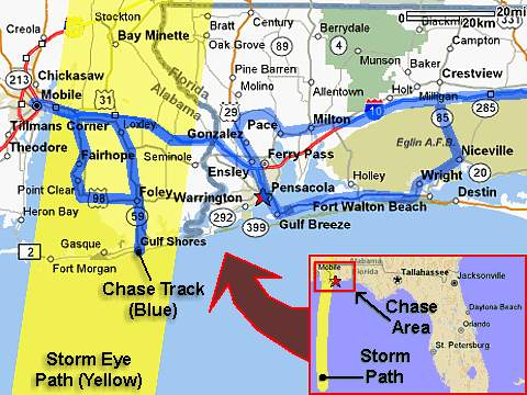
| This area shows pictures taken from the observations of strong category-three hurricane Ivan in Florida panhandle near Pensacola in Escambia County as well as near Mobile Alababma. The storm, was yet another major hurricane (at least 130-MPH at US landfall) that originally began as a tropical disturbance that moved off Africa. The storm quickly strengthened, and first slammed into Granada and the eastern Caribbean. The storm was later to become a rare category-five hurricane, with maximum winds up to 165-MPH as it brushed by Jamaica and the Cayman Islands. It crossed the extreme western tip of Cuba as it made its final turn towards the US as it cycled between category-four and five strength. Hurricane Ivan finally came ashore on the east side of Mobile Bay and buffeted Pensacola, Florida with its worst eyewall conditions on Wednesday morning, September 15, 2004 at about 2:45 AM as a borderline category 3-4 storm with 130-MPH winds gusting to 165-MPH. The central pressure at time of eye interception near Fairhope, Alabama was measured at about 943 MB with an eye 30 miles across. This hurricane interception included extreme storm surge footage, winds gusting over 130-MPH, and an hour wait in calm winds while taking measurements inside the eye of the storm near Fairhope (evacuated Thomas Hospital was the reinforced-building observation point for the eyewall weather) as other members of the chase team stayed in Mobile, Alabama. The entire chase was from September 14 through September 16, with about 1,766 total miles logged. Note - This page may take a while to load on some SLOWER connections! |
| CHASER NAME | HOME CITY | CALLSIGN | OCCUPATION |
| CHRIS COLLURA | MIRAMAR, FL | KG4PJN | COMPUTER ANALYST |
| DOUG KIESLING | MINNEAPOLIS, MN | N/A | BNVN PRESIDENT |
The participants below are not from the former "Weathervine", SKY-CHASER, or BNVN chase team(s) but did actively participate in our storm research efforts and deserve appreciation for their great help and severe weather expertise.
Jeff Gammons was unable to accompany on this storm due to medical reasons. Jason Foster also was not available to chase this hurricane. Both, however, are being recognized for their great help in now-casting for myself and the rest of my chase team.
| CHASER NAME | HOME CITY | CALLSIGN | OCCUPATION |
| JIM EDDS | FLORIDA KEYS | KG4TBE | PHOTOGRAPHER |
| MARK RACKLEY | FLORIDA KEYS | N/A | DIVE INSTRUCTER |
|
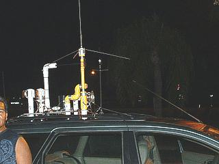
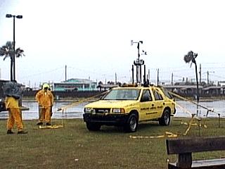
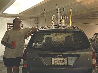
Here is my chase vehicle and equipment ready to go for the hurricane Ivan chase during a fuel stop in Bradenton, Florida. The man standing to the left was one of many curious locals who could not resist asking about the equipment. |
|
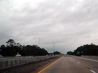
This is Interstate 10 east of Pensacola, Florida one day before hurricane Ivan. At first glimpse, this picture simply appears to be a highway. However, note that my travel lane is entirely empty (westbound lane) and all traffic is fleeing the storm in the opposite direction! |
|
This picture shows Mark Suddath's "sacrificial lamb" chase vehicle parked at the beach in Gulf Shores, Alabama. Equipped with instumentation and cameras, the goal is to record data and video as hurricane Ivan makes landfall without risking human life or limb. Such remote probes can be an expensive endeavor but record data / video footage that is priceless. Note the guy lines holding the vehicle in place. The lettering on the side says "hurricane landfall project". |
|
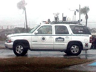
Here is a picture of another hurricane chaser's vehicle. This one is sponsored by Lowes home improvement centers. |
|
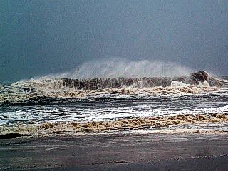
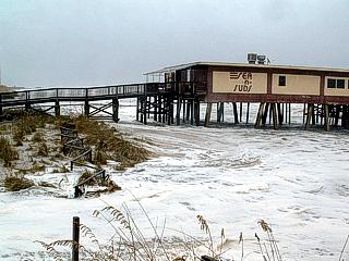
Hurricane surf pounds Gulf Shores / Orange Beach, Alabama one day before the arrival of hurricane Ivan. Tides here ran over 5 feet above normal as Ivan was a large and powerful storm less than 200 miles to the south. |
|
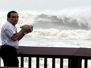
Here is a picture of myself filming the raging Hurricane surf in Gulf Shores / Orange Beach. Jim Edds was responsible for taking this "action shot" of myself. |
|
Run-up from the large surf and pre-storm surge caused severe coastal flooding at Gulf Shores Beach when Ivan was still well to the south. Winds here were east gusting to 45-MPH. |
|
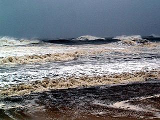
This is another picture of the exceptionally large hurricane surf at Gulf Shores Beach, Alabama well ahead of hurricane Ivan. Waves pushed ahead of tropical cyclones can sometimes do more damage than the winds themselves. |
|
Storm surge flooding under some beachfront homes in Gulf Shores Beach, Alabama. This is all salt water flooding. |
|
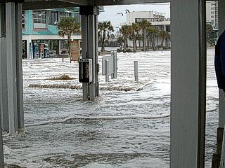
More storm surge flowing across the beachfront, into the beach-front parking, then into the street and storefronts of Gulf Shores Beach, Alabama. This salt water flowed fast! |
|
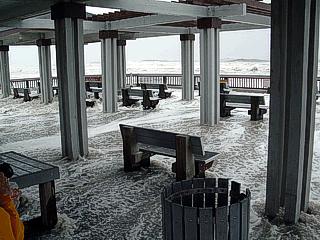
Here is the storm surge and run-up rushing over the boardwalk and picnic areas of Gulf Shores Beach, Alabama. |
|
This is picture of myself in Mobile, Alabama at a parking garage with my chase vehicle waiting for the onset of hurricane conditions. |
|
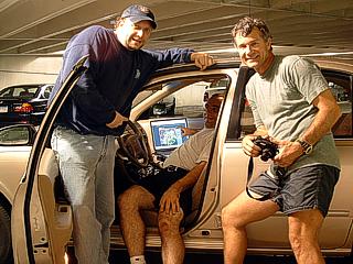
Here is our immediate chase team, Doug Kiesling is to the left (with BNVN), Myself is in the center of the vehicle (Jim Edds Nissan) looking at the radar image on the laptop, and Jim Edds (KG4TBE) is to the right. |
|
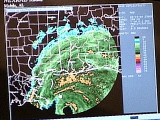
An ominous image of the approaching category three to four hurricane with 130-135 MPH winds appears on Jim Edd's laptop screen as we access the Mobile Alabama radar. The storm actually jogged right of Mobile, causing me to leave Jim and Doug behind to take measurements inside the eye of the storm farther east. Such data is crucial to a successful hurricane chase. |
|
Doug Kiesling and Jim Edds documenting hurricane conditions with full raingear and camera housings near Mobile Bay in downtown Mobile Alabama. |
|
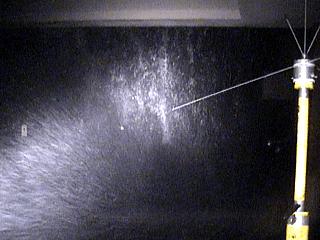
After myself relocating to Fairhope, Alabama, about 20 miles SE of Mobile across the bay, I hunkered down in front of Thomas Hospital and waited for the eyewall. The hospital, although evacuated and with only a security crew, had emergency power during the storm. In this picture, winds gusting to over 130-MPH made for quite a scary night. |
|
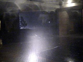
Violent sideways eyewall rains and 130-MPH winds blasted the hospital for about an hour around 2:30 AM on September 16 in Fairhope. Note the intense waterfall coming off the roof of the hospital frontage. |
|
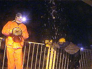
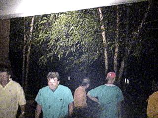
During the eye of the storm, which passed directly over Fairhope, emergency personnel from the hospital take a break and enjoy the calm of the eye outside. The trees in this picture are still, and some are gazing up into the night sky at stars and birds. |
|
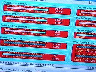
A minimum central pressure at landfall of Ivan was set by the National Hurricane Center at 939 MB. About 10 miles inland, in Fairhope, my pressure bottomed out in the eye at 943 MB, or 27.85 inches of mercury, (note the reading on the second meter from the bottom on the left of the display). The display is part of some Visual Basic software I developed for the Weatherlab weather station. |
|
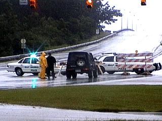
A police roadblock prevents unauthorized access to the barrier islands along Highway 59 between Foley and Gulf Shores, Alabama after the passage of hurricane Ivan. Only scientific and media personnel were allowed through this roadblock. |
|
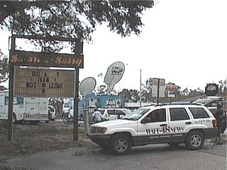
It was impossible to get to the Beach near Gulf Shores after the hurricane simply because the coastline was literally underwater. In this picture, the remains of a sign saying "Go away Ivan, not welcome" can be seen next to a flood of media vehicles. |
|
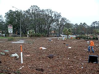
This is a picture of what was left of one of the busiest thoroughfares from Foley to Gulf Shores, Alabama - Highway 59. Debris, seaweed, and wreckage now covers the road along the leading edge of the storm surge. The surge still remained high long after hurricane Ivan ended. |
|
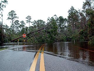
A back roadway simply disappears off Highway 59 near a park and zoo in Waterville in Gulf Shores, Alabama. Note the height of the surge and trees down. This was all salt water from the Gulf of Mexico, two miles away. |
|
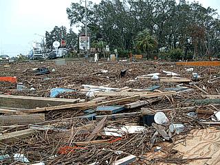
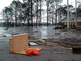
Closer view of the wreckage line long Highway 59 in Gulf Shores, Alabama. Note the debris consisting of boards, lumber, weeds, beach-front property remnants, and tree debris. The actual beachfront is still 2 miles away. |
|
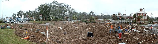
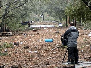
Here is a side street extendng west off Highway 59 in Gulf Shores. The affects of debris, wind damage, and storm surge are very apparent. |
|
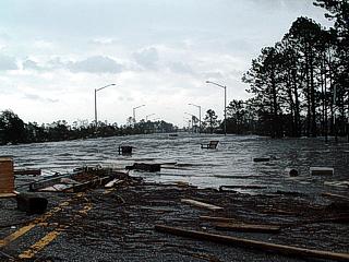
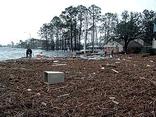
This is Highway 59 covered by the storm surge after hurricane Ivan's passage looking towards the beach. A huge debris front marks the inland extent of the surge. |
|
This is also Highway 59, taken from the same spot as the picture above, but looking more to the southwest to show flooded buildings. |
|
Yet another picture of the surge along Highway 59 showing the large debris front as well. |
|
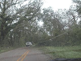
Scenes like this included many downed trees and powerlines making getting out of our chase area a long and frustrating process. Here dome tree debris and powerlines down can be seen along highway 90 west of Pensacola, Florida. |
|
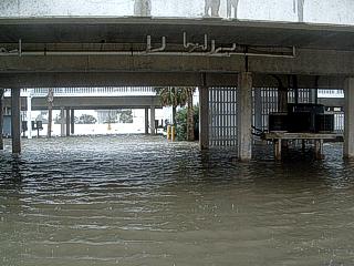
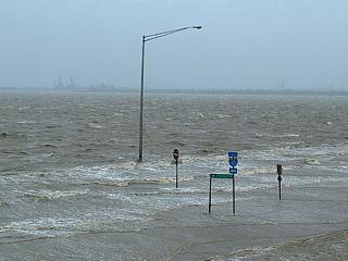
This is an Interstate-10 off ramp and service road in Mobile Bay east of Mobile, Alabama. The storm surge is still high enough to cover everything near the causeway. |
|
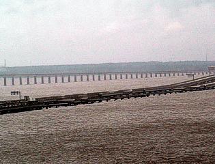
The horiffic sight of a demolished causway bridge can be seen from the west side of Escambia Bay north of Pensacola, Florida. This is the Interstate-10 causeway. Note that the entire road surface, made of reinforced conrete, had no chance against the storm surge coming into the bay. Also note the tractor trailer to the left missing its entire front-end inwhich the truck driver was killed. |
HTML File "iv04.htm" - Developed By Chris Collura
To Return To The HOME Page Of This Site Click The "INDEX.HTM" Link Here!