
| This area shows pictures taken from the observations of hurricane Gordon in Northwestern Florida near Cedar Key and Tampa. The storm formed in the Gulf Of Mexico on the north coast of Mexico and moved towards the NE while becoming a minimal hurricane of 75 MPH. The storm weakened slightly to a 70 MPH tropical storm while making landfall in Cedar Key - The chase target area. The storm packed 70 to 75 MPH wind gusts but also spawned isolated tornadoes and supercell thunderstorms on its right semi-circle. Do not confuse this chase with tropical storm Gordon of 1994. Non-retired Atlantic tropical system names repeat every six years. This chase observation was also conducted with the former "Weathervine" storm intercept team. The chase lasted from 5 AM September 17 to 3 AM the next day, with over 820 total miles logged! |
|
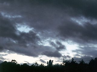
Near Cedar Key, Florida on September 17, 2000 just prior to landfall of Gordon. The broad and disorganized center of the weakening system still has a region of lesser clouds and bursts of blue skies. Here the winds were beginning to die off a bit from 70 MPH and rapidly shift from NE to south. This is the so called "eye" of the storm passing just to our west. |
|
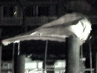
In total darkness at a small marina, a boat's bimini top flaps in the 70 MPH wind gusts before being ripped loose. Night vision was used to capture this picture after dark on September 17, 2000 on a bay marina in Citrus County, Florida. Still 4 miles from the gulf, the south to southwest winds behind the storm to the NW are off the Gulf and more sustained. This is the only marine photo of Gordon's effects due to road closures and authorities denying access to the Gulf shores. |
|
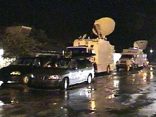
At a marina in Citrus County after dark on September 17, 2000, a large number of other storm chasers and media and news personnel "converge" to observe the effects of Gordon. This is called a "chaser convergence" and is quite common in tornadic storms in the Midwest and Plains and in this case, hurricanes and tropical systems along the coastal regions. |
|
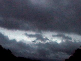
Just prior to sunset, east of Cedar Key in NW Florida, the inner bands of Gordon during its weakening stages to a tropical storm are visible streaming overhead. These narrow rows of clouds are parallel to the strong prevailing winds on the right side of the storm, currently making landfall in Cedar Key to our west. These bands are also called cloud "streets" because they look like streets around the storm when it is viewed from above or from space. This picture was taken on Sepember 17, 2000. |
|
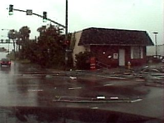
While passing through downtown Tampa on September 17, 2000, the entire side of a building with scaffolding collapses from a hurricane-forced wind gust on the right semi-circle of Hurricane Gordon just offshore in the Gulf Of Mexico to the West. The entire street to the right in this picture is strewn with debris and scaffolding. Had this been 24 hours later, during rush hour on Monday, the outcome could have been far more deadly to those on the sidewalk and street. |
|
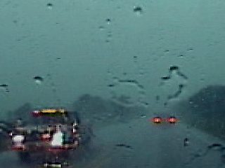
Penetrating heavy rain and tropical storm forced winds en-route to intercepting hurricane Gordon on the morning of September 17, 2000. Here we are penetrating a spiral rain band rotating around the hurricane called a "feeder band". This line of showers and thunderstorms also contained some tornadic supercells. Just stepping outside to get gas in this downpour for a minute gets every layer of cloths down to your skin SOAKED! |
|
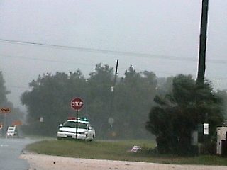
This was the farthest we can get to Cedar Key, Florida until law enforcement officials close the road to the barrier islands. With a storm surge forecast of over 8 feet, nobody was allowed to pass these roadblocks, even news, residents, and media personnel. The storm surge was less than expected. In the picture above, inner convection around Gordon's center drops moderate sideways rain with 70 MPH winds. Here, we were about 5 miles East of Cedar Key on September 17, 2000. |
|
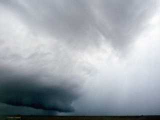
A high precipitation HP supercell developes ahead of an intense feeder band well to the East of Hurricane Gordon near the East side of Lake Okeechobee. This show was taken from highway 710 en-route to intercepting Gordon later in the day of September 17, 2000. The storm here prompted both a severe thunderstorm and tornado warning and was one of many tornado-producing supercells spawned on the foreward-right side of hurricane Gordon. These storms form in these regions due to high instability, moisture convergence, and wind shear. The strong winds verring with height allowed helicity values near 500, giving the storms the "twist" you see in the picture above. |
|
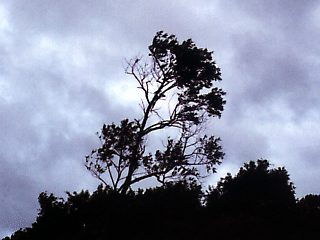
About 5 miles from Cedar Key, Florida on September 17, 2000, winds over 70 MPH cause trees to sway and twigs to break loose. The wind here is from the NE and was the strongest encountered during this chase. |
HTML File "gordon00.htm" - Developed By Chris Collura
To Return To The HOME Page Of This Site Click The "INDEX.HTM" Link Here!