
| This area shows pictures taken from the indirect penetration of hurricane Georges on September 25, 1998 in southern Dade county, Florida. The core of the storm hit the southern Florida Keys but was not chased because the road to the keys was close by state troopers. Some severe feeder bands and winds were still experienced. The storm core had winds up to 100 MPH in a diffuse eyewall. Conditions in the chase areas had winds up to 70 MPH or more. The storm formed in the Atlantic, smashed into Puerto Rico, the Dominican Republic, Haiti, Cuba then onto the Florida Keys before going into the Gulf of Mexico. |
|
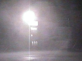
A spiral rain band, or feeder band, rotates into the south Dade county area near the roadblock of the roadway into the Florida Keys. Winds in this rain squall gust over 70 MPH with very heavy rains during the wee hours of September 25, 1998. The closed roadway prevented a chase track into the Keys to the core of Georges. |
|
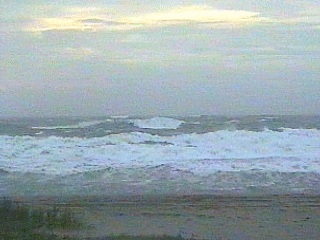
In South Beach, Florida, at sunrise on September 25, 1998, 50 MPH winds churn up the ocean into a white choppy mess. The hurricane surf here is in excess of ten feet high and tides are a few feet above normal. The eye of the storm was off the Florida Keys as the time, but this area is to the right side, or "dirty side" of the hurricane. |
|
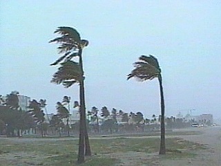
Palm trees sway in South Beach, Florida as hurricane Georges passes through the Florida Keys to the south on the morning of September 25, 1998. Winds here are over 50 MPH with higher gusts in squalls. This area is on the forward right quadrant of the hurricane, which has strong winds extending farthest from the storm center. |
HTML File "georgs98.htm" - Developed By Chris Collura
To Return To The HOME Page Of This Site Click The "INDEX.HTM" Link Here!