
Facebook Photo Album Timeline Photos
(Timeline Photos Sky-Chaser Chris Collura Facebook Posts)
[ PARENT INDEX ]

Wow, that's bad. At least I won't miss much next week or so :/
Posted: Apr 24, 2020, 11:18 AM

Not a bad view of a brief tornado to the north of Beloit, Wisconsin (just north of the IL / WI border) during the afternoon of May 23.
Posted: May 23, 2020, 8:58 PM
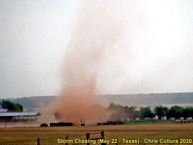
From May 22 (2020 USA) east of Shepard AFB in Clay County ... Small tornado near RFD while hail bombs were pitting the ground farther north.
Posted: May 24, 2020, 5:33 AM
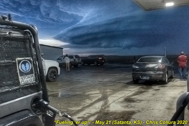
Satanta, Kansas - May 21, 2020. Supercell approaches gas station / truck stop neat Sublette.
Posted: May 30, 2020, 6:20 AM
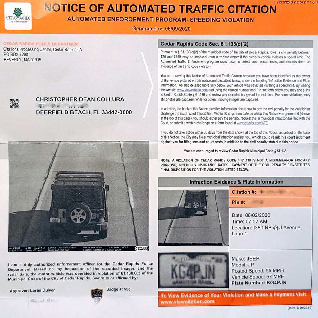
Iowa at it's finest ... It was a pleasure seeing some "compensation" for 22,721 miles of storm chasing as a cool "gift" in my mailbox back in FL yesterday......Aren't they supposed to be removing these red light / speed cameras? Guess not.
Posted: Jul 1, 2020, 7:14 AM
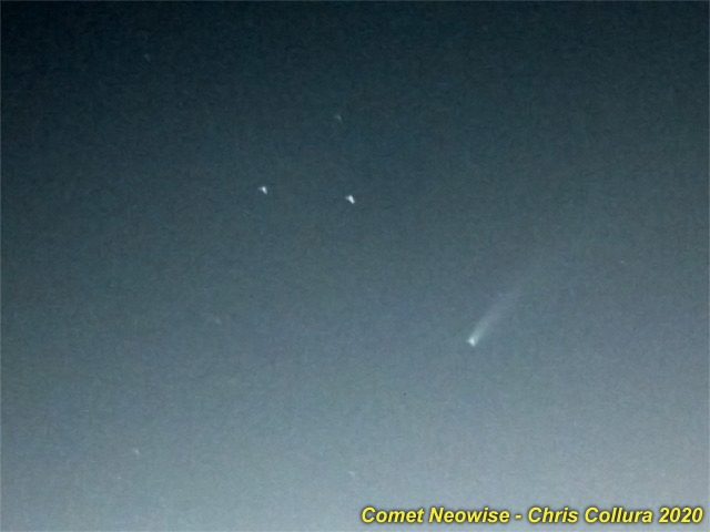
Tough to get comet Neowise, but at least I saw it, through city light pollution and a little luck!
Posted: Jul 17, 2020, 10:10 PM
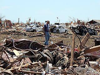
The song is from 1989 (Rush, RIP Niel) but so fitting for 2020... Nature has some new plagueTo run in our streetsHistory some new wrinkleWe are doomed to repeatFugitives at the bedroom doorLovers pause to find an open storeRain is burning on the forest floorAnd the red tide kisses the shoreThis is not a false alarmThis is not a testStay out of the sunIt only burns my skinSky full of poisonAnd the atmosphere's too thinBless the sun, the rain no moreRiver running like an open soreBlack wind falling through the ocean floorAnd the red tide washes ashoreThis is not a false alarmThis is not a testNowhere we can fly awayNowhere we can restThe party is disrupted byAn uninvited guestDeadline approachesFor the weary landIt used to be somethingBut we let it run down in our handsToo late for debate, too bad to ignoreQuiet rebellion leads to open warBring a sea-change to the factory floorAs the red tide covers the shoreNow is the time to turn the tideNow is the time to fightLet us not go gentlyTo the endless winter nightNow is the time to make the timeWhile hope is still in sightLet us not go gentlyTo the endless winter nightLet us not go gentlyTo the endless winter nightThis is not a false alarmThis is not a testNowhere we can fly awayNowhere we can restLet us not go gentlyTo the endless winter nightLet us not go gentlyTo the endless winter nightLet us not go gentlyTo the endless winter night
Posted: Jul 21, 2020, 1:57 PM

Interesting ... NOAA Buoy 42020 is inside the eye of Hanna (less than 6 Kts of wind and pressure 28.86" / ~978 mb)...https://www.ndbc.noaa.gov/station_page.php?station=42020
Posted: Jul 25, 2020, 10:38 AM

Uh OH ... Where's the beautiful southern wall that was there at 6:45 PM EDT?#HalfCane
Posted: Jul 31, 2020, 7:19 PM
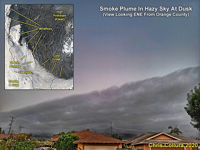
Scary seeing fires burning in California with smoke plumes making interesting patterns across the sky.
Posted: Sep 9, 2020, 9:24 AM

This is a view from an aircraft west of Los Angeles showing the smoke from the CA fires (in the right image). To the left, is a "normal" image on a clear day there (same position in the sky and altitude). It's scary seeing the mark these fires made on our atmosphere.
Posted: Sep 17, 2020, 9:02 AM
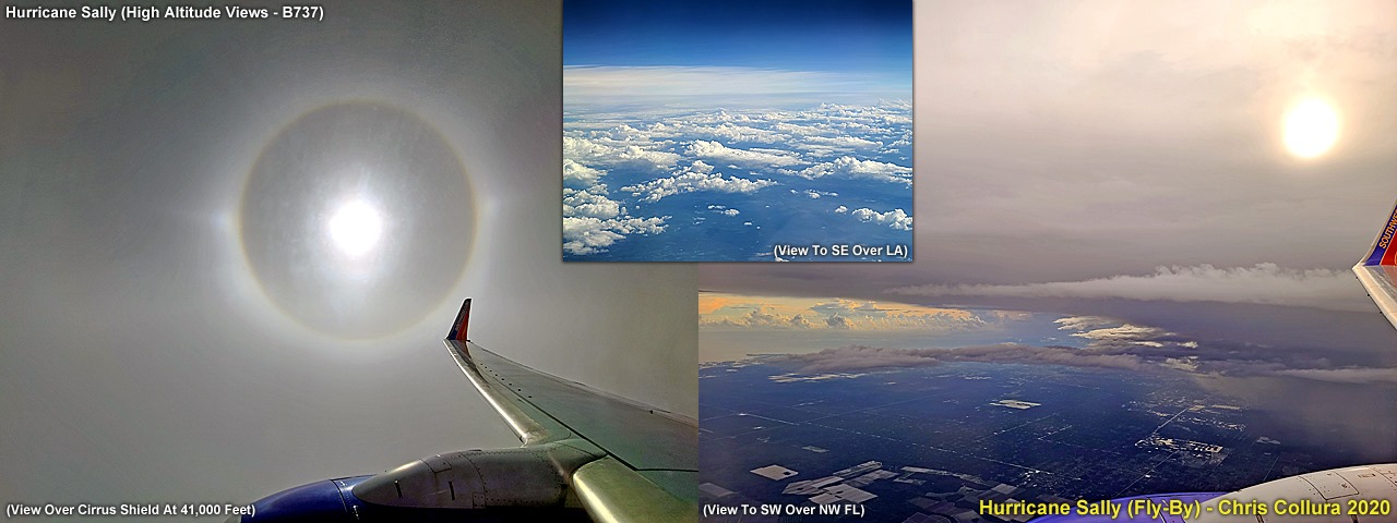
In case you are wondering, I did not chase hurricane Sally due to appointments and work / family related stuff that would have been almost impossible to change.But here are some pictures of the "topside" of hurricane Sandy from an airliner flying west to east and skirting over the northern side of the storm on Sept 15 late in the day. The milky white clouds are cirrus and cirrostratus, and extend as high as 60,000 feet. The B737 plane is flying at 41,000 feet.Despite being above 99% of the convective activity, the ride is quite bumpy, and flying east - The clockwise (anticyclonic) high-altitude outflow actually pushes the plane somewhat, making for an early arrival despite going around the storm system.The cirrus clouds present a beautiful halo around the sun due to fine ice crystals in left image. To the right is the view of the storm cirrus canopy from over Florida. The upper-middle inset is the view over Louisiana looking SE and approaching the edge of Sally.
Posted: Sep 17, 2020, 9:46 AM

Posted: Sep 18, 2020, 3:16 PM
Posted: Sep 18, 2020, 3:26 PM

2020 has been a hell of a year for many people. What many failed to realize is to hold on to love and respect for one another amidst all this gloom and doom. It has become a dying art and many folks are suffering dearly.Bring back the love and care for one another, and protect ourselves and others as well. It just might be the best thing we all can do at this point - AND - It just might help things get better. You will be mighty surprised.
Posted: Oct 24, 2020, 9:26 AM
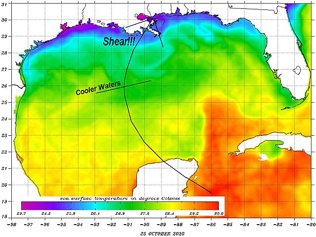
As we approach November ... The threat of a powerful hurricane in the Northern Gulf shall decrease. Cooler waters and wind shear are common this late in the hurricane season. We certainly won't get a "hurricane Michael" out of Zeta. But still, a strong tropical storm is the last thing Louisiana needs in 2020.
Posted: Oct 26, 2020, 4:28 PM

Happy holidays to everyone as Christmas and New Years of 2020 approach - Speaking of "2020", this is a year many of us want to forget. I wish everyone a happy holidays and new year of great health and prosperity. We all need it.
Posted: Dec 15, 2020, 2:54 PM

Crappy picture of Jupiter closing in on Saturn from Orange County, California (Dec 20, 2020). Cool seeing one of Jupiter's moons in the shot.
Posted: Dec 20, 2020, 6:10 PM

Jupiter and Saturn after dusk...
Posted: Dec 21, 2020, 6:27 PM
Generated by Sky-Chaser Chris Collura on Wednesday, March 24, 2021 at 6:19 PM UTC-07:00
HTML File "index07.htm" (Facebook) - Developed By Chris Collura
To Return To The HOME Page Of This Site Click The "INDEX.HTM" Link Here!


