Facebook Photo Album Timeline Photos
(Timeline Photos Sky-Chaser Chris Collura Facebook Posts)
[ PARENT INDEX ]

September 11, 2001 was a very sad day for America ... So this little graphic has been placed here for the honor and memories of that tragic day exactly ten years ago this week.
Posted: Sep 5, 2011, 6:42 AM

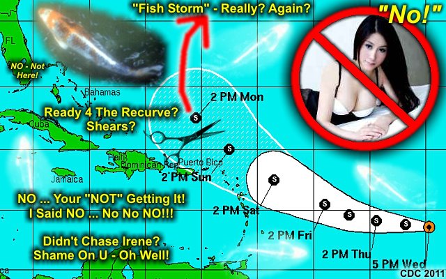
FISH anyone?
Posted: Sep 7, 2011, 4:33 PM

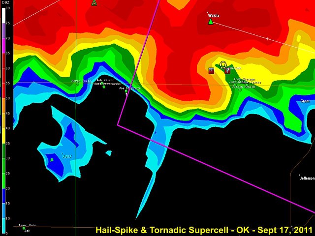
Radar (KICT) reflectivity image closeup of storm in Grant County, OK late in the day on Sept 17 (as it was producing a tornado). Impressive hail-spike is prominent as well.
Posted: Sep 17, 2011, 5:19 PM

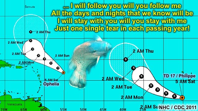
TS Ophelia expected to be another storm to remain out at sea ... If you missed Irene, you probably MISSED 2011.
Posted: Sep 21, 2011, 4:31 PM

Follow the FISH ... That's WHERE the tropics of 2011 is headed ;-(Time to consider other activities besides chasing hurricanes.
Posted: Sep 24, 2011, 7:07 AM

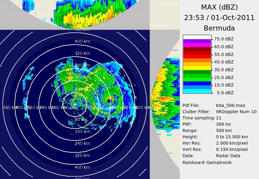
Hurricane Ophelia is "safely" passing well to the east of Bermuda this (10/1) evening with 135 MPH winds (Category 4). Nothing going on at the island due to it being too far west of the storm. Very impressive on the BDA radar, though. I did not go there and chase it because I knew it was going to miss Bermuda (pass east of there)!
Posted: Oct 1, 2011, 5:11 PM

Thought this number was kind of funny on a travel site ;-)Yeah, not cheap, but why charge THAT price (the Devil's number)?
Posted: Oct 3, 2011, 5:16 PM

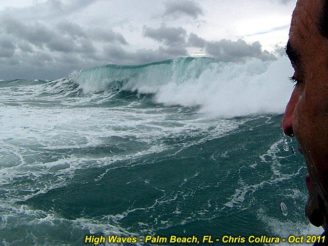
Strong pressure gradient between developing subtropical low and Canadian High is producing near gale-forced winds along the SE Florida Coast. It's so much fun to play in the 8-12 foot waves off Boynton Beach with my SeaDoo watercraft!
Posted: Oct 8, 2011, 5:34 PM

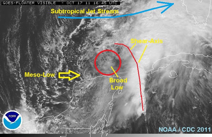
Interesting "micro-cyclone" (mesolow type feature) on the SW side of the broad area of low pressure north of the Yucatan (developing subtropical system). Very distinct on visible satellite.
Posted: Oct 17, 2011, 10:42 AM

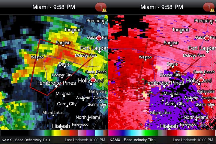
Large wall cloud / possible tornado (or at least a large funnel) was observed at about 9:45 PM west of I-75 near Pembroke Pines, FL. This image is the radar grab from the small tornadic supercell storm as it passed west of Davie and near Sunrise at about 9:55 PM. Power flashes noted at that time...
Posted: Oct 18, 2011, 7:40 PM

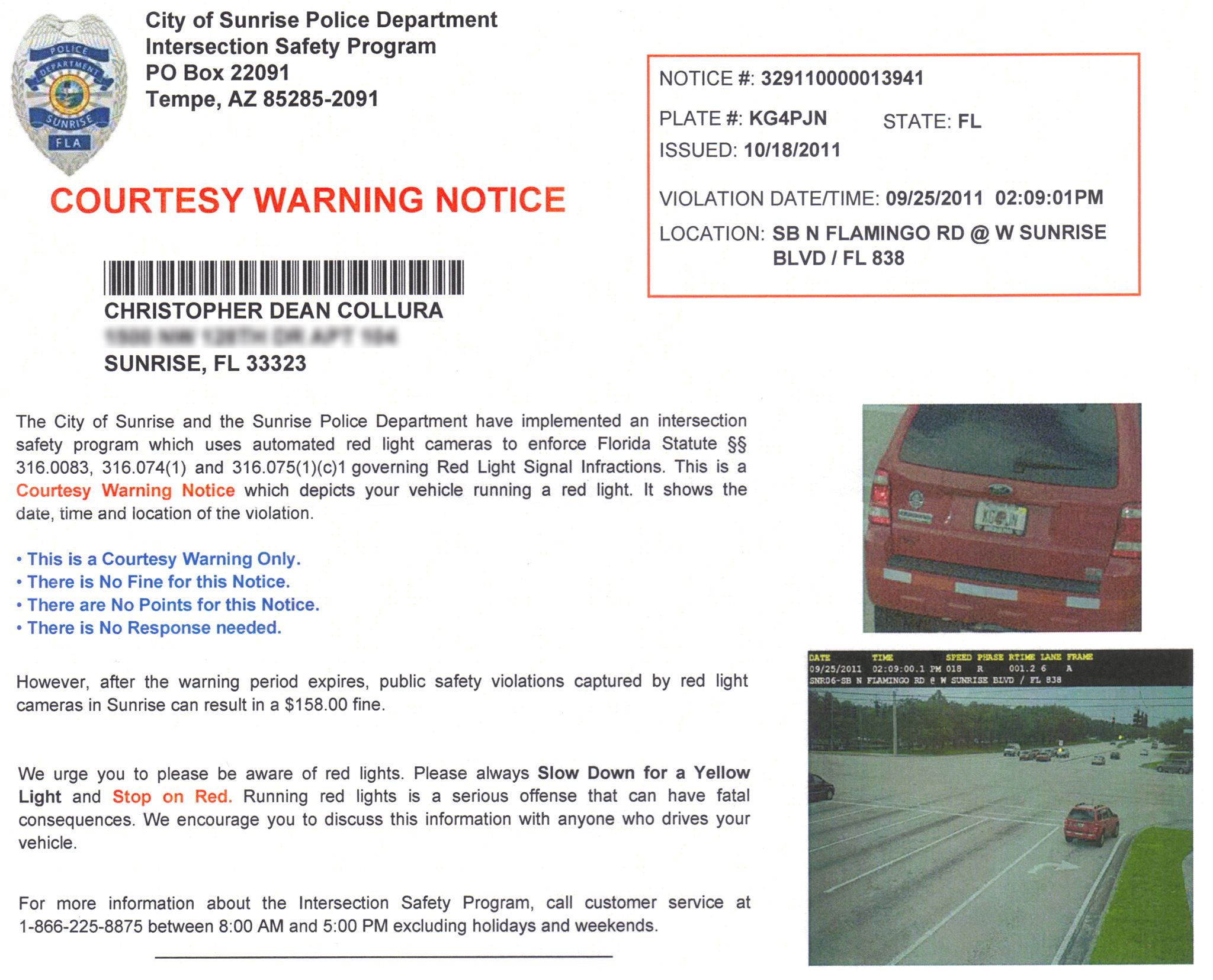
Be careful as traffic cameras are watching - Don't even slow down for a red light / right turn - STOP completely. Big brother is WATCHING YOU!
Posted: Oct 30, 2011, 10:27 AM

Happy Halloween!
Posted: Oct 30, 2011, 5:17 PM

Always so KEWL (cool) looking down on a city from high altitude ;-)
Posted: Nov 22, 2011, 3:41 PM

It's HAMMER time. ANYONE sending me these requests will be UN FRIENDED, no questions asked.I was told about this little "V" to remove them, and I'm still searching for it. Second, I tried blocking all the apps on Saturday ... Obviously that did not work ... The image was from 5 minutes ago today.I am tired of sifting through JUNK messages, where 1 out of 5 or 10 is legit / real.
Posted: Jan 25, 2012, 8:09 AM

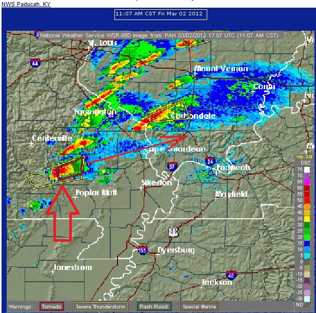
This is the FIRST cell to really watch!
Posted: Mar 2, 2012, 9:18 AM

WTF is going on with SW Airlines now? I found some awesome deals to fly out (Denver and even catch eclipse on 20th) on May 19 through 31 and I go to do a search, the little wheel goes rouind and round for a LONG time, and then THEIR system times out with an error message. Looks like their site crashed because they FINALLY lowered their fares and "everyone" hogged on it...
Posted: May 15, 2012, 12:44 PM

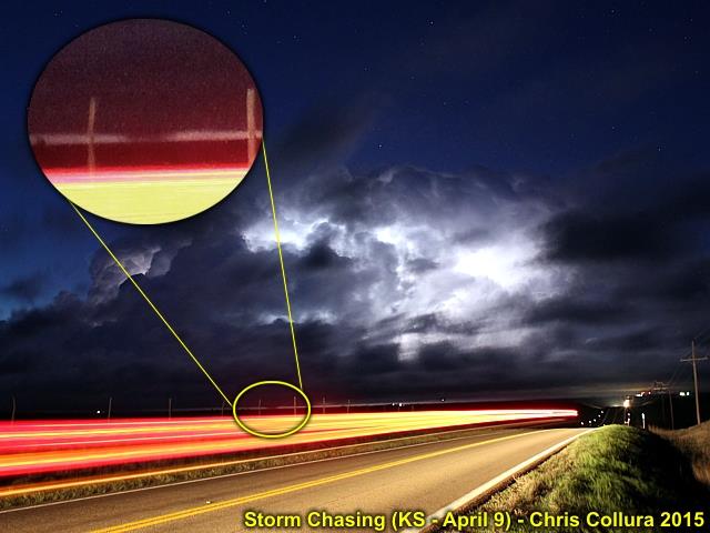
This is an annotated image of the Oakley / Grinnell to north-central Kansas supercell (time exposure of about 30 seconds illuminated by incredible lightning) and the large tornado is clearly visible under the cloud base. At one point, you could actually see two distinct tornadoes with this cell. May 9, 2015.
Posted: May 12, 2015, 5:29 AM

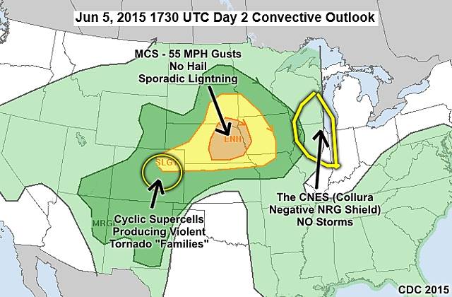
Tomorrow's forecast ... Enjoy.
Posted: Jun 5, 2015, 9:28 PM

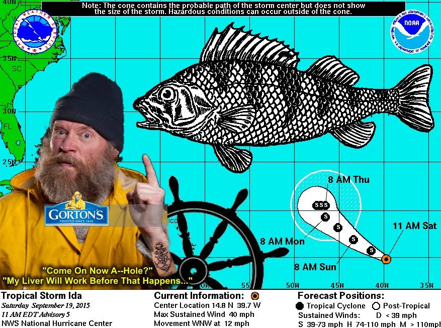
This weeks atlantic tropical prospects...USA and Caribbean is still VERY safe :)
Posted: Sep 19, 2015, 8:12 AM

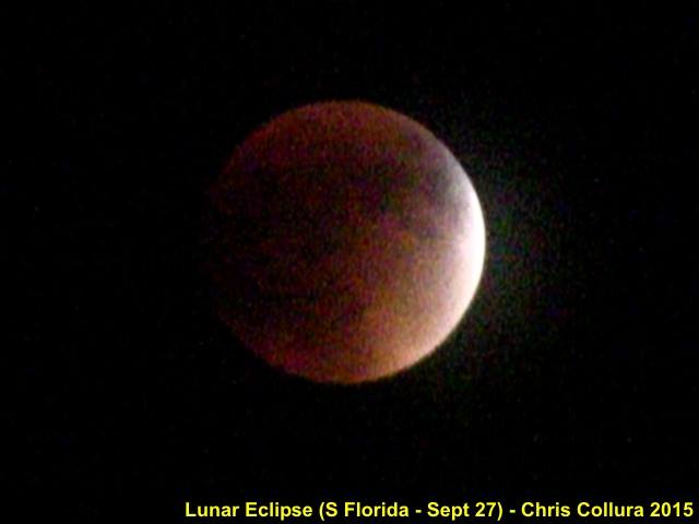
Got a break in the pesky cloud deck to capture the reddish color on this video frame grab of the super moon lunar eclipse during the late evening of September 27, 2015.
Posted: Sep 27, 2015, 8:49 PM

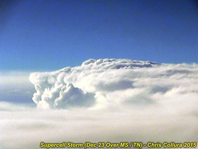
Happy Holidays and God bless anyone affected by the tornadoes in the mid south today (12/23). I was able to get a glimpse of that tornadic monster looking west from high altitude (about 39,000 feet) flying from Chicago to Florida. Excuse the blurriness, it was very bumpy from the turbulence. In Florida safely now for a couple of days.
Posted: Dec 23, 2015, 4:34 PM

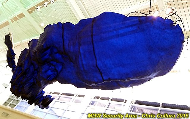
This is a decoration hanging over the security area at Midway Airport in Chicago. Can you guess what it is (or choose what you THINK it might be below)? 1). A fancy eggplant. 2). An abstract sculpture. 3). A bathymetry map of Lake Michigan. 4). A cloud formation. 5). None of the above.
Posted: Dec 24, 2015, 7:54 PM

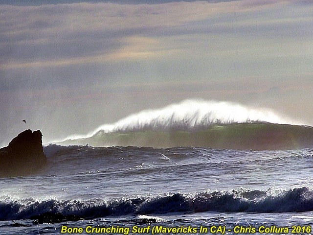
Massive waves affecting San Mateo County (The "Mavericks" surf spot near Half Moon Bay) during the afternoon of Jan 1, 2016. These giant swells are generated during the winter months in the North Pacific Ocean and come ashore in Northern California will full force that's not to be reckoned with. These giant waves can (and have) killed!
Posted: Jan 1, 2016, 7:06 PM

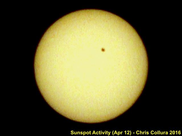
Like the old police song (King of Pain) from the 80's goes: "There's a little black spot on the sun today..."Sunspot activity as of April 12, 2016.
Posted: Apr 12, 2016, 4:06 PM

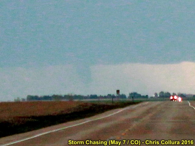
Wish I was closer like many others were. Never get suckered away from your target area!
Posted: May 7, 2016, 6:19 PM

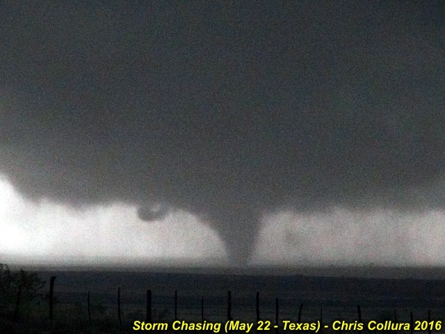
Awesome chase day today in the Texas Panhandle. I was on the southern storm SE of Amarillo near Memphis, Texas. And what a beast it was!
Posted: May 22, 2016, 9:04 PM

Video frame grab from the dash-cam looking east along Interstate 70 west of Chapman, Kansas. This is pretty much when the violent wedge tornado, with 70 MPH rain and hail wrap over me, was moving eastward skirting the south side of Chapman after being on the ground for at least 90 minutes, and after I drove 100 miles playing catch-up to this storm.
Posted: May 25, 2016, 11:37 PM

Heading back to Chicago this weekend after an extraordinary storm chase trip. About a week was all it took to see more photogenic tornadoes than some people see in 5 (or even 10) years. Both May 24 (Dodge City tornado-fest) and May 25 (violent wedge) will forever reinforce both my passion and respect for these amazing storms. Also it was a hoot running into all you great folks out there, on some of the best chaser convergences (more like a pre-chase party)!
Posted: May 27, 2016, 8:01 PM

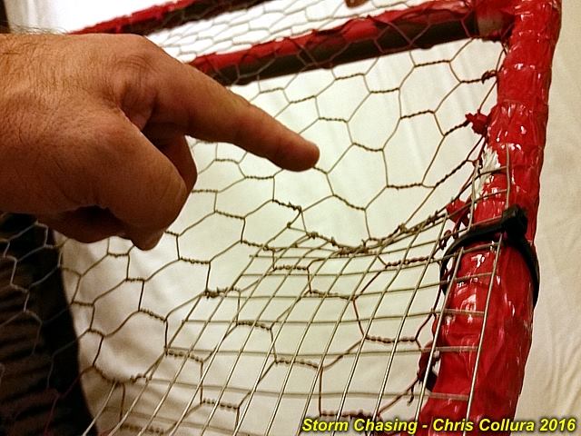
Back here in Chicago after one hell-ov-a chase trip the past week. Unpacking my vehicle and I come across one of my removeable hail grills - Deeply dented by probably tennis ball to baseball sized hail! This was the hail grill protecting the front windshield, and all my "glass" is intact on my vehicle (the same cant be said for the hood and such)!
Posted: May 28, 2016, 6:51 PM

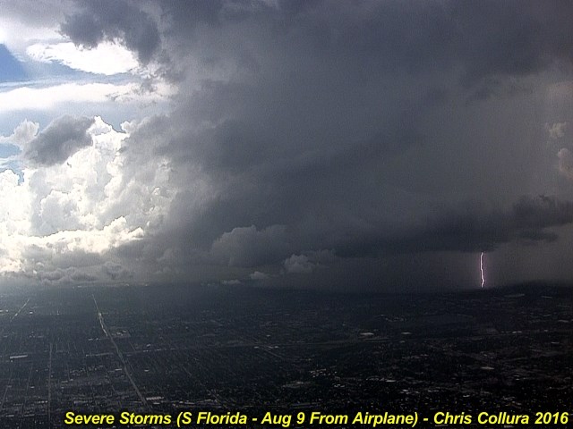
Flying in a thunderstorm environment is no joke. Here we are carefully routing around and to the north of a severe storm west of Fort Lauderdale, FL during the afternoon of August 9, 2016 while heading to a stopover in DC then Chicago. The view to the west after takeoff is ominous!
Posted: Aug 9, 2016, 8:20 PM

Oh, NO!!! Not again?This is the place to be IF you like chasing tropical cyclones. Yes, another typhoon poised to graze Taiwan.I am seriously considering a chase there this year, as the shear and dry air in the Atlantic has me laughing my ass off... What a joke.
Posted: Sep 16, 2016, 6:07 AM

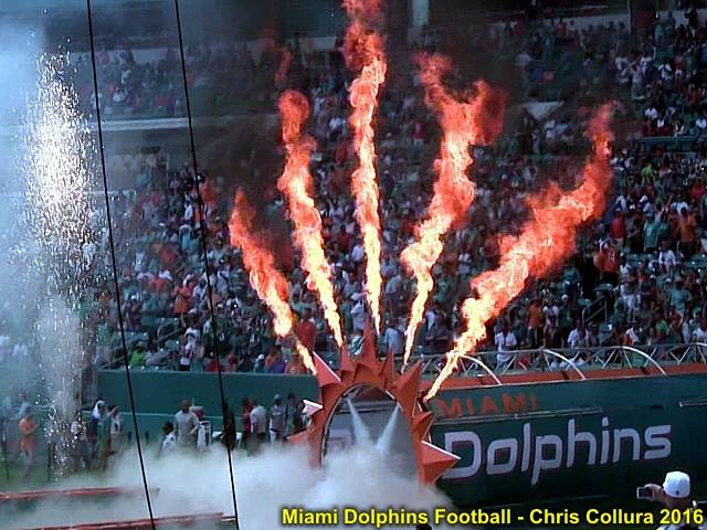
Miami Dolphins (Game 3 on September 25th) ... They sure made a "hot entrance" to a winning game!
Posted: Sep 26, 2016, 10:05 AM

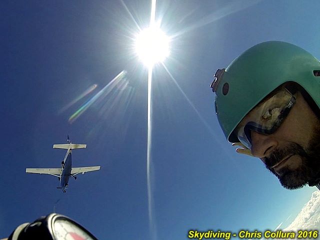
Skydiving over Clewiston, Florida high above the clouds. October 15, 2016. Just exited the C-208 Caravan jump aircraft.
Posted: Oct 16, 2016, 7:32 AM

When you love the "window seat" and are happy to get one on a completely full flight ... Then you get on the plane AND ???
Posted: Nov 11, 2016, 12:53 PM

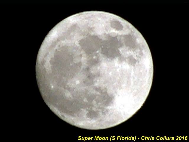
Full moon over south Florida now, so called "super moon" (I assume it's the moon during it's Perigee, or closest orbit to earth).
Posted: Nov 13, 2016, 4:07 PM

This was around 5:18 CDT (April 19, 2017) between Eagle and Lincoln, Nebraska with a supercell storm that was very organized before everything became linear. Can anyone else comment on this? (I don't wanna call this a tornado as it may just be a rotating wall cloud!)
Posted: Apr 19, 2017, 11:12 PM

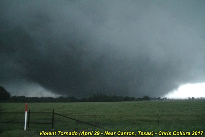
This was the scene to the south of Canton, Texas during the evening of April 29, 2017 ... Massive and violent wedge tornado tearing across the landscape. Unfortunately damage, injuries, and deaths occurred with this tornado. Be aware that all it takes is a supercell storm to form under the right parameters to become more violent than expected! Always have a tornado plan.
Posted: Apr 30, 2017, 12:18 AM

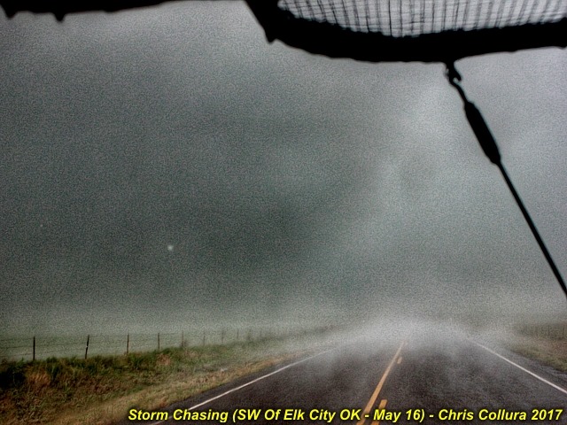
Frightening view of the edge of the tornado in the rain headed towards Elk City on May 16 looking east (on 152) in at least 3" hail and winds gusting over 100 MPH. A bit close for comfort as we watched a building lose its roof and debris flying right next to us!Crazy and very busy day to day chasing. Derek Sibley and I were on 3 major supercell storms, the first with a funnel / small tornado northwest of Perryton. Texas ... Then shifted south catching rain-wrapped tornado that went south of Wheeler, Texas ... Then finally the Elk City storm. Missed the Mclean one as we were a bit north for the first round of storms. Hope everyone stayed safe out there.
Posted: May 16, 2017, 10:22 PM

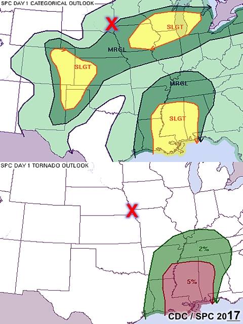
When the chase season of 2017 is FINALLY over for me ... Past couple of days were a waste. Going home (finally)!The red "X" is where I'm at now ... In BETWEEN (mother nature's legs) :-)
Posted: Jun 22, 2017, 6:10 AM

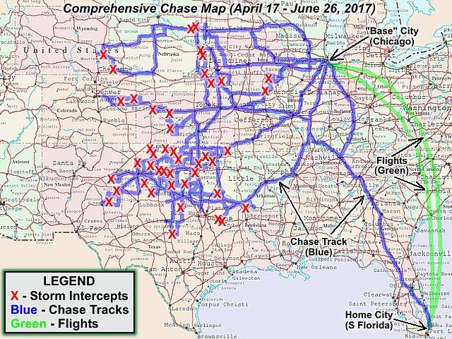
Finished with chase trip for 2017 from April 17 to June 26 (on and off)! See the link below for more information...http://www.sky-chaser.com/mwcl2017.htm
Posted: Jun 30, 2017, 9:45 AM

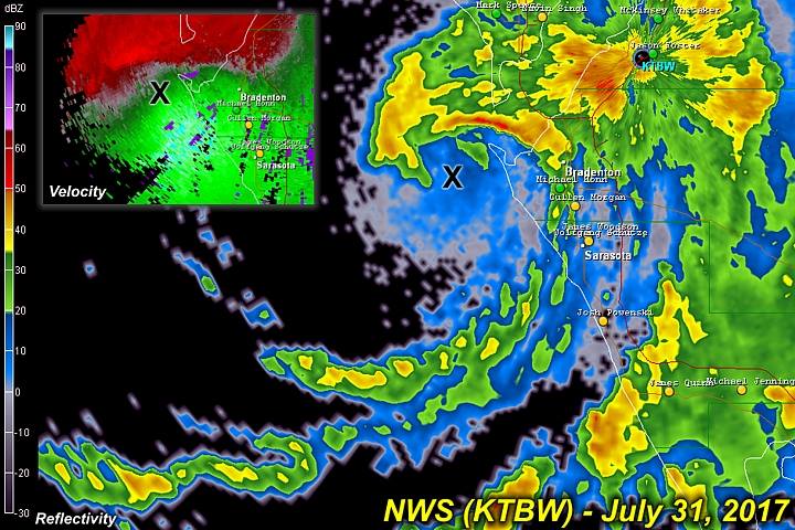
Tropical storm Emily is making landfall in the Tampa Bay area this morning with 45 MPH winds (a minimal tropical storm). The biggest threat will be heavy rains, extending well to the east of this highly sheared system. I am not chasing this.
Posted: Jul 31, 2017, 7:26 AM

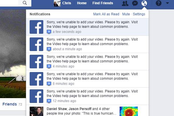
I guess FB needs blood and an HIV test too?I tried WMV, MPG, MP4, AVI, etc......So WTF "DOES WORK" Mr Zuckerman???
Posted: Sep 5, 2017, 4:40 PM

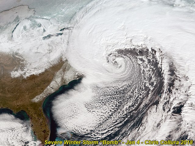
Bomb cyclone off the NE USA now. Impressive visible satellite presentation as well. This storm probably has hurricane forced winds as well. Check out that "eye" like feature!
Posted: Jan 4, 2018, 7:49 AM

Tragic shootings continue across the USA as of 2018 - The most recent being very close to where I live in Broward County, Florida on Valentines Day (February 14) in 2018 at the Stoneman Douglas High School in Plantation, Florida (claiming 17 innocent and young lives). Crazed Nikolas Cruz (age 19) was the shooter in this cowardly act, using an AR 15 assault rifle. This raises the question on not only gun control, but assessing the severity and dangers of mental illness. Very little is being done to combat mental illness and provide help for mentally ill people, and if guns are banned, other means of terrorism or violence will be sought (such as bombs, vehicles, etc. used as "weapons"). This is the latest in a long list of shootings and terrorist acts (including those at the Pulse Night Club in Orlando, the Fort Lauderdale Airport, and Las Vegas to name just a few). These acts are doing nothing but invoking anger and a ghastly fear in almost every American. God help is all.
Posted: Mar 9, 2018, 7:27 PM

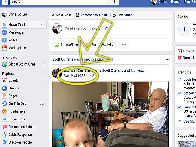
Guys ... You folks (IT group at FB) need to get this right! When someone refreshes and / or goes out of Facebook and back in - Stop shuffling the stories like THIS. I have absolutely NO INTEREST in seeing posts from May 14 (ON May 23) and I'm sick and tired of spending hours looking for a post I was JUST viewing !!!!
Posted: May 23, 2018, 7:38 AM

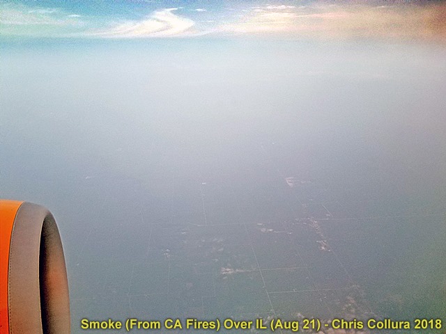
Sad in many ways (akin to Florida's red tides) ... Looking down from an airliner passing through 30,000 feet over Illinois (late on Aug 21) - Over 1,700 miles away from California - The smoke layer from the California wildfires (reaching as high as 20,000 feet) can be seen below, even blocking a clear view of the ground. A reminder on how the earth and atmosphere is connected and vulnerable to pollution / climate changes.
Posted: Aug 22, 2018, 8:57 AM

Today is September 24, my birthday, 2018. Exactly a year ago today (on my birthday) I was not safe and sound here in South Florida, but awaiting evacuation / humanitarian flight out of devastated Puerto Rico (hurricane Maria), with many unfortunate people who will never celebrate another birthday. Be nice to all around those you love and always make every day special.http://www.sky-chaser.com/maria17.htm
Posted: Sep 24, 2018, 10:35 AM

Some "Hope in the 'land of NO'?" ... Maybe!Watching this tropical disturbance in the NW Caribbean / Southern Gulf of Mexico as of late Friday. It has some potential for development over the next 5 days. Lets see what happens!Note: Tropical storm Leslie will remain over the open Atlantic waters - Threatening no more than fish, dolphins, and ships.
Posted: Oct 5, 2018, 1:13 PM

Beautiful view of the "blood" moon (lunar eclipse) from south Florida.
Posted: Jan 20, 2019, 9:49 PM

This is not today (4/14), and certainly not yesterday (4/13), but exactly 7 years ago today in central Kansas (April 14, 2012 - Rice County EF-4)! We need some of this ;]
Posted: Apr 14, 2019, 9:33 AM

For all you computer geeks, especially the older folks, this is a Brother "word processor" from a catalog in the late 80's / early 90's. There is something wrong with this picture - Can you spot it?
Posted: Apr 19, 2019, 10:03 AM

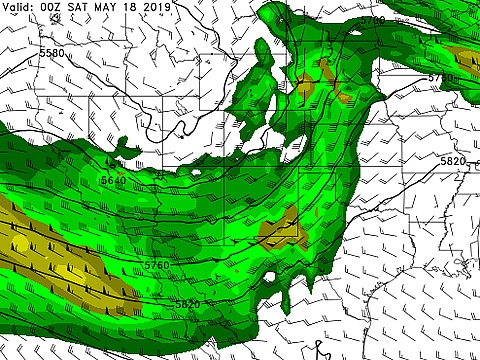
The feared ridge is currently breaking down and in a mere few days I'll be out of the Chicago area and back in the back-bone of tornado alley. Starting Friday (5/17) a severe weather "extravaganza" will unfold and continue well past the day 8 outlooks (even as far as May 25) as per SPC and some models! Definitely an event that's not for the faint of heart. This basically brings a mixed emotion. Ofcourse there is excitement - BUT also a feeling that lives and property may be lost - The latter is what we all hope WONT happen. Lets hope everyone will be safe out there over the next week or two, both storm chasers and non-chasers alike. It's gonna be a very busy time. Lets all do this - and do it right!
Posted: May 14, 2019, 6:25 AM

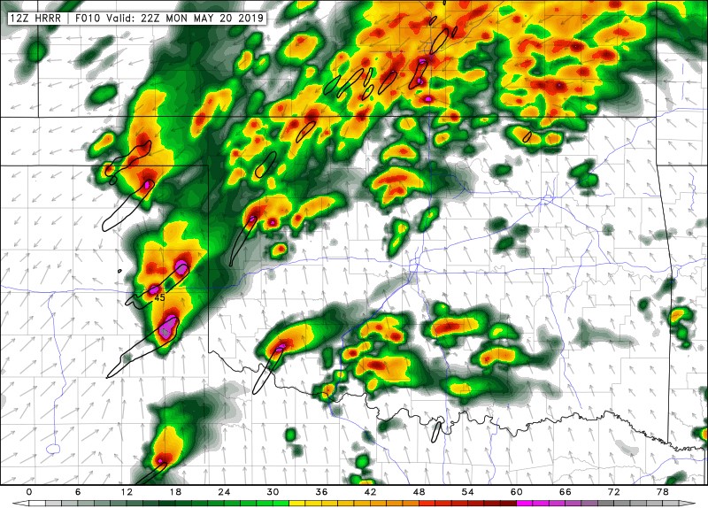
Getting ready to head out and hopefully pick a good storm later today. Terrifying high-risk as per SPC with tornado probabilities of 30% hatched (even hail and wind both hatched 45%)! Just about any supercell that goes up will be capable of producing violent long-track tornadoes. Please be safe out there today.
Posted: May 20, 2019, 7:34 AM

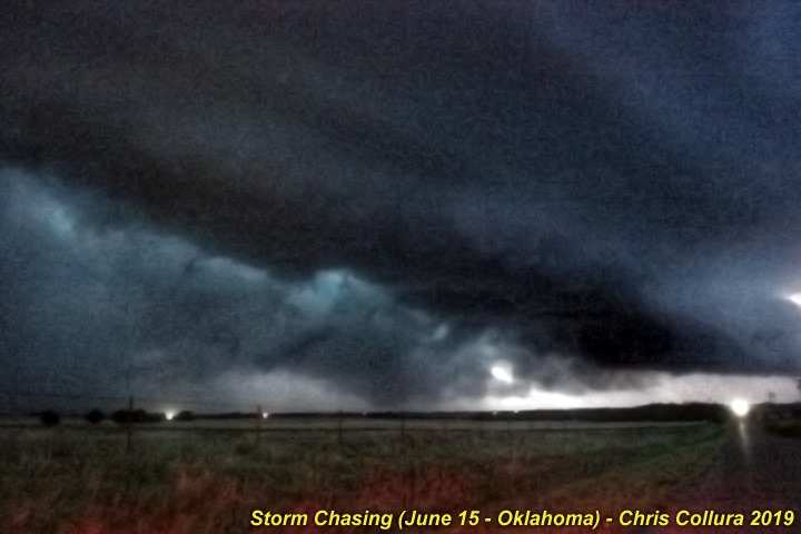
Oh those 2% days can always be interesting, ey? This was about 20 miles north of Clinton, Oklahoma on June 15, 2019 at dusk!
Posted: Jun 15, 2019, 9:10 PM

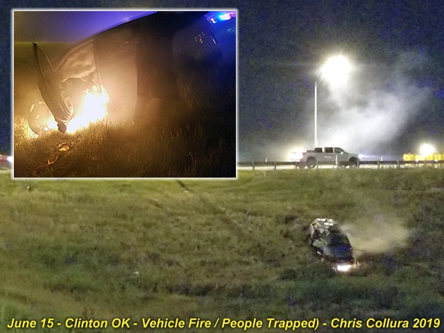
Last night (Saturday June 15, 2019) I came across a nearly deadly accident on the entrance ramp to I-40 westbound off Highway 183 in Clinton, Oklahoma. With tornado sirens blaring and 70+ MPH RFD winds with a confirmed large tornado to the north, I came across a pickup truck and mangled guard rail and a mangled car down the embankment. I stopped as I did not see anyone on the scene and the car had a fire in its front end. I ran down with another local to check and a women and two children were trapped in the vehicle and pinned. We called EMS and managed to smash the window (using my bare hands - ouch!) and try to get the doors open, as well as stomp and keep the fire getting to the driver and kids, barely conscious. There was not much we can do as the doors were just jammed. The police and fire department arrived within minutes as we kept trying to try to pry the doors and get the people out. EMS ran down and pryed the driver door, dragging her to safety, as well as the kids and right after that (the inset in the photo) the drivers side door was involved in the fire. The woman and kids appeared seriously injured (probably blunt trauma as the car rolled multiple times). Had it not been for the timely and professional services of our brave men with Clinton Police and Fire, I probably would have seen a young woman and her kids burn to death with me forced to helplessly watch (as well as the sounds of their screams haunting me forever). If you see any firefighter or EMS - Give them an hug and a big wet kiss too!
Posted: Jun 16, 2019, 6:09 AM

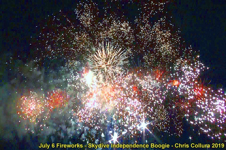
Here's my shot of some cool fireworks (at the skydiving "Independence Boogie" in Rochelle, IL) on July 6, 2019.
Posted: Jul 7, 2019, 3:36 PM

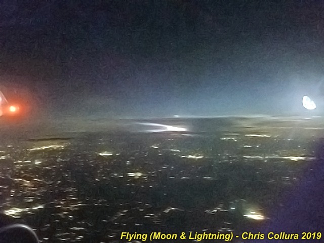
Moon and distant lightning from a thunderstorm (at 37,000 feet over Atlanta). Crappy smart-phone pic but better than nothing.
Posted: Aug 21, 2019, 7:52 AM

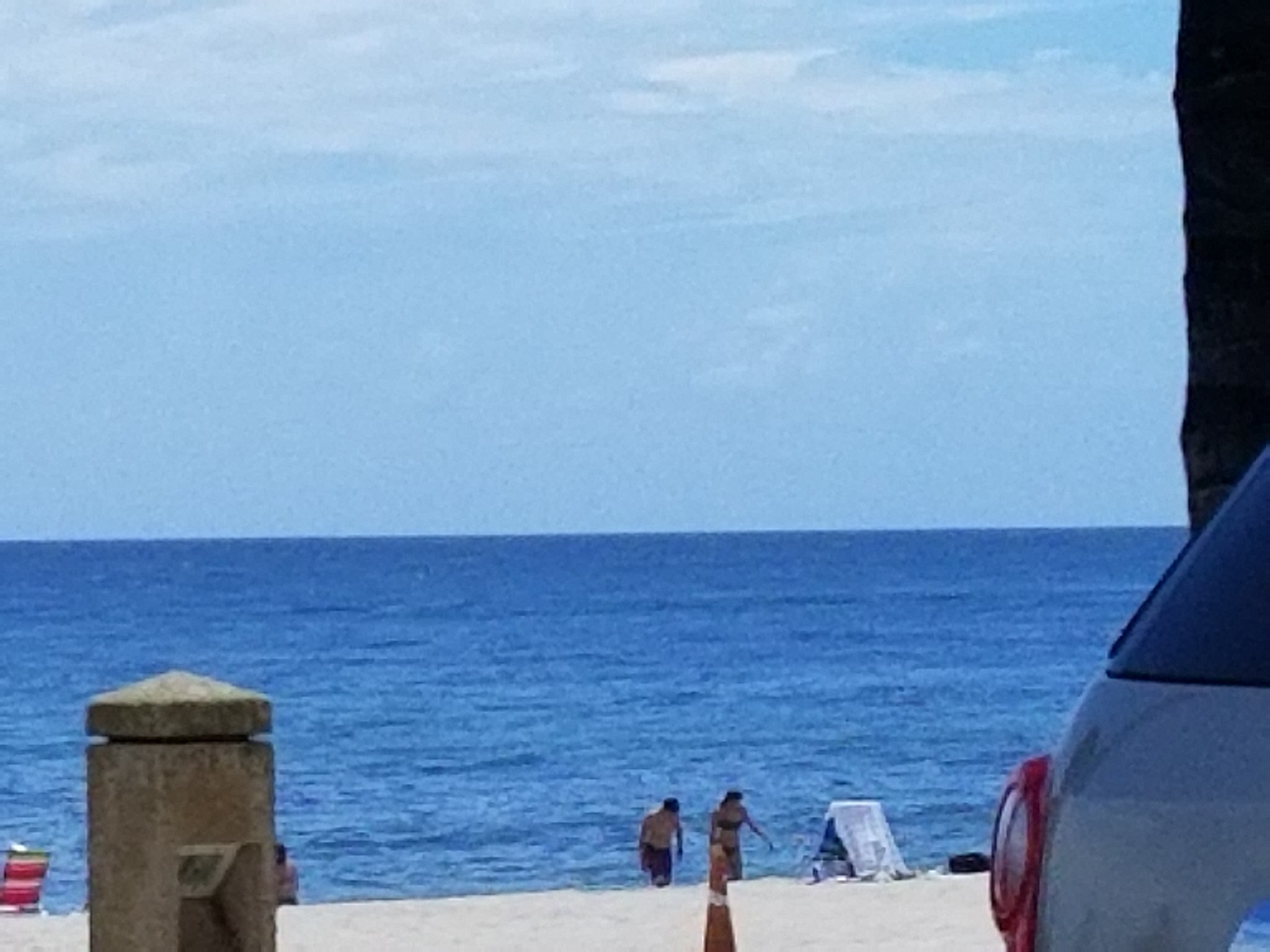
Pulled over earlier off Palm Beach, Florida for "checking the waves" (from the roadway) at a closed beach. The officer even went on to search my vehicle UNTIL I showed him my web site and what I do.He should be in the NE Bahamas, LOL, if he wants to be policeman.Yet, the beach 5 miles to the south was jammed and not even a single parking spot. Dorian is just making people absolutely miserable in every aspect.Here's the destructive surf evey one is terrified of... Seriously?Lets make it a "Brandon Clement" day :)
Posted: Sep 1, 2019, 10:50 AM

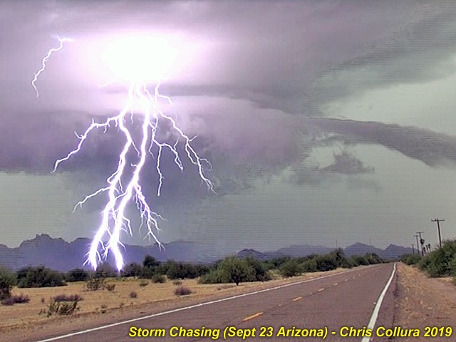
Took a break for a bit and I am back here. I was able to get out and do a little bit of storm chasing yesterday in far western Arizona with an interesting desert monsoon setup. The lightning is just something else out there in Maricopa County. Enjoy!
Posted: Sep 24, 2019, 10:15 AM

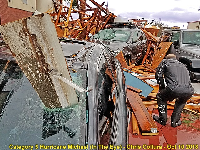
About this time a year ago, Tim Millar, @[1610340277:2048:Derek Sibley] and I were venturing out of the hotel in Calloway, FL during the calm eye of category 5 hurricane "Michael" on October 10, 2018. In this picture debris impales cars as the sun peeks out overhead with blue skies during Michael's eye around noon.
Posted: Oct 10, 2019, 9:56 AM

That tiny little speck on the sun is the planet Mercury transiting the sun this morning (around 9:30 PDT) viewed from Orange County, California (Nov 11, 2019)!
Posted: Nov 11, 2019, 9:52 AM

It is a beautiful day :)
Posted: Nov 23, 2019, 4:47 PM

Wanna chase an ambulance? Why on earth am I getting these messages? Please stop!!! These medicines that were toxic were older versions and taken care of ... I really have no time to keep blocking these.
Posted: Nov 23, 2019, 4:49 PM

Negative NRG?Yeah ... Seems like the frequency of THESE showing up on my YouTube alerts are DIRECTLY related to how shitty my mood is for that day (!)
Posted: Mar 31, 2020, 11:59 AM

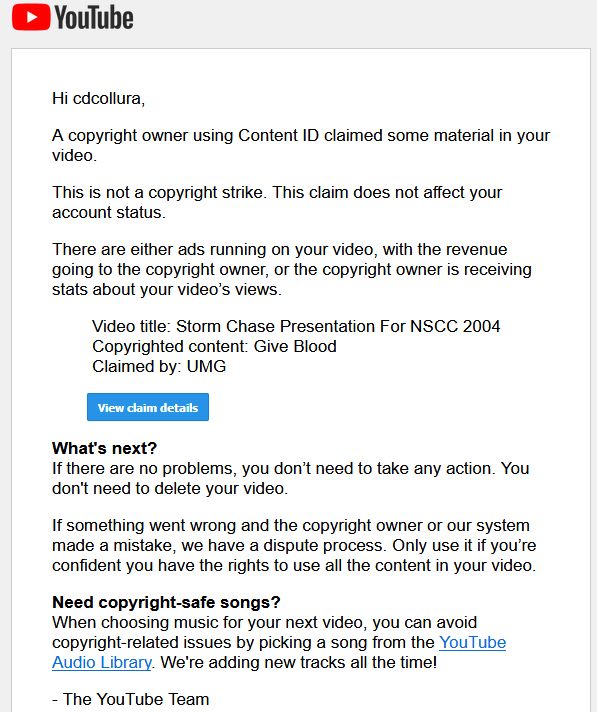
In light of all this DOOM going on, I have been hard at work editing down cool videos to share. Yet no one I personally sent anything to replied with a simple "that's cool" … Then I DID see a copyright infringement email from a YouTube video from 2004, long - LONG - time ago - Where no one said "boo" about.And just today, I mix down a cool skydiving video, the same one no one even looked at on my PM's, and that DID get "attention" - Within 3 minutes of posting it - Telling me it's muted for content that's not mine. I fully credited any music. Come f'cking on.This video has been REMOVED - Not my problem - Bitch to FB if you cannot see it :/
Posted: Apr 4, 2020, 10:19 PM

'Nother one (from WAY back in 2004)......Why is this being flagged NOW? Is someone reporting me (?)
Posted: Apr 4, 2020, 10:23 PM

Just saying … I just happened to have lots of TP … PM me if interested (LOL)!
Posted: Apr 7, 2020, 6:19 PM

After a very long deliberation and weighing the value of this social app, I am making the decision to permanently delete it. I have made a twitter profile for storm research and such, which is at "@sky_chaser_com". I may or may not create a limited profile on here with a similar name.I have been active on Facebook since 2007, and since then it has grown and evolved in many ways, some good, some bad. I greatly appreciate those who provided support and positive experiences regarding the passions and sports I love.After I remove my profile, pretty much everything can be seen on my main website (at "sky-chaser.com"), or twitter profile, at "sky_chaser_com"). Videos on my YouTube channel will persist and remain in place. Thank you all for your experiences on Facebook.
Posted: Apr 14, 2020, 11:55 AM
Generated by Chris Collura on Wednesday, April 15, 2020 at 11:31 AM UTC-07:00
HTML File "index41.htm" (Facebook) - Developed By Chris Collura
To Return To The HOME Page Of This Site Click The "INDEX.HTM" Link Here!


