
Facebook Photo Album Storm-Chasing Decade 2010-2019
(Storm-Chasing Decade 2010-2019 Sky-Chaser Chris Collura Facebook Posts)
[ PARENT INDEX ]

2010: Above is a terrifying view of the violent tornado, rated high-end EF-4, just about to cross north of the small town of Bowdle, South Dakota on May 22, 2010. There is a farmstead in the foreground and it is just about to be hit by the southern edge of the tornado, nearly a mile wide at times. Tornadoes that are wider than they are tall, like this one, are called "wedge" tornadoes. Such tornadoes have a very complicated damage pattern, as there is one large circulation, with smaller circulations inside.
Posted: Dec 17, 2019, 7:49 PM
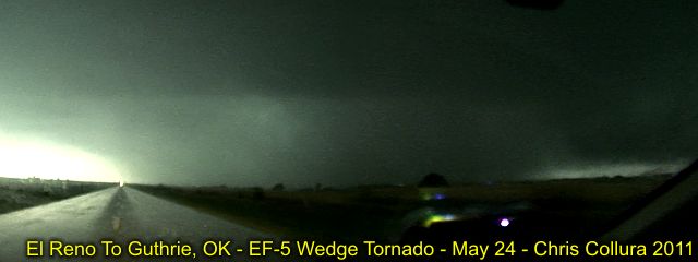
2011: Above is a nightmare-ish panorama (and utterly frightening) picture of a violent tornado in Canadian County, Oklahoma on May 24, 2011. The view is looking south on Highway 270 south of Calumet, OK and northeast of El Reno and about 2 miles north of I-40. This was one of the strongest tornadoes of the day (May 24, 2011) with a high-risk outlook and a violent tornado outbreak well underway. Although partially rain wrapped, this is a MILE WIDE wedge tornado, packing EF-5 winds of at least 200 MPH, the HIGHEST on the tornado scale. This long tracked tornado raced from southwest of El Reno, Oklahoma to near Guthrie, a path of over 75 miles. This storm caused extensive damage to homes (some completely swept off their foundations) and at least 9 deaths. May 24 was one of several major chase days of 2011, aside to the devastating (and similar) tornado that affected Joplin, Missouri on May 22. The roaring sound from this tornado (on May 24) at a 1-2 mile away distance sounded more like a fighter jet taking off than the familiar "freight train" sound!
Posted: Dec 17, 2019, 7:51 PM
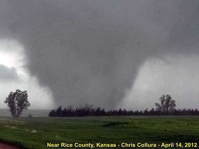
2012: In the above image, taken near Geneseo, Kansas on April 14, 2012, a violent wedge tornado (nearly a mile wide) churns violently in an open field (fortunately), packing winds near 200 MPH, and earning at least an EF-4 rating (on a 0 to 5 scale) during a high-risk setup. This was one of the strongest (out of over a hundred) tornadoes to develop in America's heartland that day. Like a bullet "missing" vital organs, it is VERY fortunate that this violent tornado above did not hit any major towns, as it managed to debark trees and remove pavement from roadways! This tornado was on the ground for nearly an hour, and had a path length of almost 75 miles. It is very important that people in these areas take the proper precautions, and act quickly during such times. There is really NO safe place in an EF-4 (or EF-5) tornado like this above ground. Tornado shelters and / or basements are your only hopes of surviving a direct hit.
Posted: Dec 17, 2019, 7:51 PM
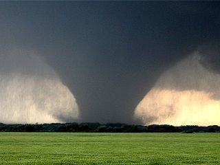
2013: View of intensifying and a soon-to-be violent tornado on May 28, 2013 near Minneapolis / Bennington, Kansas. This large tornado (3/4 mile wide in this picture) is intensifying and will pack winds of EF-4 strength. The view is West.
Posted: Dec 17, 2019, 7:53 PM

2014: Above is an absolutely incredible view of the multiple violent tornadoes churning over the Nebraska countryside north of Pilger, Nebraska on the afternoon of June 16, 2014. At least two tornadoes are visible, each an EF-4 violent tornado (with the left one being possibly stronger) with yet a third tornado trying to form to the far left as lightning strikes to the right! These two tornadoes are actually interacting with one another since they are similar size in a phenominon called the "Fujiwhara Effect". They will eventually merge into a violent mile+ wide wedge tornado before occlusion and development of yet another tornado "family" to the east. The town of Pilger, Nebraska was completely destroyed by the tornado to the left, with at least 3 people killed about 15 minutes before this picture was taken (near Highway 275 looking to the north). Note the devastated farmstead in the foreground.
Posted: Dec 17, 2019, 7:53 PM

2015: The first major chase trip in early April 2015 landed in Illinois near Rochelle late in the day on April 9th. In this spectacular picture above, a violent tornadic supercell with wedge tornado looms ominously looking northwest of Rochelle, Illinois. This violent tornado was to tear across the small towns of Kings and Fairdale causing extensive damage, killing two people, and injuring dozens more. The picture above was the view of the violent tornado from north of I-88 and west of I-39 on county road 251 and north of Hillcrest.
Posted: Dec 17, 2019, 7:53 PM

2016: Main stovepipe and new mesocyclone to the right, with simultaneous tornadoes a minute or so later. This was repeated a few times. Eventually, the new (right) mesocyclone became dominant, and absorbed the weakening / roping out stove pipe from the old mesocyclone. This weakening tornado wrapped around the new mesocyclone like a satellite tornado before being absorbed. Dodge City, Kansas.
Posted: Dec 17, 2019, 7:54 PM
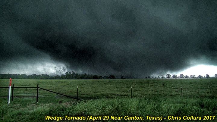
2017: The terrifying mass of fast moving clouds, dirt, and debris churns over an open field and takes aim on the eastern side of Canton, Texas during the late afternoon of April 29, 2017. This was a powerful wedge tornado that finished toppling high voltage transmission lines just east of Highway 19, and is continuing north and northeastward towards Interstate 20 and the unfortunate towns of Canton and Fruitvale, Texas. The tornado was rated a high-end EF-3 tornado, with winds well over 160 MPH, and caused 5 deaths and dozens of injuries along a path 51 miles long and after being on the ground for over an hour. The tornado was up to a mile wide in some places. This scene always causes me and other storm chasers to have a strong respect for the destructive power, then sadness as lives are lost and changed forever. While taking the above picture (from video), and from less than a mile from the tornado core, the sound resembled a loud train with a low "growling" sound, with vibration felt in my chest as well as the ground. My ears also popped. Luckily I was able to keep my distance in the "bear's cage" of the supercell between the RFD hook and tornado core flow, and wound up with this absolutely incredible footage. At the same time - Always keep the people affected by these storms in out hearts and prayers.
Posted: Dec 17, 2019, 7:55 PM
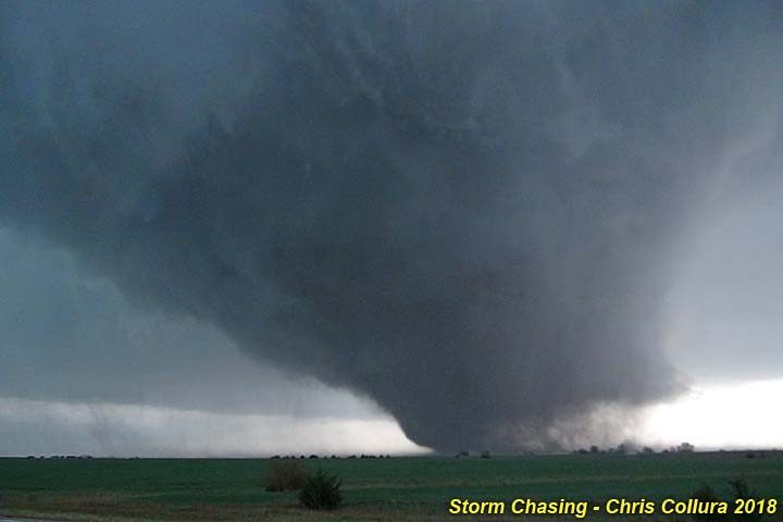
2018: The main chase trip in Spring of 2018, and the month of May itself, starts off with an incredible tornado interception on May 1, 2018 on Ottawa, Kansas along state-road 18 east of Tescott and ironically to the northwest of Bennington / Culver late in the day! Fortunately this tornado, rated high-end EF-3 with winds at least 160 MPH and a path width of 1/2 mile, remained over open rural country and did not hit any populated areas. The entire life-cycle of this tornado was documented, with video of the event fed out shortly after and presented later on network TV.
Posted: Dec 17, 2019, 7:56 PM
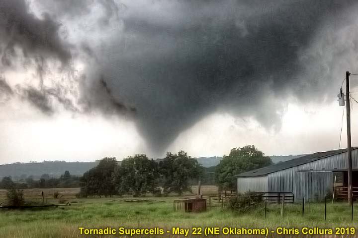
2019: In this picture, a beautiful but strong tornado looms over an Oklahoma ranch near Wilson / Okmulgee looking westward late in the afternoon of May 22, 2019. On this same day, devastating tornadoes affected areas northeastward into Missouri in Jefferson City after dark. Storm chasing these incredible storms required deep respect for them, as well as being sensitive for anyone affected.
Posted: Dec 17, 2019, 7:56 PM
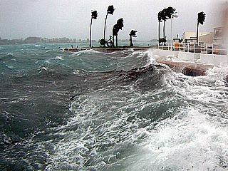
2010: Hurricane Igor, Bermuda. Large waves better the relatively protected lagoon near the main center of St George. This lagoon is roughly a mile or so across, but is suseptible to storm surge (it is connected to the ocean by inlets) and wave action when winds exceed 70 MPH.
Posted: Dec 17, 2019, 7:57 PM
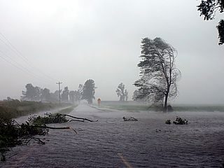
2011: Hurricane Irene in NC. Here is a picture of some severe fresh water flooding in the farming areas in and around Highway 264 and near Pantego, NC. The attempt was to travel back north and east towards Highway 264 and eventuially Highway 64 for a "second" intercept of hurricane Irene's core on the north side of Pamlico Sound. This trip was not easy, with many detours around flooded roads and downed trees.
Posted: Dec 17, 2019, 7:59 PM
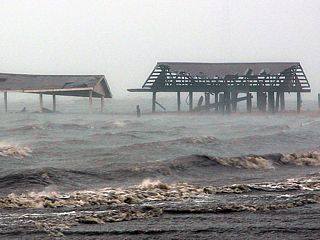
2012: Hurricane Issac in Louisiana. Damaged roofing and storm surge flooding south of Interstate 10 and near the junction of Highway 11 on the eastern side of Lake Ponchartrain.
Posted: Dec 17, 2019, 8:01 PM
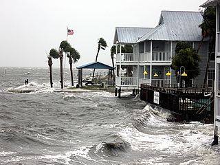
2013: Tropical Storm Andrea in Florida. Tropical Storm Andrea and storm surge in Cedar Key, FL on June 6.
Posted: Dec 17, 2019, 8:02 PM

2014: Hurricane Arthur in NC. Storm surge and waves lash a waterfront area off Highway 64 near Nags Head, NC during the morning of July4 as the Pamlico Sound surge ensued after passage of the eye of the storm.
Posted: Dec 17, 2019, 8:03 PM

2016: Hurricane Hermine in FL. This is the scene on the east side of Alligator Point, Florida (near Saint James) during the afternoon of September 1, 2016 as hurricane Hermine approaches. High surf and rising storm surge (8 to 12 feet above normal in some areas during the peak of the storm) cause an already storm damaged road to collapse into the Gulf of Mexico. This drives home the point that it simply is not a good idea to stay on a barrier island with a hurricane rapidly approaching.
Posted: Dec 17, 2019, 8:03 PM
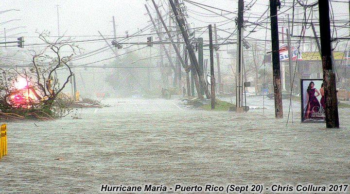
2017: Hurricane Maria in Puerto Rico. This is a view of Highway 1, a major route through Caguas, Puerto Rico, as the winds and rain from Hurricane Maria was winding down during the morning of September 20, 2017. Not only were the 150+ MPH wind gusts bad enough, but flash flooding also became catastrophic, with between 35 and 40 inches of rain falling in this area alone. Puerto Rico face a long and daunting recovery, with power out for at least 6 months in some places, and flooding / wind damage of catastrophic proportions.
Posted: Dec 17, 2019, 8:04 PM
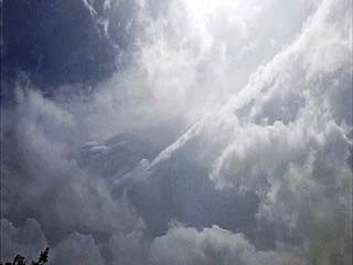
2019: Hurricane Michael in FL. We entered the western sections of the calm eye - With light winds and partly cloudy skies at our location. Looking up in this picture, the 60,000 foot eyewall edge stretches across the upper right with the bright sun overhead and blues skies! The calm lasted roughly 10 to 15 minutes.
Posted: Dec 17, 2019, 8:06 PM
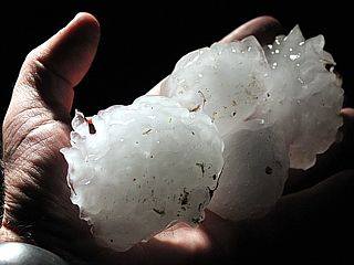
2015: Hail SW of Wichita, Kansas. Piece of very large hail held up to car headlight. This was one of many pieces covering the ground near Nashville, Kansas on the evening of April 8.
Posted: Dec 17, 2019, 8:07 PM
Generated by Chris Collura on Wednesday, April 15, 2020 at 11:31 AM UTC-07:00
HTML File "index39.htm" (Facebook) - Developed By Chris Collura
To Return To The HOME Page Of This Site Click The "INDEX.HTM" Link Here!


