
Facebook Photo Album Storm Chasing 2018
(Storm Chasing 2018 Sky-Chaser Chris Collura Facebook Posts)
[ PARENT INDEX ]
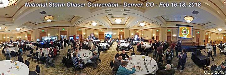
The storm chaser convention in 2018 took place from February 16th through the 18th in Denver, Colorado at the Hilton Doubletree off Quebec Street and just south of I-70. This continued to be a great event each year, thanks to the great efforts of Roger Hill and his group, but unfortunately this year had a lower attendance due to many last minute cancellations, and this convention is rumored to be the last one because of heavy expenses and losses incurred by Roger and his group.
Posted: Feb 23, 2018, 7:24 AM
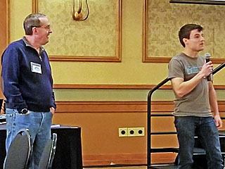
Convention organizer Roger Hill (left) and storm chaser / vendor Skip Talbot with Storm-Assist (to the right).
Posted: Feb 23, 2018, 7:26 AM
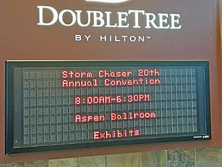
Sign in Doubletree Hilton for the storm chaser convention during the ice-breaker on February 16 in the late evening.
Posted: Feb 23, 2018, 7:26 AM
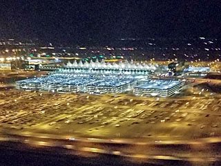
Arrival into Denver International Airport during the late evening of February 15, 2018 with light snow falling.
Posted: Feb 23, 2018, 7:26 AM
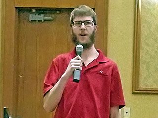
James Breitenbach talking about mobile technology for chasing in the vehicle.
Posted: Feb 23, 2018, 7:26 AM
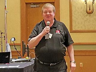
Cliff Wyndham with Baron Weather Works talking about his company (founded after the Huntsville, Alabama tornado in November 1989).
Posted: Feb 23, 2018, 7:26 AM
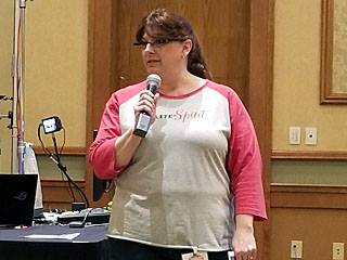
Vendor for Safelite Auto Glass talking about special programs for glass replacement in vehicles involved in storms (especially hail damage)!
Posted: Feb 23, 2018, 7:26 AM
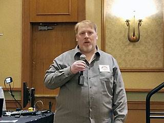
Tim Vasquez, writer of Digital Atmosphere, talking about his products and storm chasing.
Posted: Feb 23, 2018, 7:26 AM
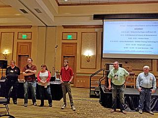
Vendor "panel" of vendors standing up in front of the audience for questions during the morning of February 17.
Posted: Feb 23, 2018, 7:26 AM
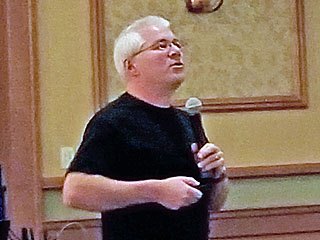
Scientist Josh Wurman talking about hurricane intercepts done during the year of 2017, amongst future plans and other studies.
Posted: Feb 23, 2018, 7:26 AM
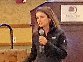
Josh Wurman's assistant talking about research operations in 2017 and future plans.
Posted: Feb 23, 2018, 7:26 AM
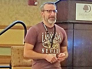
Doctor Jason Persoff talking about mental issues and addictions that may afflict some storm chasers. He did a fantastic speech on this topic.
Posted: Feb 23, 2018, 7:26 AM
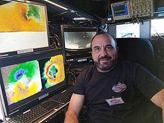
Inside the dual-polarization DOW (Doppler on Wheels) radar truck with myself sitting in their "office". The images are from Hurricane Harvey in Texas in August 2017 as well as Dodge City in May 2016.
Posted: Feb 23, 2018, 7:26 AM
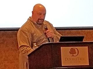
Doug Kiesling talking about video rights and copyrights, another fantastic subject.
Posted: Feb 23, 2018, 7:26 AM
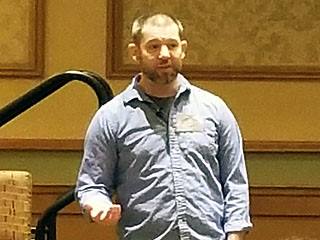
Jason Caster talking about chasing on a budget and tips on saving money on chase trips during the morning of February 18.
Posted: Feb 23, 2018, 7:26 AM
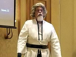
Tim Marshall doing his key speech about "rogue weather events" in 2017 dressed as Luke Skywalker.
Posted: Feb 23, 2018, 7:26 AM
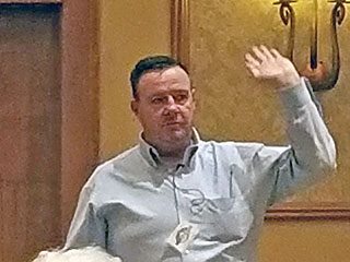
Matt Deighton talks on Sunday, February 18 about what hes done during and after the Greensburg KS tornado in May 2007. He focused on recovery and inspiration after major disasters.
Posted: Feb 23, 2018, 7:26 AM
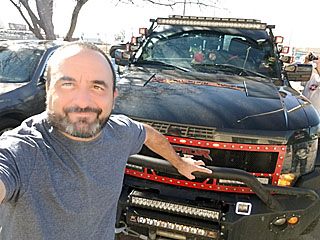
Myself in front of one of the chase vehicles parked in front of the hotel during the afternoon of February 18.
Posted: Feb 23, 2018, 7:26 AM
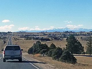
View of the Palmer Divide 30 miles to the SE of Denver near Highway 30 on a beautiful and warm winter day (70 deg F) after spending time with Doug and Ryan at Eric Treece's ranch house before returning to the airport.
Posted: Feb 23, 2018, 7:26 AM
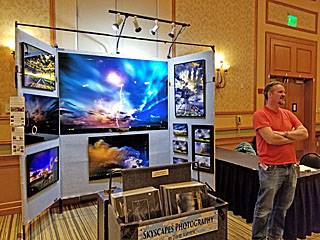
Skyscapes photography vendor booth offering aluminum prints of severe storms for sale, one of several great vendors there.
Posted: Feb 23, 2018, 7:26 AM
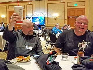
Doug Kiesling (left) at our convention table early on February 17.
Posted: Feb 23, 2018, 7:26 AM
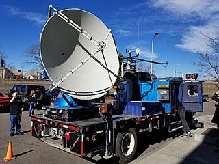
Dual-polarization DOW (Doppler on Wheels) radar truck on display in the parking lot during the day of February 17.
Posted: Feb 23, 2018, 7:26 AM
360 View of radar truck at Chasercon 2018.
Posted: Feb 23, 2018, 7:33 AM
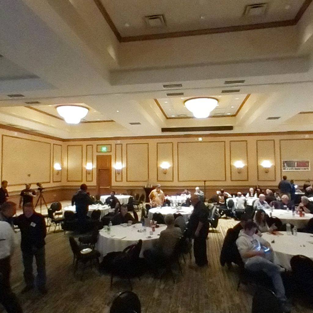
360 View of convention at Chasercon 2018.
Posted: Feb 23, 2018, 7:33 AM
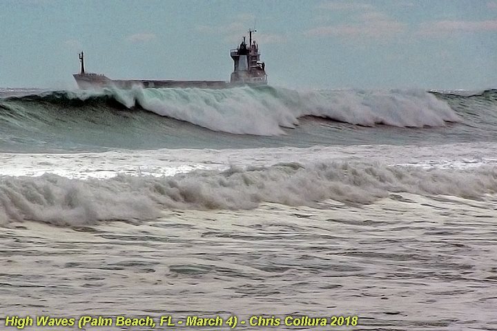
Large waves breaking with a ship waiting off shore of Lake Worth Inlet (Palm Beach County) on the FL east coast during the morning of March 4 as 15 foot swells affect the area from an ocean storm in the NW Atlantic off New England.
Posted: Mar 5, 2018, 12:30 PM
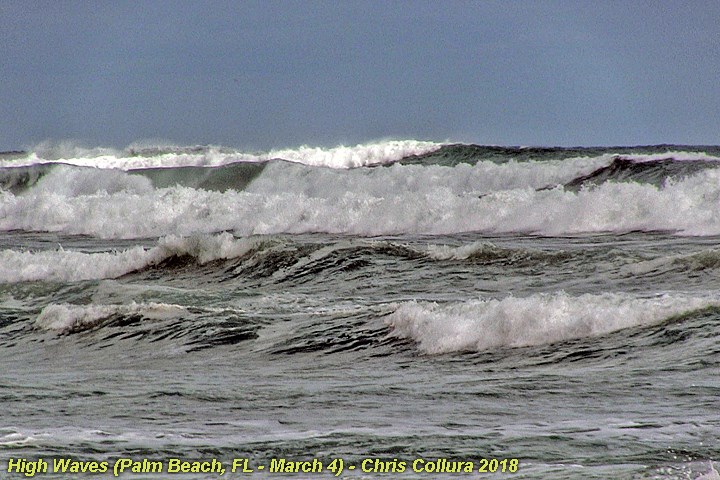
Large waves breaking offshore of Palm Beach County on the FL east coast during the morning of March 4 as 15 foot swells affect the area from an ocean storm in the NW Atlantic off New England.
Posted: Mar 5, 2018, 12:30 PM
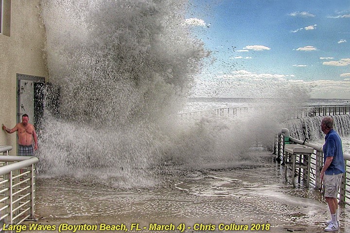
Large wave crashes into sand pumping station on the north side of Boynton Inlet (Boynton Beach) on the FL east coast during the morning of March 4 as 15 foot swells affect the area from an ocean storm in the NW Atlantic off New England.
Posted: Mar 5, 2018, 12:30 PM
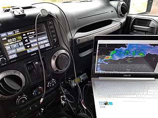
Inside of my chase vehicle (a 2016 Jeep Wrangler) ready to chase on March 19, 2018.
Posted: Mar 21, 2018, 10:47 AM
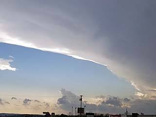
View of impressive anvil blowoff from an intensifying tornadic supercell west of Russellville, Alabama after 6 PM in Franklin County.
Posted: Mar 21, 2018, 10:47 AM
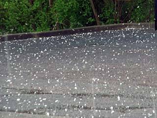
Hail up to golfball sized affecting Meridianville, Alabama north of Huntsville around 4 PM on March 19.
Posted: Mar 21, 2018, 10:47 AM
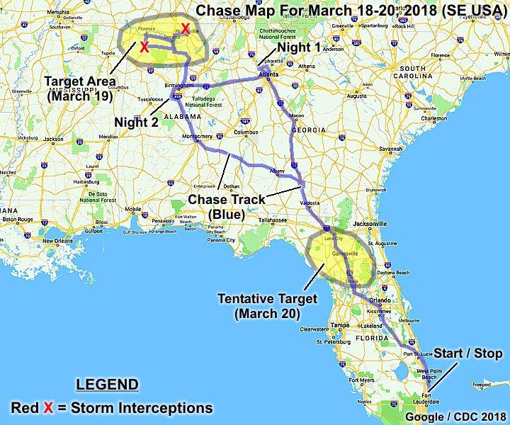
This is a chase map for the chase from March 18 through March 20, 2018. The chase track is in blue (which includes the long "ferry" trip from Florida and to the target areas). The target areas appear as yellow outlines for the main chase days, with storm intercepts denoted by the red "X's". The main chase day was March 19.
Posted: Mar 21, 2018, 10:47 AM
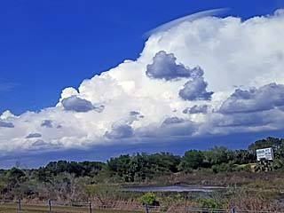
Non severe storm in central Florida while beginning a long road trip to Georgia and Alabama during the afternoon of March 18, 2018.
Posted: Mar 21, 2018, 10:47 AM
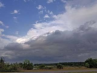
Low topped non-severe storm west of Orlando while heading back to south Florida late in the day on March 20.
Posted: Mar 21, 2018, 10:47 AM
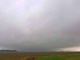
Area of rotation to the southwest of Courtland, Alabama on the first supercell of the day on March 19. This was along the warm front and storm motions were fast and visibility poor.
Posted: Mar 21, 2018, 10:47 AM
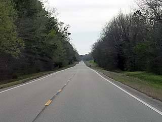
Highway 82 in eastern Alabama extending into a "traffic-less" vanishing point while heading east of Montgomery on March 20, 2018.
Posted: Mar 21, 2018, 10:47 AM
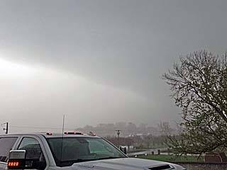
View of backside of the hail core and area of weak rotation on March 19 near Meridianville, Alabama.
Posted: Mar 21, 2018, 10:47 AM
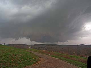
Supercell storm (in classic mode) to the west of Russellville, Alabama on Mrch 19. This is an intensifying storm and will produce a weak tornado soon.
Posted: Mar 21, 2018, 10:47 AM
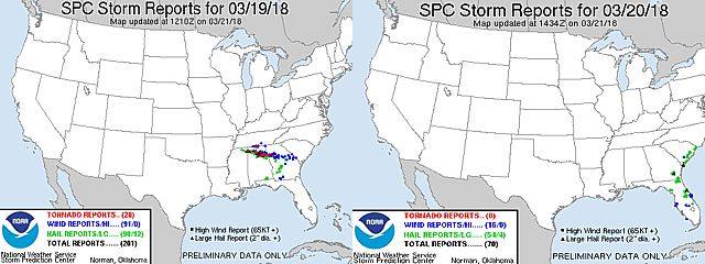
These are two images from the storm Prediction Center (SPC) storm reports for March 19 (left) and 20 (right), 2018. A red dot denotes a tornado report, a blue dot a damaging severe wind report (58 MPH and up), and a green dot a severe hail report (1" and larger). Significant wind (65 knots and up) and significant hail (2" and larger) is denoted by a black square and triangle, respectively. Note the main track of the storms over northern Alabama on March 19.
Posted: Mar 21, 2018, 10:47 AM

March 19 was the main chase day of this trip. The image above to the left is the tornado outlook as per the SPC for the main target areas. In the middle image, tornado watch 13 is shown. The visible satellite is the image to the right, showing the storms over northern Alabama at about the time the Russellville tornado ocurred. A radar (base reflectivity) image of the Franklin County supercell is in the right inset.
Posted: Mar 21, 2018, 10:47 AM

March 20 was mainly a travel day back into Florida. In the images above, the SPC 12z outlook is shown to the left (enhanced-risk). In the middle is the graphic of tornado watch 17 for that area. In the right, are the disorganized severe storms (base reflectivity radar) over Florida during the afternoon of March 20.
Posted: Mar 21, 2018, 10:47 AM
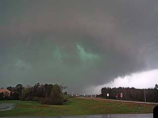
Intense rain-wrap and hail core while looking west towards Russellville, Alabama. There is a developing rain-wrapped tornado in there, and significant damage was being done in Russellville at the time.
Posted: Mar 21, 2018, 10:47 AM
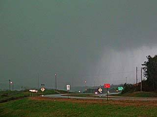
Closer view of rain-wrapped tornado as is was doing damage in Russellville, Alababa. The tornado would be to the lower-left of the center of this picture.
Posted: Mar 21, 2018, 10:47 AM
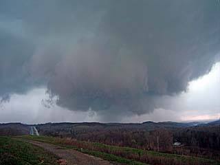
Close-up view of rotating wall cloud to the west of Russellville, Alabama.
Posted: Mar 21, 2018, 10:47 AM
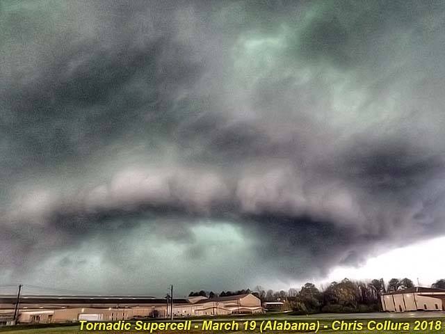
First Tornadic supercell of the year - March 19, 2018 in Franklin County, Alabama (near Russellville).
Posted: Mar 21, 2018, 11:00 AM
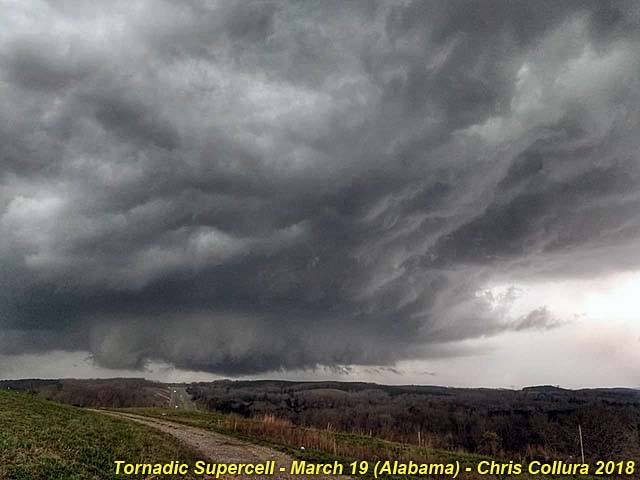
First Tornadic supercell of the year - March 19, 2018 in Franklin County, Alabama (near Russellville).
Posted: Mar 21, 2018, 11:00 AM
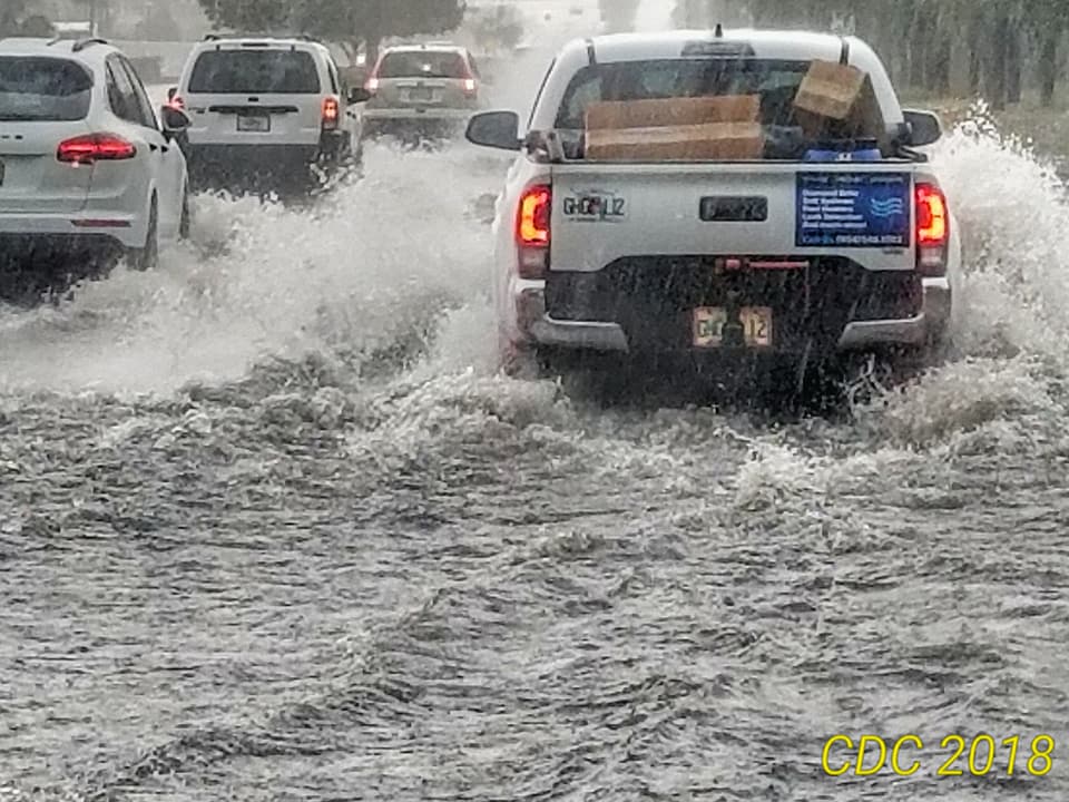
Flooding behind storm clusters in Pompano Beach, Florida - April 10, 2018.
Posted: Apr 10, 2018, 2:37 PM
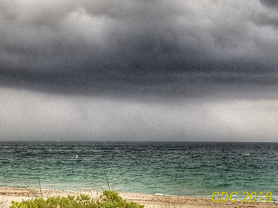
Funnel / waterspout well to the northeast offshore of Fort Lauderdale beach (the funnel / former tornado - waterspout is just left of the buoy). April 10, 2018.
Posted: Apr 10, 2018, 2:37 PM
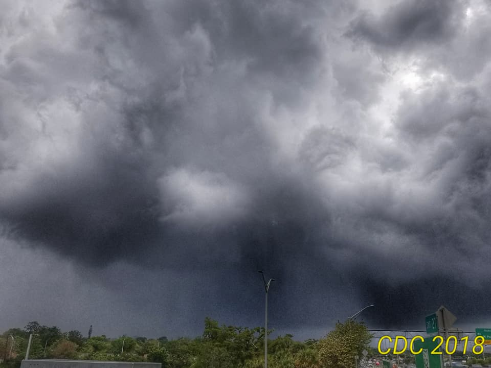
View of tornado and supercell from traffic jam on I-95 and Sunrise Blvd in Ft Lauderdale, FL on April 10, 2018. The tornado is not fully condensed but just to the left of the light pole in this picture.
Posted: Apr 10, 2018, 2:37 PM
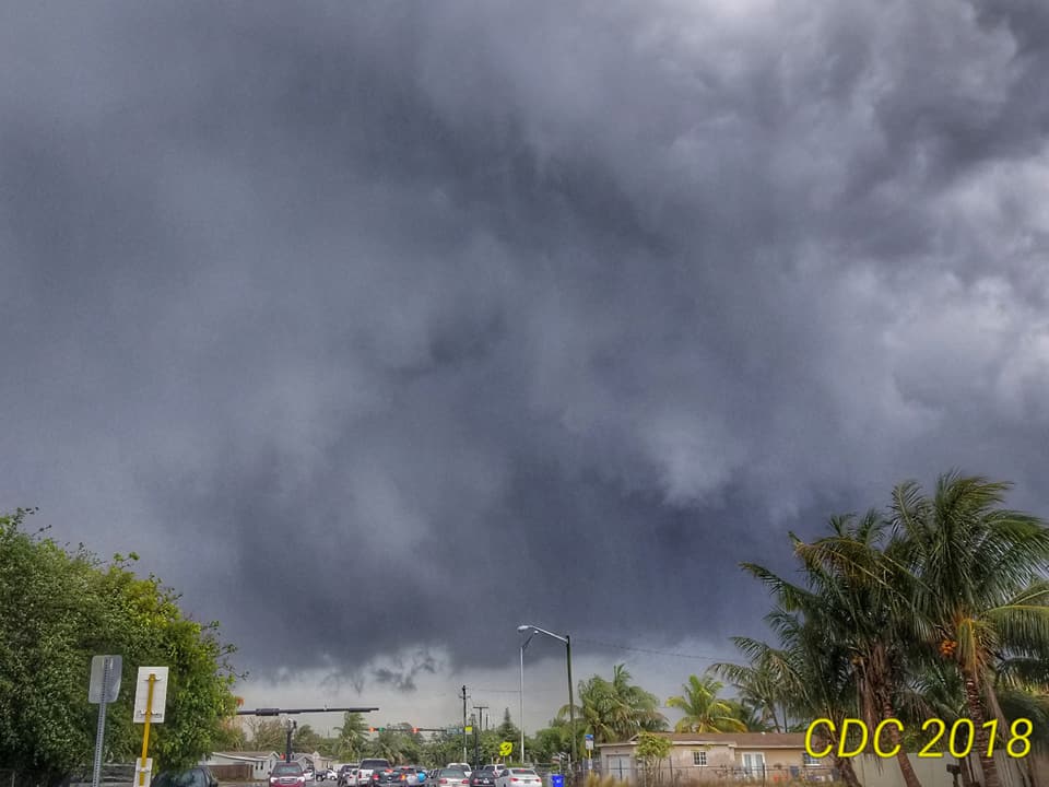
Developing tornadic superell over Fort Lauderdale, Florida at around 4 PM EDT on April 10, 2018.
Posted: Apr 10, 2018, 2:37 PM
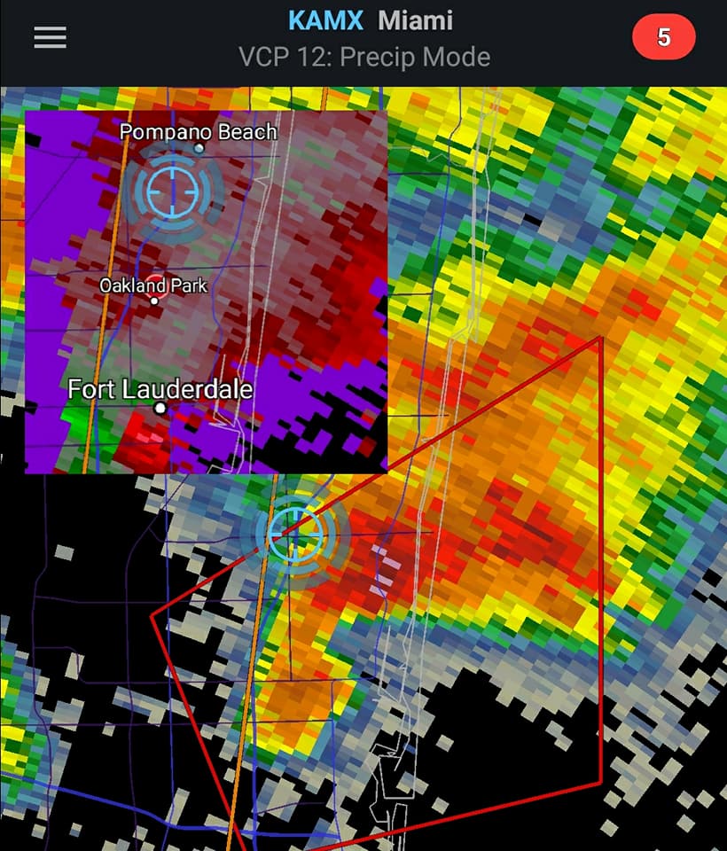
Rare Fort Lauderdale tornadic supercell on April 10, 2018 during the afternoon. Reflectivity shows hook and "flying eagle" form, with the inset showing a velocity gate-to-gate couplet to the lower left.
Posted: Apr 10, 2018, 2:37 PM
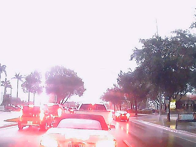
Close, loud, and intense CG lightning flash associated with a multicell storm cluster behind a tornadic storm offshore of Fort Lauderdale, Florida on April 10, 2018.
Posted: Apr 10, 2018, 6:28 PM
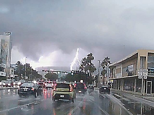
Intense lightning flash on tornado warned storm during the late afternoon of April 10, 2018. This is looking north in Ft Lauderdale, Florida.
Posted: Apr 10, 2018, 6:28 PM
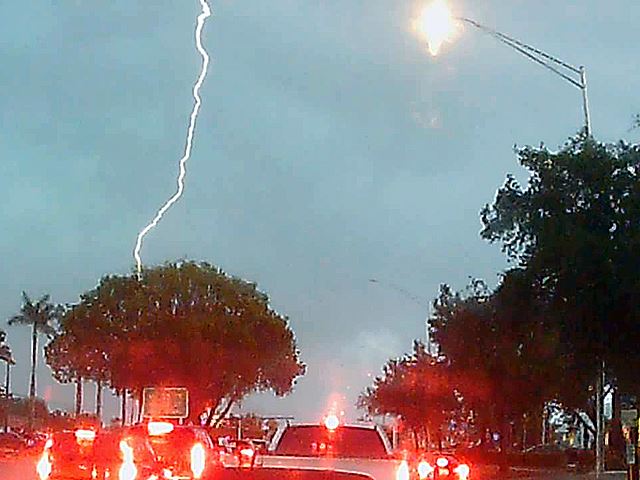
CG lightning flash associated with a multicell storm cluster behind a tornadic storm offshore of Fort Lauderdale, Florida on April 10, 2018.
Posted: Apr 10, 2018, 6:28 PM
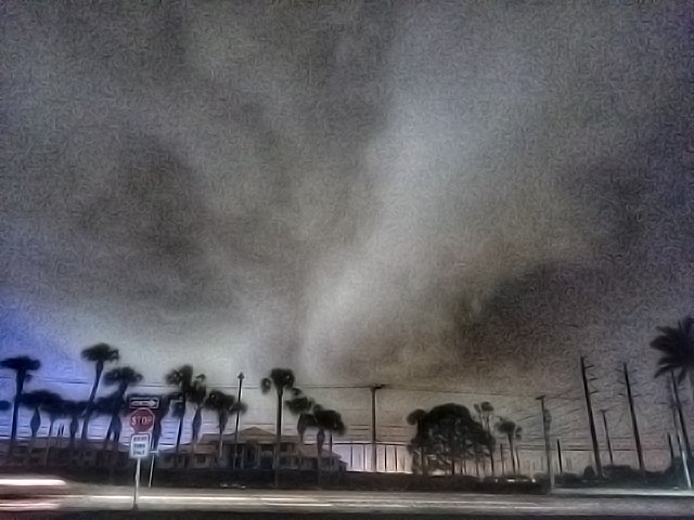
Severe warned storm in western Palm Beach (Royal Palm Beach). April 15, 2018 after dark.
Posted: Apr 15, 2018, 6:09 PM
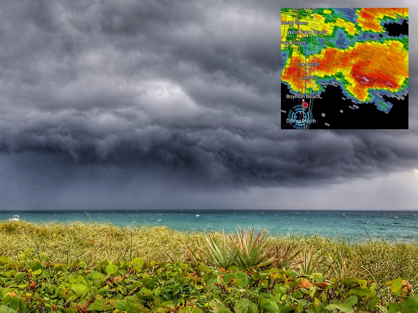
Watched a weekly rotating storm move offshore of Palm Beach County, Florida late in the day (around 4:30 PM EDT) of April 24, 2018.
Posted: Apr 24, 2018, 5:19 PM
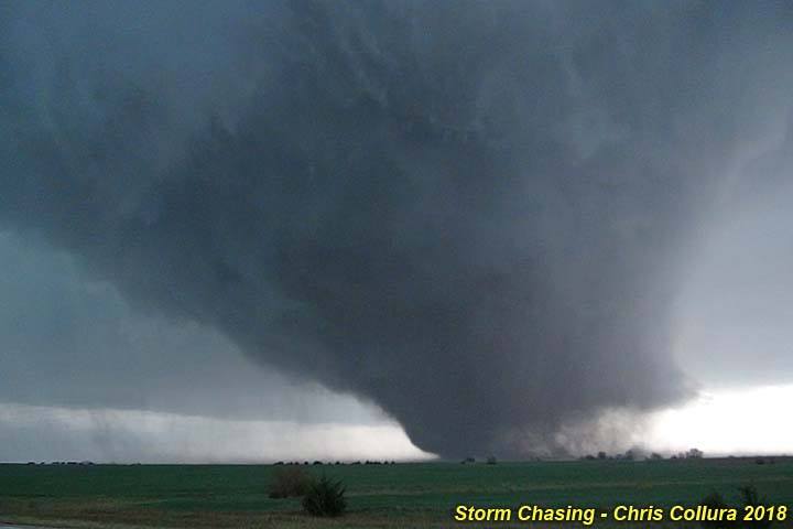
Storm Chasing - Kansas (May 1, 2018) - Chase trip 2018!
Posted: May 2, 2018, 7:14 AM

Storm Chasing - Kansas (May 1, 2018) - Chase trip 2018!
Posted: May 2, 2018, 7:14 AM
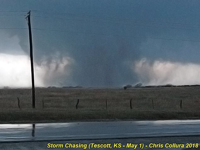
Storm Chasing - Kansas (May 1, 2018) - Chase trip 2018!
Posted: May 2, 2018, 7:14 AM
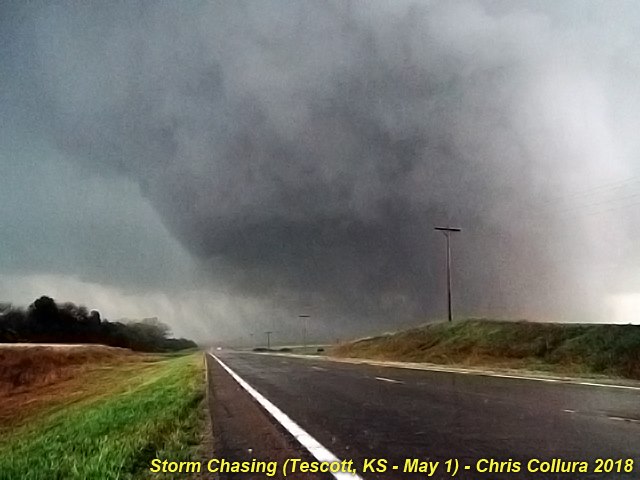
Storm Chasing - Kansas (May 1, 2018) - Chase trip 2018!
Posted: May 2, 2018, 7:14 AM

Storm Chasing - Kansas (May 1, 2018) - Chase trip 2018!
Posted: May 2, 2018, 7:14 AM
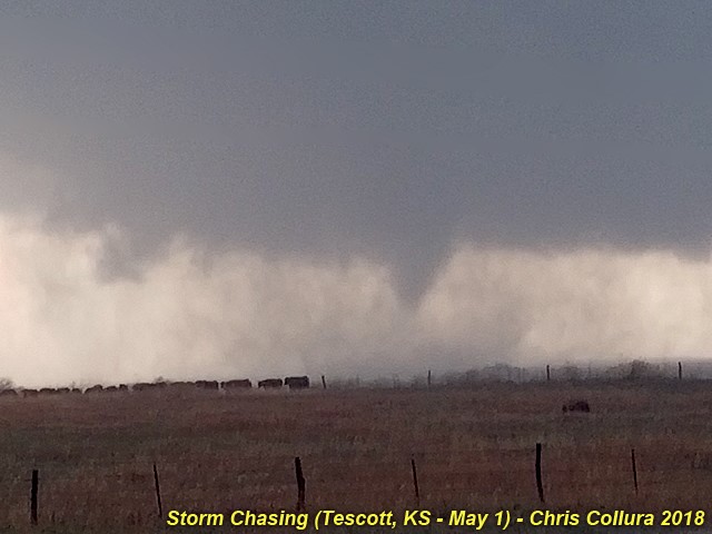
Storm Chasing - Kansas (May 1, 2018) - Chase trip 2018!
Posted: May 2, 2018, 7:14 AM
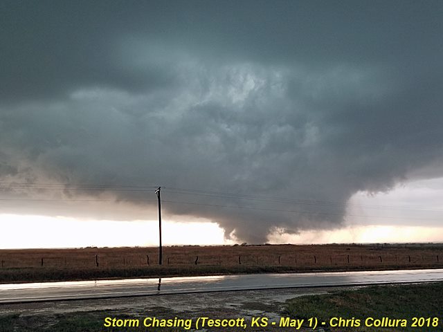
Storm Chasing - Kansas (May 1, 2018) - Chase trip 2018!
Posted: May 2, 2018, 7:14 AM

Storm Chasing - Kansas (May 1, 2018) - Chase trip 2018!
Posted: May 2, 2018, 7:14 AM
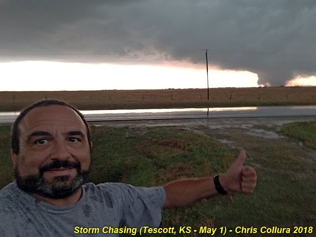
Storm Chasing - Kansas (May 1, 2018) - Chase trip 2018!
Posted: May 2, 2018, 7:14 AM

Storm Chasing - Kansas (May 1, 2018) - Chase trip 2018!
Posted: May 2, 2018, 7:14 AM
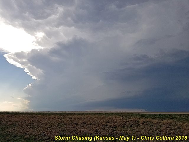
Storm Chasing - Kansas (May 1, 2018) - Chase trip 2018!
Posted: May 2, 2018, 7:14 AM

Storm Chasing - Kansas (May 1, 2018) - Chase trip 2018!
Posted: May 2, 2018, 7:14 AM
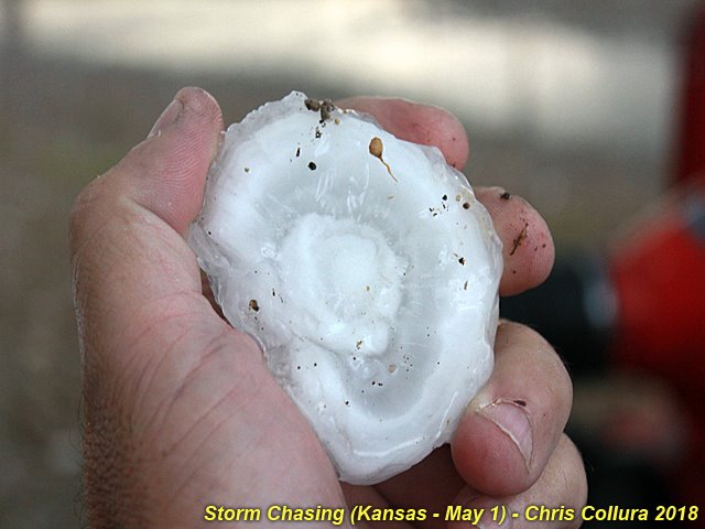
Storm Chasing - Kansas (May 1, 2018) - Chase trip 2018!
Posted: May 2, 2018, 7:14 AM
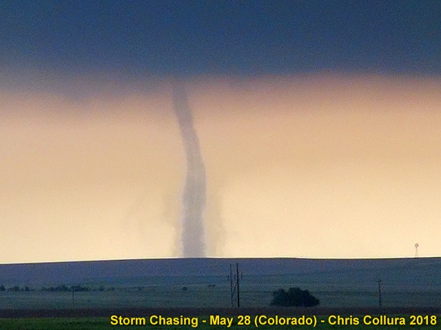
Multiple landspout tornadoes (first landspout) - Kit Carson County, Colorado - May 28, 2018.
Posted: May 28, 2018, 11:29 PM
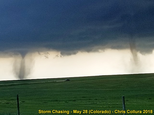
Multiple landspout tornadoes - Kit Carson County, Colorado - May 28, 2018.
Posted: May 28, 2018, 11:29 PM
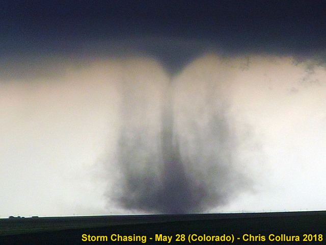
Multiple landspout tornadoes - Kit Carson County, Colorado - May 28, 2018.
Posted: May 28, 2018, 11:29 PM
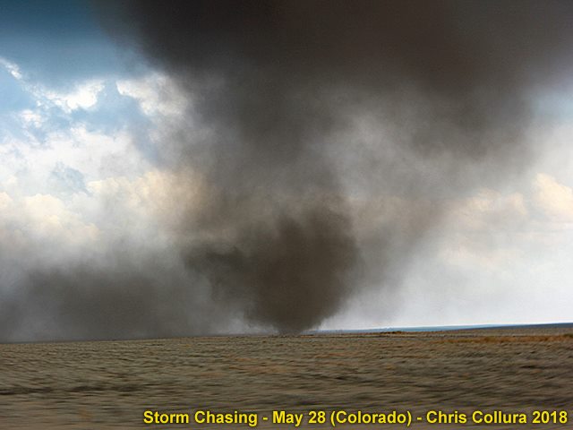
Multiple landspout tornadoes (northern tornado) - Kit Carson County, Colorado - May 28, 2018.
Posted: May 28, 2018, 11:29 PM
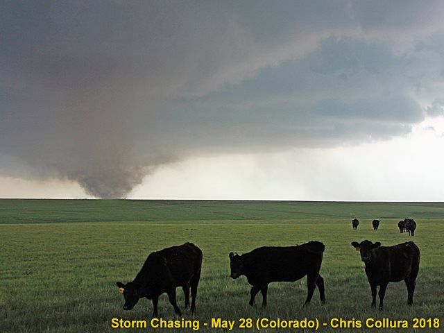
Multiple landspout tornadoes (southern tornado) - Kit Carson County, Colorado - May 28, 2018.
Posted: May 28, 2018, 11:29 PM
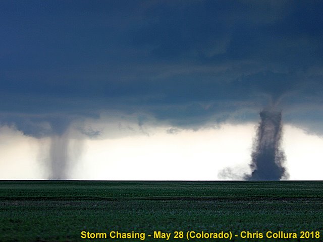
Multiple landspout tornadoes ("Wray twins) - Kit Carson County, Colorado - May 28, 2018.
Posted: May 28, 2018, 11:29 PM
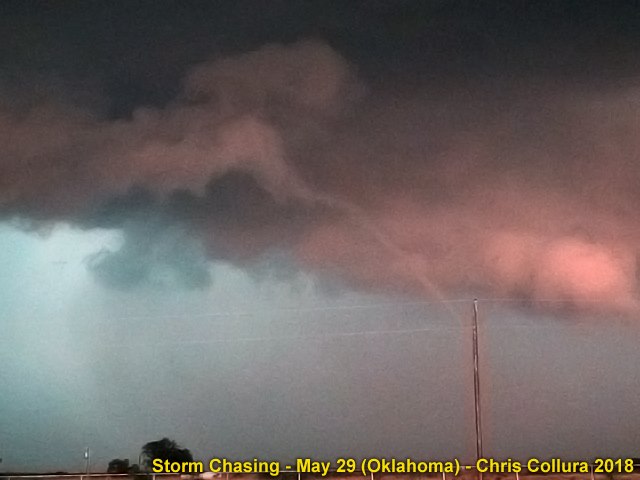
Brief and thin rope funnel / tornado near Waynoka, OK late on May 29, 2018.
Posted: May 29, 2018, 10:09 PM
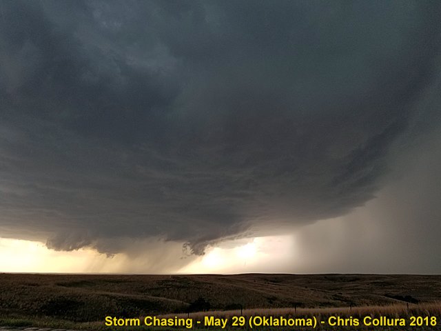
Storms in N Central Oklahoma - Intensifying supercell storm west of Selman, OK. May 29, 2018.
Posted: May 29, 2018, 10:09 PM
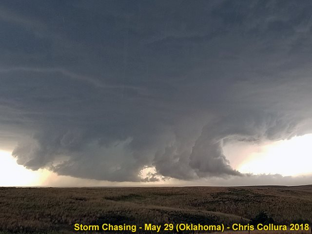
Intense rotation (note the streamwise vorticity current feeding into the storm from the right and getting tilted vertically) and large wall cloud west of Selman, OK. May 29, 2018.
Posted: May 29, 2018, 10:09 PM
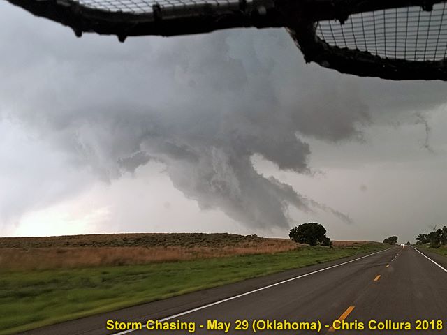
Rotating wall cloud / funnel near Selman, OK. May 29, 2018.
Posted: May 29, 2018, 10:09 PM

Possible cone tornado developing near Waynoka, OK late on May 29, 2018.
Posted: May 29, 2018, 10:09 PM
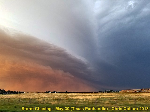
Impressive "derecho" type outflow with dust plume (haboob). Texas Panhandle on May 30, 2018.
Posted: May 31, 2018, 12:10 AM
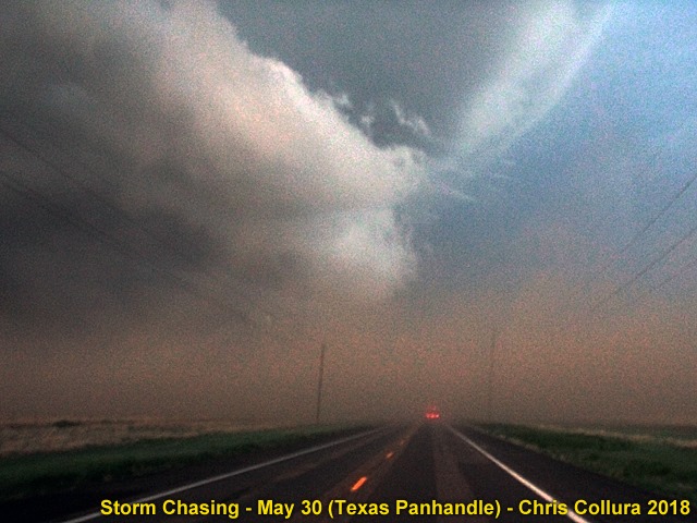
Blowing dust / haboob. Texas Panhandle on May 30, 2018.
Posted: May 31, 2018, 12:10 AM

Overturned truck. Texas Panhandle on May 30, 2018.
Posted: May 31, 2018, 12:10 AM
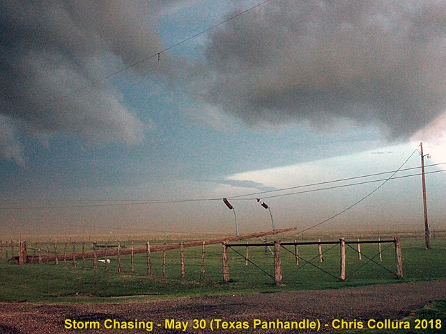
Downed power lines. Texas Panhandle on May 30, 2018.
Posted: May 31, 2018, 12:10 AM
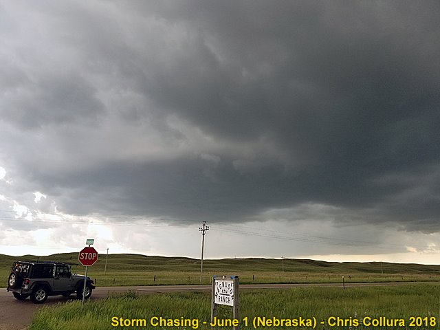
Developing supercell storm near Wood Lake, NE - June 1, 2018.
Posted: Jun 1, 2018, 10:25 PM
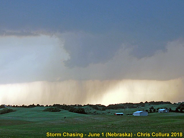
Rotating wall cloud near Taylor, NE - June 1, 2018.
Posted: Jun 1, 2018, 10:25 PM
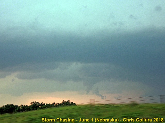
Funnel north of Taylor, NE - June 1, 2018.
Posted: Jun 1, 2018, 10:25 PM

Looking southwest at possible funnel from 281 at dusk and 40 miles north of Grand Island, NE - June 1, 2018.
Posted: Jun 1, 2018, 10:25 PM
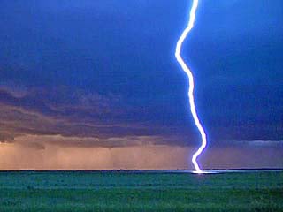
Close CG lightning while west of Cando, North Dakota late on June 14, 2018.
Posted: Jun 18, 2018, 10:58 AM

Rapidly rotating wall cloud / funnel (or possible tornado?) near Leon, Iowa late in the day on June 25, 2018.
Posted: Jun 26, 2018, 8:00 AM

Supercell storm - North-central Illinois (August 20, 2018). Upscale growth into bow / line segment.
Posted: Aug 20, 2018, 6:19 PM
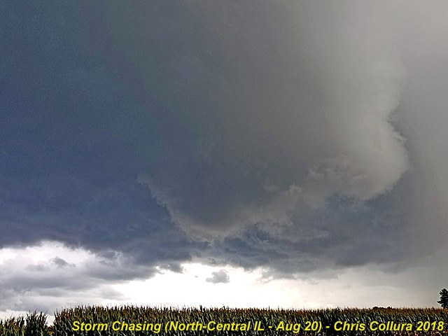
Supercell storm - North-central Illinois (August 20, 2018). Low level mesocyclone.
Posted: Aug 20, 2018, 6:19 PM

Supercell storm - North-central Illinois (August 20, 2018). Rotating wall cloud.
Posted: Aug 20, 2018, 6:19 PM
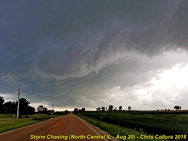
Supercell storm - North-central Illinois (August 20, 2018). RFD and rotating portion of storm.
Posted: Aug 20, 2018, 6:19 PM
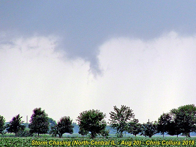
Supercell storm - North-central Illinois (August 20, 2018). Brief funnel cloud.
Posted: Aug 20, 2018, 6:19 PM
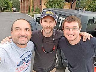
From left to right is myself, Canadian explorer George Kouranis, and meteorologist Derek Sibley near Wrightsville Beach causeway late on September 12.
Posted: Sep 17, 2018, 6:57 PM
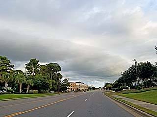
One of the outermost rain bands approaching Wrightsville Beach / Wilmington, North Carolina late in the day on September 12 as meteorologist Derek Sibley and I arrived in the target area. Hurricane Florence is still a few hundred miles away.
Posted: Sep 17, 2018, 6:57 PM
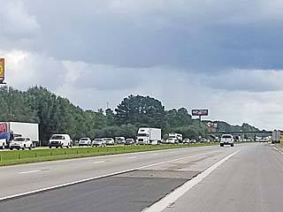
Evacuation traffic headed southbound on I-95 in South Carolina during the morning of September 12, 2018. Note that there is little of no traffic on our side (northbound).
Posted: Sep 17, 2018, 6:57 PM
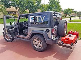
Preparing my chase vehicle, a 2016 Jeep Wrangler, for the chase of hurricane Florence. This is before departing south Florida late in the day on September 11, 2018.
Posted: Sep 17, 2018, 6:57 PM

Police roadblock at the entrance to the Wrightsville Beach causeway late on September 12. No one was allowed to cross over except residents and those with media credentials.
Posted: Sep 17, 2018, 6:57 PM
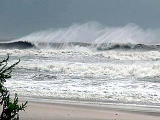
Violent surf (15+ foot waves) pounding North Topsail Beach, NC during the morning of September 13, 2018. Hurricane Florence was about 100 miles to the east, moving towards us. Winds here are tropical storm forced from the north and blowing offshore.
Posted: Sep 17, 2018, 6:57 PM
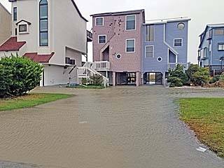
Beachfront homes with flooding and minor damage to the first levels in North Topsail Beach on September 13.
Posted: Sep 17, 2018, 6:57 PM
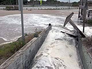
Wave runup and storm surge pouring over dunes, across stairs, and into parking lot during the morning of September 13 at North Topsail Beach. This was just after the high tide cycle.
Posted: Sep 17, 2018, 6:57 PM
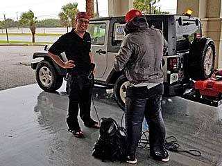
Meteorologist Reed Timmer, left, and part of his group in North Topsail Beach on September 13 before we were asked to leave by police.
Posted: Sep 17, 2018, 6:57 PM
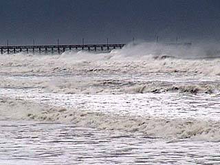
View of North Topsail Beach pier before leaving (police orders) late on September 13 as hurricane Florence draws closer.
Posted: Sep 17, 2018, 6:57 PM

A BP gas station canopy is topped by strong winds of the outer eyewall of Florence just before midnight on September 13 in North Topsail Beach.
Posted: Sep 17, 2018, 6:57 PM
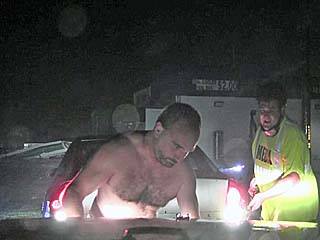
Myself using the winch on my jeep (I am hooking it up) to pull fellow storm chaser Kyle Bower's car (chasing with Derek Smith) from a ditch at the BP gas station in North Topsail Beach on September 13. Since I was completely SOAKED to the bone, I just decided to remove my shirt and rain coat.
Posted: Sep 17, 2018, 6:57 PM
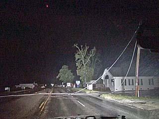
Downed powerlines across Highway 17 north of Wilmington, NC after midnight on September 14, 2018.
Posted: Sep 17, 2018, 6:58 PM
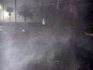
Strong winds gusting over 80 MPH and horizontal (sideways) rain at the Wilmington Red Roof Inn during the pre-dawn hours of September 14. This marked the arrival of the inner eyewall.
Posted: Sep 17, 2018, 6:58 PM
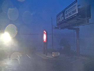
Sunrise twilight and horizontal rains and winds at the Wilmington Red Roof Inn on September 14.
Posted: Sep 17, 2018, 6:58 PM

View of radar image on my smartphone (Radarscope app) just before entering the calm eye of hurricane Florence just prior to landfall at Wrightsville Beach to the east of Wilmington on September 14.
Posted: Sep 17, 2018, 6:58 PM
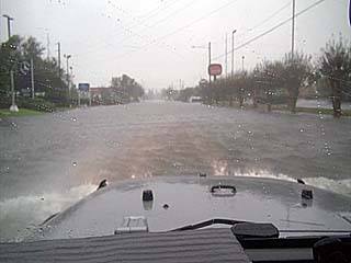
The beginning of a catastrophic flooding event for Wilmington and the surrounding areas. Here the roadway is covered with rising waters of both the Cape Fear River and storm surge. This was just before entering into the calm eye of Florence during the morning of September 14.
Posted: Sep 17, 2018, 6:58 PM

The edge of the calm eye (brighter sky) of hurricane Florence can be seen over the southeastern horizon near Wilmington after sunrise on September 14.
Posted: Sep 17, 2018, 6:58 PM
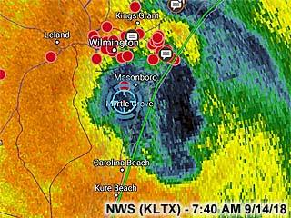
Radar (base reflectivity) image of the eye of hurricane Florence sitting over my location (the blue crosshairs) just before 7:45 AM EDT southeast of Wilmington on September 14.
Posted: Sep 17, 2018, 6:58 PM

View looking up towards the sky while inside the calm eye of hurricane Florence at about 7:45 AM EDT on September 14 while just SE of Wilmington. The eye was clouded over, with a thin fog / stratus layer, but bright with a warm and muggy environment with skies bright overhead. In this shot you can see ocean birds "caught up" within the eye (there were hundreds of birds noted overhead at one point)!
Posted: Sep 17, 2018, 6:58 PM

The backside of the hurricane arrives at Wrightsville Beach by mid morning of September 14, with a strong wind from the east and southeast, as hurricane Florence turns to the southwest. The flying tree debris did minor damage to by vehicle.
Posted: Sep 17, 2018, 6:58 PM
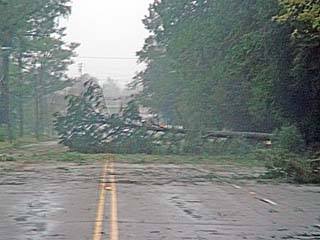
Trees begin falling and blocking roads after the wind shift in Wilmington during the mid morning of September 14 as hurricane Florence drifts southwest over the area.
Posted: Sep 17, 2018, 6:58 PM
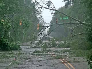
Parts of Highway 74 out of Wilmington blocked by downed trees during the mid morning of September 14.
Posted: Sep 17, 2018, 6:58 PM
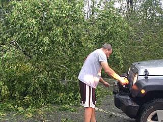
Myself using the winch to help clear trees blocking Highway 74 out of Wilmington on September 14. We are trying to get out before flooding traps us. A group of folks had chain saws and I am helping them. Picture taken by meteorologist Derek Sibley.
Posted: Sep 17, 2018, 6:58 PM

View of Highway 74 with heavy rain, wind, and tree debris while headed northwest away from Wilmington during the late morning of September 14.
Posted: Sep 17, 2018, 6:58 PM
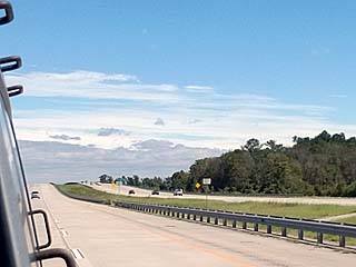
Heading south out of Hardeeville, South Carolina the following day during the morning of September 15, 2018. The view is looking back along I-95 at the edge (or margin) of now tropical storm Florence looming over the horizon.
Posted: Sep 17, 2018, 6:58 PM

From left to right is Dave Lewison, Tim Millar, and Scott Mcpartland at the Wilmington Holiday Inn and ready for the chase of Florence late on September 12.
Posted: Sep 17, 2018, 6:58 PM
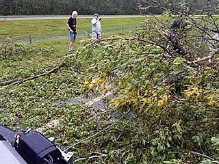
Another view of my vehicle and winch cable clearing downed trees from Highway 74 during the late morning of September 14. Picture taken by meteorologist Derek Sibley.
Posted: Sep 17, 2018, 6:58 PM
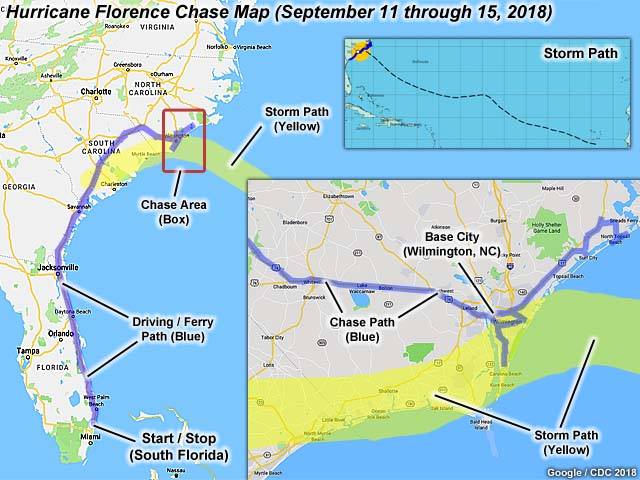
This is a chase map for hurricane Florence for September 11 to 15, 2015. The storm track (mainly the hurricane core and eye) is denoted by the yellow swath in the main map graphic as well as the inset in the lower right. Blue paths indicate chase and driving paths, including the "ferry" to and from tha main target area. The inset in the upper right shows the NHC (National Hurricane Center) storm track of Florence across the Atlantic basin over a period of nearly 2 weeks.
Posted: Sep 17, 2018, 6:58 PM
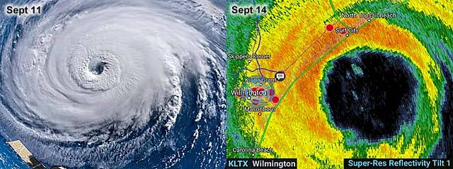
These are two images showing hurricane Florence. To the left is an absolutely incredible image taken by NASA aboard the International Space Station (ISS) as it passed over the storm on September 11. To the right is the base reflectivity of the inner eyewall as it was just about to make landfall near Wrightsville Beach / Wilmington early on September 14.
Posted: Sep 17, 2018, 6:58 PM
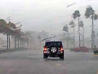
Picture of my chase vehicle in the storm at Dania Beach. Picture taken by Derek Sibley on September 3.
Posted: Sep 17, 2018, 7:14 PM

Meeting up with Derek Sibley and his mother in Dania Beach, Florda during the morning of September 3.
Posted: Sep 17, 2018, 7:14 PM
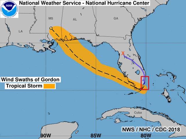
This is a chase map for tropical storm Gordon, mainly for September 3, 2018. The storm path (based on the National Hurricane Center) is shown originating to the southeast of southern Florida through the landfall point near and just west of the Alabama / Mississippi border on the northern Gulf coast. The box indicates the area where most of the observtions were done. The blue line is the chase path (terminating with a red "X" near Ocala as I opted out of continuing towards a second intercept in the northern Gulf coast, and turned around on September 4.
Posted: Sep 17, 2018, 7:14 PM
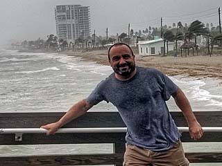
Myself standing in strong winds and rain at the Dania Beach fishing pier. September 3.
Posted: Sep 17, 2018, 7:14 PM
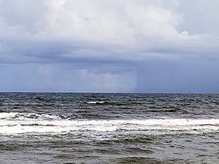
Rather fair weather precedes the development of tropical storm Gordon on the southeast coast of South Florida on September 2, 2018.
Posted: Sep 17, 2018, 7:14 PM
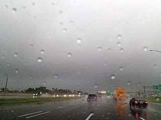
Heavy rains during the early morning of September 3, 2018 as feeder bands (rain squalls with tropical storm forced winds) move into South Florda. This is looking southward on I-95 near Fort Lauderdale.
Posted: Sep 17, 2018, 7:14 PM

Heavy surf looking southwward along the beach from Dania fishing pier. September 3.
Posted: Sep 17, 2018, 7:14 PM
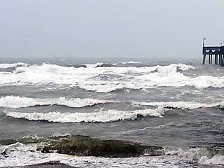
View of large waves breaking on the north side of the Dania fishing pier. September 3.
Posted: Sep 17, 2018, 7:14 PM
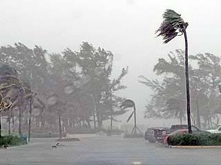
Strong winds gusting 40 to 50 MPH affecting Dania Beach, Florida on September 3.
Posted: Sep 17, 2018, 7:14 PM
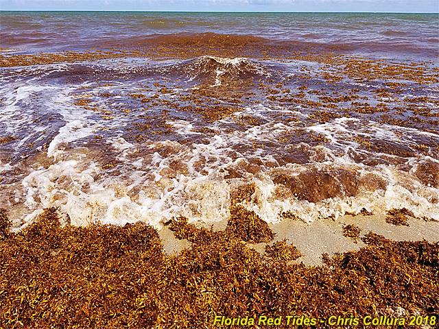
Red tide issues now working their way around to the South Florida coasts due to winds and currents. Extreme blooms of algae - Including seaweed (sargassum) - Grow excessively, killing fish and covering beaches in rotting mats. Would you swim or surf in this?
Posted: Oct 4, 2018, 6:54 AM

View of Florida's state capitol building while departing Tallahassee early before dawn on October 10, 2018. My trip began with leaving south Florida on the 9th and heading up to the Florida Panhandle, spending the first night in Tallahassee. In this picture, I'm leaving and heading west to the primary target near Panama City, FL - Which is close to the landfall point.
Posted: Oct 15, 2018, 4:52 PM
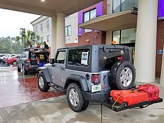
My vehicle and a few others east of Panama City at the Holiday Inn Express east of Panama City (in Calloway, FL) during the morning of October 10. Meteorologist Tim Millar's vehicle is in front of mine (the Jeep Wrangler). Turns out this area is close to "ground zero" as the storm comes in later and much of this area will experience total devastation.
Posted: Oct 15, 2018, 4:52 PM
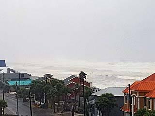
View of Panama City Beach from a parking structure showing the tremendous hurricane surf in the Gulf of Mexico. The storm eye will actually pass east of this area, putting it under the left / western eyewall.
Posted: Oct 15, 2018, 4:52 PM
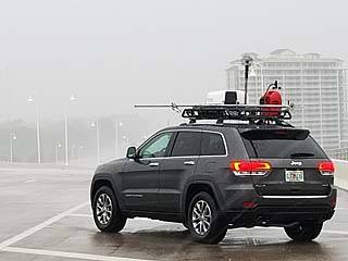
Meteorologist Tim Millar's chase vehicle on the Highway 98 causeway between Panama City and Panama City Beach. We are checking out that area for possible chase options / parking garages. Tim is calibrating the roof-top radar in this picture.
Posted: Oct 15, 2018, 4:52 PM

Large waves and surge along the beach in Panama City Beach before heading back east.
Posted: Oct 15, 2018, 4:52 PM
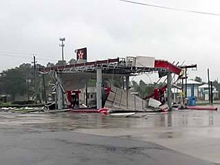
Texaco gas station suffering damage as the first hurricane forced wind gusts affect Long Point (near Calloway and Springfield, FL) while re-positioning back east of Panama City.
Posted: Oct 15, 2018, 4:52 PM
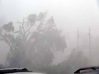
First eyewall winds, now well above hurricane forced and gusting over 100 MPH, downing trees on the southeast side of the Holiday Inn Express in Calloway, FL off Highways 98 and 22.
Posted: Oct 15, 2018, 4:52 PM
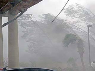
Eyewall winds increase and approach gusts over 130 MPH, flattening trees and starting to damage the entrance roof to the Holiday Inn Express in Calloway.
Posted: Oct 15, 2018, 4:52 PM
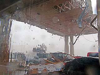
Holiday Inn Express front entrance roof beginning to catastrophically fail. Winds approaching 150 MPH gusts around noon on October 10.
Posted: Oct 15, 2018, 4:52 PM
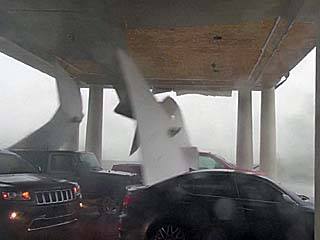
Ceiling panels falling off and being blown away from the entrance roof to the Holiday Inn Express.
Posted: Oct 15, 2018, 4:52 PM
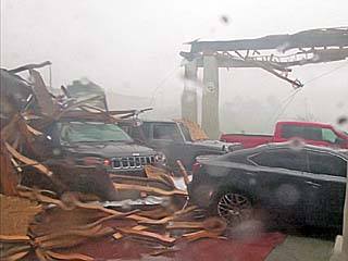
Holiday Inn Express front entrance roof is practically gone in inner eyewall winds - Gusting 150 to 175 MPH. Cars - Including our chase vehicles are buried in the rubble.
Posted: Oct 15, 2018, 4:52 PM
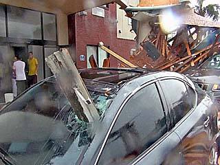
View of damage vehicles as we near entrance to the calm eye of hurricane Michael during the afternoon of October 10. Note the vehicle impaled through the driver's side windshield with heavy lumber!
Posted: Oct 15, 2018, 4:52 PM

We entered the western sections of the calm eye - With light winds and partly cloudy skies at our location. Looking up in this picture, the 60,000 foot eyewall edge stretches across the upper right with the bright sun overhead and blues skies! The calm lasted roughly 10 to 15 minutes.
Posted: Oct 15, 2018, 4:52 PM
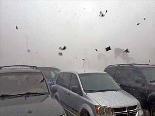
The second half of the eyewall of Michael strikes with a vengeance - With 150 MPH winds from the opposite direction after passage of the eye. Here the winds are out of the northwest (opposed to ENE and NE before the eye) as the backside of the hurricane passes, with zero visibility and flying debris once again.
Posted: Oct 15, 2018, 4:52 PM
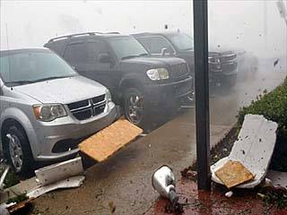
Debris flying by and strong winds gusting near 150 MPH on the backside of hurricane Michael under the eyewall.
Posted: Oct 15, 2018, 4:52 PM
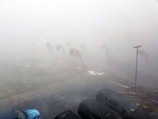
View out of broken window looking southwest across the entrance to the Holiday Inn Express and Highway 22 as the eyewall of hurricane Michael continues to rake the area.
Posted: Oct 15, 2018, 4:52 PM

Same view as the picture above, once out of the zero-visibility eyewall and visibility improves - Revealing utter destruction of most structures.
Posted: Oct 15, 2018, 4:52 PM
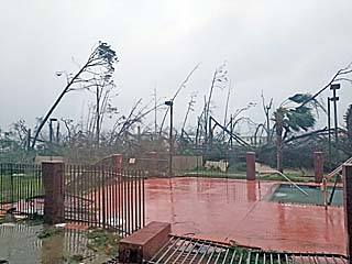
View looking northeast near the pool area of the Holiday Inn Express with most trees destroyed and the ones remaining stripped of leaves and branches.
Posted: Oct 15, 2018, 4:52 PM
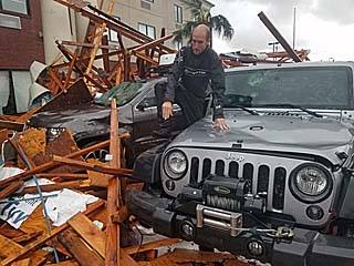
Tim Millar climbing over his vehicle - Buried in rubble, and next to my vehicle after the winds die down below hurricane forced.
Posted: Oct 15, 2018, 4:52 PM

One of many destroyed residences and stripped trees near Calloway, FL late on October 10.
Posted: Oct 15, 2018, 4:52 PM
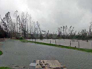
Fresh water flash flooding on the north side of the Calloway Holiday Inn Express.
Posted: Oct 15, 2018, 4:52 PM
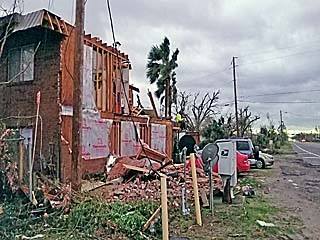
One of many devastated apartments across the street (Highway 22) from the hotel before sunset on October 10. This was a gruesome and sad sight. Many people here are in shock, dazed and confused on what happened to their city just hours prior.
Posted: Oct 15, 2018, 4:52 PM
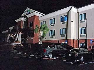
View of our hotel, the Holiday Inn Express, along Highway 22 in near total darkness (our spotlights illuminating the damaged front entrance) just before midnight on October 10. I spent about an hour speaking to some locals under the Milky Way of stars, watching a rescue helicopter piercing the darkness from time to time.
Posted: Oct 15, 2018, 4:52 PM

Breakfast in the south parking lot the following morning of October 11, 2018. Derek Sibley, Tim Millar, and myself are enjoying hot coffee and breakfast using our portable stoves and provisions. In a disaster like this - You need to bring stuff WITH YOU.
Posted: Oct 15, 2018, 4:52 PM

More severe street flooding and stripped trees to the north of Calloway, Florida while leaving on October 11.
Posted: Oct 15, 2018, 4:52 PM
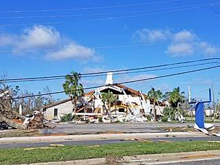
Destroyed church north of Calloway, Florida near Highway 98.
Posted: Oct 15, 2018, 4:52 PM

Traffic heading eastbound on I-10 was at a standstill due to debris and trees blocking the road west of Marianna, Florida. Chaser Tim Millar is to the right.
Posted: Oct 15, 2018, 4:52 PM
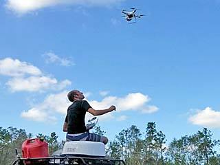
Tim Millar flying his drone over the traffic jam to get footage and / or see whats going on up ahead. Eventually we moved and made it back to south Florida by around midnight / early morning on October 12.
Posted: Oct 15, 2018, 4:52 PM

My immediate storm chasing group for the storm, among others. From left to right: Meteorologist Tim Millar, myself, Josh Morgerman (iCyclone), and Meteorologist Derek Sibley.
Posted: Oct 15, 2018, 4:52 PM
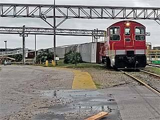
Derailed / flipped cars on a train at the paper mill southwest of Calloway late on October 10. Every box car behind the prime mover (locomotive) is tipped over from right to left.
Posted: Oct 15, 2018, 4:52 PM

These are two images showing hurricane Michael. The left image shows a close up of the storm eye offshore on the 15:20z visible satellite image (around 10:20 AM CDT). The eyewall of the storm core, with cumulonimbus clouds 10-12 miles high, surrounds a visually clear and calm eye, and presents an appearance of a sports "stadium" or large "teacup" due to the late morning sun angle. The small "X" in the left image shows our general location where myself and my chase group was with (near Calloway, FL, which is east of Panama City). The right image is the base reflectivity NWS radar image at around 1 PM to 1:30 CDT out of Elgin Air Force Base. The clear eye of the storm has made landfall and is moving to the NNE. Around the eye is the red region indicating violent (wind swept and horizontal) rain. The red dots are storm chasers / Spotter Network positions. My location is the blow cross-hairs, and I am just inside the northwestern portion of the calm eye. My group and I measured barometric pressures as low as 923 mb inside that portion of the eye. The "light radar returns" inside the eye are not clouds, but most likely birds caught up in it.
Posted: Oct 15, 2018, 4:52 PM
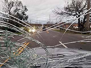
View of Highway 22 through my shattered windshield while taking a local to check on damage at her factory (a paper mill) a few miles up the road.
Posted: Oct 15, 2018, 4:52 PM
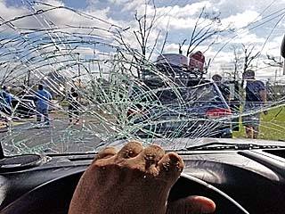
Leaving Calloway early on October 11, after the curfew was lifted at 8 AM (anyone caught on the streets during the night would be arrested). Driving was difficult with my windshield shattered and many roads blocked with debris.
Posted: Oct 15, 2018, 4:52 PM

Mobile home tossed upside-down and destroyed among other destroyed structures and stripped vegetation north of Calloway, Florida.
Posted: Oct 15, 2018, 4:52 PM
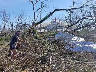
Tree debris and damage blocking the roadway near Youngestown, Florida along Highway 231. This stopped our northeastward progression - Causing us to back-track west to near Highway 77. Note the completely stripped and defoliated trees (looking like trees in winter up north).
Posted: Oct 15, 2018, 4:52 PM
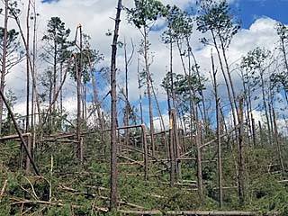
Numerous trees snapped and stripped well inland to west of Tallahassee near Marianna, Florida and along Interstate 10. Damage extended far inland northeast of the landfall point, causing I-10 to be blocked and / or closed for many hours.
Posted: Oct 15, 2018, 4:52 PM
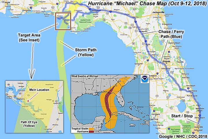
This is a chase map for hurricane Michael for October 9 to 11, 2018. The storm track is denoted by the yellow swath in the main map graphic (mainly the hurricane core and eye) as well as the inset (path of eye) in the lower left. Blue paths indicate chase and driving paths, including the "ferry" to and from the main target area (the square in the main graphic in the Florida Panhandle). The main location where the storm core and eye passage was observed is denoted by the small "X" in the lower left target insert. In the lower center inset, the National Hurricane Center storm wind swaths and path is shown in a composite image. The orange and red areas denote the path of tropical storm and hurricane forced winds, respectively, stretching from the NW Caribbean off Central America to the US Carolinas. Northeast of the Carolinas, the path of Michael abruptly ends because the storm became extratropical on October 12.
Posted: Oct 15, 2018, 4:52 PM

This image s a visible satellite image of hurricane Michael approaching the Florida Panhandle at about 10:20 AM CDT (15:20z). The storm is still rapidly intensifying with winds approaching 150 MPH at the time. The "stadium" effect makes the clear eye reminiscent as a "cup" due to the morning sun angle. Note the symmetry of the store core region (eyewall) and nearly perfect upper-level anticyclonic outflow in all quadrants.
Posted: Oct 15, 2018, 4:52 PM
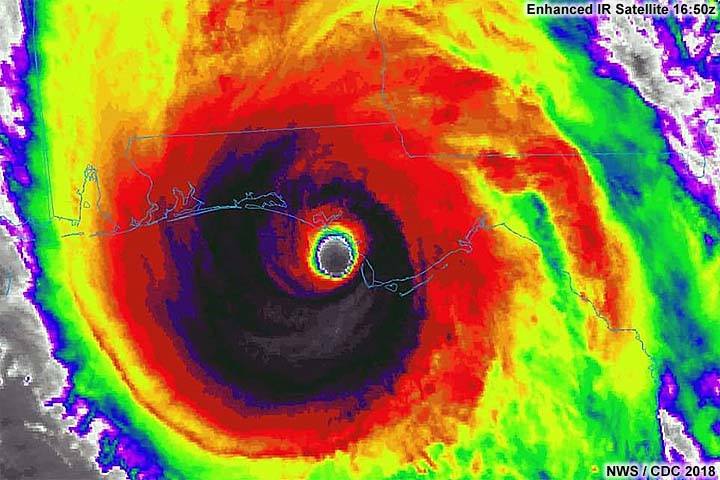
This image is an enhanced infrared satellite image of hurricane Michael just about to make landfall in the Florida Panhandle just before noon central time (16:50z). The cloud tops are extremely cold, meaning they are tall and reach extreme altitudes (around 60,000 feet), where the temperatures are -80 C (well below -100 deg F) or lower. The clear eye can be seen just off Mexico Beach / Panama City at the time, which is nearly devoid of any clouds. At this point the storm was max'd out, with 155 MPH sustained winds (approaching category 5 strength) and a central pressure of 919 mb!
Posted: Oct 15, 2018, 4:52 PM
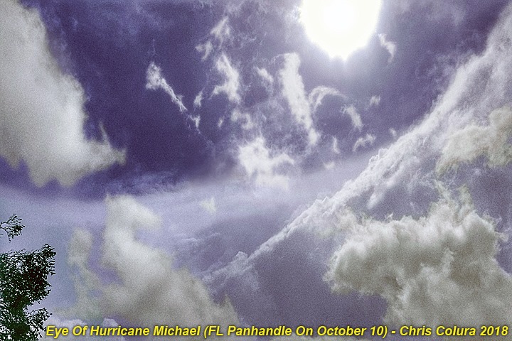
Better view (from different camera and touched up) of the NW side of the calm eye of Hurricane Michael during the early afternoon of October 10, 2018 east of Panama City near Callaway, Florida. The view is to the SSW with the low clouds seen sinking and evaporating with bright sun overhead and the eyewall "stadium" effect. Temperatures inside the "wam core" eye were hot and sunny (around 90 deg F)!
Posted: Oct 17, 2018, 10:26 AM
Generated by Chris Collura on Wednesday, April 15, 2020 at 11:31 AM UTC-07:00
HTML File "index35.htm" (Facebook) - Developed By Chris Collura
To Return To The HOME Page Of This Site Click The "INDEX.HTM" Link Here!


