
Facebook Photo Album Storm Chasing 2014
(Storm Chasing 2014 Sky-Chaser Chris Collura Facebook Posts)
[ PARENT INDEX ]
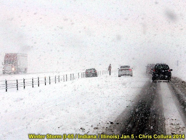
I-65 near Lafayette, IN on Jan 5, 2014. I-65 was shut down after noon on Jan 5. Many stranded motorists in heavy snow.
Posted: Jan 6, 2014, 4:23 PM
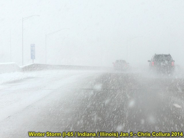
I-65 northbound out of Indianapolis on Jan 5, 2014. Nearly whiteout.
Posted: Jan 6, 2014, 4:24 PM
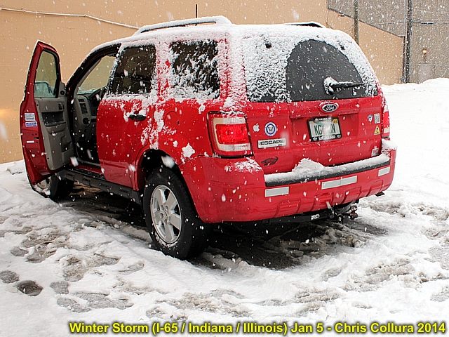
My vehicle's first taste of true snowfall during the morning in Indianapolis on Jan 5.
Posted: Jan 6, 2014, 4:24 PM

Looking out into a field near Lafayette, IN on Jan 5, 2014. Where's the "sky"?
Posted: Jan 6, 2014, 4:24 PM

During the morning of January 6 to the NW of Chicago on January 6, 2014 ... Clouds form at low altitude resembling cirrus clouds with a sundog. Temperatures from -15 to -20 below zero ... Cold!
Posted: Jan 6, 2014, 4:24 PM
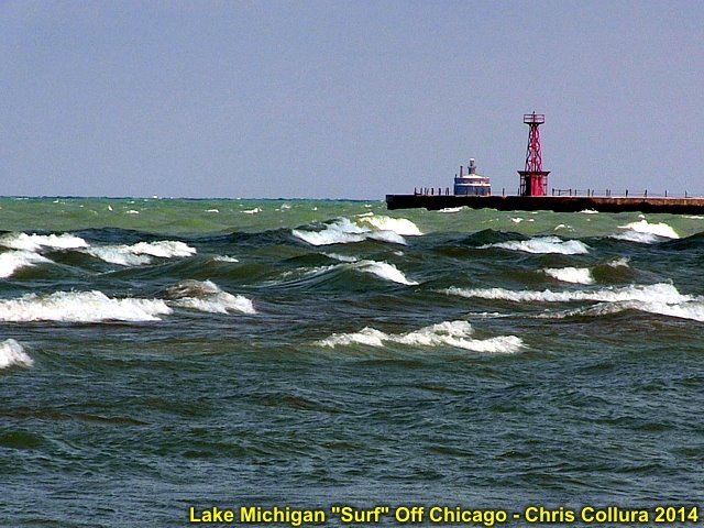
Choppy 3-5 foot waves off Chicago's north side in Lake Michigan (late March 2014).
Posted: Mar 30, 2014, 12:27 PM
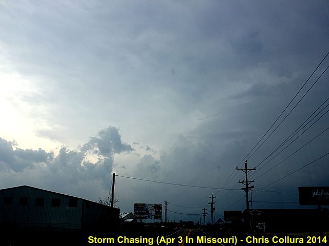
View of severe (tornado warned) HP supercell storm near Osage Beach, Missouri on April 3, 2014.
Posted: Apr 5, 2014, 9:56 AM
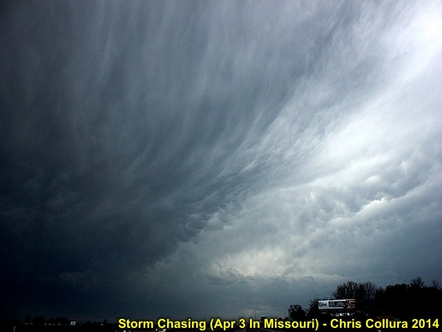
Interesting cloud formations and mammatus associated with severe thunderstorms near St Louis, MO on April 3, 2014.
Posted: Apr 5, 2014, 9:56 AM
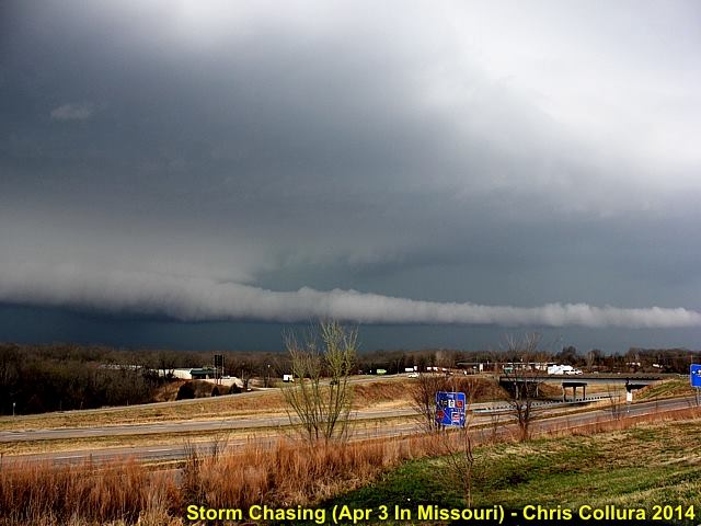
Long beavers tail into wall cloud on tornado warned HP supercell storm near Osage Beach, Missouri on April 3, 2014.
Posted: Apr 5, 2014, 9:56 AM
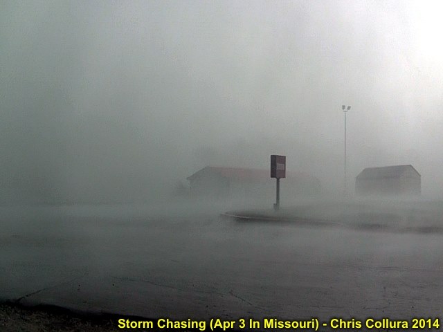
Torrential rains and winds gusting near 70 MPH in the core of an HP supercell storm near Osage Beach, Missouri on April 3, 2014.
Posted: Apr 5, 2014, 9:56 AM
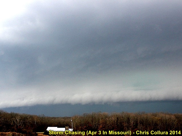
Gust front (shelf cloud) on tornado warned HP supercell storm as it becomes outflow dominant near Osage Beach, Missouri on April 3, 2014.
Posted: Apr 5, 2014, 9:56 AM
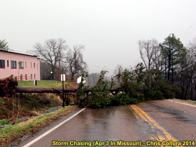
Tree down along Highway 52 after the passage of an HP supercell storm near Osage Beach, Missouri on April 3, 2014.
Posted: Apr 5, 2014, 9:56 AM
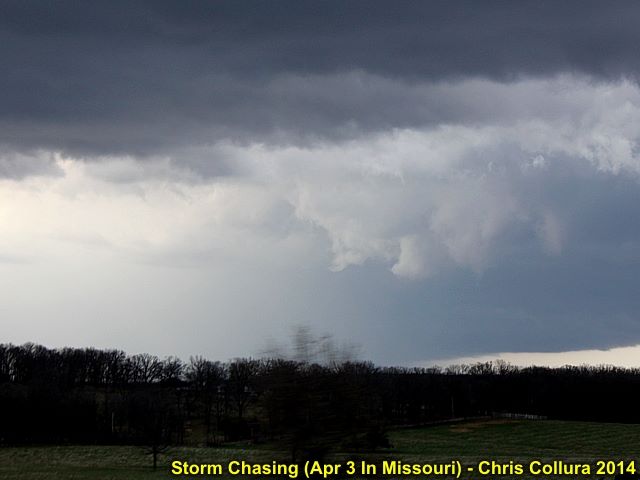
RFD clear area and wall cloud / funnel in SE Osage County, Missouri later in the day on April 3, 2014.
Posted: Apr 5, 2014, 9:57 AM
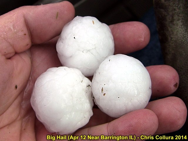
Golfball sized hail falls from a "tail-end' supercell storm near Barrington, IL (April 12, 2014) in the NW Chicago suburbs.
Posted: Apr 12, 2014, 10:15 AM
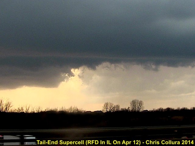
Updraft region (note RFD) of supercell storm (tail end of line) crossing north of I-90 in the NW Chicago suburbs on April 12, 2014.
Posted: Apr 12, 2014, 10:26 AM
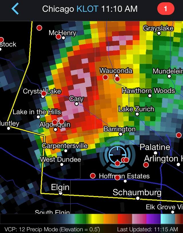
Chicago radar image of tail-end storm on April 12, 2014.
Posted: Apr 12, 2014, 10:27 AM

Elevated supercell (just north of stationary front) near Waverly, IA on April 12, 2014. Intense hail core is just right of the road.
Posted: Apr 13, 2014, 7:23 AM

Here is a picture of myself in the chase vehicle (my 2009 Ford Escape) headed west on Highway 3 towards a storm near Waverly, IA on Apr 12.
Posted: Apr 13, 2014, 7:23 AM
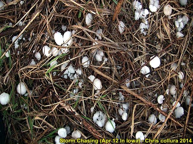
Golfball sized hail laying in the grass behind the supercell in IA near Waverly N of Highway 3 on Apr 12.
Posted: Apr 13, 2014, 7:23 AM

View of hail core (left) and updraft (right) and developing RFD (center) assicaiated with the supercell storm NE of Waverly, Iowa on April 12, 2014.
Posted: Apr 13, 2014, 7:23 AM
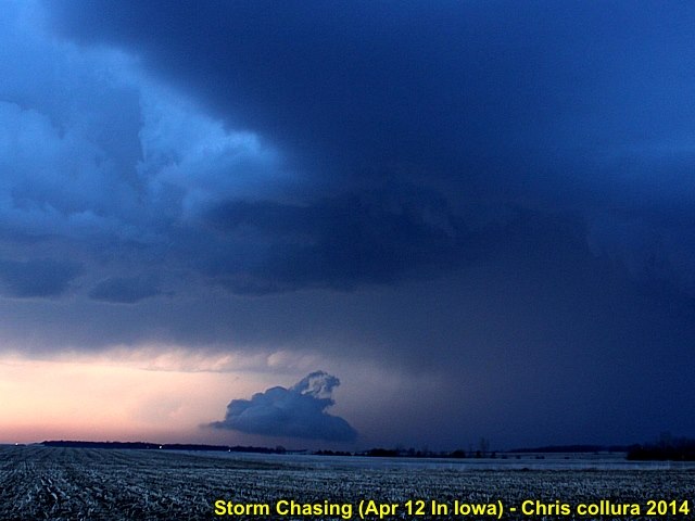
Interesting 'scud bomb' under the mesocyclone north of Highway 3 and east of Waverly, IA on April 12.
Posted: Apr 13, 2014, 7:23 AM

Snowfall on April 14, 2014 in NW Chicago suburbs.
Posted: Apr 14, 2014, 4:29 PM
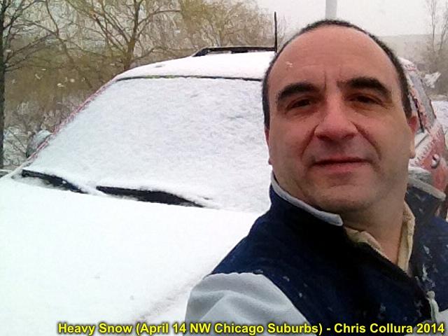
Snowfall on April 14, 2014 in NW Chicago suburbs with myself in front of my car. A day earlier I was in shorts and a T-Shirt.
Posted: Apr 14, 2014, 4:29 PM

Prominant dryline slicing across Dodge City, KS during the afternoon (capped) of April 26, 2014. Radar is clear-air mode reflectivity.
Posted: Apr 26, 2014, 3:13 PM
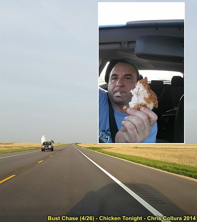
Having chicken (from Greensburg gas station Dillons market) in Kansas after cap-busting hard in OK with a slight sunburn on April 26, 2014.
Posted: Apr 27, 2014, 6:10 AM
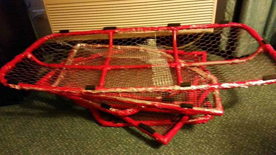
Paint drying on the hail grills. Should look better on my red escape!
Posted: May 7, 2014, 5:35 PM
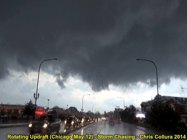
Rain free base / mesocyclone associated with a severe thunderstorm in Cook County (near Chicago), IL on May 12, 2014.
Posted: May 12, 2014, 7:33 PM
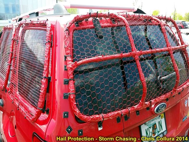
Hail "grills" being sized on the windows of my Ford Escape, preparing for the upcoming chase towards the middle to end of May 2014.
Posted: May 12, 2014, 7:33 PM
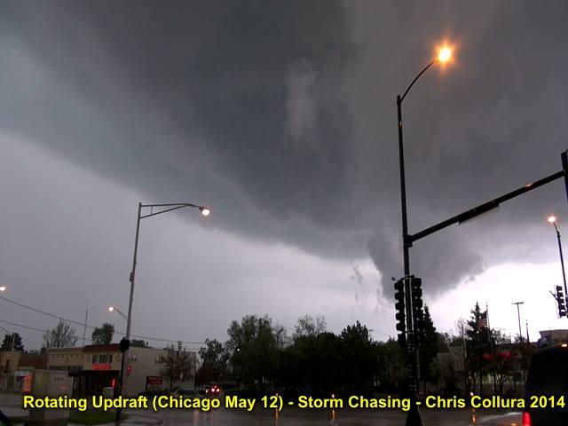
Another view of the mesocyclone and wall cloud on the southern side of a severe (supercell) storm over Cook County, IL on May 12 (Chicago area).
Posted: May 12, 2014, 7:44 PM

Supercell at sunset - Central Iowa - May 8, 2014.
Posted: May 14, 2014, 4:51 PM

Severe storm - Central Iowa - May 8, 2014.
Posted: May 14, 2014, 4:51 PM

RFD clear slot - Central Iowa - May 8, 2014.
Posted: May 14, 2014, 4:51 PM
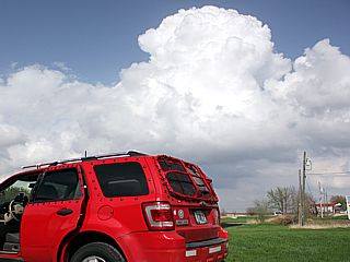
Initiation - Central Iowa - May 8, 2014.
Posted: May 14, 2014, 4:51 PM
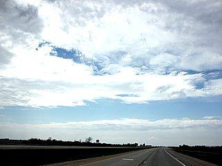
Shortwave axis - Central Iowa - May 8, 2014.
Posted: May 14, 2014, 4:51 PM
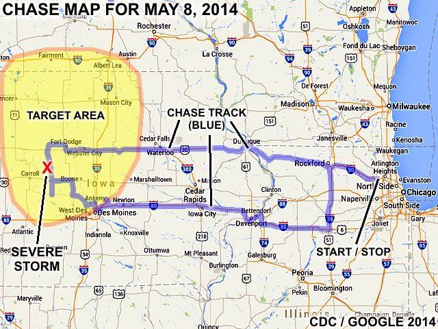
May 8 chase map (2014).
Posted: May 14, 2014, 4:51 PM

April 12 chase map (2014).
Posted: May 14, 2014, 4:51 PM
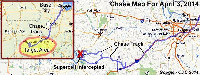
April 3 chase map (2014).
Posted: May 14, 2014, 4:51 PM
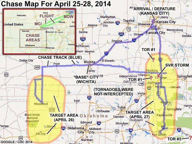
April 25-28 chase map (2014).
Posted: May 14, 2014, 4:51 PM

Developing supercell storm - Arkansas on April 27.
Posted: May 14, 2014, 4:54 PM
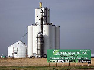
April 26 cap bust - Kansas.
Posted: May 14, 2014, 4:54 PM
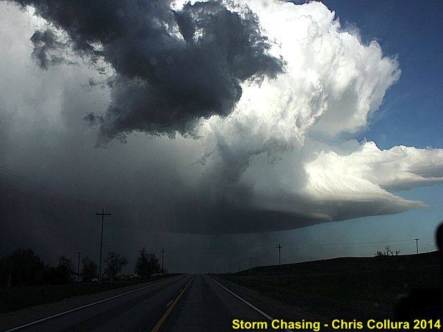
Powerful updraft viewed from storm backside - May 19, 2014 in Nebraska near Kimball.
Posted: May 19, 2014, 10:47 PM
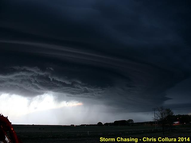
Striated shelf cloud and supercell storm near Chappell, NE at dusk on May 19, 2014.
Posted: May 19, 2014, 10:47 PM
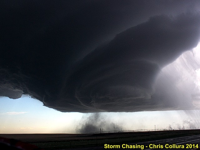
Very intense LP supercell picks up dust (almost a tornado) in Banner County, Nebraska - May 19, 2014.
Posted: May 19, 2014, 10:47 PM

Banner County (Highway 71) in Nebraska ... Beautiful LP supercell storm ... The mother ship hovers ... May 19, 2014.
Posted: May 19, 2014, 10:47 PM

View of convective complex of storms SE of denver, CO (from near Dalton, Nebraska) on May 20, 2014. These storms are about 150 to 200 miles away - Thanks to the awesome high plains visibility!
Posted: May 20, 2014, 10:33 PM
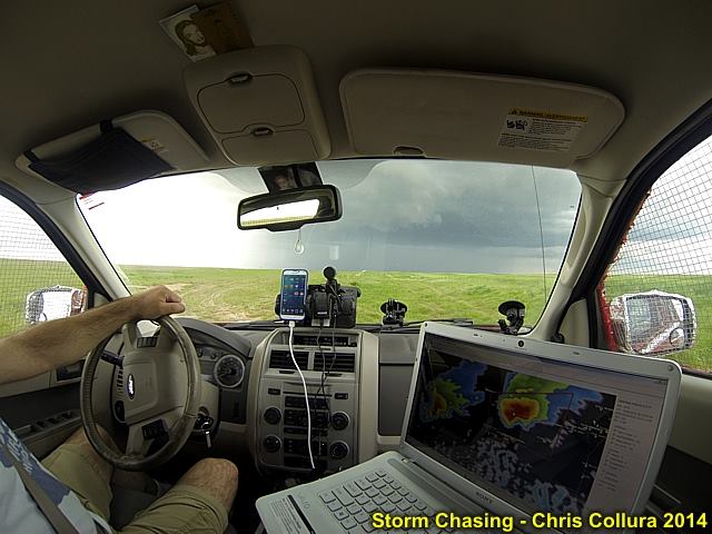
Here is my "office" during my chase trips!
Posted: May 20, 2014, 10:33 PM

Dalton, Nebraska ... Only 315 people live there. Nice quaint small town, blink and you'll miss it!
Posted: May 20, 2014, 10:33 PM
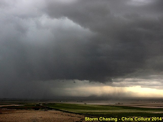
Powerful RFD and downdraft "hole" in the cloud base. This was SW of Haig, Nebraska. Note the dust plume. May 20, 2014.
Posted: May 20, 2014, 10:33 PM
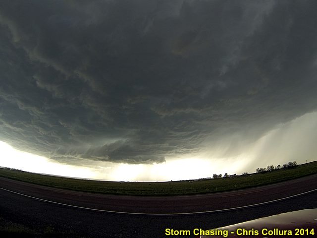
Wall cloud and supercell updraft base near Hawk Springs, Wyoming on May 20, 2014.
Posted: May 20, 2014, 10:33 PM

This was rotating hard, until the wet RFD got too strong and sheared it apart. Lookign west from near Highway 158 NE of Hawk Springs, Wyoming on May 20.
Posted: May 20, 2014, 10:34 PM

Incredible velocity signature of the tornadic supercell storm near Denver International Airport on May 21, 2014!
Posted: May 21, 2014, 5:00 PM
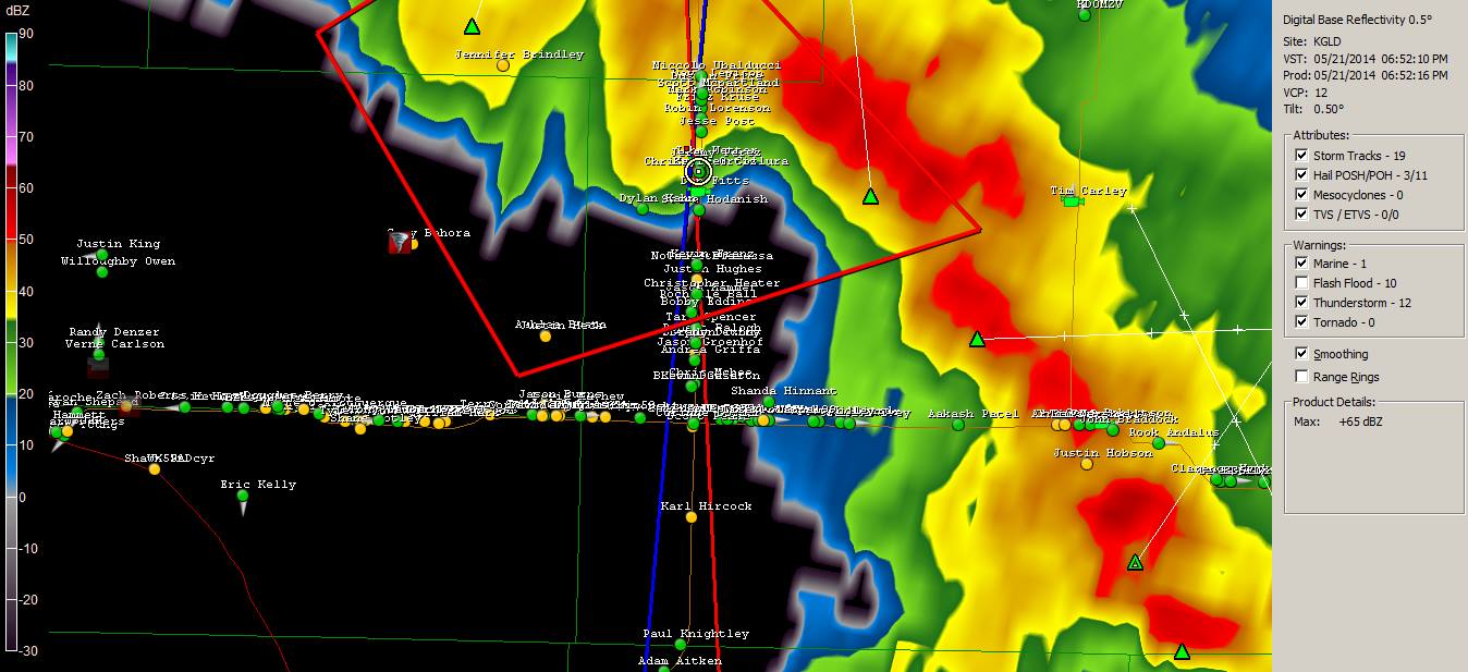
Now THAT'S a chaser convergence!
Posted: May 21, 2014, 5:00 PM

Incredible reflectivity signature (the "eagle" cannot scream any louder) of the supercell storm near Denver International Airport on May 21, 2014!
Posted: May 21, 2014, 5:00 PM
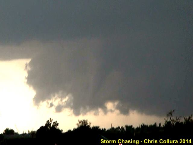
Funnel cloud / possible firsrt tornado from the supercell over Denver International Airport (reported near Towers road) on May 21, 2014.
Posted: May 21, 2014, 5:37 PM
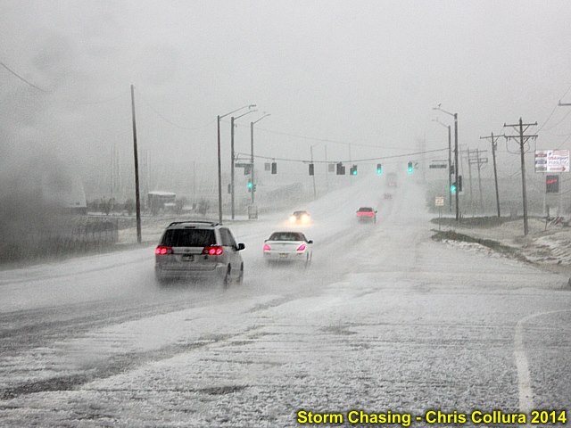
Hail fall covers ground with some stones up to 2 inches near Commerce City, Colorado just west of Denver International Airport. May 21, 2014.
Posted: May 21, 2014, 5:37 PM
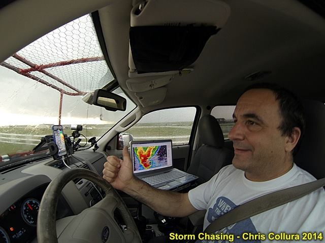
Heading east out of Brighton with an incredible radar presentation of the storm on my screen! May 21, 2014.
Posted: May 21, 2014, 5:37 PM
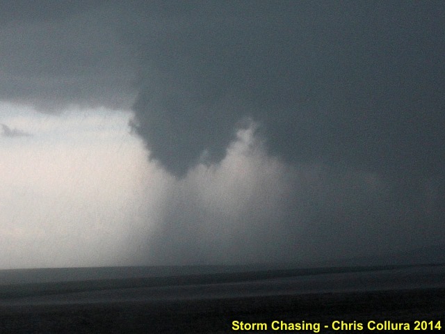
Another rotating funnel / tornado looking south towards the HP notch of the storm. May 21, 2014 east of Denver International Airport.
Posted: May 21, 2014, 5:37 PM
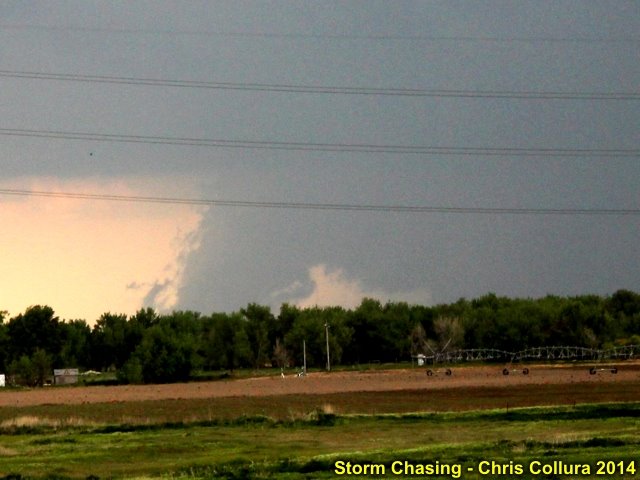
This was a rotating wall cloud, probably not a tornado ... This was the same feature posted by some people at Denver International Airport. May 21, 2014.
Posted: May 21, 2014, 5:37 PM
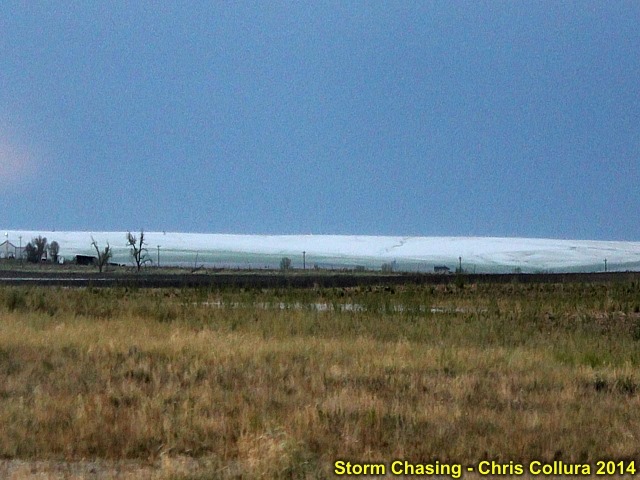
From Highway 36 near Byers, Colorado ... The hail "swath" is pretty ominous 2-3 hours after an HP supercell dumped nearly a half foot of hail on the landscape! May 21, 2014.
Posted: May 21, 2014, 9:13 PM
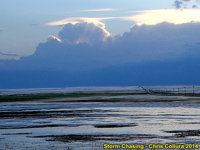
The melting hail and passage of a tornadic HP supercell leaves its mark on the landscape. This caused a massive hail fall and flash flooding north of Byers, Colorado on May 21, 2014.
Posted: May 21, 2014, 9:13 PM

An LP supercell storm develops right over downtown Denver (the skyline is to the lower right) with the best structure of the day. May 22, 2014.
Posted: May 23, 2014, 12:18 AM
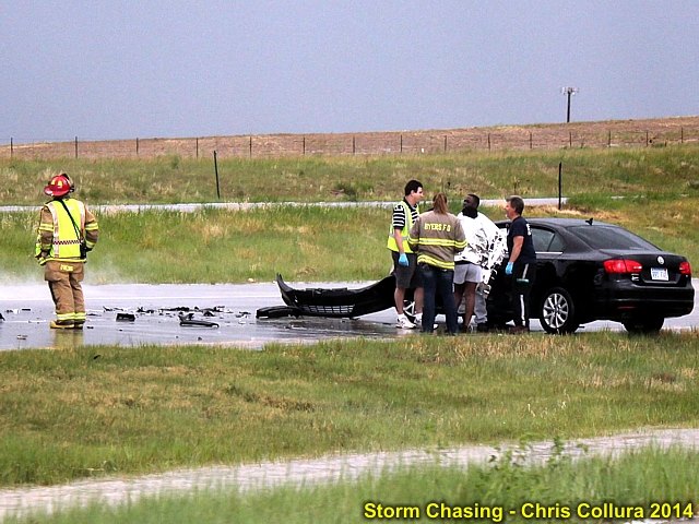
An accident ocurred on I-70 just east of Bennett, Colorado due to hydroplaning on rain and hail soaked roads. Dan Shaw is to the left of th group of people helping out. May 22, 2014.
Posted: May 23, 2014, 12:18 AM

Some flash floowing between Strasburg and Bennett Colorado. May 22, 2014.
Posted: May 23, 2014, 12:18 AM
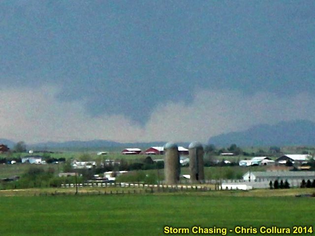
Not sure what this "feature" was looking far to the southwest at some storm cells developing south of Denver and east of the front range. May 22, 2014.
Posted: May 23, 2014, 12:18 AM
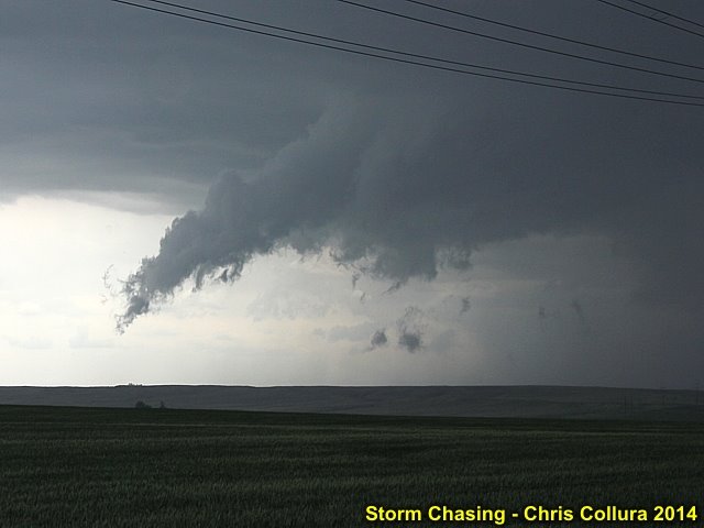
This is NOT a tornado, but rising scud along a gust front ahead of a supercell storm embedded in a cluster of severe storms SW of Byers, Colorado. May 22, 2014.
Posted: May 23, 2014, 12:18 AM

This is apalling...
Posted: May 23, 2014, 7:10 AM

Funny seeing this on a theme park ad near Des Moines, Iowa. May work during the next death ridge...
Posted: May 24, 2014, 11:41 AM

Myself chasing storms in central Nebraska on June 3, 2014 in moderate / high risk.
Posted: Jun 4, 2014, 5:03 PM
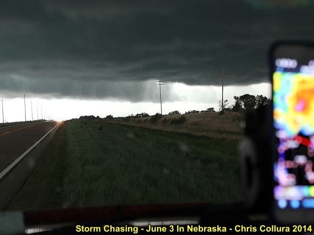
Intense RFD in supercell storm northwest of Ord, Nebraska before becoming undercut by outflow - June 3, 2014.
Posted: Jun 4, 2014, 5:03 PM
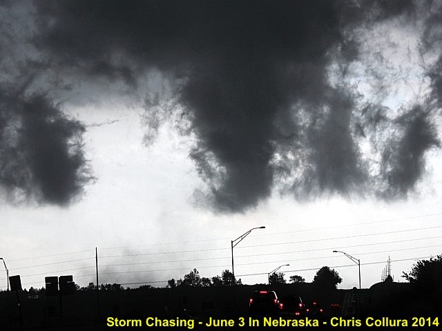
Interesting funnel and gustnado developing on the southern side of an outflow dominant supercell storm in Greely County, NE - June 3, 2014.
Posted: Jun 4, 2014, 5:03 PM
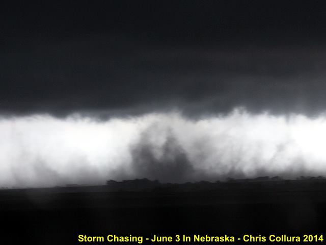
Another gustnado / weak tornado on the southern side of an outflow dominant HP supercell storm in Greely County, NE - June 3, 2014.
Posted: Jun 4, 2014, 5:03 PM
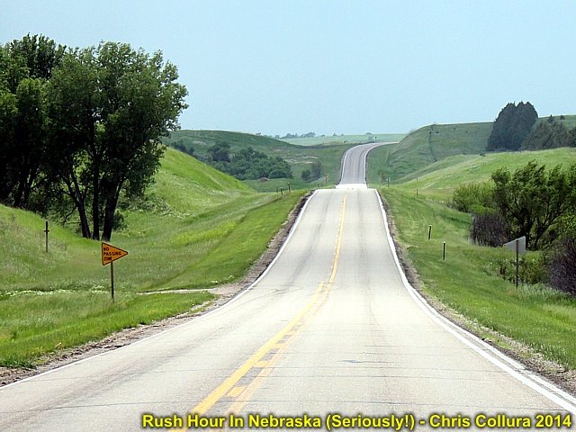
Think of THIS next time you are stuck in traffic! This is about 4:30 PM in rural Nebraska waiting for storms - June 3, 2014.
Posted: Jun 4, 2014, 5:03 PM
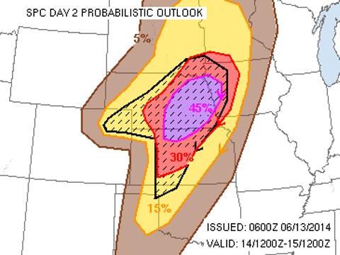
Hummm ... I guess I know where I'm going this Saturday (June 14)! Somewhere in the 45 percent - Duh!
Posted: Jun 13, 2014, 5:04 AM
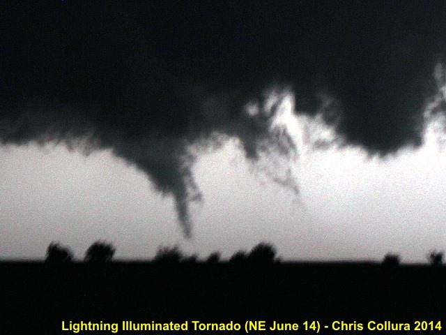
One of a few brief touchdowns north of Adams County, NE and west of Harvard, NE illuminated by continuous lightning (June 14 at roughly 10 PM CDT).
Posted: Jun 15, 2014, 8:52 AM
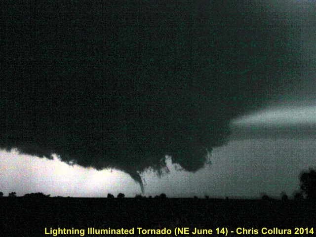
Wider view of one of a few brief touchdowns north of Adams County, NE and west of Harvard, NE illuminated by continuous lightning (June 14 at roughly 10 PM CDT).
Posted: Jun 15, 2014, 8:52 AM

Myself again in my "office" for the day storm chasing (June 14, 2014).
Posted: Jun 15, 2014, 8:52 AM
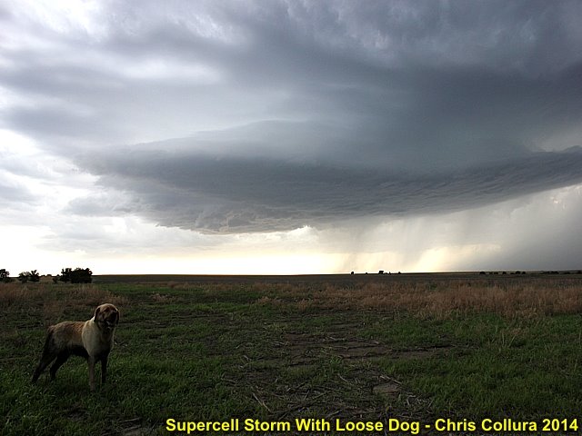
Who's dog is this? Anyway he stopped and said hello in front of a classic supercell storm northeast of Smith Center, Kansas - June 14, 2014.
Posted: Jun 15, 2014, 8:52 AM

Northeast of Smith Center, Kansas - June 14, 2014.
Posted: Jun 15, 2014, 8:52 AM
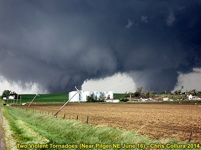
Two violent tornadoes near Pilger, Nebraska during the afternoon of June 16, 2014.
Posted: Jun 16, 2014, 4:24 PM
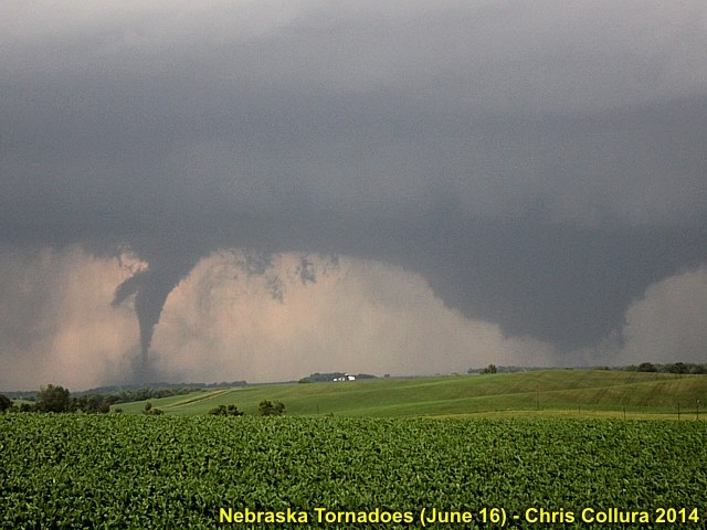
Cycles again ... This time 15 miles east of Pilger, NE. June 16, 2014 ... I wonder how much this day will be studied?
Posted: Jun 16, 2014, 4:47 PM

Two to redeem 2014's tornado less streak I guess! June 16, 2014 in Nebraska. I am sure Tim Samaras and his group would have loved this...
Posted: Jun 16, 2014, 4:47 PM
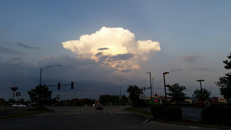
Isolated storm over chicago on June 17, 2014.
Posted: Jun 17, 2014, 6:19 PM

Isolated storm over chicago on June 17, 2014.
Posted: Jun 17, 2014, 6:22 PM

Post tornado intercept steak :)
Posted: Jun 17, 2014, 6:47 PM
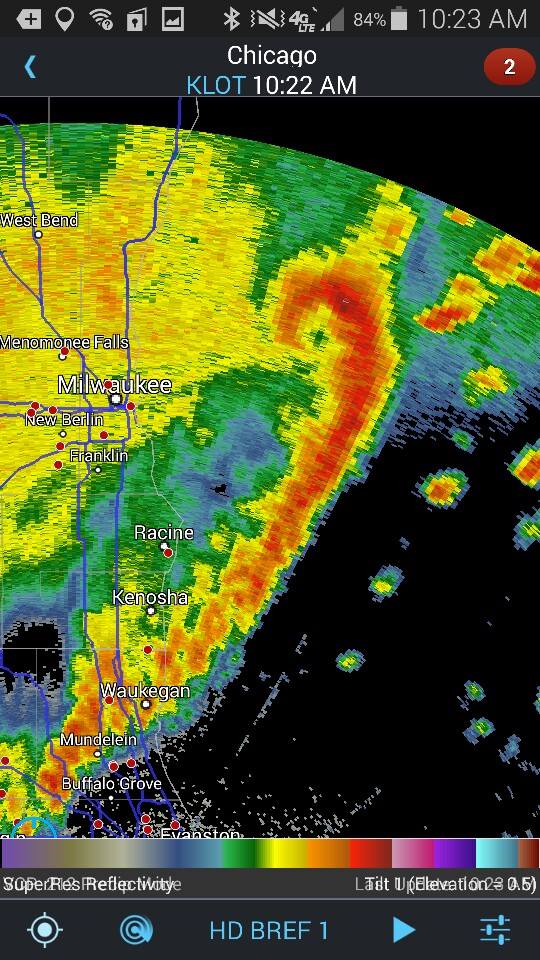
Interesting "rotating head" off Milwaukee with a squall line extending southwards out of it to the Chicago area on the morning of June 18, 2014.
Posted: Jun 18, 2014, 8:26 AM
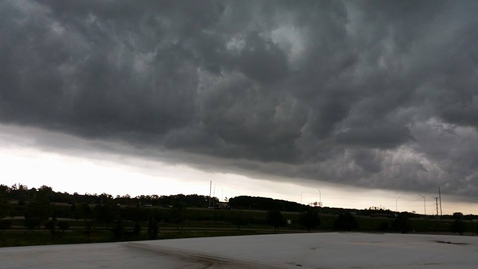
Shelf cloud "whales mouth" associated with a squall line west of the Chicago area on the morning of June 18, 2014.
Posted: Jun 18, 2014, 8:26 AM
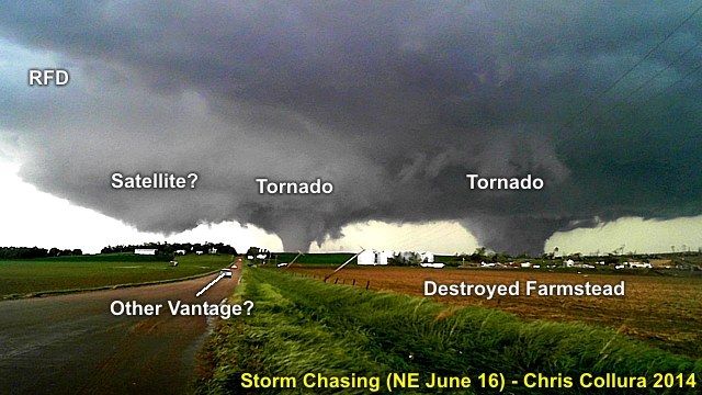
Annotated image of the view looking north from near Highway 275 north of Pilger, NE on June 16, 2014. Quite possibly 3 tornadoes, but I cannot confirm the ground "contact" on the leftmost "feature".
Posted: Jun 19, 2014, 4:06 PM

Stanton, Nebraska EF-4 wedge tornado close-up (June 16, 2014).
Posted: Jun 19, 2014, 4:10 PM
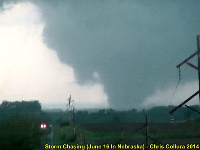
Stanton, Nebraska EF-4 tornado developing (June 16, 2014).
Posted: Jun 19, 2014, 4:10 PM
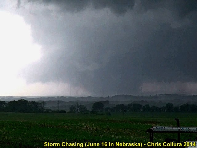
Stanton, Nebraska EF-4 wedge tornado wider shot.
Posted: Jun 19, 2014, 4:10 PM
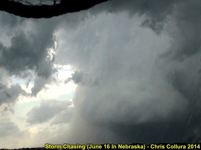
Powerful RFD behind Stanton, NE EF-4 tornado. June 16, 2014.
Posted: Jun 19, 2014, 4:10 PM

Stanton, Nebraska EF-4 tornado starting to occlude / become rain wrapped (June 16, 2014).
Posted: Jun 19, 2014, 4:10 PM

Stanton, NE tornado still barely visible with debris and hail wrap. At this time, new meso is producing tornado to east. June 16, 2014.
Posted: Jun 19, 2014, 4:10 PM
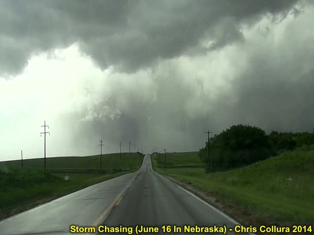
Another view of the Stanton, NE tornado later in it's life-cycle on June 16. Time is roughly 4:05 PM CDT.
Posted: Jun 19, 2014, 4:10 PM
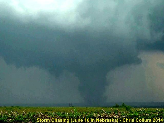
Pilger, NE tornado getting stronger at about 4:10 to 4:15 PM CDT on June 16.
Posted: Jun 19, 2014, 4:10 PM

Pilger, NE tornado rapidly forms to the east while Stanton, NE tornado is still in progress.
Posted: Jun 19, 2014, 4:10 PM
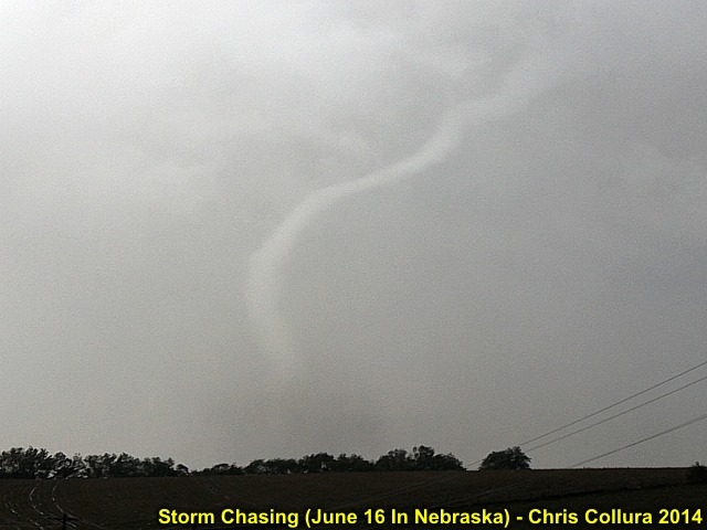
Stanton, NE tornado roping out on June 16.
Posted: Jun 19, 2014, 4:10 PM

Another view of the Stanton, NE tornado roping out from elephant trunk on June 16.
Posted: Jun 19, 2014, 4:10 PM
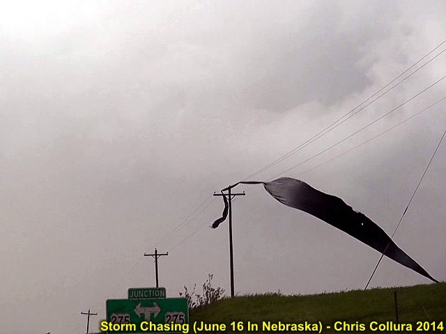
Debris in wires, Stanton, NE tornado has roped out completely (little needle funnel left in the center of the picture barely visible). June 16, 2014 at about 4:15 PM. Time to head east on Highway 275 towards Pilger, NE.
Posted: Jun 19, 2014, 4:11 PM

Pilger, NE tornado looking east on Highway 275 out of Stanton, NE on June 16 at about 4:15 PM CDT.
Posted: Jun 19, 2014, 4:11 PM
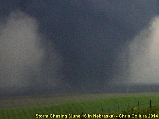
Pilger, NE is being hit here. The debris surrounds the tornado giving it an appearance like this. Roughly 4:20 PM CDT on June 16. This was at LEAST EF-4.
Posted: Jun 19, 2014, 4:11 PM
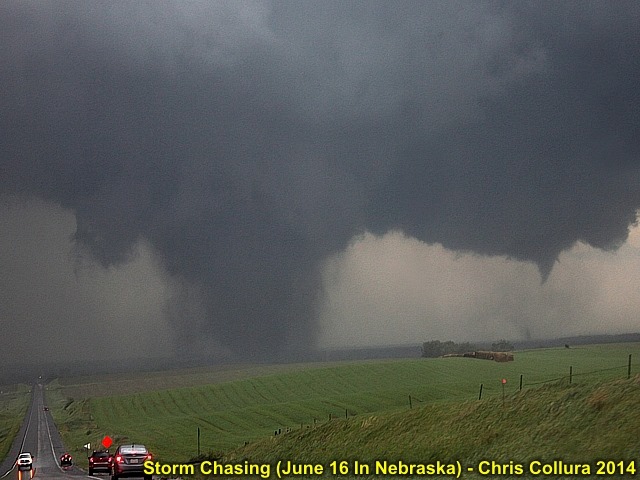
Pilger, NE tornado hitting town south of highway 275. Second tornado is starting to its south and southeast.
Posted: Jun 19, 2014, 4:11 PM

Now the "violent twins" begin as first tornado passes north of Pilger, NE. Folks with the tour groups got their "money's" worth on this trip! Roughy 4:25 on June 16, looking east on Highway 275.
Posted: Jun 19, 2014, 4:11 PM
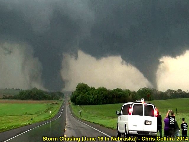
Another view of twin tornadoes near Pilger, NE as tour group watches in awe. BOTH rated EF-4 with one to the left possibly stronger. June 16, 2014.
Posted: Jun 19, 2014, 4:11 PM
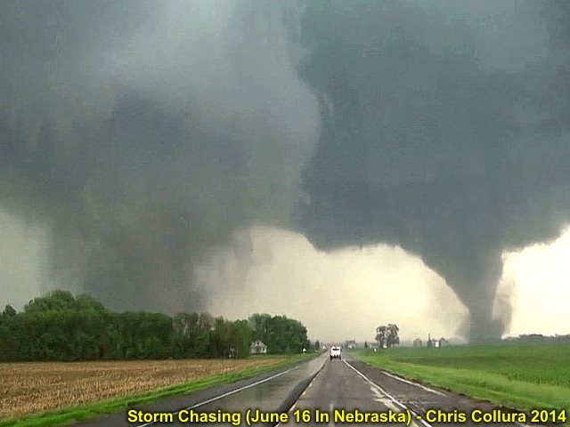
Debris filled left (remnants of Pilger, NE homes and such) with EF-4 "Pilger East" tornado south of 275. June 16, 2014.
Posted: Jun 19, 2014, 4:11 PM

Close-up shot of the "eastern" Pilger, NE tornado "twins". EF-4 damage and winds occurring with this one too. June 16, 2014 at about 4:30 PM CDT.
Posted: Jun 19, 2014, 4:11 PM
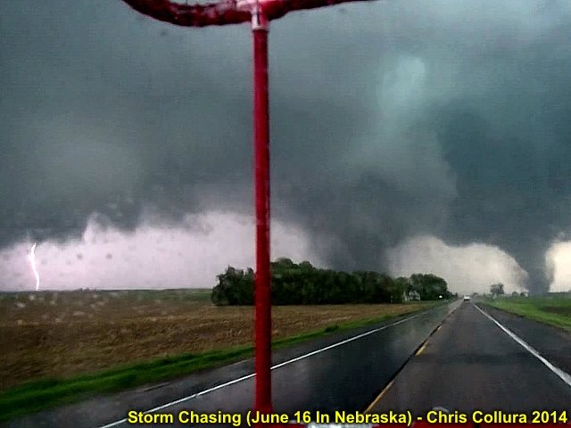
Lightning strike, left, and two "violent twins" north of Pilger, NE on June 16.
Posted: Jun 19, 2014, 4:11 PM
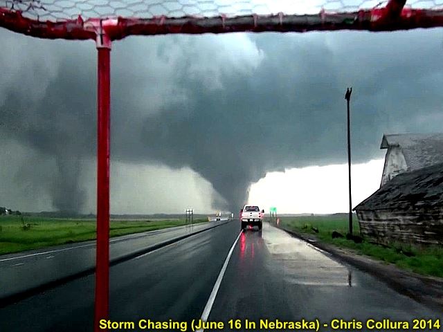
Second "Pilger East" tornado crossing Highway 275.
Posted: Jun 19, 2014, 4:11 PM
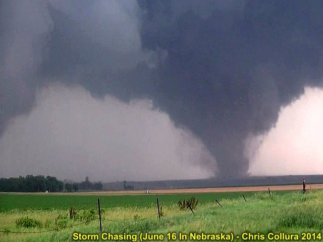
Second tornado now north of Highway 275.
Posted: Jun 19, 2014, 4:11 PM

First violent tornado lifts a bit (but still broad but weaker) to the left as the second one intensifies a bit more at about 4:35 PM CDT on June 16.
Posted: Jun 19, 2014, 4:11 PM
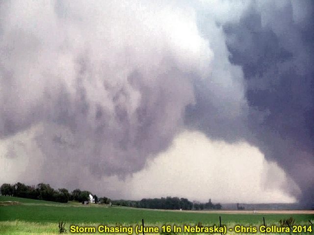
First tornado starting to intensify again.
Posted: Jun 19, 2014, 4:11 PM

EMS / police vehicle rusing towards Pilger, NE behind the tornadoes at about 4:40 PM or so. June 16, 2014.
Posted: Jun 19, 2014, 4:12 PM

First tornado cycling back up with second one maxing out in intensity.
Posted: Jun 19, 2014, 4:12 PM

Twin tornadoes again in the field and farmland north of Highway 275, moving NE at about 30 MPH.
Posted: Jun 19, 2014, 4:12 PM
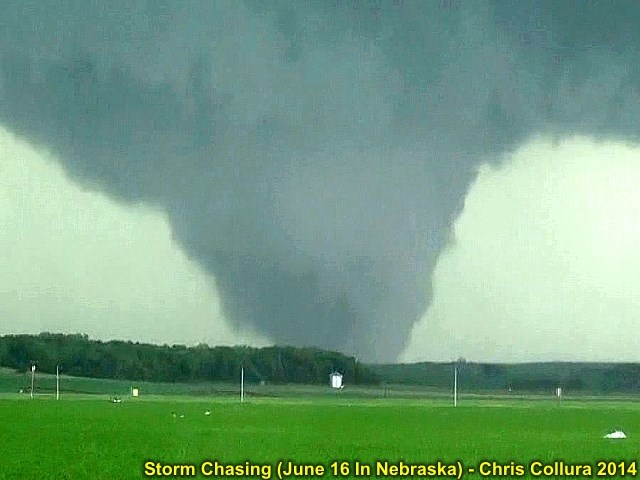
Second Pilger, NE EF-4 tornado close-up.
Posted: Jun 19, 2014, 4:12 PM
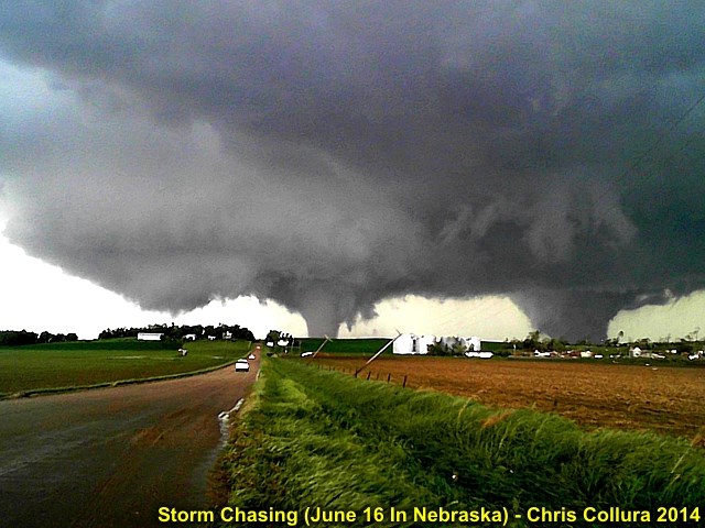
Twin tornadoes still moving north and "Fujiwhara" effect (they rotate around each other). Third possible tornado developing to ther left! Time roughly 4:45 CDT on June 16.
Posted: Jun 19, 2014, 4:12 PM
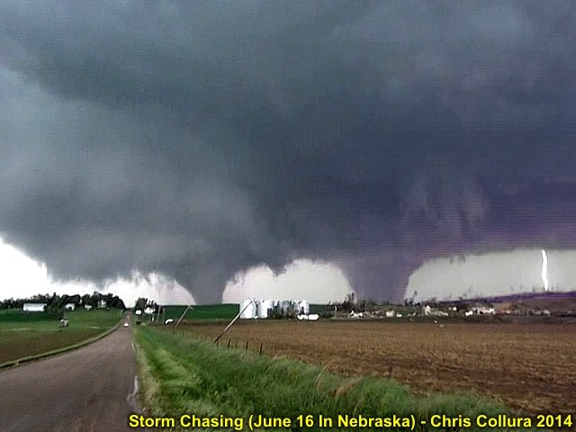
Lightning strike to the far right, farmstead destroyed in foreground. Possible 3rd tornado combining with stove-pipe to the left. Both EF-4 (at least).
Posted: Jun 19, 2014, 4:12 PM
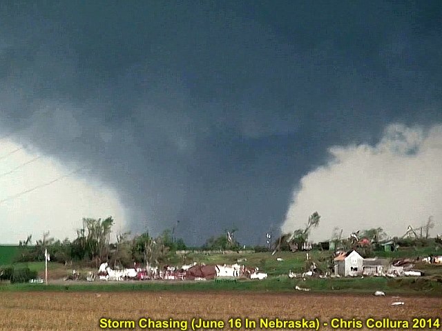
Destroyed farmstead and close up of violent tornado moving off to the NE. Other tornado will move around this one and get absorbed.
Posted: Jun 19, 2014, 4:12 PM
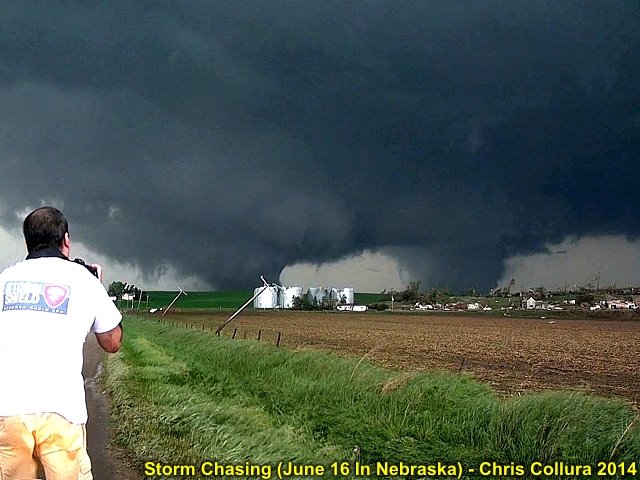
Myself taking pictures of the tornadoes. Time roughly 4:45 PM CDT on June 16.
Posted: Jun 19, 2014, 4:12 PM
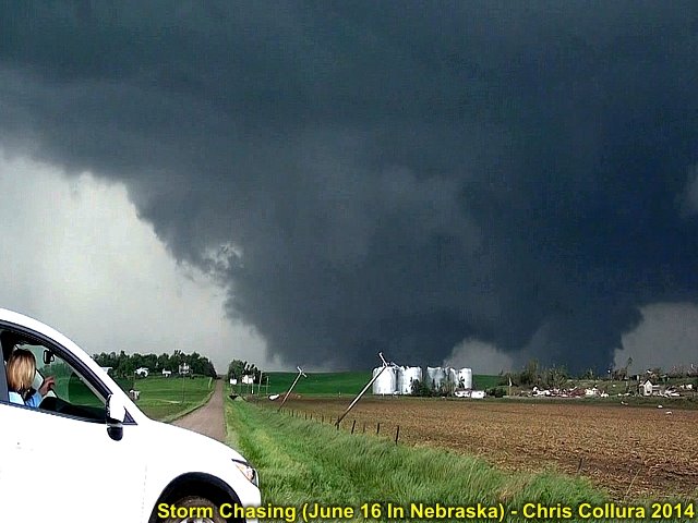
Owners of destroyed home / farmstead watch in horror. Two tornadoes "Fujiwhara" and begin to combine to violent mile+ wide wedge by 4:50 PM CDT.
Posted: Jun 19, 2014, 4:12 PM
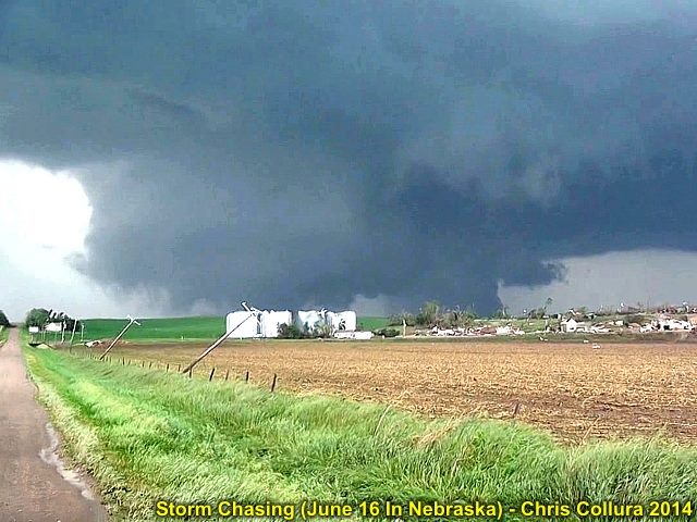
"Composite" wedge tornado forming ... This will continue NE and become rain-wrapped / occluded soon. June 16, 2014.
Posted: Jun 19, 2014, 4:12 PM
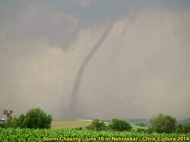
Thin rope develops east of the occluding wedge (formerly the twin tornadoes) and west of yet another tornado forming to the east!
Posted: Jun 19, 2014, 4:12 PM
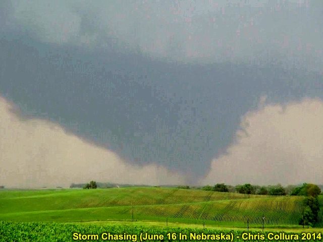
New tornado east of the developing rope tornado, both of which are east of the wedge which is becoming rain-wrapped. Time roughly 4:50 to 4:55 PM CDT.
Posted: Jun 19, 2014, 4:12 PM

Massive wedge barely visible to the left and becomign rain-wrapped. Stove pipe forming from thin rope in between the wedge and eastern tornado.
Posted: Jun 19, 2014, 4:12 PM

Full view of all three from left to right. Occluding wedge, stove pipe, and third eastern tornado forming. Time about 4:55 PM central.
Posted: Jun 19, 2014, 4:12 PM
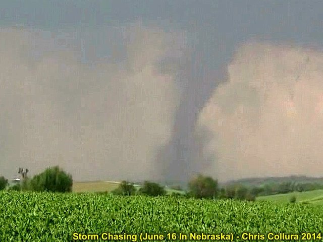
Closer view of the stove pipe tornado between the two.
Posted: Jun 19, 2014, 4:13 PM
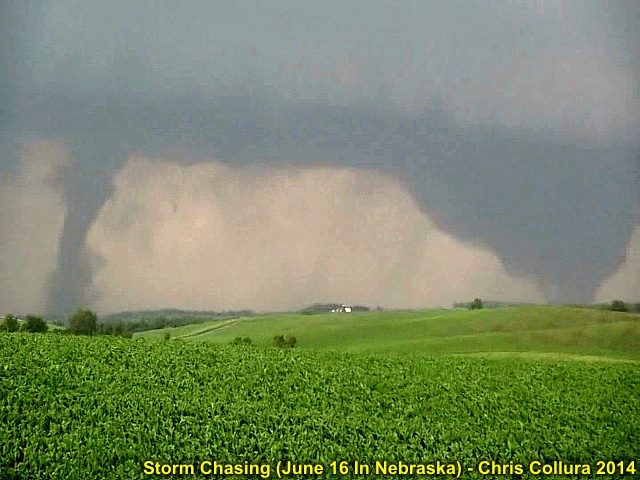
Wedge weakening and occluding to the west. Now we have 2 new tornadoes to the east, a stove pipe and cone tornado. These lated for about 5-10 minutes, and lifted by about 5:10 PM CDT. June 16, 2014.
Posted: Jun 19, 2014, 4:13 PM

Storm wraps up again about 10 miles southwest of Sioux City, Iowa (on Nebraska side). Powerful RFD clear slot (view is to the SSW). Rapid rotation by about 5:30 PM CDT.
Posted: Jun 19, 2014, 4:13 PM
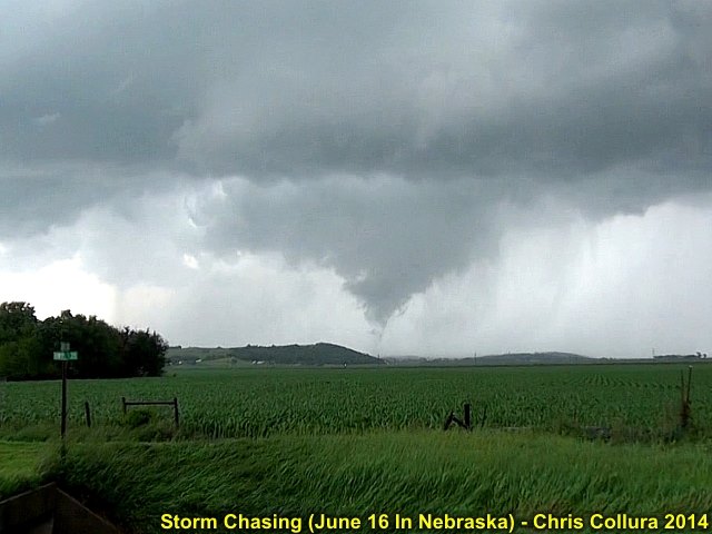
Final tornado lasts about 3 minutes 7 miles or so to the SW of Sioux City. Time is about 5:35 PM.
Posted: Jun 19, 2014, 4:13 PM
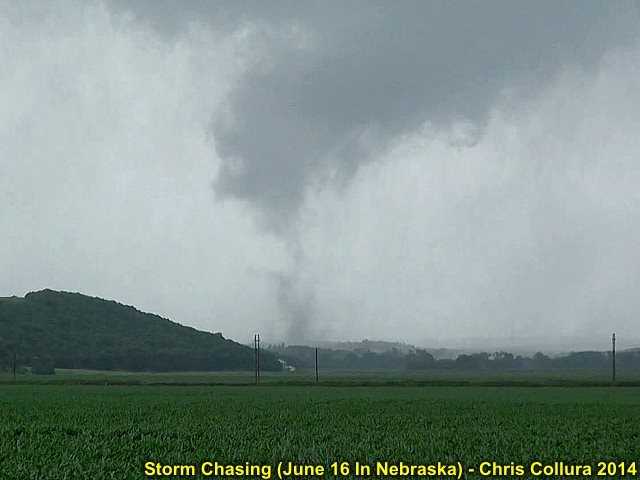
Closer view of the last tornado from this incredible cyclic supercell storm 7 miles or so SW of Sioux City, Iowa. Tornado lifted after 5:35 PM or so. June 16, 2014.
Posted: Jun 19, 2014, 4:13 PM

Elevated HP supercell storm (note the RFD with shelf cloud below it, de coupled from the storm). This storm produced 3.0 to 3.5" hail near Omaha, Nebraska earlier (around noon on June 16, 2014). Here hs the storm prior to waekening in Iowa.
Posted: Jun 19, 2014, 9:11 PM
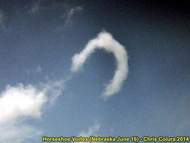
Horeseshoe vortex in a cumulus field to the southwest of Sioux City, Iowa and near tyhe Nebraska border. June 16, 2014.
Posted: Jun 19, 2014, 9:11 PM
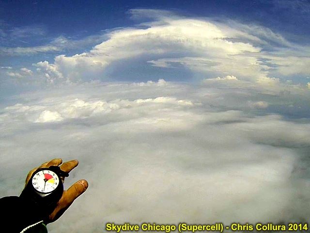
View of supercell thunderstorm over Illinois while skydiving at Ottawa. Severe thunderstorm watch box #340 was also active at the time! June 21, 2014.
Posted: Jun 21, 2014, 9:29 PM
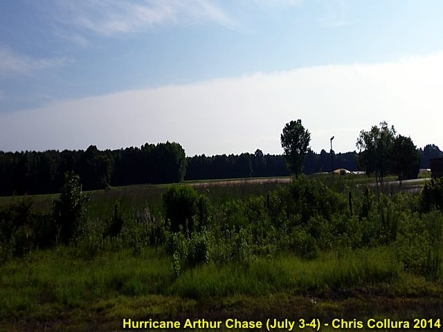
The "edge" of hurricane Arthur (cirrus shield) moving away and being replaced with beautiful July 4th weather over eastern NC.
Posted: Jul 4, 2014, 2:55 PM

Some chasers from Virginia inside the eerie calm of the eye of hurricane Arthur near Nags Head, NC early on July 4th (4 AM). Note the thin fog in the air. Stars visible aloft at the time.
Posted: Jul 4, 2014, 2:55 PM
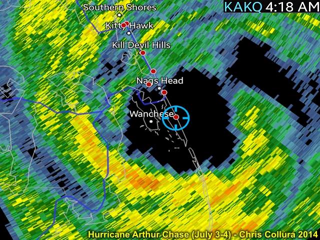
My GPS location inside the eye of hurricane Arthur early on July 4th while along the outer banks.
Posted: Jul 4, 2014, 2:56 PM
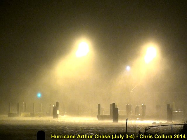
Backside of the eye and start of second eyewall with strong winds at US Coast Guard station in the outer banks (NC). Early july 4, 2014.
Posted: Jul 4, 2014, 2:56 PM

Collapsing beachfront home on eroding shoreline on the outer banks in NC during hurricane Arthur early on July 4, 2014.
Posted: Jul 4, 2014, 2:56 PM
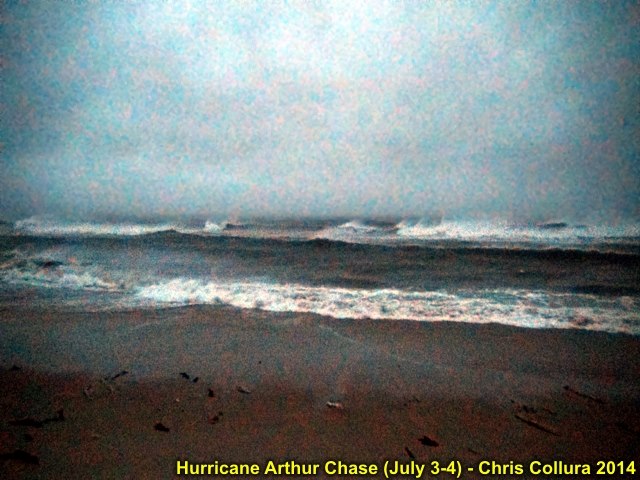
Hurricane surf off the outer banks NC as hurricane Arthur moves offshore and races to the NE during the morning of July 4.
Posted: Jul 4, 2014, 2:56 PM

Storm surge and waves lash a waterfront area off Highway 64 near Nags Head, NC during the morning of July4 as the Palmico Sound surge ensued after passage of the eye of the storm.
Posted: Jul 4, 2014, 2:56 PM
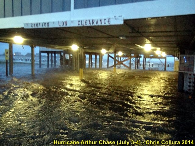
Flooded parking area near Nags Head, NC during the morning of July4 as the Palmico Sound surge started.
Posted: Jul 4, 2014, 2:56 PM

US Army reserve vehicle transporting pregnant woman to safety as she was in labor during the storm. This is Highway 64 flooding from the Palmico Sound storm surge early on July 4, 2014 near Nags Head, NC.
Posted: Jul 4, 2014, 2:56 PM
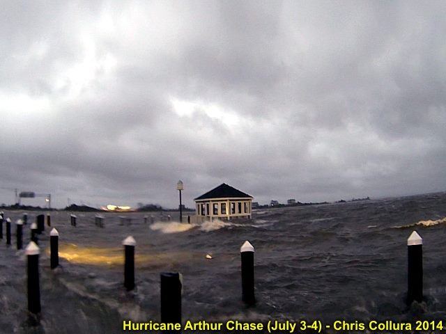
Same place (showing the negative surge) later during the morning on July 4 near Nags Head, NC. This water rushed back in fast with the wind shift to NW as the storm eye passed.
Posted: Jul 4, 2014, 2:56 PM
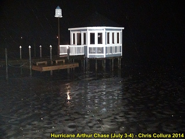
Negative surge (offshore flow pushes water in portion of bay OUT) with no water under docks and such. This was before dawn near Nags Head on July 4.
Posted: Jul 4, 2014, 2:56 PM

Self picture of myself watching the rapidly rising water (Palmico Sound) near Nags Head, NC at daybreak on July 4.
Posted: Jul 4, 2014, 2:56 PM
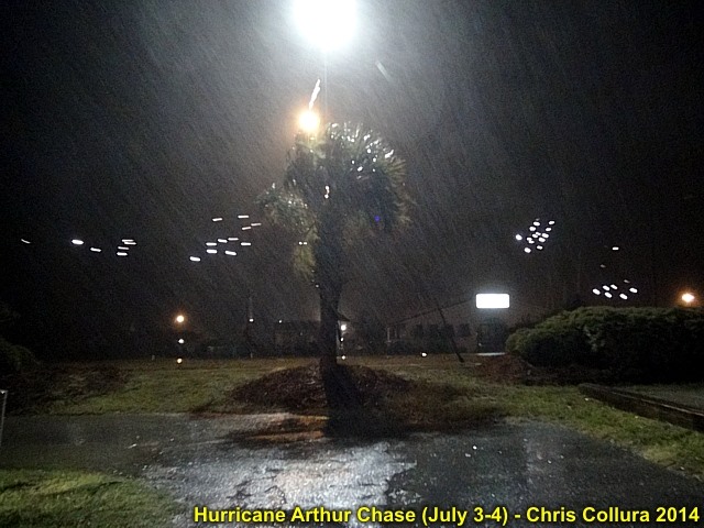
Sparks fly as powerlines touch in strong winds near Atlantic Beach / Morehead City, NC late on July 3, 2014.
Posted: Jul 4, 2014, 2:56 PM
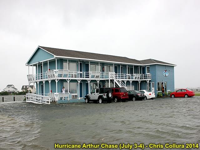
Flooded residence from the rapidly rising water (Palmico Sound) near Nags Head, NC after daybreak on July 4.
Posted: Jul 4, 2014, 2:57 PM
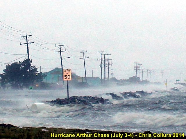
Highway 64 flooding from the Palmico Sound storm surge early on July 4, 2014 near Nags Head, NC.
Posted: Jul 4, 2014, 2:57 PM

Flying into Raleigh, NC from Chicago late in the day on July 3, 2014. This is the "edge" of the cloud shield and feeder bands of hurricane Arthur looming over the horizon.
Posted: Jul 4, 2014, 2:57 PM
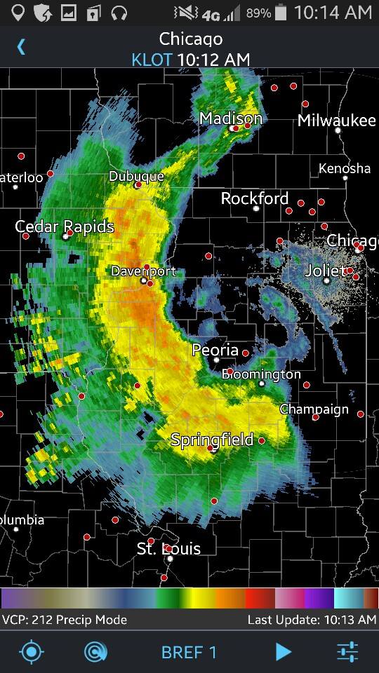
MCV apparent with overnight MCS crossing into IL (July 25, 2014).
Posted: Jul 25, 2014, 8:16 AM

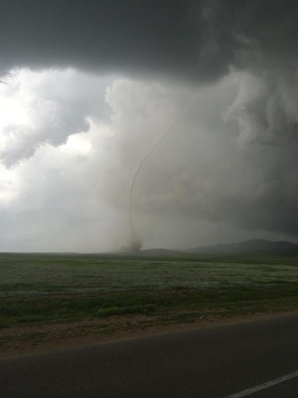
These are NOT my pictures but I am forwarding them because these are from a pretty interesting land spout event in Mongolia! Looks like something you would see in Colorado here in the states ... but under the right conditions ... such storms can occur anywhere on earth.
Posted: Jul 28, 2014, 9:00 AM
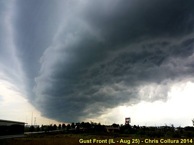
Nice shelf cloud pushing well ahead of a severe thunderstorm over western Cook County, IL on August 25, 2014.
Posted: Aug 25, 2014, 3:48 PM
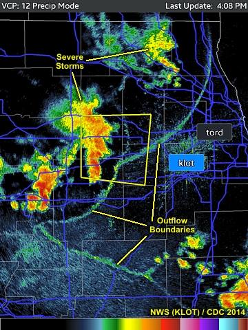
Interesting outflow boundaries across Illinois on Aug 25, 2014 during the afternoon.
Posted: Aug 25, 2014, 3:59 PM
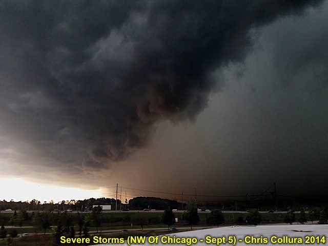
Powerful severe thunderstorm rolls through Western Chicago suburbs, with hurricane forced winds in excess of 80 MPH, during the afternoon Around 2:45 pm on Sept 5, 2014. This is a view of the gust front, looking WSW, with the passage of the wet RFD / intense bow with an embedded HP supercell in the storm line.
Posted: Sep 5, 2014, 5:02 PM

View looking to the west at the inflow "notch" of the severe HP storm in a severe line segment (RFD and edge of intense bow with 80+ MPH wind gusts is to the left). Interesting wall cloud as well. Sept 5, 2014 in NW Chicago suburbs.
Posted: Sep 5, 2014, 5:02 PM
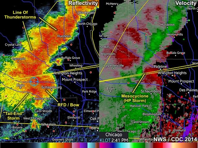
Radar (reflectivity and velocity) images as a severe storm pushes across the NW Chicago suburbs just before 3 PM CDT on Sept 5, 2014. Clearly there is a rotating storm, with an intense HP supercell storm embedded in the southern end of the line of severe storms.
Posted: Sep 5, 2014, 5:03 PM
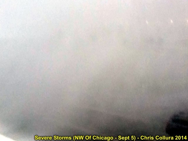
Peaking storm winds around 80 MPH with horizontal rain and hail associated with the severe storms near Hoffman Estates, IL on Sept 5, 2014.
Posted: Sep 5, 2014, 5:03 PM
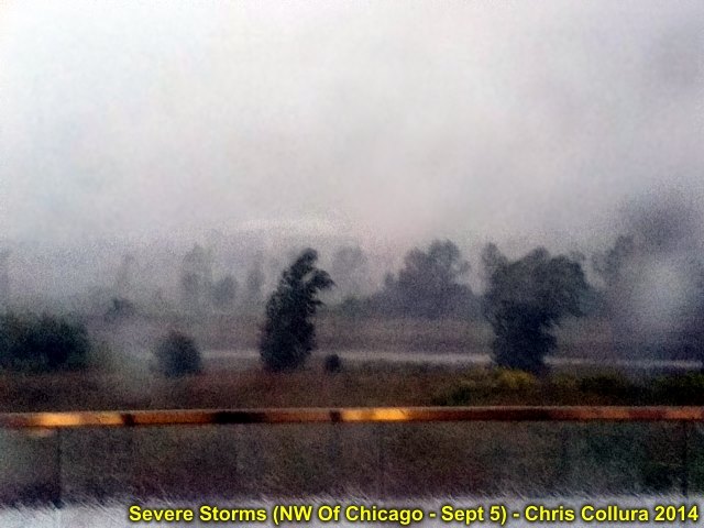
Onset of strong winds associated with the severe storms near Hoffman Estates, IL with 60+ MPH gusts from the SW on Sept 5, 2014.
Posted: Sep 5, 2014, 5:03 PM

Anvil back-shearing on backside of the severe storms NW of Chicago on Sept 5, 2014.
Posted: Sep 5, 2014, 5:03 PM
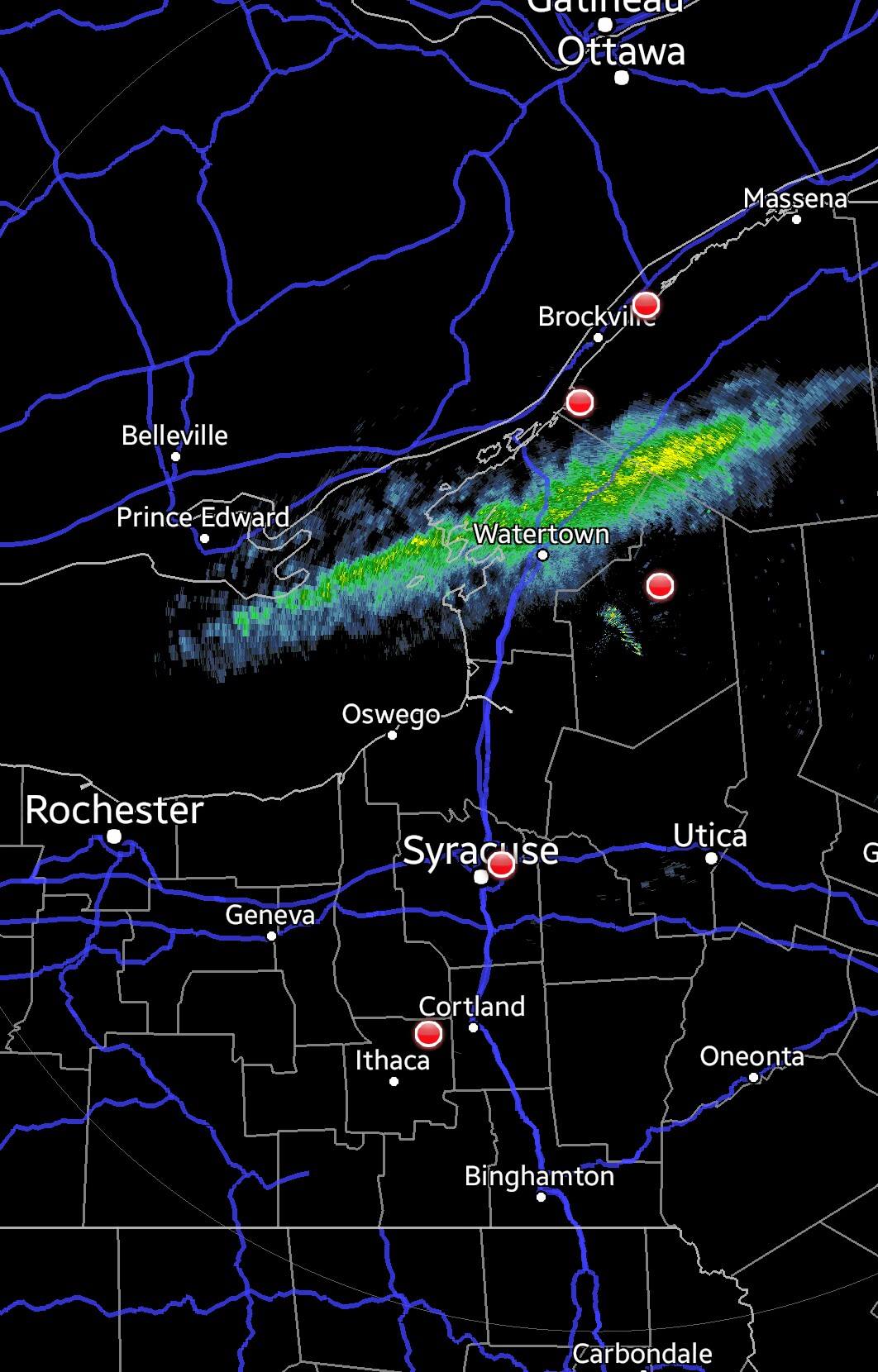
Lake effect snow bands off Lake Ontario affecting Tug Hill area on Nov 18, 2014.
Posted: Nov 18, 2014, 6:40 AM
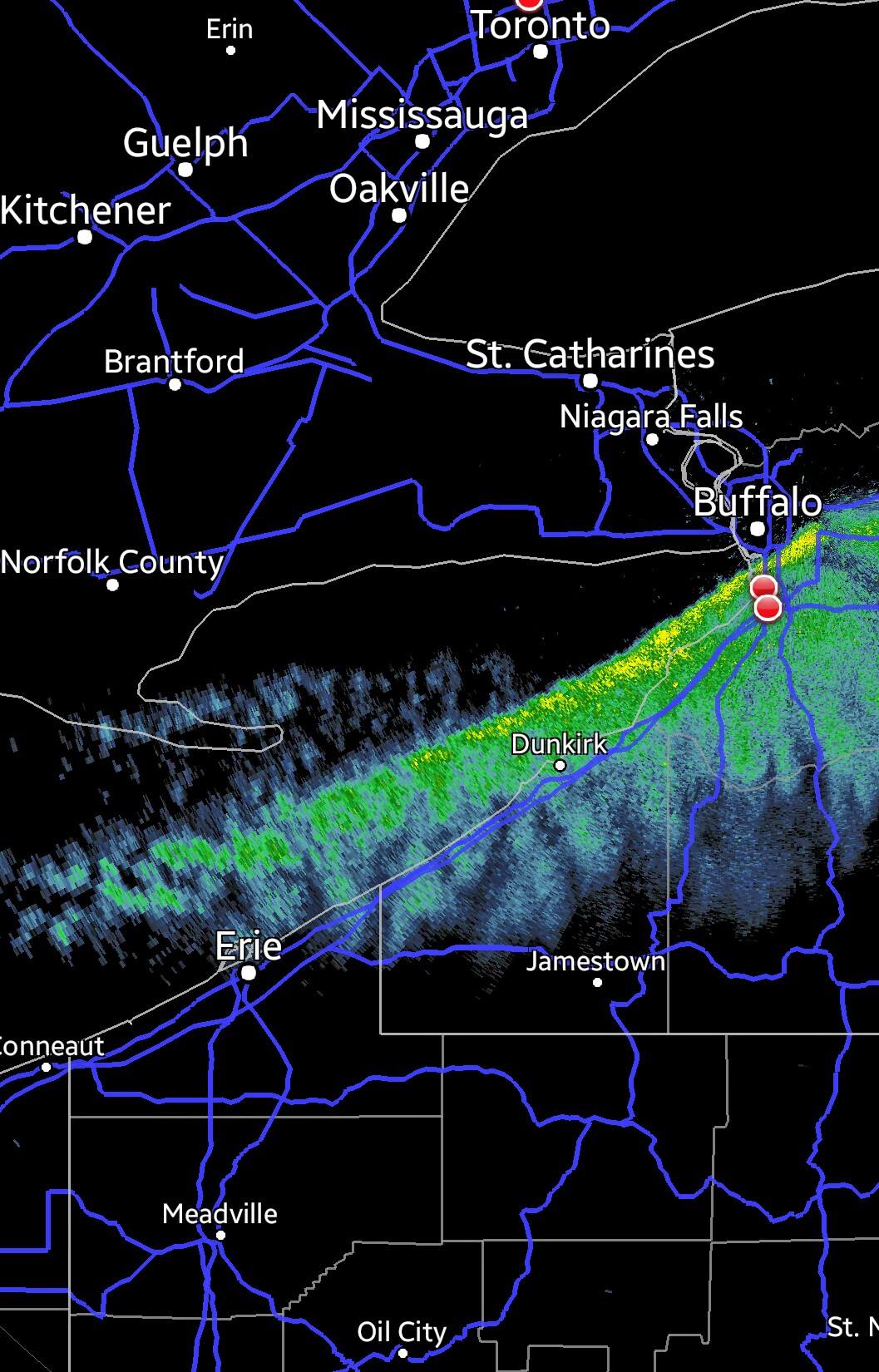
Extreme narrow band of lake effect snow across Lake Erie on Nov 18, 2014.
Posted: Nov 18, 2014, 6:40 AM

Lake effect snow in W Michigan on Nov 18, 2014. East side of Lake Michigan.
Posted: Nov 18, 2014, 6:40 AM
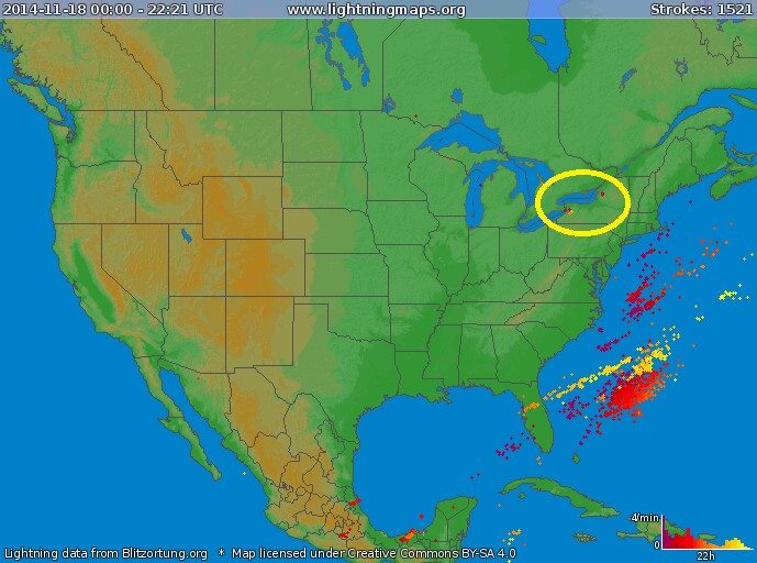
With almost all of the lightning offshore of Florida and over the deep tropics, notice the few strokes over the eastern Great Lakes associated with devastating lake effect snow on Nov 18, 2014.
Posted: Nov 18, 2014, 2:28 PM
Generated by Chris Collura on Wednesday, April 15, 2020 at 11:31 AM UTC-07:00
HTML File "index31.htm" (Facebook) - Developed By Chris Collura
To Return To The HOME Page Of This Site Click The "INDEX.HTM" Link Here!


