Facebook Photo Album Storm Chasing 2013
(Storm Chasing 2013 Sky-Chaser Chris Collura Facebook Posts)
[ PARENT INDEX ]

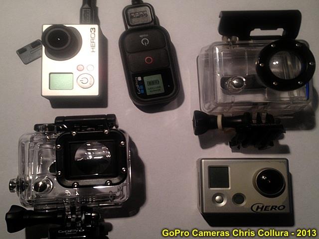
New GoPro Hero 3 (Black version) purchased this evening (Jan 31)! Camera and remote is to the upper left, and original GoPro HD camera (for comparison) is to the right.
Posted: Jan 31, 2013, 4:32 PM

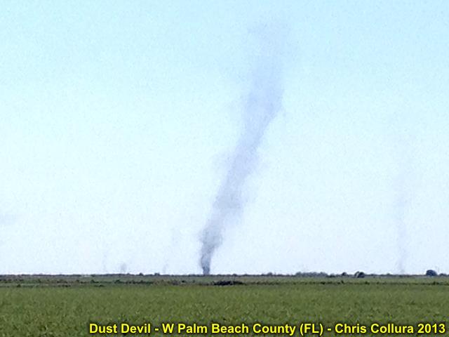
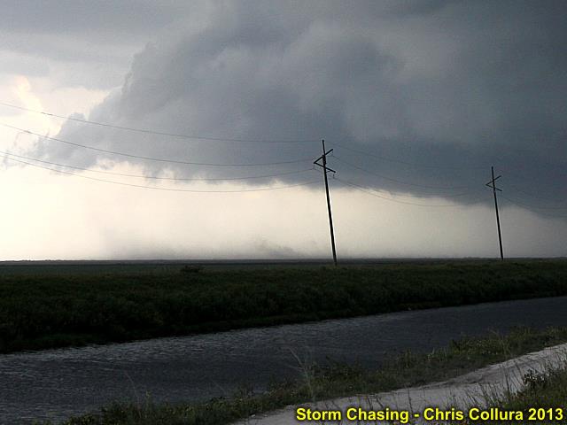
Large dust devil (with smaller ones) over sugar cane fields of western Palm Beach County, Florida - March 16, 2013.
Posted: Mar 16, 2013, 5:24 PM

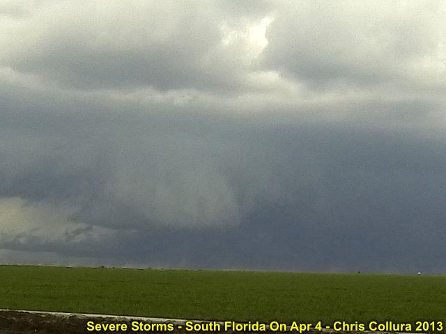
Posted: Apr 4, 2013, 5:59 PM

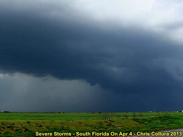
Posted: Apr 4, 2013, 5:59 PM

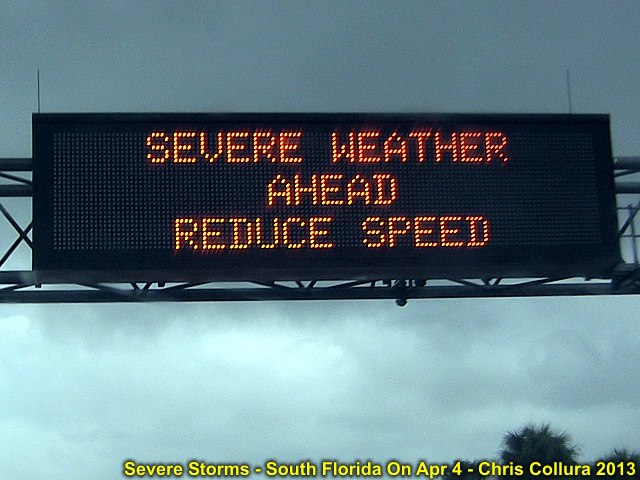
Posted: Apr 4, 2013, 5:59 PM

Posted: Apr 4, 2013, 5:59 PM

Posted: Apr 4, 2013, 5:59 PM

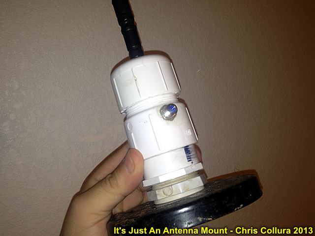
TSA really freaked out when seeing this antenna mount I slapped together at the last minute. It's PVC and allows easy mounting on any vehicle or my weather station (for hurricanes). It was enough to close the security lane and bring in some "investigators" from TSA's Elite Staff - They even took photos of it! When it was just an antenna mount, things re-opened (after 20 minutes) and moved on. Luckily US Air (FLL to Kansas City) was not crowded!
Posted: Apr 7, 2013, 6:45 AM

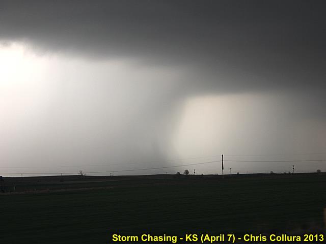
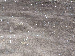
Lots of golfball sized hail falling from the storm near Otis, KS (April 7, 2013).
Posted: Apr 7, 2013, 8:37 PM

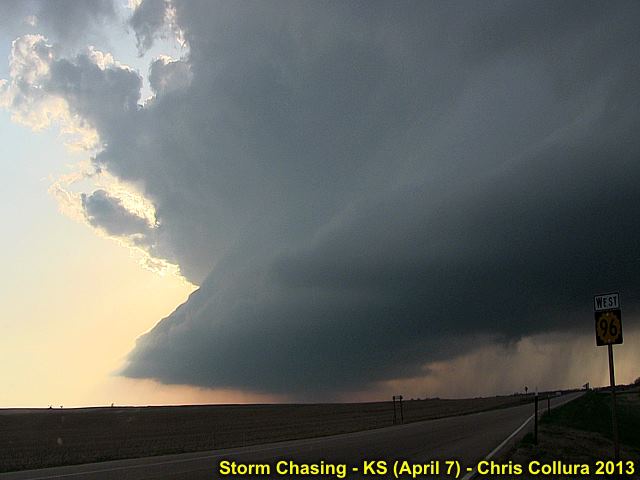
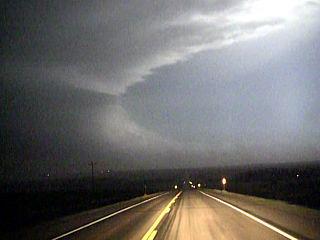
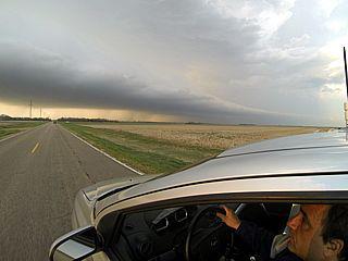
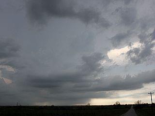
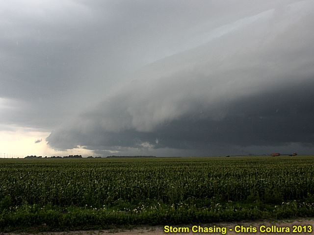
Storm structure - KS (April 7, 2013).
Posted: Apr 7, 2013, 8:37 PM

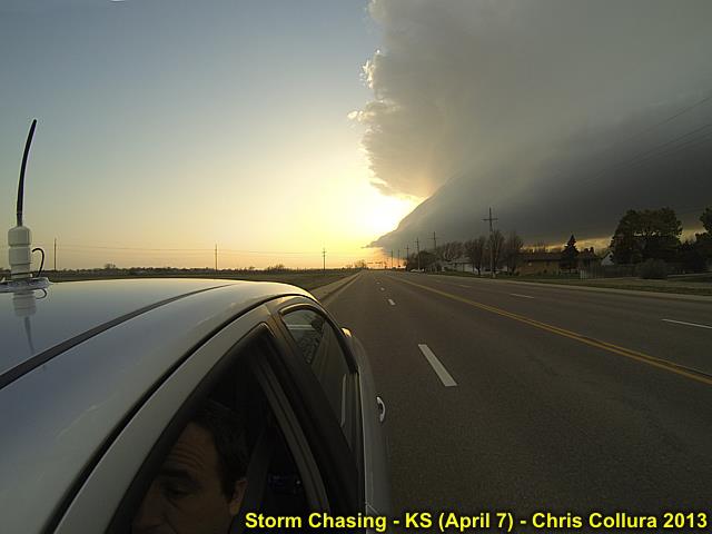
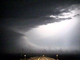
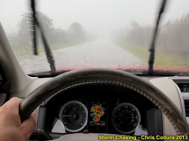
Wide shot of myself driving and supercell updraft / RFD section - Kansas (April 7, 2013).
Posted: Apr 7, 2013, 8:37 PM

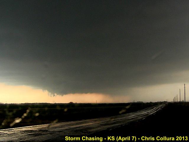
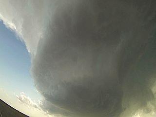
Supercell storm updraft base "trying" near Otis, Kansas (April 7, 2013).
Posted: Apr 7, 2013, 8:38 PM

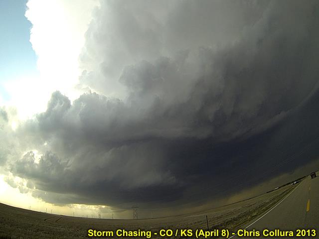
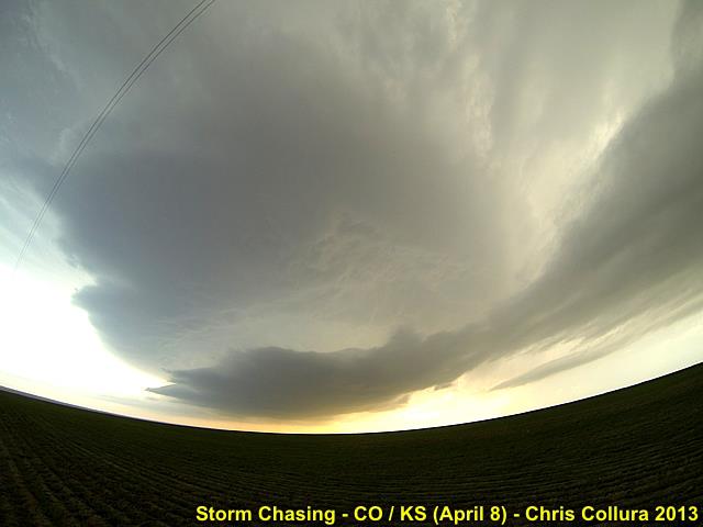
Supercell near Burlington, Colorado - April 8, 2013.
Posted: Apr 9, 2013, 12:20 AM

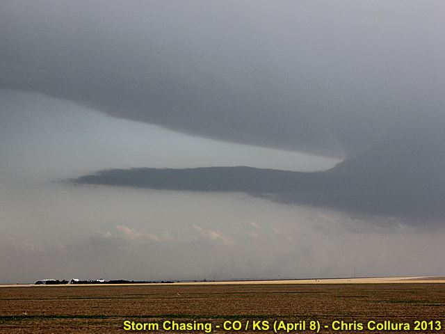
Beaver's tail of supercell near Burlington, Colorado - April 8, 2013.
Posted: Apr 9, 2013, 12:20 AM

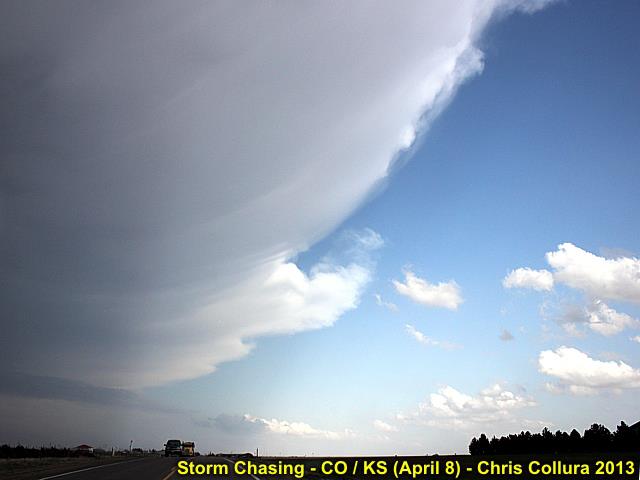
Anvil and shadow of supercell near Burlington, Colorado - April 8, 2013.
Posted: Apr 9, 2013, 12:20 AM

Developing supercell in NE Colorado - April 8, 2013.
Posted: Apr 9, 2013, 12:20 AM

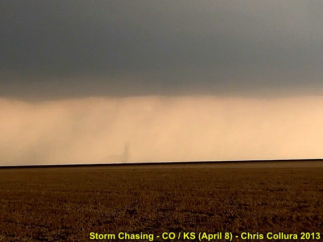
Brief landspout tornado northeast of Burlington, Colorado - April 8, 2013.
Posted: Apr 9, 2013, 12:20 AM

Supercell SW of Saint Frances, Kansas - April 8, 2013.
Posted: Apr 9, 2013, 12:21 AM

Tornadic supercell storm near NE / KS border - April 8, 2013 ... strong inflow.
Posted: Apr 12, 2013, 6:04 PM

Tornadic supercell storm near NE / KS border - April 8, 2013 (N of Atwood, KS) ... Amazing inflow features.
Posted: Apr 12, 2013, 6:04 PM

Tornadic supercell storm near NE / KS border - April 8, 2013 ... Corn husks and dust flying in 60 Knots inflow.
Posted: Apr 12, 2013, 6:04 PM

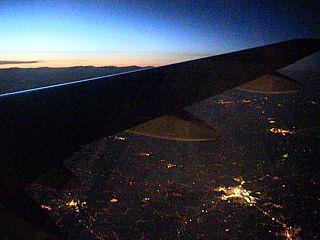
Overflying St Louis, MO (with sunset and city lights below) enroute to Kansas City on April 6.
Posted: Apr 13, 2013, 7:19 AM

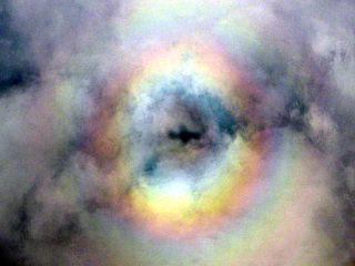
Pilot's glory above deck of clouds after leaving Kansas City on Apr 10 (this was above the system producing tornadoes later that day).
Posted: Apr 13, 2013, 7:19 AM

April 9 west of Lawton, OK - Undercutting and surging cold front makes for a bust (sort of)...
Posted: Apr 13, 2013, 7:19 AM

Nickel to quarter sized hail - NE Colorado on April 8.
Posted: Apr 13, 2013, 7:19 AM

Developing supercell storm in Kansas - April 7, 2013.
Posted: Apr 13, 2013, 7:19 AM

Chaser J Gustino after dark in Kasnas photographing a dying supercell storm.
Posted: Apr 13, 2013, 7:19 AM

LP supercell storm struggling south of a more powerful storm on April 7 (Kansas).
Posted: Apr 13, 2013, 7:19 AM

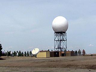
NWS radar in Goodland, Kasnas on April 8.
Posted: Apr 13, 2013, 7:19 AM

Heading towards the storm! April 7 (Kansas).
Posted: Apr 13, 2013, 7:19 AM

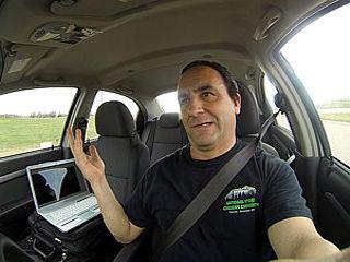
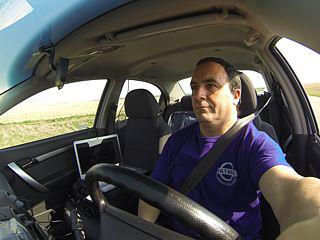
Myself driving towards the Kansas target on April 7.
Posted: Apr 13, 2013, 7:19 AM

Driving in open coutry - NE Colorado (April 8).
Posted: Apr 13, 2013, 7:19 AM

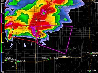
Radar image of violent (tornadic) supercell storm in NW Kansas and nearing SW Nebraska after dark on April 8 (NWS radar reflectivity image from Goodland).
Posted: Apr 13, 2013, 7:19 AM

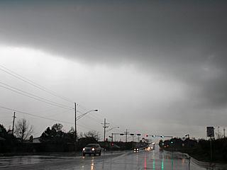
Wet RFD near Lawton, OK on April 9.
Posted: Apr 13, 2013, 7:19 AM

@[593439289:2048:Roger Hill]'s tour group on April 8, 2013 near Burlington, CO under a developing supercell storm.
Posted: Apr 13, 2013, 7:19 AM

Supercell storm being undercut by surging cold front near Lawton, OK on April 9.
Posted: Apr 13, 2013, 7:19 AM

Supercell storm (and green hail core to right) NW of Burlington, CO on April 8.
Posted: Apr 13, 2013, 7:19 AM

Developing supercell storm (left moving) on April 8 (NE Colorado).
Posted: Apr 13, 2013, 7:19 AM

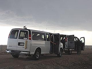
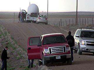
Storm chasers / researchers - Near Burlington, CO on April 8.
Posted: Apr 13, 2013, 7:19 AM

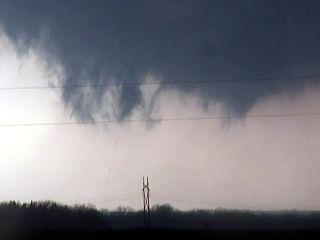
Probably the smallest and thinnest tornado I ever seen - Kasnas on April 7.
Posted: Apr 13, 2013, 7:19 AM

@[724566193:2048:Verne Carlson] just east of Greensburg, Kasnas on April 7, just before heading north on 183.
Posted: Apr 13, 2013, 7:19 AM

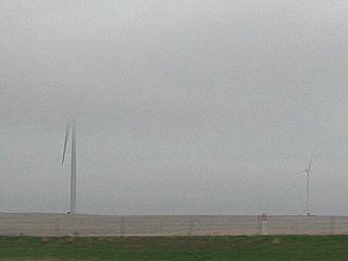
Low stratus and cold fog on the morning of April 9 near Russel, Kansas. Wind turbines "in the clouds".
Posted: Apr 13, 2013, 7:19 AM

Storm chasing - S Florida (April 20) - Glades / Palm Beach County.
Posted: Apr 20, 2013, 3:40 PM

Storm chasing - S Florida (April 20) - Gust Front - Palm Beach County.
Posted: Apr 20, 2013, 3:40 PM

Storm chasing - S Florida (April 20) - Glades / Palm Beach County.
Posted: Apr 20, 2013, 3:40 PM

Storm chasing - S Florida (April 20) - Strong Outflow - Palm Beach County.
Posted: Apr 20, 2013, 3:40 PM

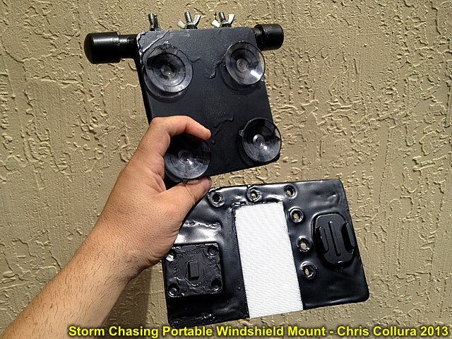
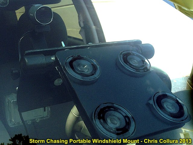
Mounting system is slim and easily packed away. Top is the windshield suction mounts, which bolt to the accessory holder, bottom. The white is velcro, with the cell phone mount to the left, and GoPro / camera mounts to the right. It's painted black to prevent glare.
Posted: Apr 21, 2013, 8:57 AM

How a "typical" storm chasing setup may look in ANY vehicle (rental car, etc). Puts everything in one place - no more tape!
Posted: Apr 21, 2013, 8:57 AM

Outside view of equipment and mount.
Posted: Apr 21, 2013, 8:57 AM

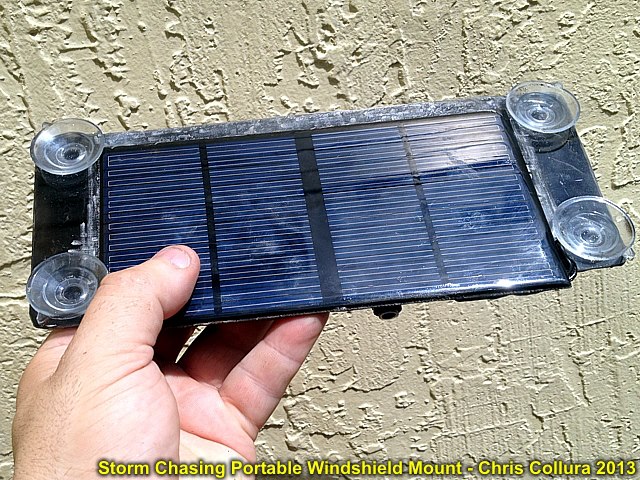
Solar panel 12VDC charger / power supply (suction mounts to windshield).
Posted: Apr 21, 2013, 8:57 AM

Sorry guys (who are chasing) ... Early May 2013 may be slow for a while.
Posted: Apr 30, 2013, 9:33 AM

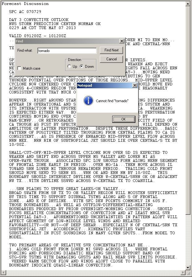
Added 5/8 based on Day 2 - Moved to this album. Long and lengthy SPC outlook(s) ... But still cannot find a 'tornado' in any of them yet :(
Posted: May 9, 2013, 12:37 PM

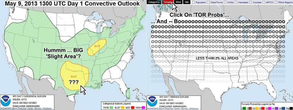
Meh 2013? A big slight and a hatched hail ... Committed to a chase? Then move the mouse over the SPC "Tornado" button and - Uh - Well, Meh (not "May")...
Posted: May 9, 2013, 12:43 PM

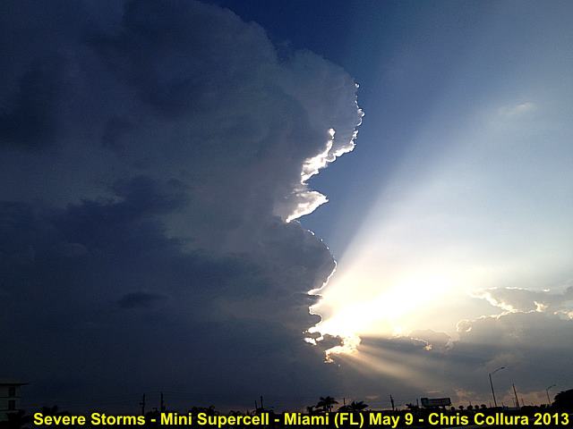
Severe thunderstorm (close up of updraft) over Miami-Dade county, FL - May 9.
Posted: May 9, 2013, 5:16 PM

Beautiful updraft of severe thunderstorm over Miami-Dade county, FL - May 9.
Posted: May 9, 2013, 5:16 PM

Severe thunderstorm over Miami-Dade county, FL - May 9.
Posted: May 9, 2013, 5:16 PM

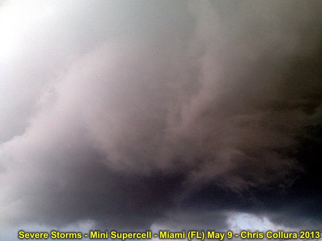
Rotating area of supercell thunderstorm over Miami-Dade county, FL - May 9.
Posted: May 9, 2013, 5:16 PM

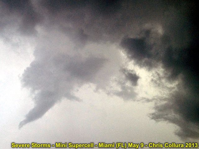
Anticyclonic (clockwise) funnel over Hialeah (Miami-Dade county), FL on May 9.
Posted: May 9, 2013, 5:16 PM

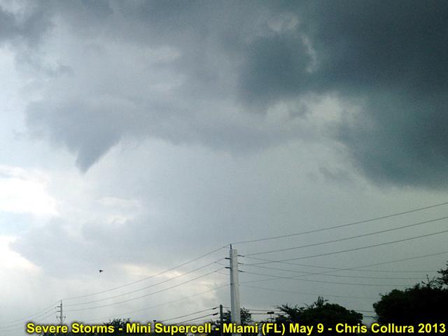
Developing anticyclonic (clockwise) funnel over Hialeah (Miami-Dade county), FL on May 9.
Posted: May 9, 2013, 5:16 PM

Anticyclonic (clockwise) rotation over Hialeah (Miami-Dade county), FL on May 9.
Posted: May 9, 2013, 5:16 PM

Developing mini supercell storm (updraft structure) near Broward / Miami-Dade county border, FL on May 9.
Posted: May 9, 2013, 5:16 PM

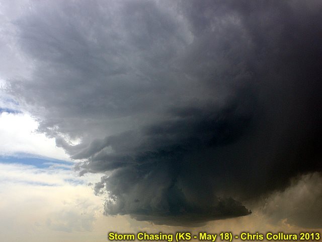
LP storm near Burlington, CO (May 18).
Posted: May 18, 2013, 10:13 PM

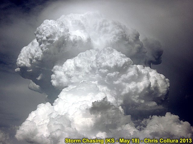
Explosive supercell development (Kansas / May 18).
Posted: May 18, 2013, 10:13 PM

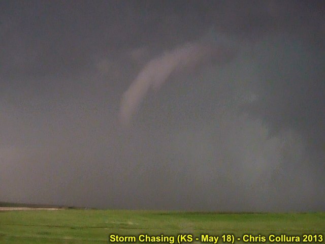
Tornado on northern supercell SW of Hays (May 18).
Posted: May 18, 2013, 10:13 PM

Tornado on northern supercell SW of Hays (May 18).
Posted: May 18, 2013, 10:13 PM

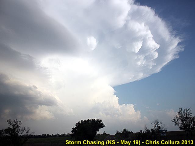
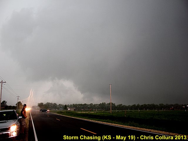
One of many intense supercell storms near Northern Oklahoma on May 19.
Posted: May 19, 2013, 7:54 PM

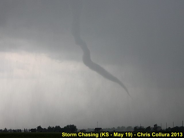
Tornado number one of the supercell south of Wichita, Kansas on May 19.
Posted: May 19, 2013, 7:54 PM

Developing LARGE tornado number 2 (the left edge of the tornado is just over the roadway. Very rapid rotation - Multi vortex tornado that hit Wichita on May 19.
Posted: May 19, 2013, 7:54 PM

Closeup of the first tornado associated with the Wichita storm on may 19.
Posted: May 19, 2013, 7:54 PM

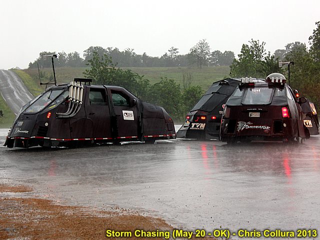
There is indeed now MORE than ONE 'Dominator' - May 20, 2013.
Posted: May 20, 2013, 7:47 PM

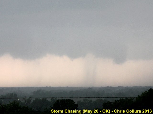
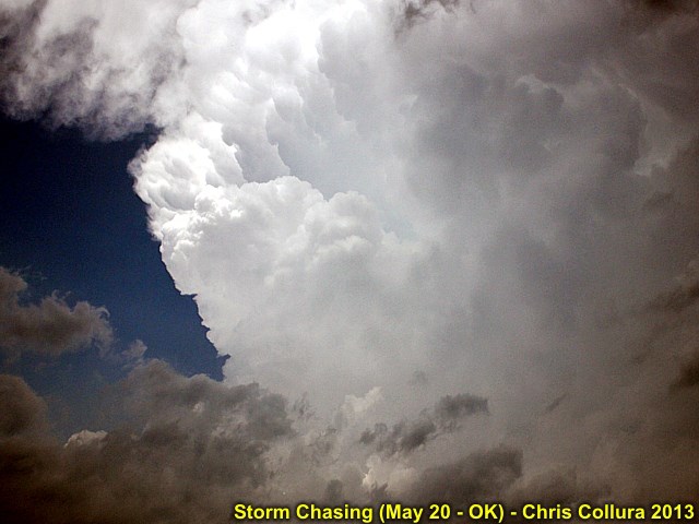
Monsters always start 'small' ... This is the initiation of the Moore, OK storm on May 20.
Posted: May 20, 2013, 7:47 PM

Some tornadic activity on the SW side of the Duncan supercell (the cell SW of the Moore, OK storm) on May 20.
Posted: May 20, 2013, 7:47 PM

This is the updraft of the Moore, OK tornadic storm about 10 minutes before it destroyed the town on May 20, 2013.
Posted: May 20, 2013, 7:47 PM

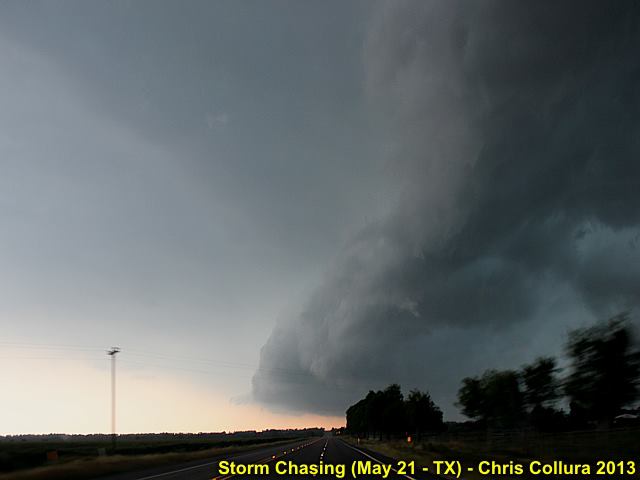
Gust front from tail-end storm 25 miles or so south of Waco, Texas on May 21, 2013.
Posted: May 22, 2013, 5:36 AM

Scores for 05/21 ... COLD air = 267, tornadoes = 0. Jackets KILL supercells!
Posted: May 22, 2013, 5:44 AM

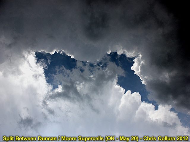
Split between two anvils ... One was the Duncan, Oklahoma supercell and the other the devastating Moore, Oklahoma storm on May 20, 2013.
Posted: May 22, 2013, 6:24 AM

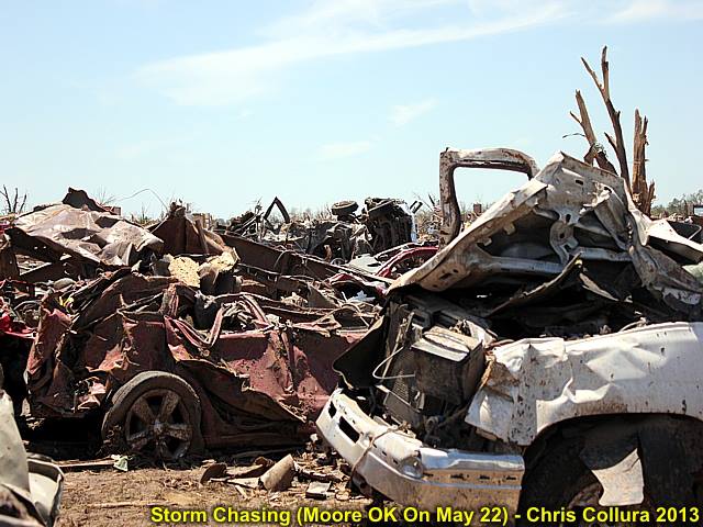
Moore, Oklahoma tornado from May 20, 2013 (picture taken on May 22) - Vehicle remains (once inside garages of disintegrated homes) piled in a field.
Posted: May 22, 2013, 10:22 PM

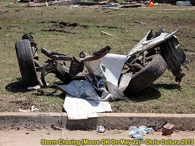
Moore, Oklahoma tornado from May 20, 2013 (picture taken on May 22) - Remains of axel from a vehicle.
Posted: May 22, 2013, 10:22 PM

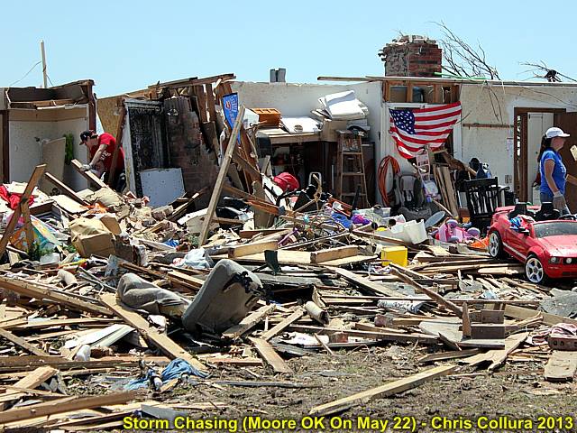
Moore, Oklahoma tornado from May 20, 2013 (picture taken on May 22) - Destroyed residence and people going through rubble.
Posted: May 22, 2013, 10:22 PM

Moore, Oklahoma tornado from May 20, 2013 (picture taken on May 22) - Completely flattened pickup truck (?).
Posted: May 22, 2013, 10:22 PM

Moore, Oklahoma tornado from May 20, 2013 (picture taken on May 22) - Debris strewn across landscape.
Posted: May 22, 2013, 10:22 PM

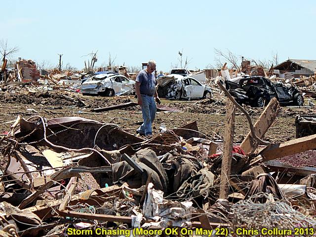
Moore, Oklahoma tornado from May 20, 2013 (picture taken on May 22) - Destroyed vehicle remains / man walking through debris.
Posted: May 22, 2013, 10:22 PM

Moore, Oklahoma tornado from May 20, 2013 (picture taken on May 22) - Overturned vehicle in front of destroyed medical offices.
Posted: May 22, 2013, 10:22 PM

Moore, Oklahoma tornado from May 20, 2013 (picture taken on May 22) - Car buried in remnants of a home.
Posted: May 22, 2013, 10:22 PM

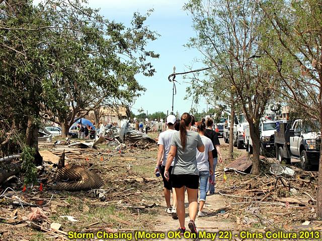
Moore, Oklahoma tornado from May 20, 2013 (picture taken on May 22) - Sidewalk along path of destruction.
Posted: May 22, 2013, 10:22 PM

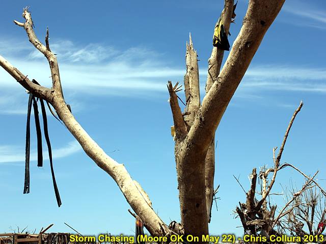
Moore, Oklahoma tornado from May 20, 2013 (picture taken on May 22) - Debarked tree.
Posted: May 22, 2013, 10:22 PM

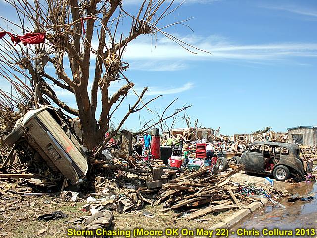
Moore, Oklahoma tornado from May 20, 2013 (picture taken on May 22) - Car in tree and destroyed home.
Posted: May 22, 2013, 10:23 PM

Moore, Oklahoma tornado from May 20, 2013 (picture taken on May 22) - Unrecognizable remains of homes / debris piled high by tornado.
Posted: May 22, 2013, 10:23 PM

Moore, Oklahoma tornado from May 20, 2013 (picture taken on May 22) - Tornado survivor holding his cat in front of his destroyed home.
Posted: May 22, 2013, 10:23 PM

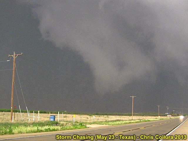
First tornado (or maybe just dust updrafting)? To the west of Dougherty, Texas and to the south of Highway 62. There is it - Peaking through the 60+ knots inflow dust! May 23, 2013.
Posted: May 23, 2013, 11:03 PM

Second possible tornado near Rotan, Texas ... May 23, 2013.
Posted: May 23, 2013, 11:03 PM

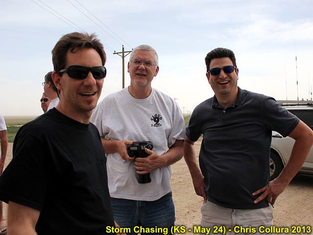
Just a part of the chaser convergence near Sheridan Lake Colorado near an LP supercell (@[846940369:2048:George Kourounis], @[1072928661:2048:Charles Edwards], and @[100000442610383:2048:Daniel Shaw]) on May 24.
Posted: May 24, 2013, 10:22 PM

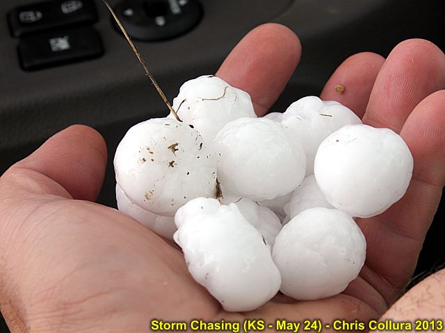
Hail falling near Cheyenne Wells, CO on May 24.
Posted: May 24, 2013, 10:22 PM

Hail near Cheyenne Wells, CO on May 24.
Posted: May 24, 2013, 10:22 PM

LP Supercell NW of Goodland, Kansas on May 24.
Posted: May 24, 2013, 10:22 PM

"When YOU tell me the LCL's gonna be low - You BETTER mean it!" ... Having fun under the meso (May 24).
Posted: May 25, 2013, 6:38 AM

Muddy road and hail core in the storm west of Doughtery, Texas on May 23. Photo taken by Clarence Bennett.
Posted: May 25, 2013, 6:38 AM

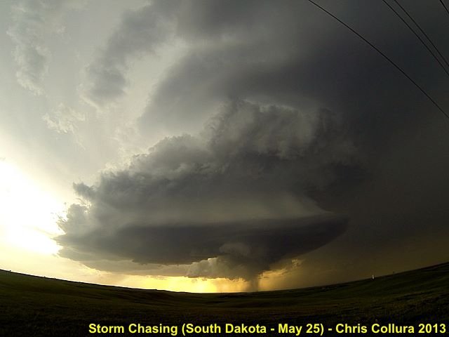
Some chasers under the 'meso' of the Rapid City, SD supercell on May 25, 2013.
Posted: May 25, 2013, 9:00 PM

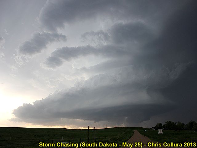
Impressive structure of the Rapid City, SD supercell on May 25, 2013.
Posted: May 25, 2013, 9:00 PM

Storm structure with powerful RFD of the Rapid City, SD supercell on May 25, 2013.
Posted: May 25, 2013, 9:00 PM

Weakening (downscale development) at dusk of the Rapid City, SD supercell on May 25, 2013.
Posted: May 25, 2013, 9:00 PM

"Stacked-Plates" appearance of the SE side of the Rapid City, SD supercell on May 25, 2013.
Posted: May 25, 2013, 9:01 PM

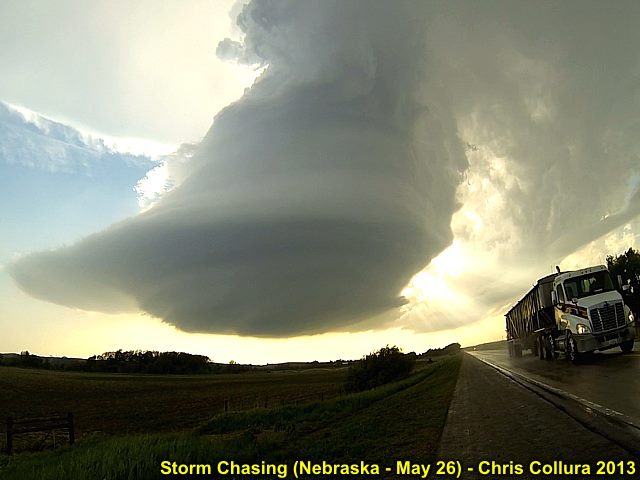
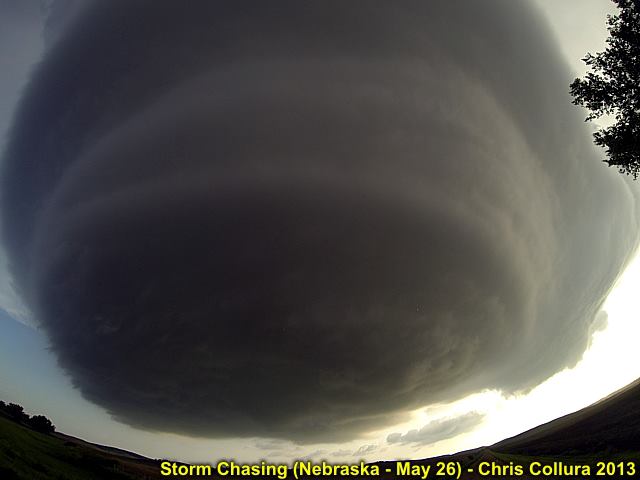
Incredible supercell structure - LP supercell near Broken Bow, Nebraska on May 26, 2013.
Posted: May 26, 2013, 11:50 PM

"Mothership" appearance of LP supercell near Broken Bow, Nebraska on May 26, 2013.
Posted: May 26, 2013, 11:50 PM

"Mothership" appearance of LP supercell near Broken Bow, Nebraska on May 26, 2013.
Posted: May 26, 2013, 11:50 PM

Lightning and mammatus from weakening LP supercell in Nebraska on May 26, 2013.
Posted: May 26, 2013, 11:50 PM

Wider shot of lightning and mammatus from weakening LP supercell in Nebraska on May 26, 2013.
Posted: May 26, 2013, 11:50 PM

Incredible supercell structure - LP supercell north of Broken Bow, Nebraska on May 26, 2013.
Posted: May 26, 2013, 11:50 PM

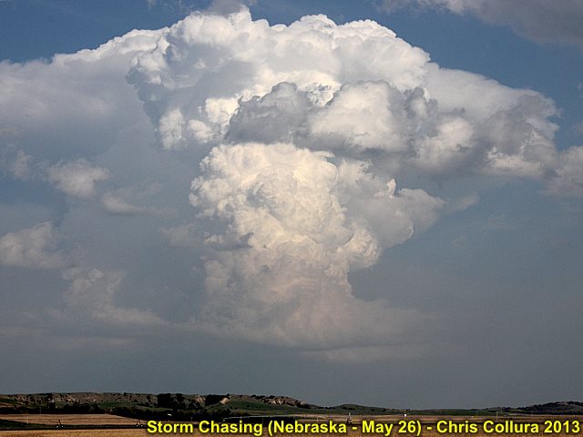
Developing LP supercell in Custer County, Nebraska on May 26, 2013.
Posted: May 27, 2013, 12:06 AM

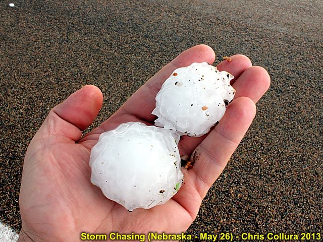
Large hail from passage of LP supercell in Custer County, Nebraska on May 26, 2013.
Posted: May 27, 2013, 12:06 AM

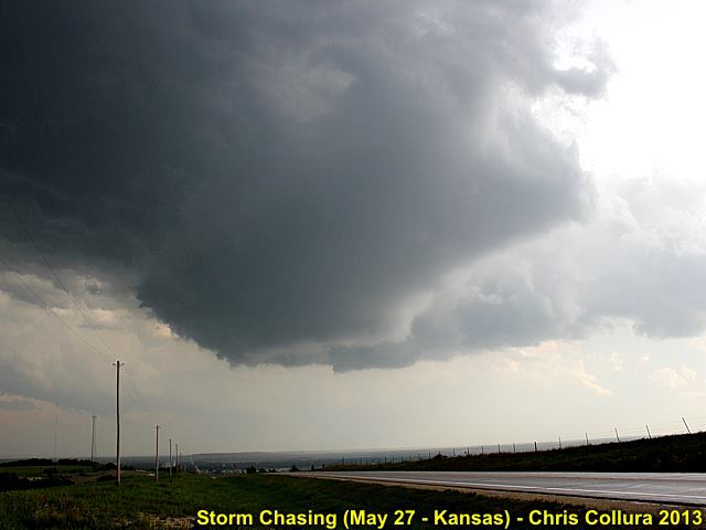
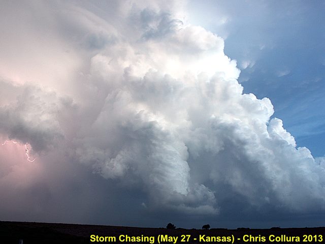
Rotating wall cloud / updraft over Osborne, Kansas - May 27, 2013.
Posted: May 27, 2013, 9:48 PM

Tail-end supercell south of I-70 and west of Salina at dusk - Kansas - May 27, 2013.
Posted: May 27, 2013, 9:48 PM

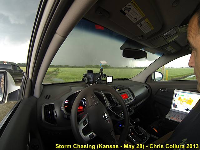
Myself in the chase vehicle (my 'office' for two weeks) near Minneapolis, Kansas on May 28, watching the wedge tornado becoming rain wrapped.
Posted: May 28, 2013, 8:51 PM

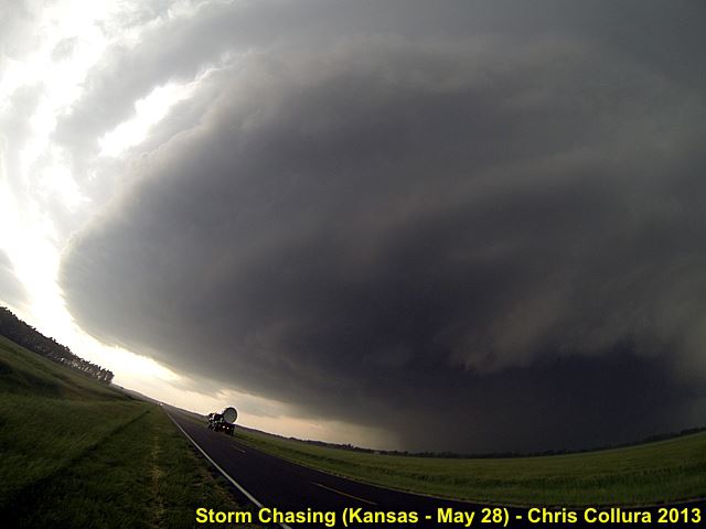
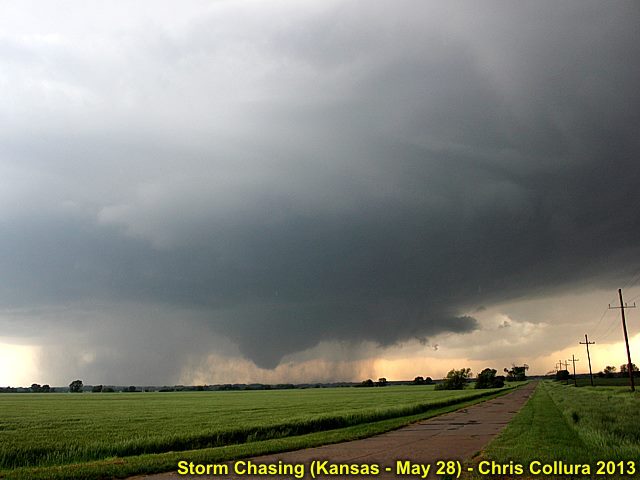
Supercell structure of the HP storm (the wedge tornado is now completely rain-wrapped) as the DOW (Doppler on Wheels) scans the storm. May 28 near Minneapolis, Kansas.
Posted: May 28, 2013, 8:51 PM

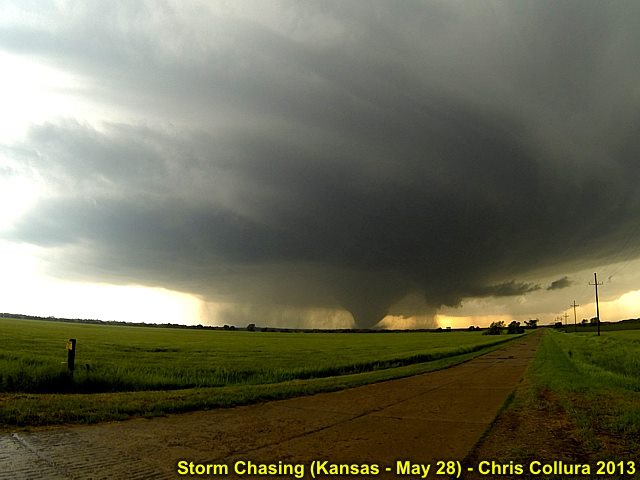
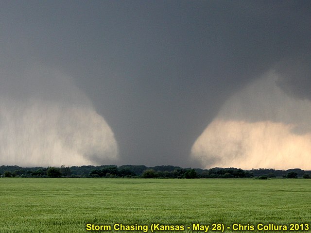
Wide angle view of developing strong tornado on May 28 near Minneapolis, Kansas.
Posted: May 28, 2013, 8:51 PM

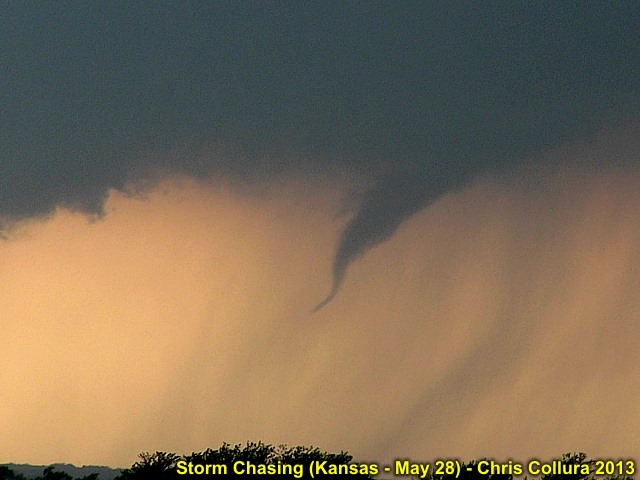
First funnel and small tornado developing on May 28 near Minneapolis, Kansas.
Posted: May 28, 2013, 8:51 PM

View of intensifying (potentially violent) tornado on May 28 near Minneapolis, Kansas.
Posted: May 28, 2013, 8:51 PM

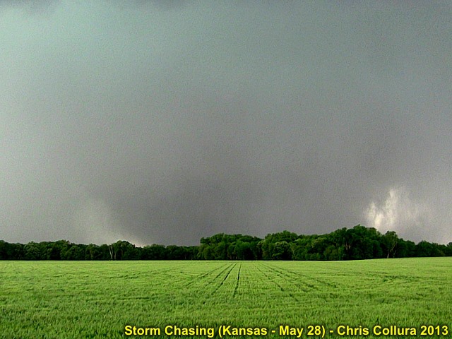
Large (Wedge) tornado starting to become rain-wrapped while nearly stationary. Show looking west from near Minneapolis, Kansas on May 28.
Posted: May 28, 2013, 8:51 PM

Developing large tornado west of Minneapolis, Kansas on May 28.
Posted: May 28, 2013, 8:51 PM

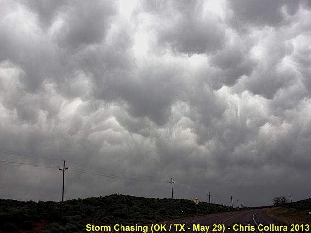
Mammatus looming above western Oklahoma on May 29, 2013.
Posted: May 30, 2013, 12:19 AM

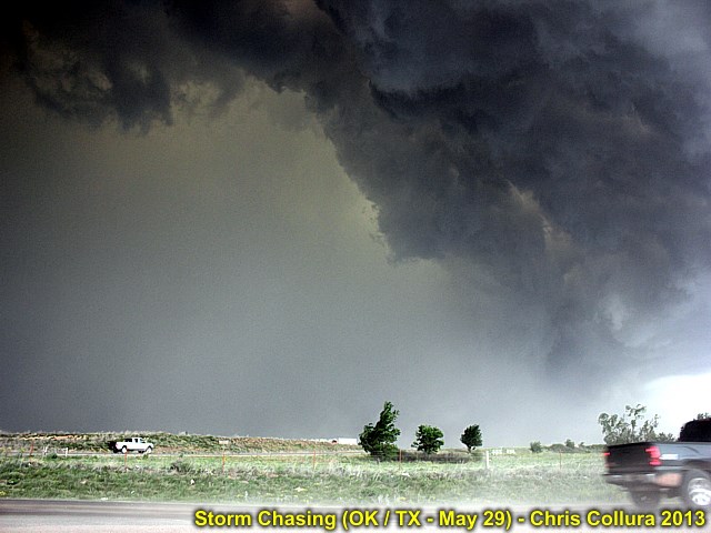
Powerful gust front and outflow ahead of a bowing-segment in a line of severe thunderstorms near Briscoe, Texas on May 29.
Posted: May 30, 2013, 12:20 AM

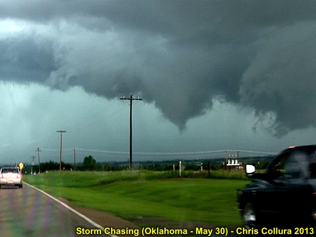
Brief tornado (some chasers closer in confirmed ground circulation briefly) near Perkins, OK on May 30.
Posted: May 30, 2013, 9:31 PM

Developing brief tornado viewed from near Coyle, OK on May 30.
Posted: May 30, 2013, 9:31 PM

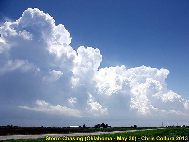
Developing supercell storms near Guthrie, Oklahoma on May 30.
Posted: May 30, 2013, 9:31 PM

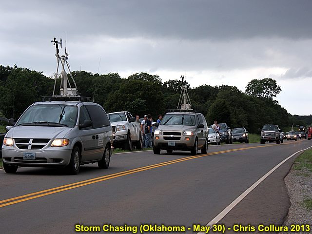
Chasers jamming the roads in Oklahoma near Agra, OK on May 30.
Posted: May 30, 2013, 9:31 PM

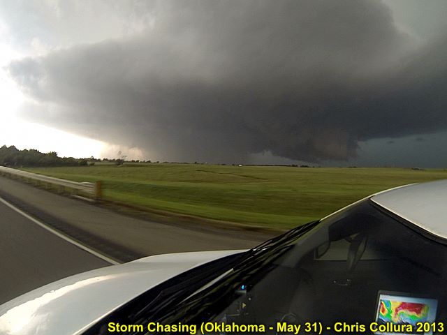
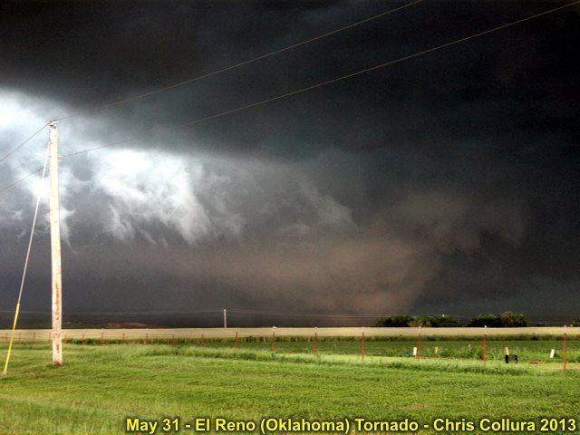
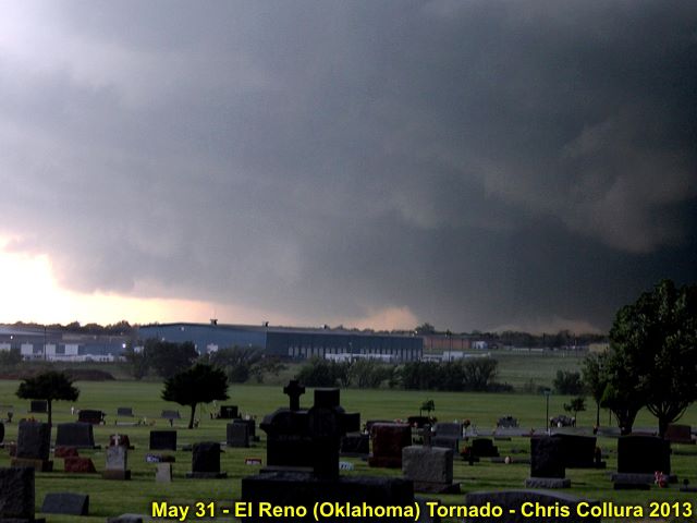
Wedge tornado moving away - Near El Reno, Oklahoma on May 31, 2013.
Posted: May 31, 2013, 11:42 PM

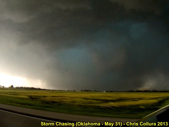
Wedge tornado - Near El Reno, Oklahoma on May 31, 2013.
Posted: May 31, 2013, 11:42 PM

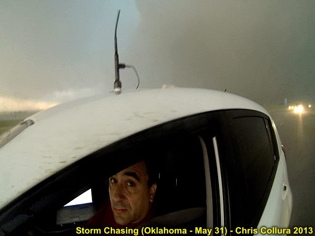
Yes - I'm scared ... A developing violent tornado is a couple of hundred of feet behind me and I'm in the 100 Kt inflow jets! Yikes! May 31, south of El Reno, OK.
Posted: May 31, 2013, 11:42 PM

Wedge tornado and chase vehicle - Near El Reno, Oklahoma on May 31, 2013.
Posted: May 31, 2013, 11:42 PM

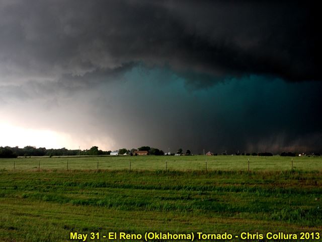
Wedge tornado with rain wrap (there is even a barely visible satellite tornado to it's right)! - Near El Reno, Oklahoma on May 31, 2013.
Posted: May 31, 2013, 11:42 PM

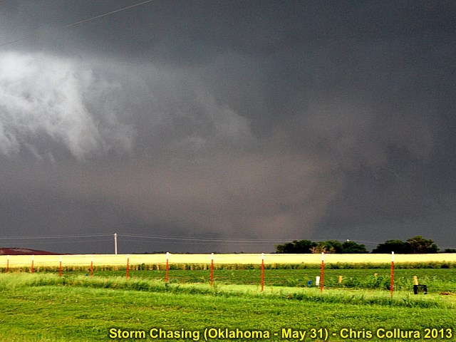
Wedge tornado approaching El Reno, Oklahoma on May 31.
Posted: May 31, 2013, 11:42 PM

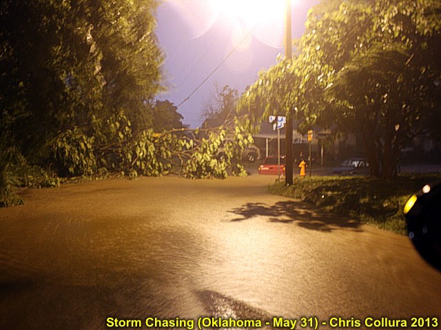
Quick shot of the flooding in suburban Oklahoma City late on May 31 ... Note the cars floating just upper-right of the center near the yellow hydrant. Trees down and flash floods! Not only 'tornadoes' :(
Posted: Jun 1, 2013, 10:22 PM

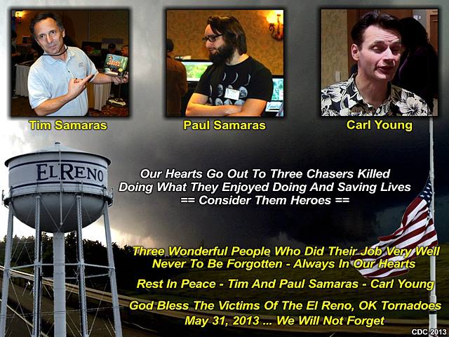
Storm chasers (and good friends of mine) Tim Samaras and his son, Paul Samaras, along with Carl Young - Perished while chasing the violent El Reno tornado on Friday, May 31, 2013. Keep these wonderful people, as well as the other victims of El Reno, Oklahoma in your prayers and thoughts. They are HEROES - Fallen and not to be forgotton. Rest in peace.
Posted: Jun 2, 2013, 8:15 AM

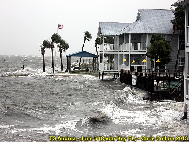
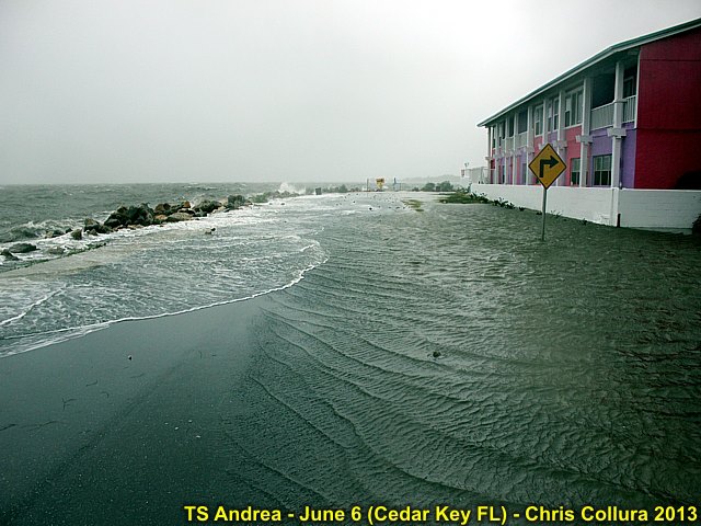
Tropical Storm Andrea and storm surge in Cedar Key, FL on June 6, 2013.
Posted: Jun 6, 2013, 3:46 PM

Tropical Storm Andrea and storm surge crossing roadway in Cedar Key, FL on June 6, 2013.
Posted: Jun 7, 2013, 1:43 PM

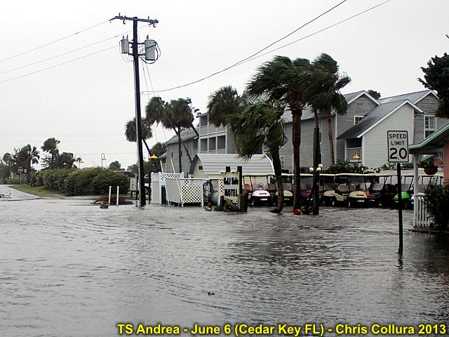
Tropical Storm Andrea and storm surge in street in Cedar Key, FL on June 6, 2013.
Posted: Jun 7, 2013, 1:43 PM

Tropical Storm Andrea and storm surge in street in Cedar Key, FL on June 6, 2013.
Posted: Jun 7, 2013, 1:43 PM

Tropical Storm Andrea and storm surge in roadway in Cedar Key, FL on June 6, 2013.
Posted: Jun 7, 2013, 1:43 PM

Tropical Storm Andrea and storm surge with local on beach bike in Cedar Key, FL on June 6, 2013.
Posted: Jun 7, 2013, 1:43 PM

Tropical Storm Andrea and storm surge in roadway / parking lot in Cedar Key, FL on June 6, 2013.
Posted: Jun 7, 2013, 1:43 PM

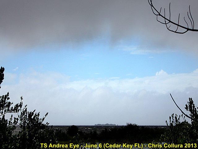
Eye / circulation center of tropical storm Andrea north of Cedar Key, FL on June 6, 2013. Note clearing and blue skies!
Posted: Jun 7, 2013, 1:43 PM

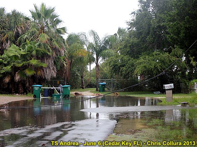
Tropical Storm Andrea and storm surge with downed powerline at residence in Cedar Key, FL on June 6, 2013.
Posted: Jun 7, 2013, 1:43 PM

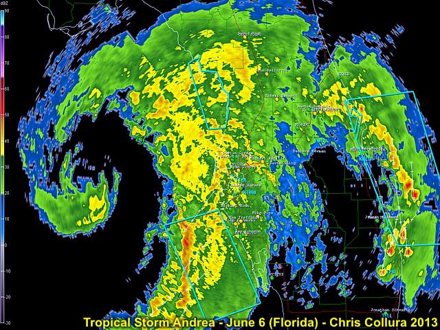
Radar image of Tropical Storm Andrea approaching NW Florida early on June 6, 2013.
Posted: Jun 7, 2013, 1:43 PM

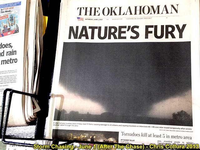
Upon leaving Oklahoma City and having breakfast on the morning of June 1, 2013 - The grim news appears in every news stand across Oklahoma.
Posted: Jun 7, 2013, 3:55 PM

An otherwise beautiful fair-weather day unfolds after the previous meteorological "mayhem" over the past couple of weeks on June 1, 2013 while doing the long drive back to Denver, Colorado. In this picture, deep blue skies and fair weather cumulus prevail over Kansas and along Interstate 70.
Posted: Jun 7, 2013, 3:55 PM

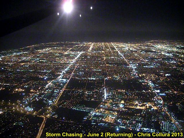
The last few moments of an epic (and sad) chase trip ... heading back into Fort Lauderdale, Florda late on June 2, 2013 and overflying the beautiful city lights (from Denver, Colorado).
Posted: Jun 7, 2013, 3:55 PM

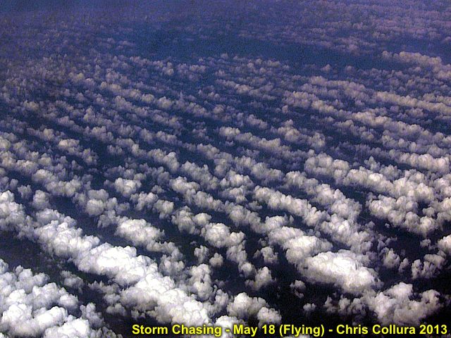
Flying out (from Fort Lauderdale, Florida to Denver, Colorado) and across the Gulf of Mexico on May 18, 2013. Note the cloud "streets" over the wam Gulf waters, denoting a long and persistant "fetch" of moisture into the Texas area ... A subtle sign of "things to come" in the central USA, as most moisture is from the Gulf of Mexico for severe weather. This was taken from a Boeing 737 at an altitude of about 38,000 feet.
Posted: Jun 7, 2013, 3:55 PM

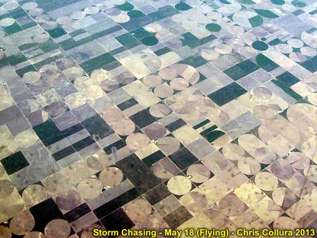
Another view taken from a Boeing 737 (from Fort Lauderdale, Florida to Denver, Colorado) at an altitude of about 38,000 feet over Kansas on May 18, 2013. The flat terrain is marked by numerous circular fields, where center point irrigation is widely used.
Posted: Jun 7, 2013, 3:55 PM

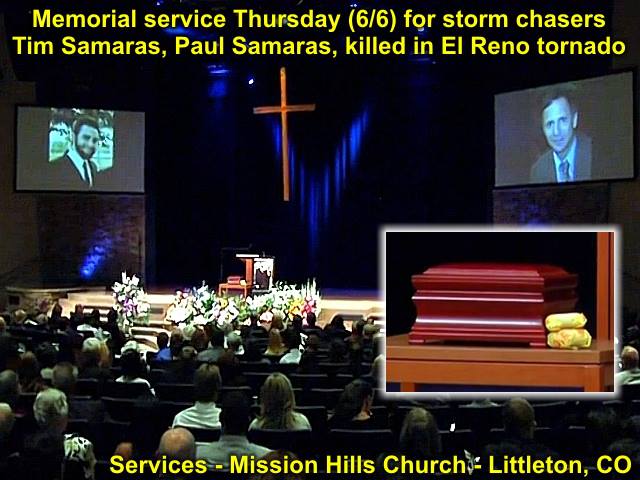
A wonderful service - Tim & Paul Samaras - June 6, 2013 in Colorado as well as Carl Young. Please visit their full link for services at http://www.thedenverchannel.com/news/local-news/memorial-service-thursday-for-stormchasers-tim-samaras-paul-samaras-killed-in-el-reno-tornado to see the service (and be ready for emotions).
Posted: Jun 11, 2013, 3:37 PM

Illuminated by lightning (and ehnanced) in this video frame grab from May 31 near El Reno, OK ... The ghostly silhouette of the satellite tornado can be seen looking northwest and just east of the "main" wedge tornado.
Posted: Jun 11, 2013, 3:41 PM

Enhanced video frame grab of the tremendous circulation to the SE of El Reno, Oklahoma on May 31. This was just to the NE of 44 and Highway 81. this tornado was HUGE!
Posted: Jun 11, 2013, 3:41 PM

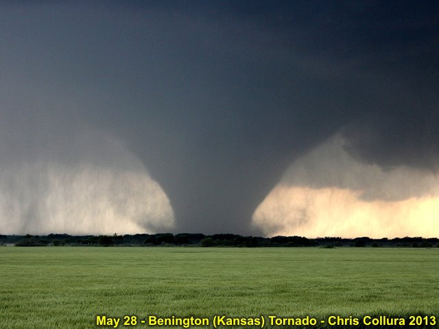
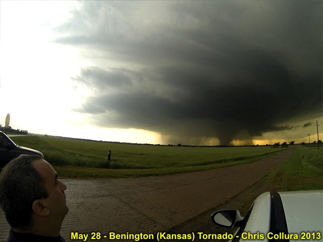
Enhanced view of the Benington, Kansas EF-4 violent tornado on May 28, 2013.
Posted: Jun 11, 2013, 3:41 PM

Touched-up view of the developing EF-5 (wedge tornado) approaching El Reno, Oklahoma on May 31, 2013.
Posted: Jun 11, 2013, 3:41 PM

Another enhanced view (and supercell structure) of the Benington, Kansas EF-4 violent tornado on May 28, 2013.
Posted: Jun 11, 2013, 3:41 PM

Myself watching in awe in an enhanced view (and supercell structure) of the Benington, Kansas EF-4 violent tornado on May 28, 2013.
Posted: Jun 11, 2013, 3:41 PM

Another enhanced view of the violent EF-5 (wedge tornado) from near Highway 81 south of El Reno, Oklahoma on May 31, 2013.
Posted: Jun 11, 2013, 3:41 PM

Just wrapped up with TWC / NBC crew shooting some B-Roll of me driving and nice interview on my storm chasing stuff! Funny seeing my apartment "transformed" into a studio for a couple hours!
Posted: Jul 15, 2013, 6:04 PM

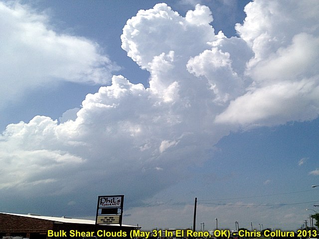
May 31, 2013 in El Reno, Oklahoma ... Towering cumulus goes up and is toppled over by the vertical wind shear! As I took this picture, Howie Bluestien was next to me - Also taking a picture ... He said "Get ready - This is the 'start of it'."
Posted: Jul 27, 2013, 5:07 PM

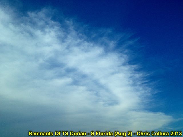
Remnants of TS Dorian in early August 2013 over S Florida. This system came all the way across the Atlantic from Africa, and the high-cloud remnants of it (after being sheared by an upper TUTT low can be seen here).
Posted: Aug 2, 2013, 6:35 AM

Remnants of TS Dorian in early August 2013 over S Florida. This system came all the way across the Atlantic from Africa, and the high-cloud remnants of it (after being sheared by an upper TUTT low can be seen here).
Posted: Aug 2, 2013, 6:35 AM

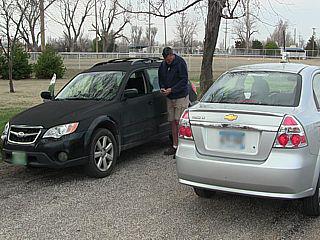
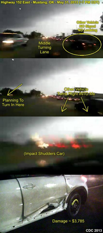
Posting this NOW after getting a really wonderful 'surprise' in my mailbox today from DTG rental asking me for $3785 ... When you are storm chasing - DON'T drive through a city!!!!! This careless SCUMBAG in this "black" car just split after hitting me ... I also found out that such 'overages' are NOT covered by other insurance - Such as the rental coverage on the credit card (but IF I declined the coverage at the counter, the credit card would have paid EVERYTHING). Oh, yeah … I have just about $3500 in my checking account right now – With rent due this week. Bring it on May 31 … You already killed 3 great scientists.
Posted: Aug 27, 2013, 4:52 PM

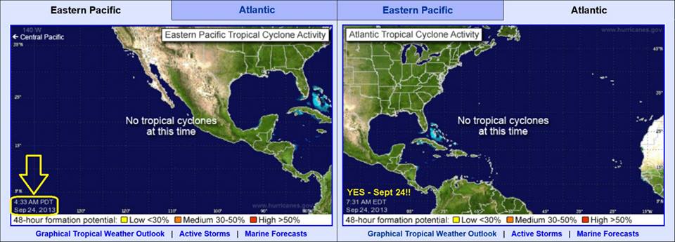
Well, It's September 24 ... Anyone who names a year when you saw THIS on September 24 gets a free espresso and a puppy...
Posted: Sep 24, 2013, 6:36 AM

First cold front - Florida on Nov 2, 2013 ... Temperature drop of 5 degrees! Woo hoo!
Posted: Nov 3, 2013, 9:12 AM
Generated by Chris Collura on Wednesday, April 15, 2020 at 11:31 AM UTC-07:00
HTML File "index30.htm" (Facebook) - Developed By Chris Collura
To Return To The HOME Page Of This Site Click The "INDEX.HTM" Link Here!


