
Facebook Photo Album Storm Chasing 2012
(Storm Chasing 2012 Sky-Chaser Chris Collura Facebook Posts)
[ PARENT INDEX ]

Tribute to chaser Andy Gabrielson ... There is NO excuse for drunk drivers - We lost a great chaser because of it. God bless and RIP - We will all miss this great young storm chaser.
Posted: Feb 8, 2012, 6:19 PM

Funny seeing this on TV while at the airport on March 2 - Just a week after "partying" with Jeff P at NSCC. Small world when it comes to storm chasing!
Posted: Mar 5, 2012, 5:11 PM
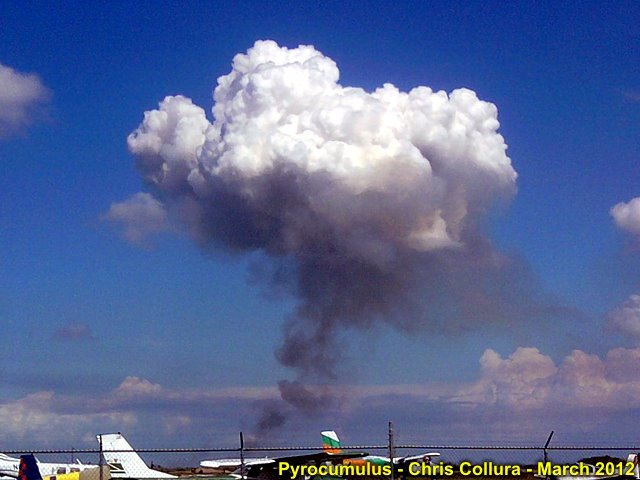
Pyrocumulus over Clewiston, FL. These cumulus clouds form over the hot thermals of a brush fire (in this case, sugar cane burning). Pyro means "fire".
Posted: Mar 15, 2012, 4:18 PM
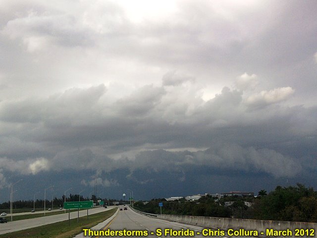
Strong thunderstorm in Broward County, Florida - March 15, 2012.
Posted: Mar 15, 2012, 4:18 PM
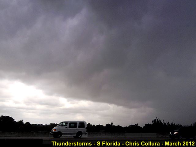
"Whale's mouth" on backside of gust front with a strong thunderstorm in Broward County, Florida - March 15, 2012.
Posted: Mar 15, 2012, 4:18 PM

Strong thunderstorm and gust front / shelf cloud in Broward County, Florida - March 15, 2012.
Posted: Mar 15, 2012, 4:18 PM

Can't wait for THIS to end...
Posted: Mar 16, 2012, 2:07 PM

Severe thunderstorm (70 MPH winds and hail to 1") affecting Hollywood, FL on April 6, 2012 (1:45 PM). Besides the whiteout conditions, note the little white pieces of hail in the lower portion of the picture.
Posted: Apr 6, 2012, 3:26 PM

Rotating wall cloud associated with the severe thunderstorm near Hollywood, FL on April 6, 2012 (about 1:30 PM).
Posted: Apr 6, 2012, 3:26 PM

How can cheap $1 (or less batteries) RUIN hundreds (or even thousands) of dollars worth of electronics? Simply leave them IN the device for a while! Trust me, they will leak electrolyte into the battery compartment, which is corrosive, and eat away at the electronics (IC's). Then you dust if off, turn it on, and nothing happens. Insert new batteries, still nothing happens when you turn it on. Take it apart, and only realize you have to throw it away (I took this picture before doing that). Luckily this was "only" a $50 FRS radio ... Lesson learned: Do NOT leave stale batteries in electronics!!
Posted: Apr 11, 2012, 4:41 PM
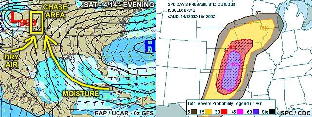
Potent 2-day outlook (moderate / high-risk) issued on 4-12 (for Saturday 4-14, 2012). Note the moisture trajectory, left, from the deep Caribbean.
Posted: Apr 12, 2012, 4:37 PM

Whoa ... Now that's really scarey!!
Posted: Apr 13, 2012, 9:12 AM
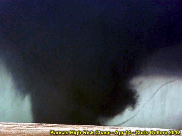
Violent motion and horizontal vortex to the right in Rice County, KS on April 14, 2012.
Posted: Apr 14, 2012, 10:49 PM

Standing in front of @[724566193:2048:Verne Carlson]'s vehicle and taking a still shot of myself with the violent tornado heading off to the NE (April 14, 2012) in rice County, Kansas.
Posted: Apr 14, 2012, 10:50 PM
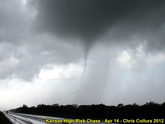
Small tornado near Rush City, Kansas on April 12, 2012.
Posted: Apr 14, 2012, 10:50 PM
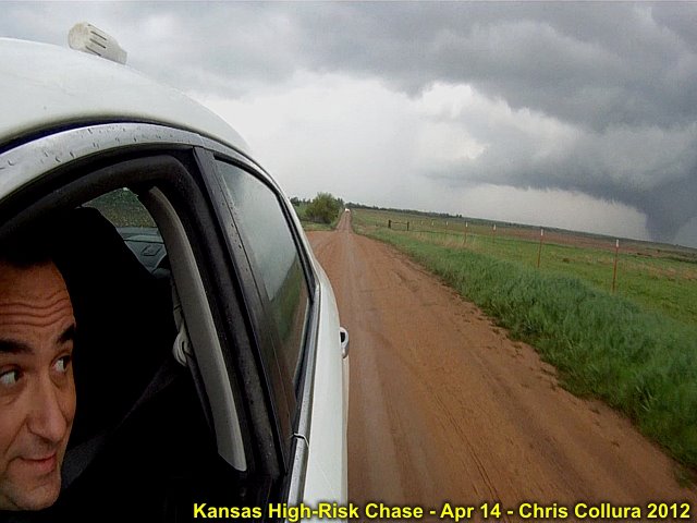
Got my GoPro shots in as well during the April 14, 2012 tornado outbreak in Kansas!
Posted: Apr 15, 2012, 5:50 PM

Rush Center (Rush County) Kansas supercell and tornado (4/14).
Posted: Apr 15, 2012, 9:20 PM
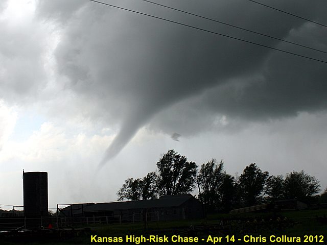
Tornado heading NE of Rush Center, KS on 4/14.
Posted: Apr 15, 2012, 9:20 PM
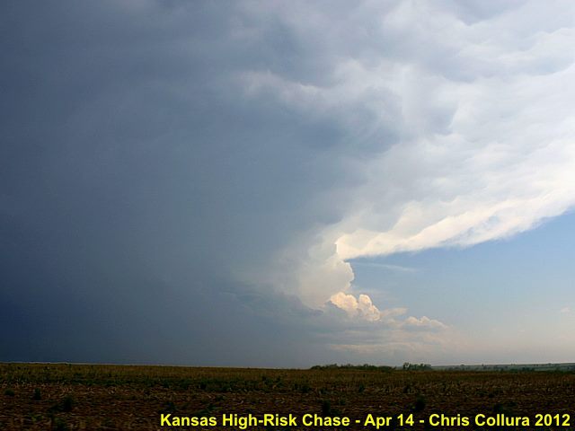
Soon-to-be violent supercell west of Chase, Kansas (4/14) ... This will produce the Rice County EF-4 long-track wedge tornado.
Posted: Apr 15, 2012, 9:20 PM
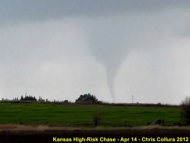
Tornado (tight shot) southeast of Rush Center, Kansas (4/14).
Posted: Apr 15, 2012, 9:20 PM
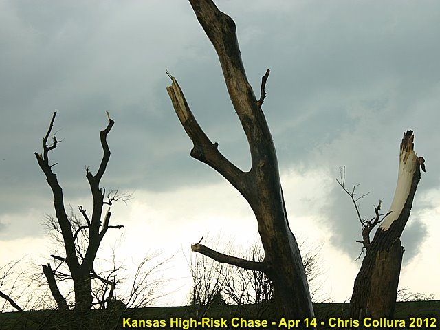
Trees debarked near EF-4 Rice County tornado (4/14).
Posted: Apr 15, 2012, 9:20 PM
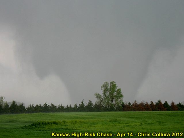
Violent tornado (4/14) near Geneseo, Kansas.
Posted: Apr 15, 2012, 9:20 PM
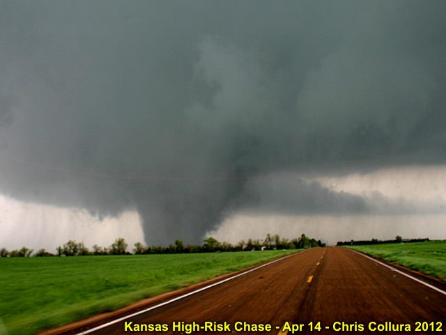
Violent EF-4 tornado near Rice County / Geneseo, Kansas on April 14.
Posted: Apr 15, 2012, 9:20 PM

Rain wrapped tornado NE of Russell, Kansas (4/14). First tornado of the high-rish day reported (it was ME) - Woo Hoo!
Posted: Apr 15, 2012, 9:20 PM
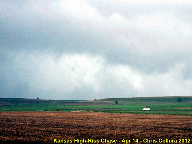
Tornado moving NNE out of Lucas, Kansas (4/14).
Posted: Apr 15, 2012, 9:20 PM

Damage to power poles near Lucas, KS.
Posted: Apr 15, 2012, 9:20 PM
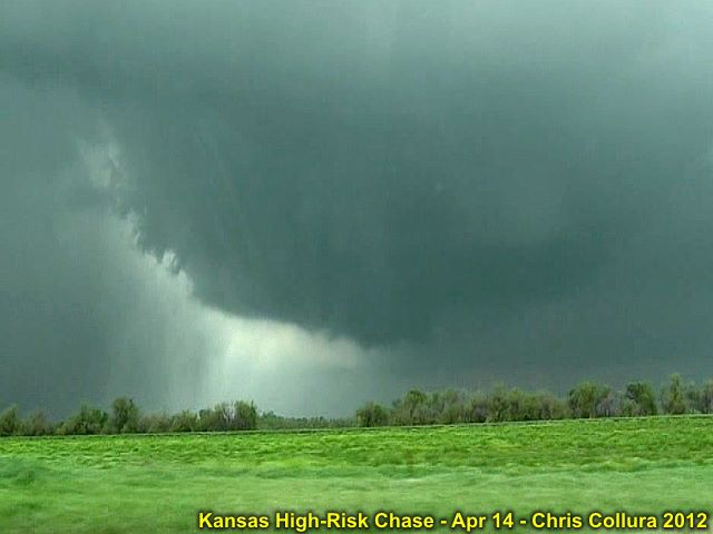
RFD and rapid development (Rice County, KS) on April 14.
Posted: Apr 15, 2012, 9:20 PM
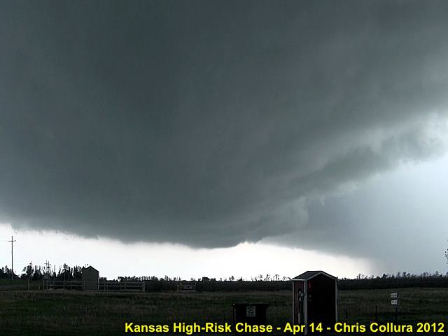
Rain-free base and RFD (right) looking south out of Lyons, Kansas on April 14.
Posted: Apr 15, 2012, 9:20 PM
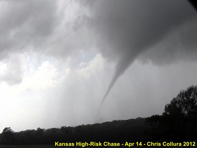
Torando between Rush Center and Bison, Kansas (4/14).
Posted: Apr 15, 2012, 9:20 PM
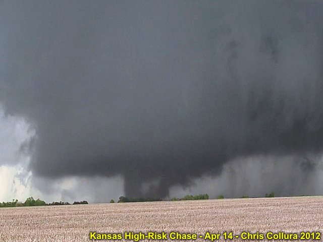
Rapid and violent tornado genesis (4/14) in Rice County, Kansas (multi-vortex stage).
Posted: Apr 15, 2012, 9:20 PM

Tornadic supercell in twighlight - Illuminated by lightning SE of Abilene, Kansas on April, 14.
Posted: Apr 15, 2012, 9:20 PM

Verne Carlson and his group enjoying the violent tornado in a field in front of them near Geneseo, Kansas on 4/14.
Posted: Apr 15, 2012, 9:20 PM

Violent (EF-4) Rice County tornado crossing Highway 14 on 4/14. Pavement being scoured about this time!
Posted: Apr 15, 2012, 9:20 PM
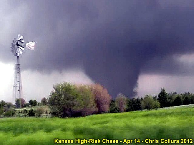
Classic tornado shot with windmill and country farmstead - Near Geneseo, Kansas (4/14).
Posted: Apr 15, 2012, 9:20 PM
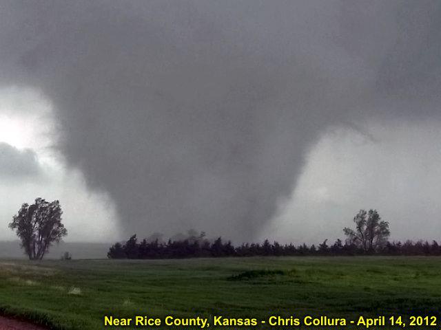
View of violent EF-4 tornado in open field near Geneseo, Kansas (4/14).
Posted: Apr 17, 2012, 4:54 PM
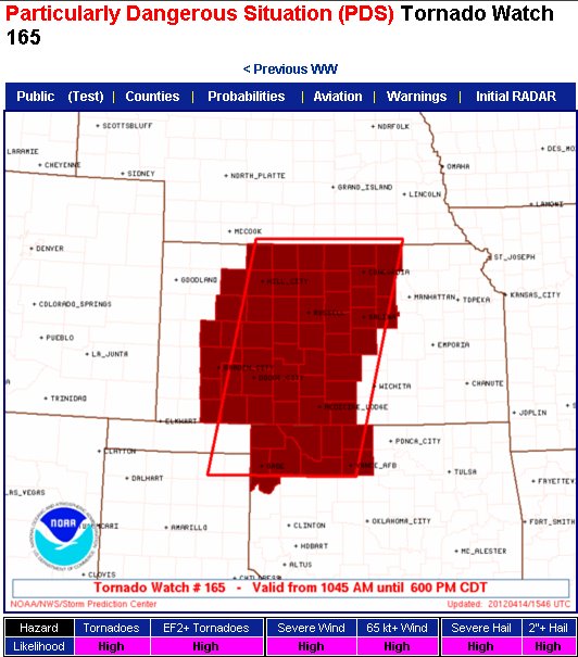
Again ... Like in May 2010 = Probabilities "Pegged" on April 14, 2012 (KS / OK)!
Posted: Apr 17, 2012, 4:55 PM

All over the news at the CNN airport TV's on April 15.
Posted: Apr 18, 2012, 6:24 PM

Distant supercell / anvil - April 13, 2012 viewed from the air.
Posted: Apr 18, 2012, 6:24 PM
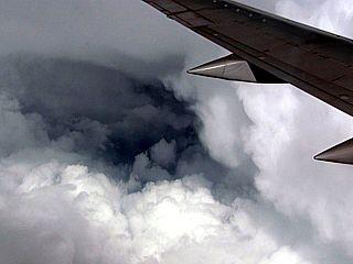
Flying between some supercells on April 15, 2012 heading back to FL.
Posted: Apr 18, 2012, 6:24 PM
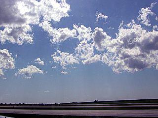
Dryline cumulus (4/15) near Kansas City.
Posted: Apr 18, 2012, 6:24 PM

One of the mom and pop motels near Witchita Kansas (4/13).
Posted: Apr 18, 2012, 6:24 PM
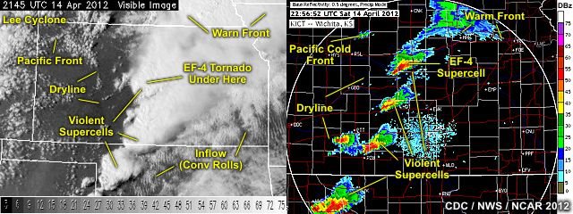
Satellite and radar reports for 4/14/2012 over Kansas.
Posted: Apr 18, 2012, 6:24 PM

High risk (4/14) - How high can U go?
Posted: Apr 18, 2012, 6:24 PM
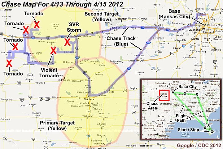
Chase track for 4/13 through 4/15 in Kansas.
Posted: Apr 18, 2012, 6:24 PM
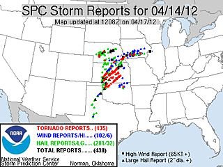
Storm reports (4/14) by SPC.
Posted: Apr 18, 2012, 6:24 PM

Ttitle page for 4/14 chase.
Posted: Apr 18, 2012, 6:24 PM
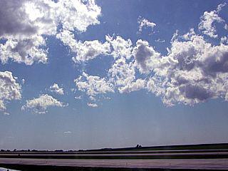
The clouds "stop" at the dryline boundary (April 15 near Kansas City).
Posted: Apr 19, 2012, 4:22 PM

This jet (contrail) is going between two tornadic supercells (4/14) east of Rush Center, Kansas.
Posted: Apr 19, 2012, 4:22 PM
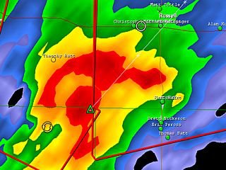
First HP supercell near Russell, Kansas (4/14).
Posted: Apr 19, 2012, 4:22 PM

Just exited the east side of the "flying eagle" (4/14) near Lyons, KS.
Posted: Apr 19, 2012, 4:22 PM
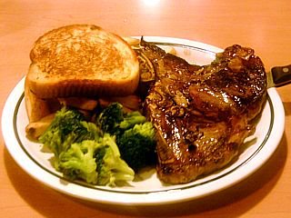
The more successful a tornado chase is = The more steak there is to be enjoyed!
Posted: Apr 19, 2012, 4:22 PM
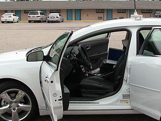
Preparing for the 4/14 tornado outbreak chase ... I managed NOT to break anything on this vehicle ;-)
Posted: Apr 19, 2012, 4:22 PM
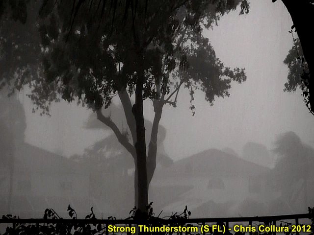
Much needed rain moves into south Florida for the weekend of April 20-22.
Posted: Apr 20, 2012, 6:35 PM
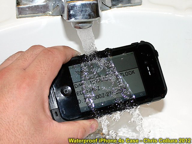
This new iPhone 4s with it's "Lifeproof" case can be submerged in up to nearly 7 feet of water (I would not try that though), but it's a great case for hurricane / storm chasing to say the least - Especially with the mobile wifi hotspot.
Posted: Apr 26, 2012, 7:44 AM

Posted: Apr 30, 2012, 8:20 PM
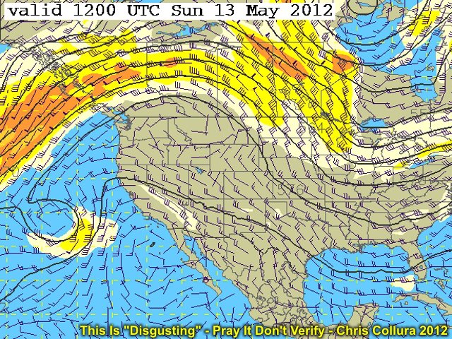
This is what the GFS is showing (as of May 7) for a week out ... This is definitely NOT something us storm chasers want to see for the rest of May. Hopefully this will pass and / or not verify...
Posted: May 7, 2012, 10:35 AM
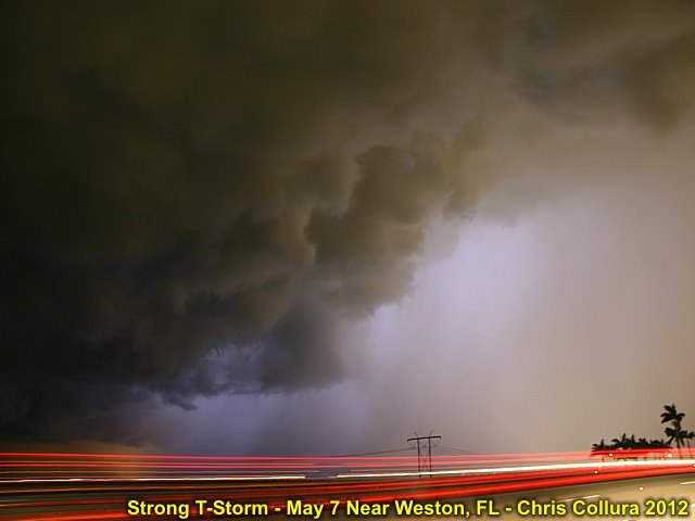
30 second time-exposure of a strong thunderstorm near Weston, Florida on May 7, 2012 (9:30 PM). I was "trying" to get some lightning bolts in there, but I was surprised to see this beautiful rain-free base and precip-core to its right!
Posted: May 7, 2012, 7:57 PM
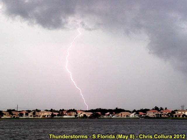
Thunderstorms - South Florida (Sunrise) on May 8, 2012.
Posted: May 8, 2012, 4:46 PM

Thunderstorms - South Florida (Sunrise) on May 8, 2012.
Posted: May 8, 2012, 4:46 PM
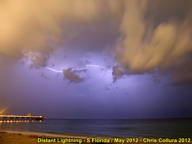
Actually NOT an HDR shot. This was a long 2 minute exposure over the ocean off Broward County, Florida on May 10 at about 10 PM, so the clouds are illuminated by light "pollution" and the CC lightning "filled" in the rest!
Posted: May 11, 2012, 7:34 AM
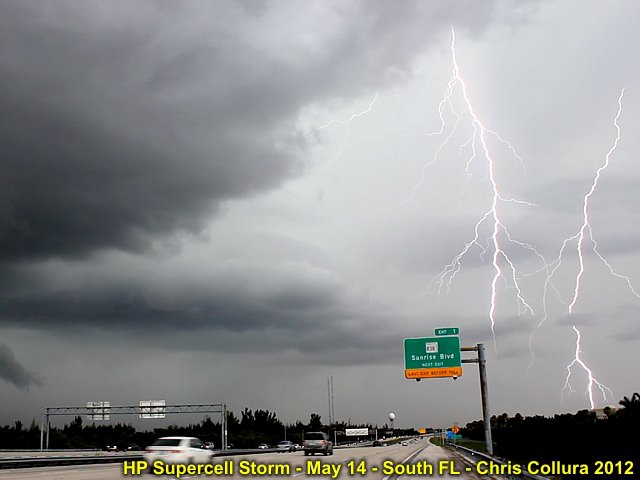
Intense positive CG's northeast of the severe storm west of Sunrise, Florida on May 14, 2012.
Posted: May 14, 2012, 5:05 PM

Another intense CG to the northeast of the severe storm near Sunrise, FL on May 14, 2012.
Posted: May 14, 2012, 5:05 PM
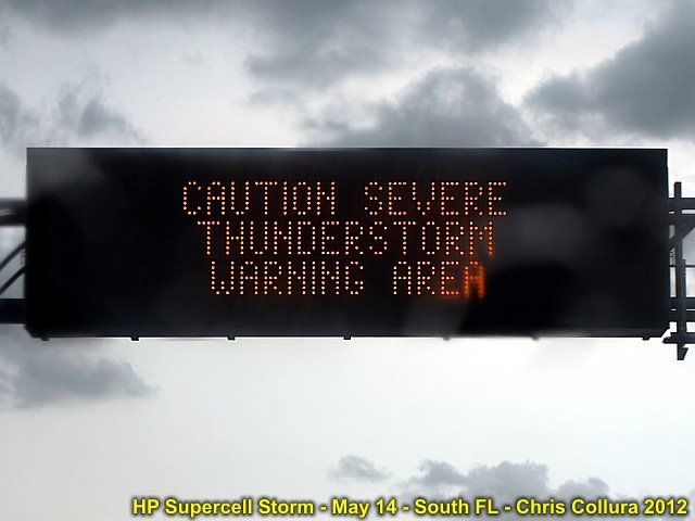
Traffic updates on a severe thunderstorm in the area. South Florida, May 14, 2012.
Posted: May 14, 2012, 5:05 PM
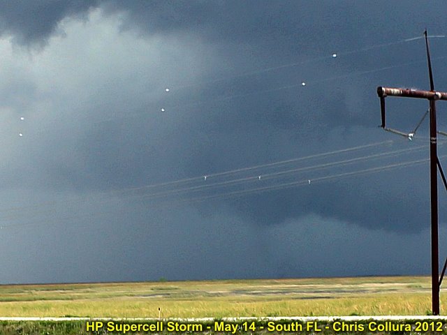
Not sure what this is, but it's in the correct place for a tornado! RFD cut to the upper left, lowering and "something" on the ground under it? Severe HP supercell storm over FL Everglades west of Sunrise on May 14, 2012. The view os to the NW.
Posted: May 14, 2012, 5:05 PM
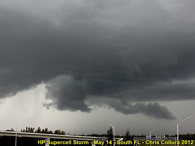
Interesting view of the weakening mesocyclone (view is to WNW) associated with an HP severe storm west of Sunrise, FL (May 14).
Posted: May 14, 2012, 5:05 PM
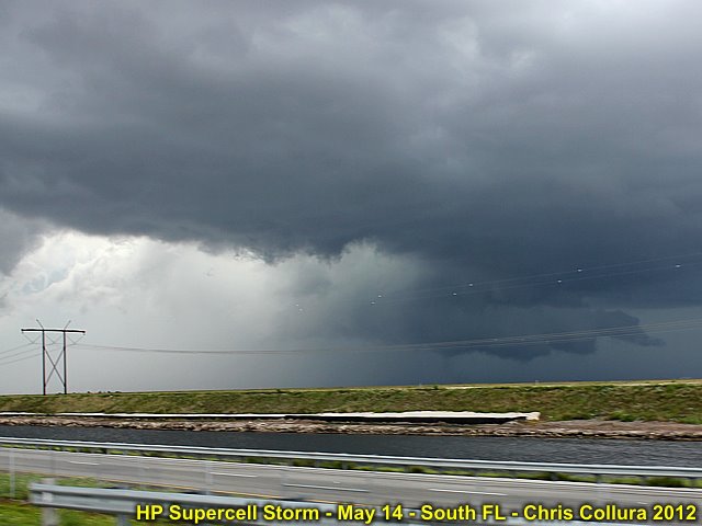
View of HP supercell (looking NW) west of Sunrise, FL on May 14. Well-defined RFD clear slot and wall cloud with funnels.
Posted: May 14, 2012, 5:05 PM
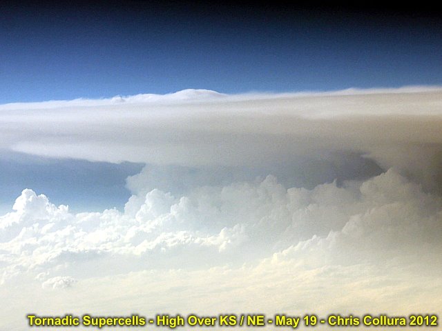
Over Kansas / Nebraska en route to Denver (from Chicago). Looks like a tornadic supercell viewed from high altitude to me! Picture taken May 19, 2012 at about 7 PM CDT.
Posted: May 19, 2012, 8:40 PM
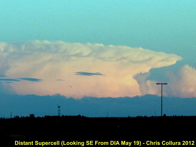
Distant view of supercell storm from near denver International Airport on May 19, 2012. View is to the SE of a storm at least 100 miles away.
Posted: May 19, 2012, 8:40 PM

Annular eclipse about 75% as seen through a dark-filter just west of Albuquerque, New Mexico during the late afternoon. Note the sunspots!
Posted: May 20, 2012, 8:56 PM

Same eclipse about 95% seen through dark filter in new Mexico.
Posted: May 20, 2012, 8:56 PM
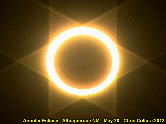
Full annular eclipse with "ring of fire" effect. The "star of David" is caused by the lens flare from a neutral density filter.
Posted: May 20, 2012, 8:56 PM
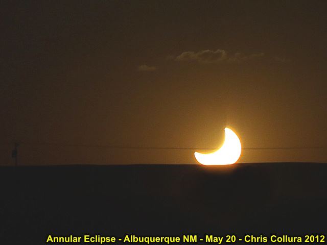
The sun set with about 50% partiality remaining (after total annular for about 4 minutes). Basically, it's HALF of a sunset!
Posted: May 20, 2012, 8:56 PM

Strongly dimmed sunlight with eclipse watchers (umbraphiles) lining the roadway atop a mountain west of Albuquereque, NM.
Posted: May 20, 2012, 8:56 PM
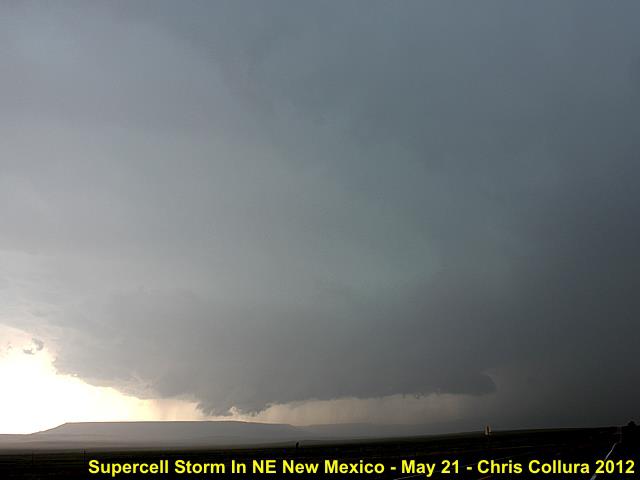
Supercell near Highway 56 and I-25 in NE New Mexico.
Posted: May 22, 2012, 2:29 AM

Rotating wall cloud / funnels from supercell in NE New Mexico (just west of I-25 on Highway 56 near Miami, NM).
Posted: May 22, 2012, 2:29 AM
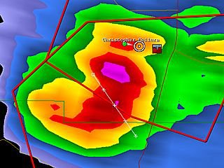
NE New Mexico - May 21, 2012.
Posted: May 22, 2012, 7:33 AM

Posted: May 22, 2012, 7:33 AM
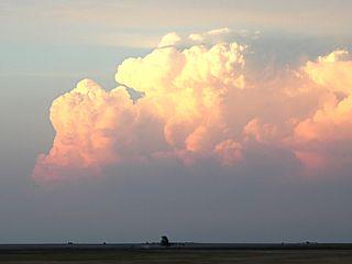
Supercell near Johnson, Kansas (May 21, 2012).
Posted: May 22, 2012, 7:33 AM
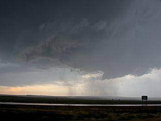
RFD and wall cloud "Bear's Cage" southwest of Springer, NM - May 21, 2012.
Posted: May 22, 2012, 7:33 AM

Supercell storm north of Minot, ND at about 8 PM CDT on May 22 (the sun sets at 9:30 PM there)!
Posted: May 23, 2012, 12:38 AM

Supercell storm north of Minot, ND attempts to produce a tornado with a rapidly rotating wall cloud on May 22.
Posted: May 23, 2012, 12:38 AM
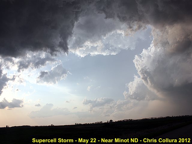
Huge RFD clear slot of supercell storm north of Minot, ND - May 22.
Posted: May 23, 2012, 12:39 AM
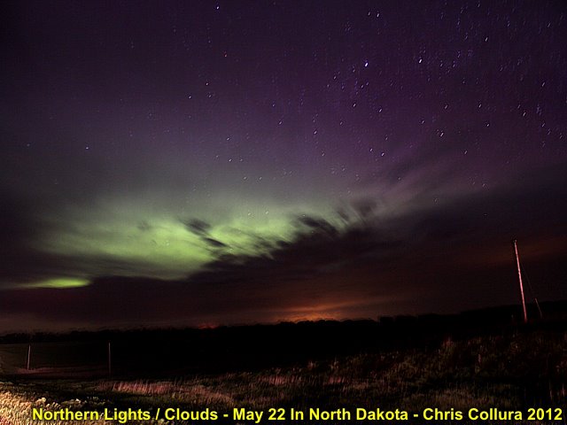
Looking northeast from near Fresseden, ND on May 22 ... I finally get to see the northern lights (and try to photograph them) for the first time in my life! Too bad the sky wasn't perfectly clear.
Posted: May 23, 2012, 12:47 AM

Another self-portrait of myself chasing with a wall cloud forming out the window (Nebraska on may 23).
Posted: May 23, 2012, 10:05 PM

Rotating wall cloud north of Northbend, NE on may 23.
Posted: May 23, 2012, 10:05 PM
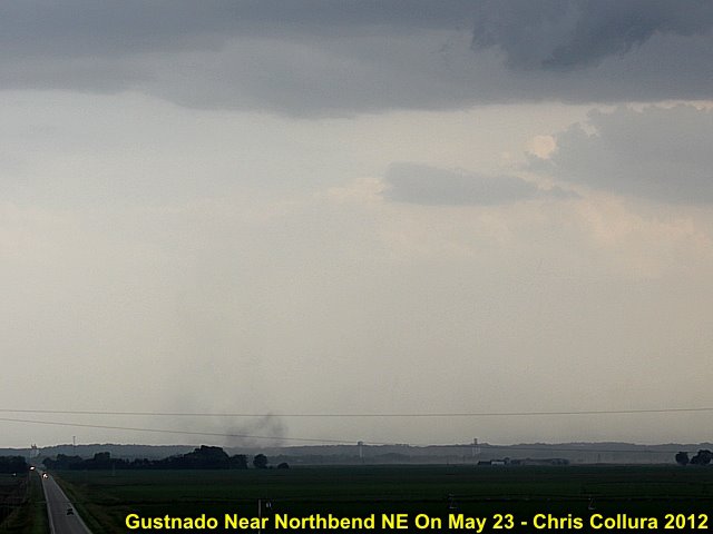
Gustsnado along RFD gust front of supercell storm north of Northbend, NE on May 23.
Posted: May 23, 2012, 10:05 PM
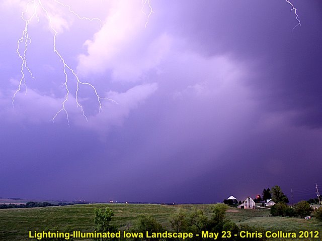
A big CG hits BEHIND me illuminating the landscape in western Iowa on May 23 at about 10 PM (the "forks" can be seen in the top of the photo)!
Posted: May 23, 2012, 10:05 PM
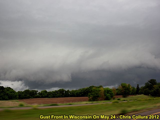
Wisconsin (near Eau Claire / Osseso) outflow-dominated severe storm on May 24.
Posted: May 24, 2012, 11:15 PM

Sunset and wind turbine east of Oniel, NE on May 26.
Posted: May 26, 2012, 10:23 PM

LP storm and wind turbine east of Oniel, NE on May 26.
Posted: May 26, 2012, 10:23 PM

Severe storm near Rochester, MN on May 26.
Posted: May 26, 2012, 10:23 PM

Wisconsin landscape (May 25) while I was "stuck there".
Posted: May 26, 2012, 10:23 PM

Posted: May 28, 2012, 11:18 AM

Posted: May 28, 2012, 11:18 AM
Posted: May 28, 2012, 11:26 AM
Posted: May 28, 2012, 11:26 AM
Posted: May 28, 2012, 11:26 AM
Posted: May 28, 2012, 11:26 AM

Posted: May 29, 2012, 6:53 AM
Posted: May 29, 2012, 6:53 AM

Posted: May 29, 2012, 6:58 AM
Posted: May 29, 2012, 6:58 AM

Posted: May 29, 2012, 6:58 AM
Posted: May 29, 2012, 6:58 AM

Posted: May 29, 2012, 6:58 AM
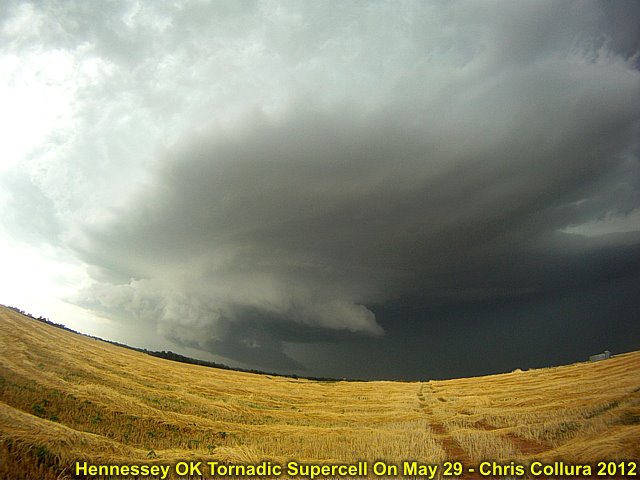
Developing tornadic supercell storm near Hennessey, OK on May 29.
Posted: May 29, 2012, 11:14 PM
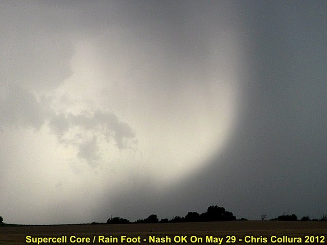
Intense rain foot from a supercell storm near Nash, OK on May 29.
Posted: May 29, 2012, 11:14 PM
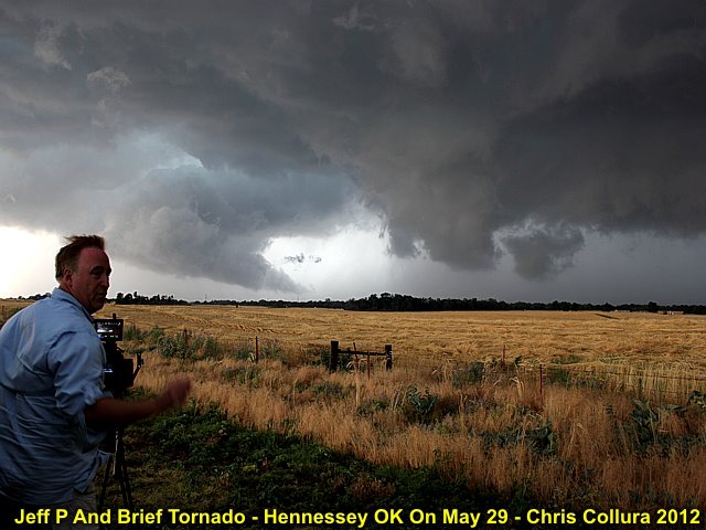
Jeff Pitrowski watching a brief tornado forming near Hennessey, OK on May 29.
Posted: May 29, 2012, 11:14 PM
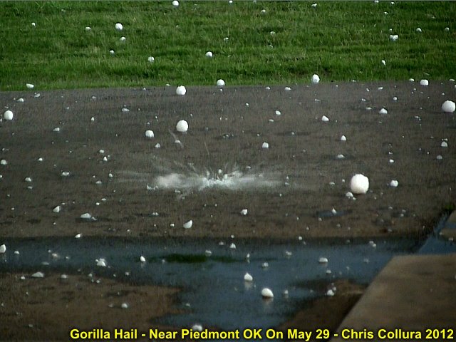
Gorilla hail falling near Piedmont, OK from a tornadic supercell storm on may 29. This hail whistled as it fell, and impacted like a shot-gun sound!
Posted: May 29, 2012, 11:14 PM
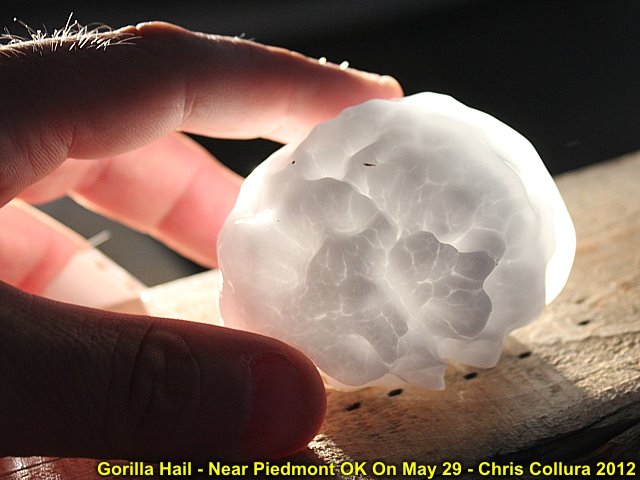
May 29 near Piedmont, OK ... This was one of the SMALLER pieces!
Posted: May 29, 2012, 11:14 PM

Barely visible view of the Piedmont tornado through heavy rain and giant hail on may 29!
Posted: May 29, 2012, 11:14 PM
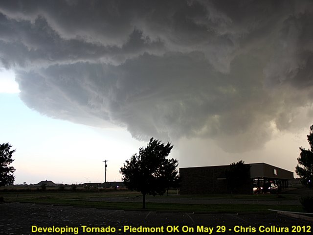
Tornado forming near Piedmont, OK on May 29 (with hail up to 5" falling)!
Posted: May 29, 2012, 11:14 PM
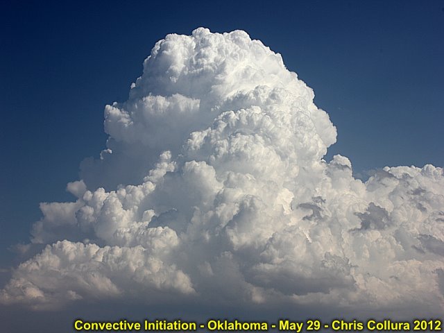
Cap is gone, and initiation underway on May 29 to the SE of Alva, OK.
Posted: May 30, 2012, 2:08 AM
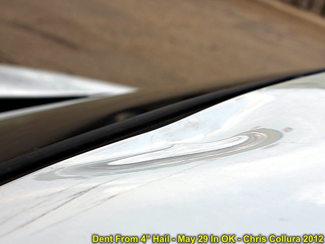
Dent from 4+ inch hail on May 29 near Piedmont, OK. How this did not take out the windshield is beyond me.
Posted: May 30, 2012, 8:17 PM
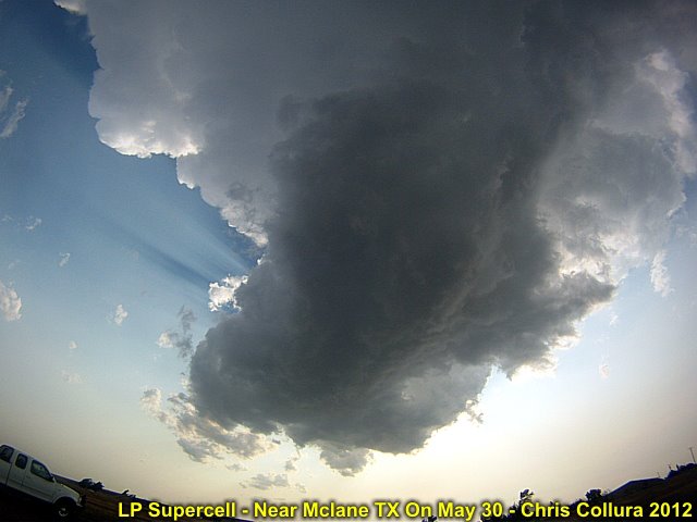
LP supercell struggling to the NW of McLane, Texas on May 30.
Posted: May 30, 2012, 8:17 PM

Panorama of the supercell near Hennessey, OK on May 29. This storm briefly produced a tornado, but the southern cell later near Piedmont was more powerful.
Posted: May 31, 2012, 6:49 PM

Mammatus clouds near Dalhart, TX on June 1, 2012.
Posted: Jun 2, 2012, 8:01 AM
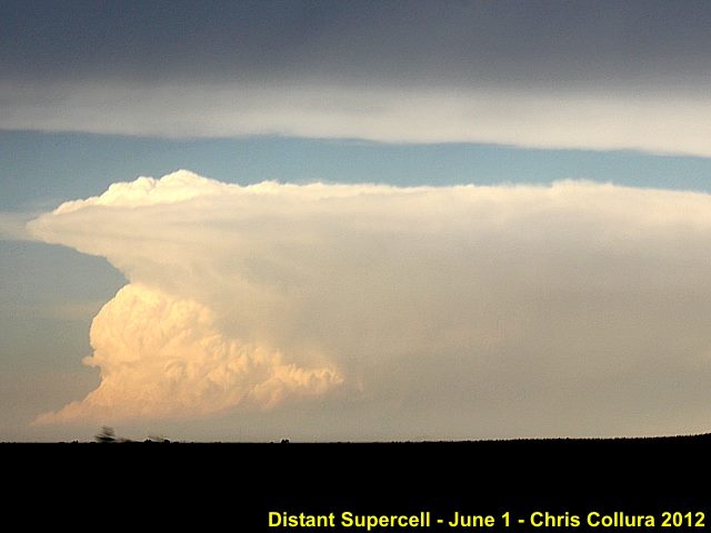
Distant supercell to the northeast (near the OK / TX / KS borders) on June 1.
Posted: Jun 2, 2012, 8:01 AM
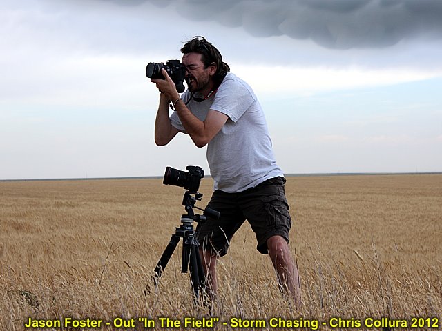
@[1267634230:2048:Jason Foster] standing in the filed near Stratford, TX on June 1 shooting pictures of a developing supercell.
Posted: Jun 2, 2012, 8:01 AM
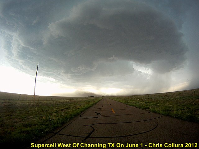
Supercell west of Channing, Texas on June 1. Note the RFD dust plume.
Posted: Jun 2, 2012, 8:01 AM
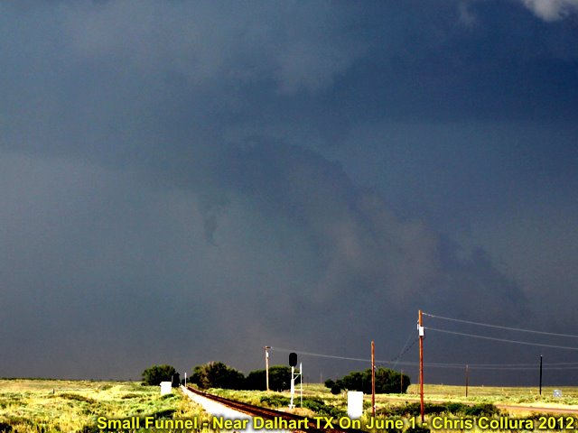
Small funnel cloude developing near Dalhart, Texas on June 1.
Posted: Jun 2, 2012, 8:01 AM

High based severe storms developing off the front-range on June 2 and moving NE into the Denver CO area. This storm will produce a derecho-like downdraft with winds from 60 to 80 MPH.
Posted: Jun 4, 2012, 6:46 AM
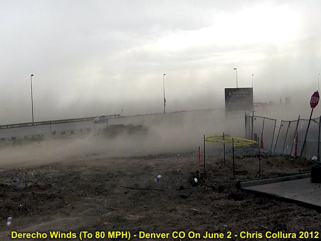
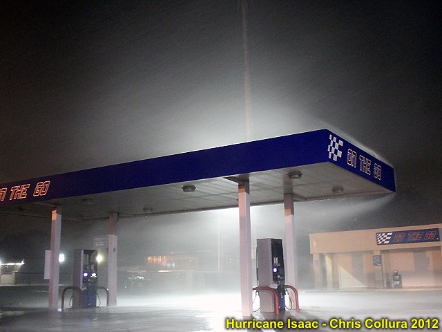
Winds at least 60 MPH and higher hit the Denver International Airport area (off Pena Blvd) at a gas station and kick up dust / debris on June 2.
Posted: Jun 4, 2012, 6:46 AM
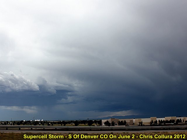
High based supercell storm developing S of Denver, CO on June 2 in upslope flow ahead of the front range.
Posted: Jun 4, 2012, 6:46 AM
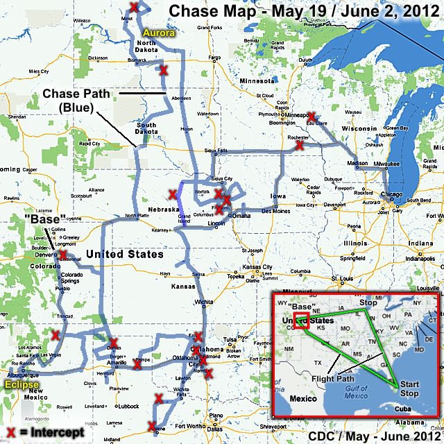
Like the old 'Beach Boys' Song...Round round get around ... I get aroundYeah ... Get around round round I get aroundI get aroundThat's my 2-week chase log in Late May 2012!
Posted: Jun 6, 2012, 4:42 PM

Cool pool and associated arcus cloud expanding from a weakening thunderstorm near Miami, FL on June 9.
Posted: Jun 9, 2012, 4:36 PM

Powerful updraft SE of Belle Glade, FL on June 9.
Posted: Jun 9, 2012, 4:36 PM

Single-cell severe warned storm west of Coral Springs, FL on June 9. Note developing hail shaft!
Posted: Jun 9, 2012, 4:36 PM
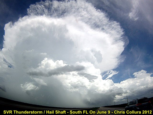
SVR storm west of Coral Springs, FL on June 9 with prominant hail shaft.
Posted: Jun 9, 2012, 4:36 PM

Interesting low pressure showing up on the KFDR (Oklahoma) radar loop on June 11, 2012.
Posted: Jun 11, 2012, 1:54 PM
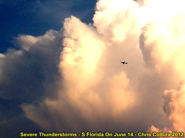
Close up shot of severe storm updradft (over Miami-Dade) in Florida on June 14 with aircraft.
Posted: Jun 14, 2012, 8:17 PM
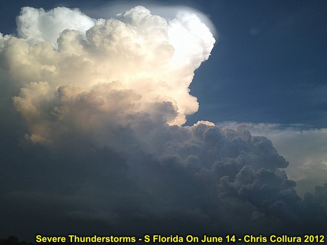
Developing severe thunderstorm over Miami-Dade county in S Florida on June 14, 2012.
Posted: Jun 14, 2012, 8:17 PM

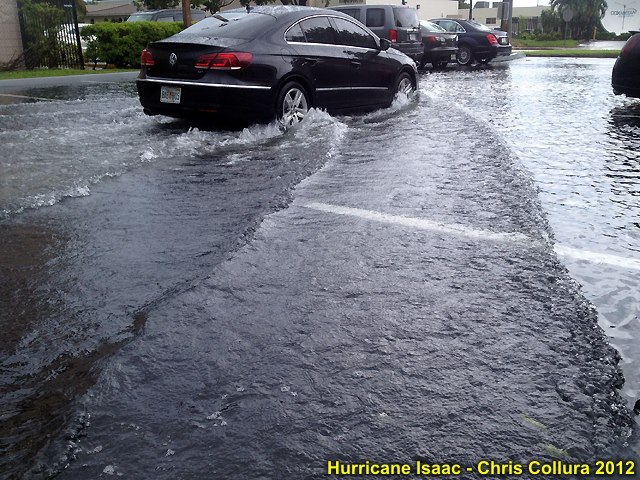
Street flooding under severe-warned thunderstorm in Miami-Dade county on June 14.
Posted: Jun 14, 2012, 8:17 PM
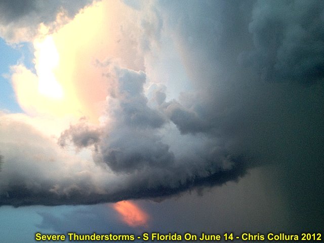
Interesting inflow band on the north side of a severe warned thunderstorm over Miami-Dade county, FL on June 14.
Posted: Jun 14, 2012, 8:17 PM

Updraft base and precip-core of a severe thunderstorm over Miami-dade county (S Florida) on June 14.
Posted: Jun 14, 2012, 8:17 PM

Storm updraft base of severe thunderstorm over Miami-Dade county, Florida on June 14.
Posted: Jun 14, 2012, 8:17 PM
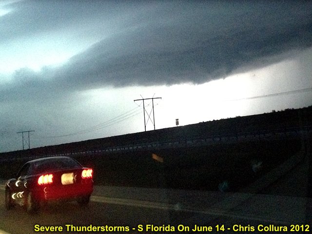
Updraft base (weak rotation) with a severe warned thunderstorm north of Weston, Florida on June 14 after dark (lightning illuminated).
Posted: Jun 14, 2012, 8:17 PM

Aircraft circumnavigating a severe thunderstorm over Miami-Dade county, Florida on June 14.
Posted: Jun 14, 2012, 8:18 PM
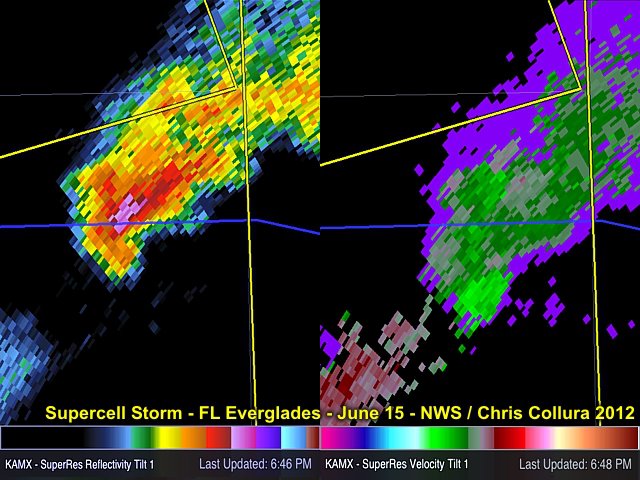
Radar image of the June 15 LP supercell over the FL Everglades in W Broward County. The blue line is I-595, the same road you see looking west in the pictures of the storm. Nice hooking in the reflectivity and precip core!
Posted: Jun 15, 2012, 5:44 PM
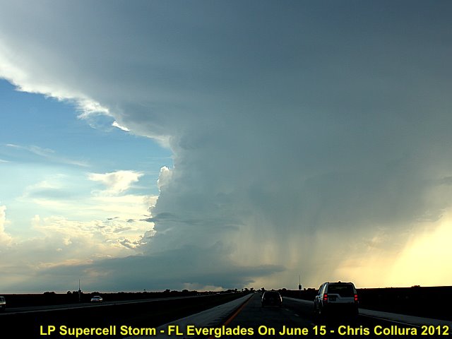
Caught this little LP storm over the Florida Everglades during the early ervening of June 15 - No, this is in South Florida and NOT West Texas! Note the developing wall cloud and little beaver's tail - View is due W.
Posted: Jun 15, 2012, 5:44 PM
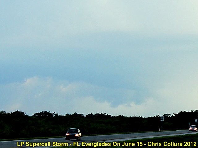
Close up of wall cloud on the June 15 Everglades storm ... Small funnel and RFD cut clearly visible.
Posted: Jun 15, 2012, 5:44 PM
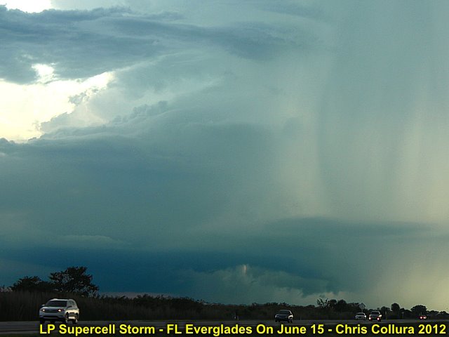
Here is the "business end" of the LP supercell over the FL Everglades on June 15. Well-defined RFD developing, with striated updraft tower.
Posted: Jun 15, 2012, 5:44 PM
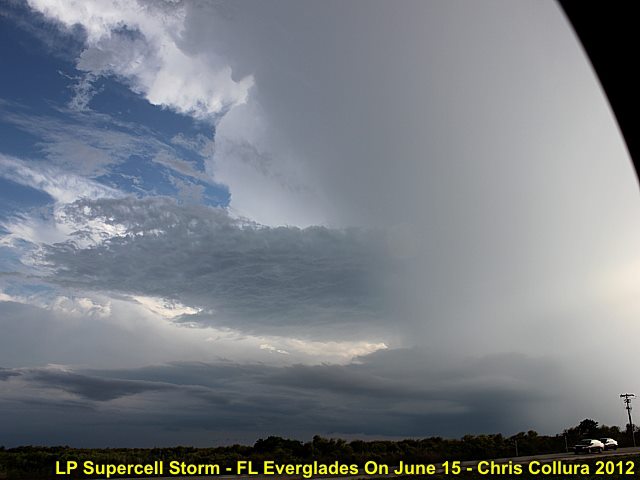
Later stages of the LP (June 15) storm, evolving to classic / HP structure (still moving SSE over the FL Everglades). This storm had multi-level inflow bands!
Posted: Jun 15, 2012, 5:44 PM

Wider view of LP storm on June 15 evolving to classic / HP with developing mid-level inflow features.
Posted: Jun 15, 2012, 5:44 PM
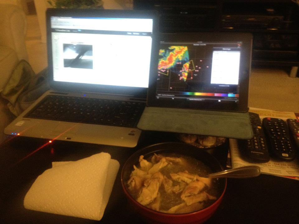
Soup and supercells ... Arm chair chasing watching SD - Thanks streamers!
Posted: Jun 17, 2012, 5:21 PM
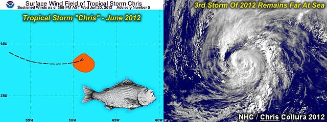
You would think the THIRD named tropical storm of the 2012 Atlantic hurricane season would have my name (tropical storm "Chris") on it and be something to chase? Nope, another storm far from any land and a weak system that churned away in the far north Atlantic. The 2012 tropical season has got off to a busy start, with two named systems BEFORE June 1 (the official start of the Atlantic hurricane season) forming in the Atlantic basin.Tropical storm Chris, the third named storm of the season, formed in the north Atlantic on June 19, 2012. It bothered no one as it remained well out to sea (what hurricane chasers call a "fish storm"). Keep track of any tropical systems and hurricanes (and plans to chase them) with my TROPICAL WEATHER page in the STORM CHASING section of my main web site, or click the link below to go right to it ... http://www.sky-chaser.com/tropics.htm
Posted: Jun 20, 2012, 2:08 PM

Here's tropical storm "Debby" from the air with an annotated satellite image (IR) at the time I was flying past her (from Toronto to Miami) on 6/25.
Posted: Jun 25, 2012, 2:20 PM
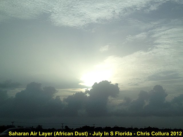
The Saharan Air Layer (Or SAL) is caused by dust from Africa (Sahara Desert) advected across the tropical Atlantic by the easterly trade winds. It's common in July / August in FL and the Caribbean. The dust appears as a haze across the sun, also note the "capped" cumulus caused by the trade wind inversion.
Posted: Jul 27, 2012, 5:06 PM
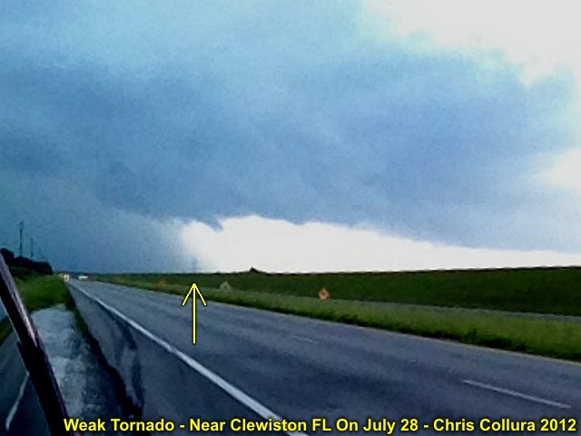
Not the best of pictures (sure were caught off guard with these king of things) ... But a small tornado was observed after skydiving near Clewiston FL from Highway 98 on the SW side of Lake Okeechobee, FL. This was the dissipating tornado, which lasted a mere 25 seconds during the afternoon of July 28, 2012.
Posted: Jul 28, 2012, 4:30 PM

Interesting "swirl" in the sky over S Florida on Aug 10, 2012 (after a round of sea-breeze thunderstorms). Mid-level "eddy" possibly?
Posted: Aug 10, 2012, 3:51 PM

Severe warned storm (Broward County, FL) on Aug 17, 2012. Gust front looking to the East.
Posted: Aug 17, 2012, 4:00 PM
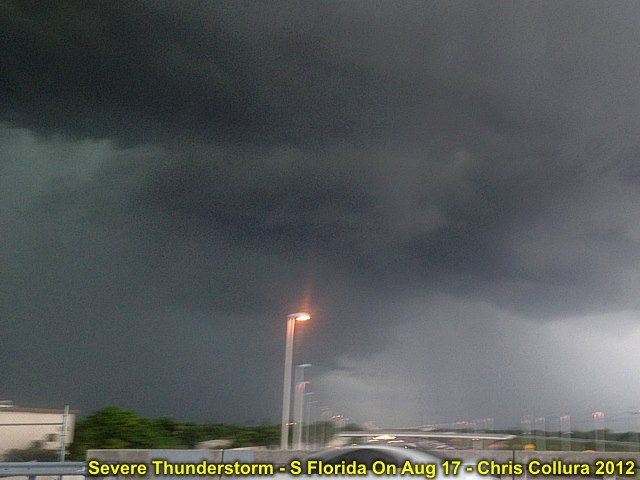
Updraft of severe storm on Aug 17, 2012 near Broward County in S FL. Note slight area of rotation (just above light pole). View is north.
Posted: Aug 17, 2012, 4:00 PM
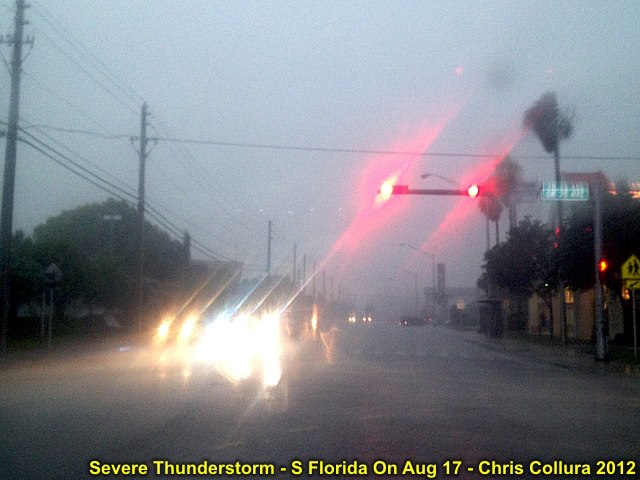
Winds up to 50 MPH, small hail, and heavy rain in Broward County, FL on Aug 17.
Posted: Aug 17, 2012, 4:00 PM
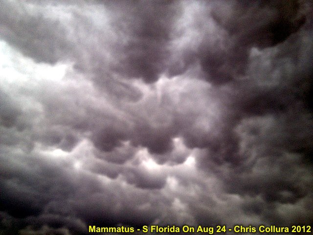
The boundary passed through S Florida on Aug 24 between the dry SAL layer and tropical air mass (containing TS Isaac within it). T Storms erupted near this wind shift line and presented a beautiful mammatus display at around 6:30 PM.
Posted: Aug 24, 2012, 4:34 PM

Eyeing Issac ... As of Aug 24 - Possible BUSY weekend / early week ahead!
Posted: Aug 24, 2012, 4:46 PM

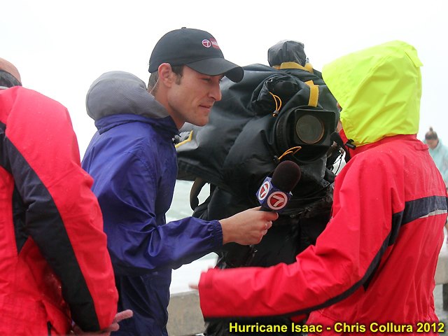
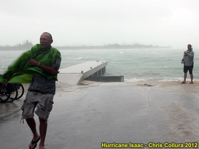
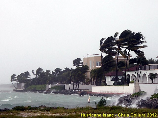
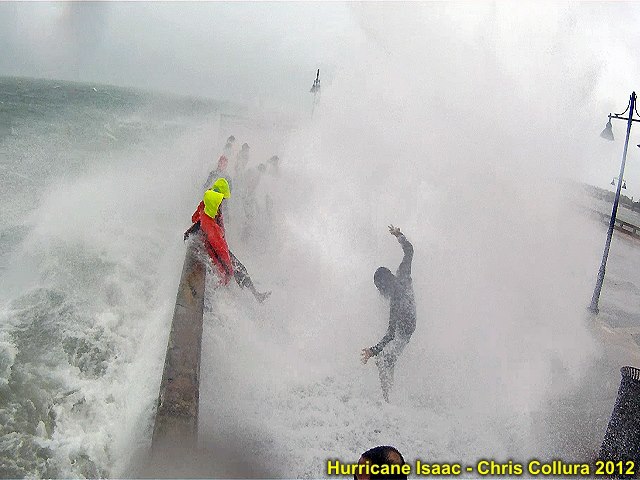
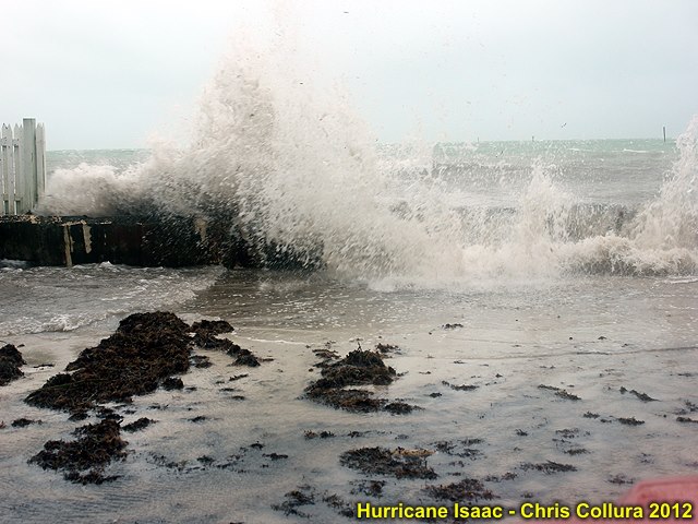
Waves from TS Isaac crashing over end of pier in Key West (Aug 26, 2012).
Posted: Aug 26, 2012, 9:15 PM
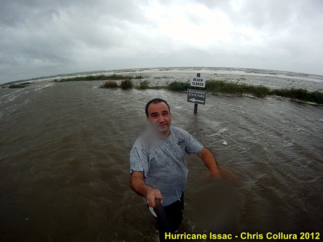
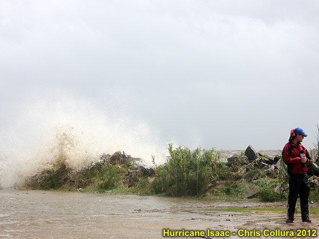
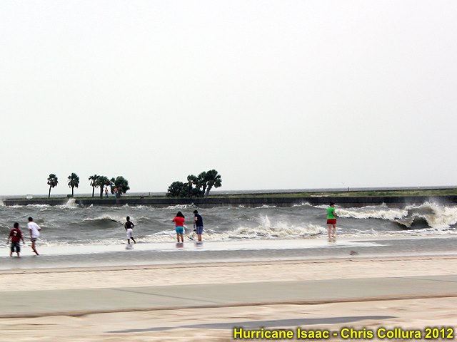
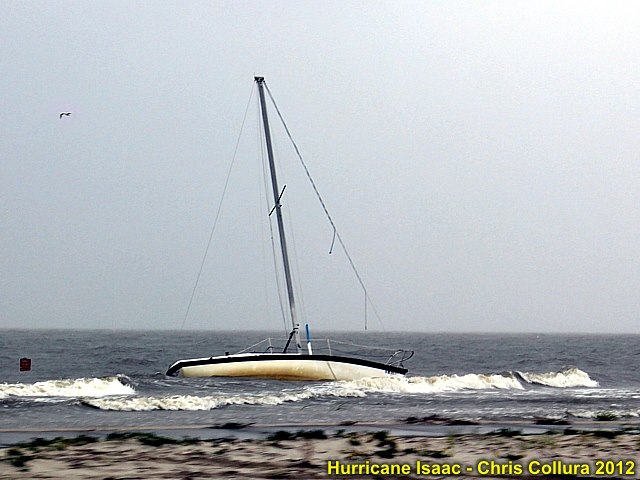
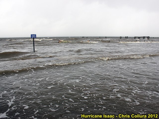
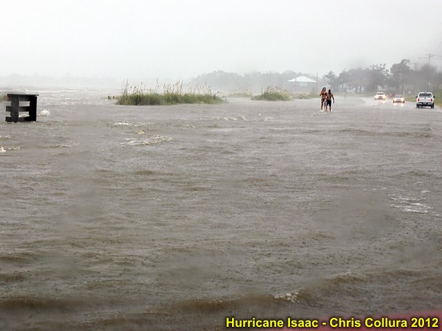
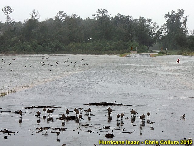
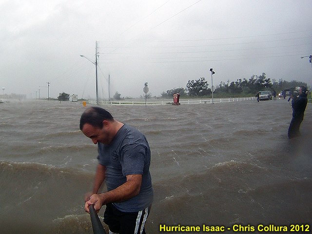
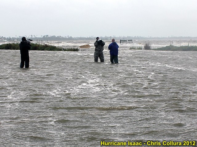
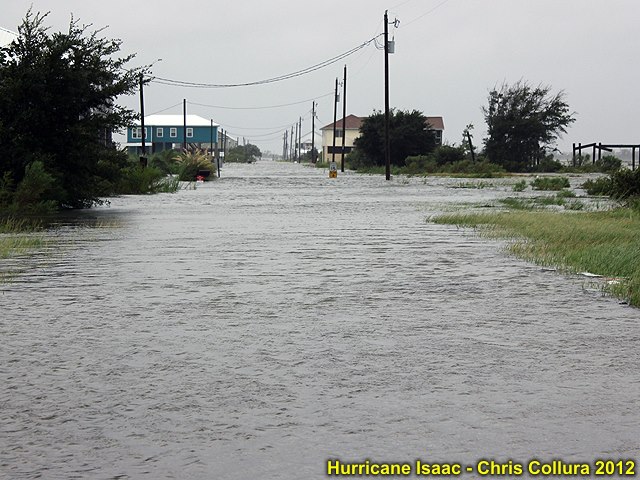
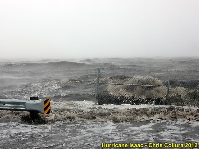
Lakeshore, MS at around 5 PM CDT in Hurricane Isaac storm surge!
Posted: Aug 28, 2012, 3:20 PM
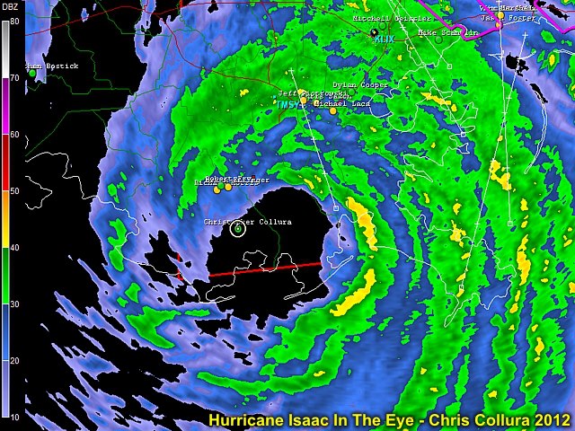
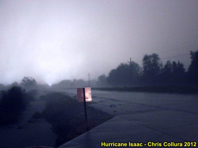
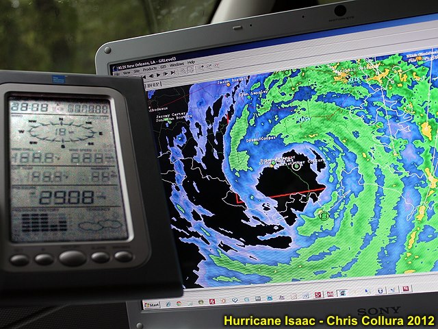
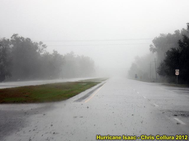
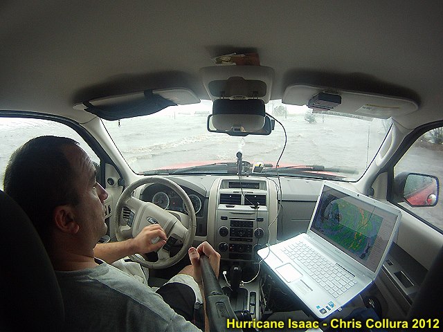
South of Chauvin, LA ... In the eye (warm, foggy, waiting for sunrise). Hurricane Isaac, Aug 29, 2012.
Posted: Aug 29, 2012, 3:20 AM
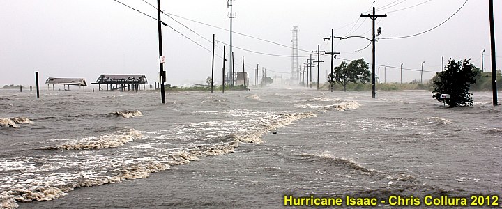
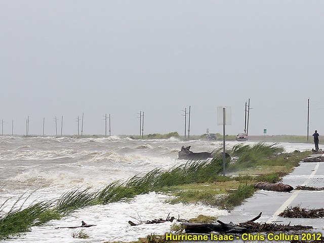
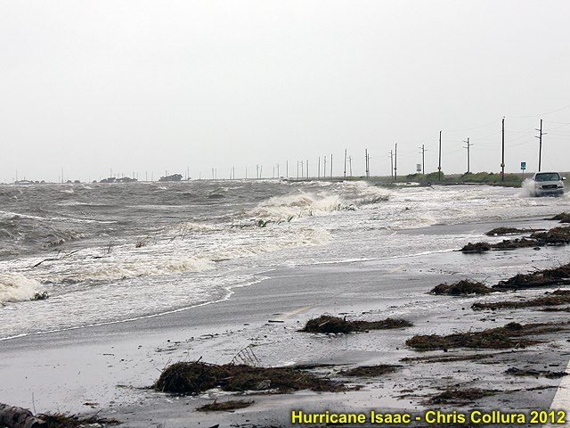
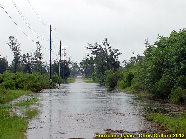
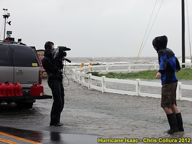
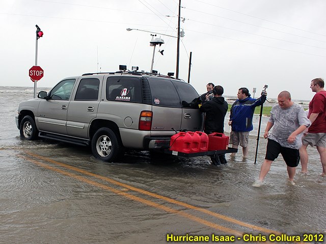
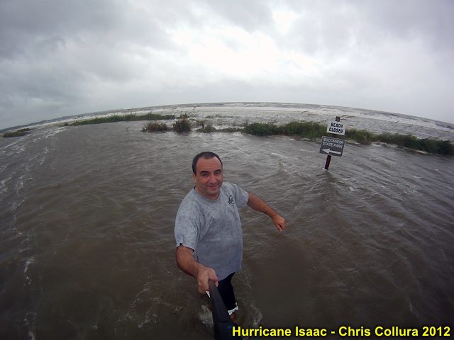
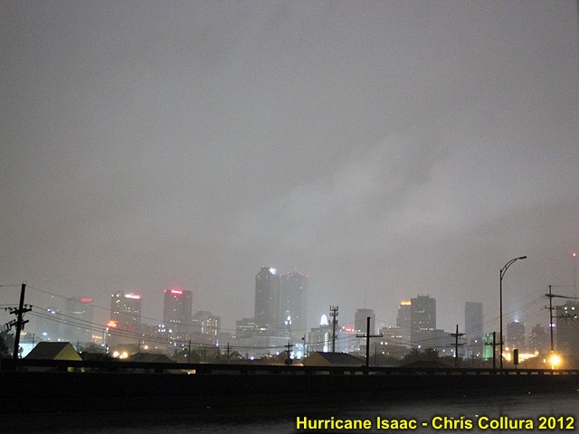
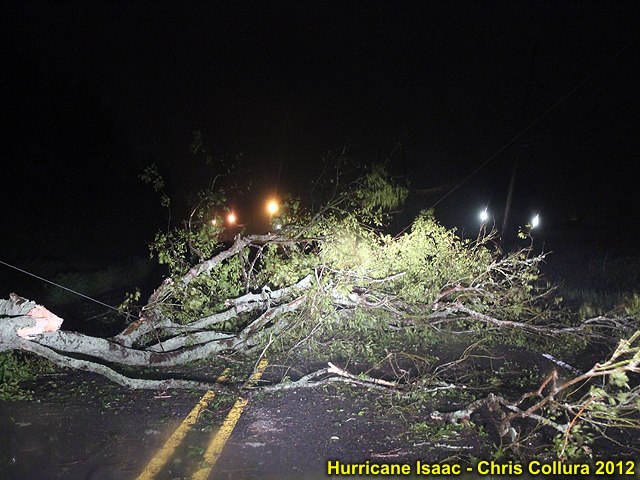
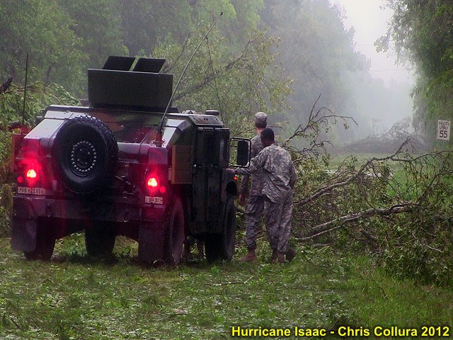
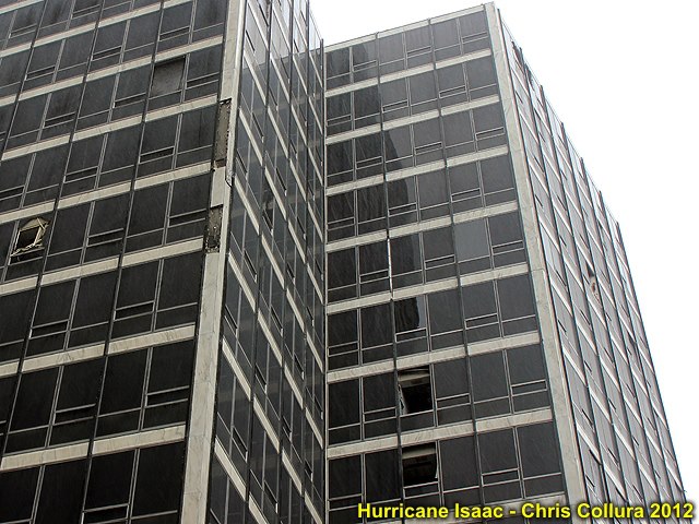
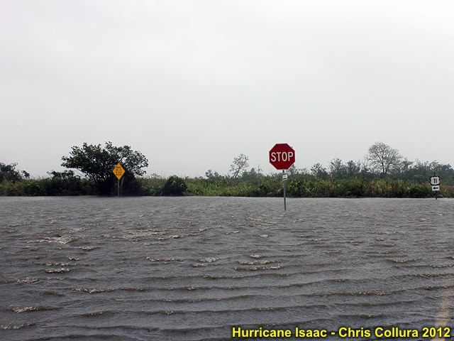
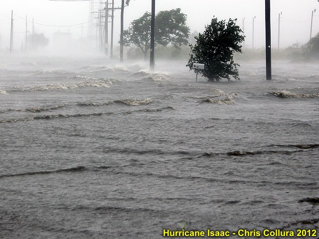
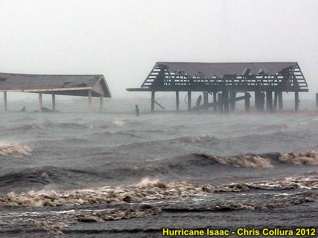
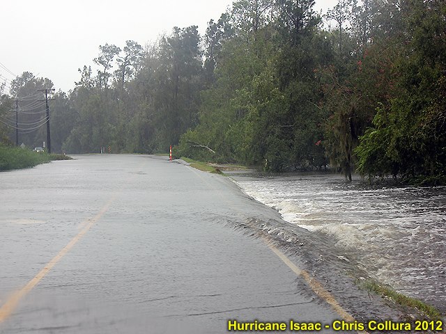
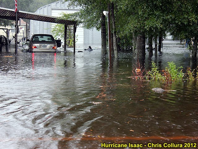
Storm surge on the morning of August 29, 2012 off I-10 southeast of New Orleans, Louisiana with winds gusting over 80 MPH. This was about 50 miles or so east of the eye of Hurricane Isaac.
Posted: Aug 30, 2012, 10:52 AM
Posted: Sep 2, 2012, 11:19 AM
Posted: Sep 2, 2012, 11:22 AM
Posted: Sep 2, 2012, 11:22 AM

Posted: Sep 2, 2012, 11:22 AM
Posted: Sep 2, 2012, 11:22 AM
Posted: Sep 2, 2012, 11:22 AM
Posted: Sep 2, 2012, 11:22 AM

Posted: Sep 2, 2012, 11:22 AM
Posted: Sep 2, 2012, 11:22 AM
Posted: Sep 2, 2012, 11:23 AM
Posted: Sep 2, 2012, 11:23 AM
Posted: Sep 2, 2012, 11:23 AM

Posted: Sep 2, 2012, 11:23 AM
Posted: Sep 2, 2012, 11:23 AM

Posted: Sep 2, 2012, 11:23 AM

Posted: Sep 2, 2012, 11:23 AM
Posted: Sep 2, 2012, 11:23 AM
Posted: Sep 2, 2012, 11:23 AM
Posted: Sep 2, 2012, 11:23 AM
Posted: Sep 2, 2012, 11:23 AM
Posted: Sep 2, 2012, 11:23 AM

Posted: Sep 2, 2012, 11:23 AM
Posted: Sep 2, 2012, 11:23 AM
Posted: Sep 2, 2012, 11:23 AM

Posted: Sep 2, 2012, 11:23 AM

Posted: Sep 2, 2012, 11:23 AM

Posted: Sep 2, 2012, 11:23 AM

Posted: Sep 2, 2012, 11:23 AM

Posted: Sep 2, 2012, 11:23 AM
Posted: Sep 2, 2012, 11:23 AM
Posted: Sep 2, 2012, 11:24 AM
Posted: Sep 2, 2012, 11:24 AM
Posted: Sep 2, 2012, 11:24 AM
Posted: Sep 2, 2012, 11:24 AM
Posted: Sep 2, 2012, 11:24 AM

Posted: Sep 2, 2012, 11:24 AM

Posted: Sep 2, 2012, 11:24 AM
Posted: Sep 2, 2012, 11:24 AM

Posted: Sep 2, 2012, 11:24 AM
Posted: Sep 2, 2012, 11:24 AM

Posted: Sep 2, 2012, 11:24 AM
Posted: Sep 2, 2012, 11:24 AM
Posted: Sep 2, 2012, 11:24 AM

Posted: Sep 2, 2012, 11:24 AM
Posted: Sep 2, 2012, 11:24 AM
Posted: Sep 2, 2012, 11:24 AM
Posted: Sep 2, 2012, 11:24 AM
Posted: Sep 2, 2012, 11:24 AM
Posted: Sep 2, 2012, 11:24 AM
Posted: Sep 2, 2012, 11:24 AM
Posted: Sep 2, 2012, 11:24 AM
Posted: Sep 2, 2012, 11:24 AM

Posted: Sep 2, 2012, 11:24 AM
Posted: Sep 2, 2012, 11:25 AM
Posted: Sep 2, 2012, 11:25 AM
Posted: Sep 2, 2012, 11:25 AM
Posted: Sep 2, 2012, 11:25 AM

Posted: Sep 2, 2012, 11:25 AM
Posted: Sep 2, 2012, 11:25 AM
Posted: Sep 2, 2012, 11:25 AM
Posted: Sep 2, 2012, 11:25 AM
Posted: Sep 2, 2012, 11:25 AM
Posted: Sep 2, 2012, 11:25 AM
Posted: Sep 2, 2012, 11:25 AM

Posted: Sep 2, 2012, 11:25 AM
Posted: Sep 2, 2012, 11:25 AM

Posted: Sep 2, 2012, 11:25 AM

Posted: Sep 2, 2012, 11:25 AM
Posted: Sep 2, 2012, 11:25 AM
Posted: Sep 2, 2012, 11:25 AM

Posted: Sep 2, 2012, 11:25 AM

Posted: Sep 2, 2012, 11:25 AM
Posted: Sep 2, 2012, 11:25 AM
Posted: Sep 2, 2012, 11:25 AM
Posted: Sep 2, 2012, 11:25 AM
Posted: Sep 2, 2012, 11:25 AM
Posted: Sep 2, 2012, 11:25 AM
Posted: Sep 2, 2012, 11:26 AM
Posted: Sep 2, 2012, 11:26 AM

Posted: Sep 2, 2012, 11:26 AM

Posted: Sep 2, 2012, 11:26 AM
Posted: Sep 2, 2012, 11:26 AM
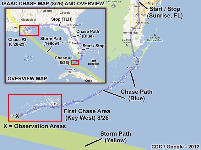
TS Isaac chase map #1 (FL Keys on 8/26) and overview.
Posted: Sep 3, 2012, 11:16 AM
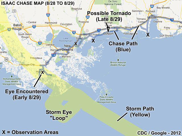
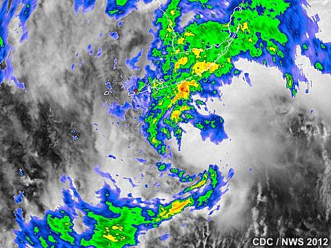
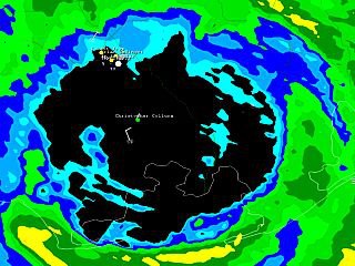
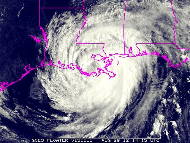
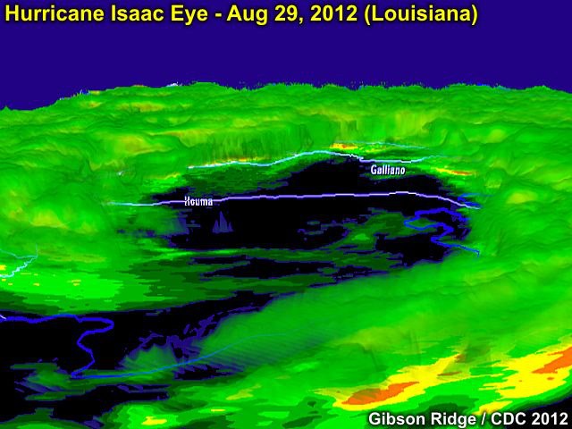
Hurricane Isaac chase in N Gulf Coast from 8/28 to 8/29.
Posted: Sep 3, 2012, 11:16 AM
Posted: Sep 4, 2012, 5:52 PM
Posted: Sep 4, 2012, 5:52 PM
Posted: Sep 4, 2012, 5:52 PM
Posted: Sep 4, 2012, 5:52 PM
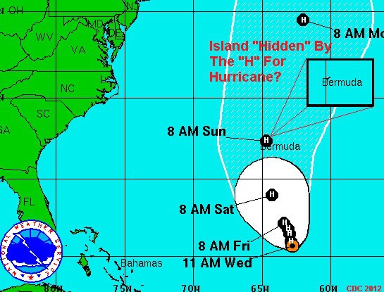
Oh boy! Bermuda is a small "target" (for hurricanes) in a BIG ocean. But so are "trailer homes" (as with tornadoes) in the huge expanses of the US Great Plains! If this verifies anyone there will be looking at blue sky through the eye of a "fish" storm Sunday morning!
Posted: Sep 5, 2012, 10:57 AM
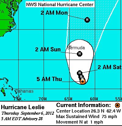
Looks like a MISS for Bermuda by a long-shot (and the drier western side too). Leslie will be a cat-2 well east of the island with Michael (a "fish" storm far to the east 'doing a 2010' to NEVER affect land) becoming the first Major hurricane of 2012. Big difference a day makes and that's why I never got tickets.
Posted: Sep 6, 2012, 7:07 AM
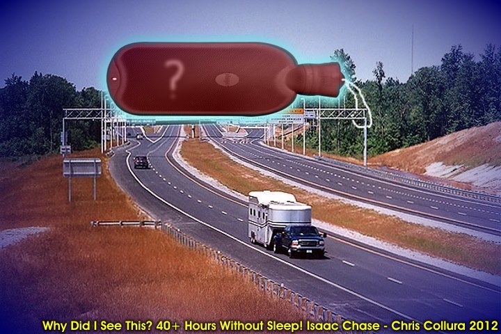
This (simulated image) was funny (but actually VERY serious / dangerous). After 40+ hour without sleep, driving through Florida, I would see the next exit / intersection and a red "hot water bottle" atop it = My cue to PULL OVER and get some REST! These are hallucinations and your body telling you you NEED SLEEP now. If you ignore them, you'll fall asleep behind the wheel (microsleep) and probably be killed! Not uncommon after hurricane chasing and wrapping up such a chase!
Posted: Sep 23, 2012, 12:37 PM
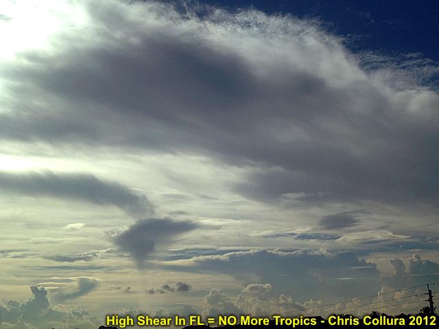
Not looking like much? Look closely, you can clearly see how the winds (over S FL) go from L/V at 20k Ft and increase to over 80 above 30 k Ft ... I guess NO more hurricanes for WHILE ;-(
Posted: Sep 28, 2012, 5:58 PM
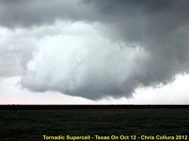
Tornadic supercell storm (wall cloud / RFD clear slot) near Plainview, Texas (Hale County) at about 7PM on Oct 12, 2012.
Posted: Oct 13, 2012, 1:32 AM
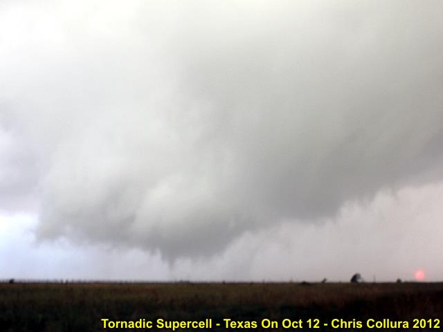
Tornadic supercell storm (Multi vortex tornado #2) near Plainview, Texas (Hale County) at about 7PM on Oct 12, 2012.
Posted: Oct 13, 2012, 1:32 AM
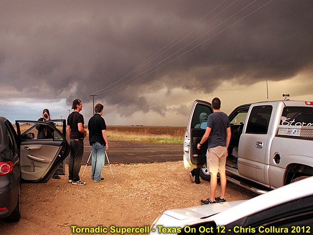
Tornadic supercell storm and groups of chasers near Plainview, Texas (Hale County) at about 7PM on Oct 12, 2012.
Posted: Oct 13, 2012, 1:32 AM

Tornadic supercell storm (first brief tornado) near Plainview, Texas (Hale County) at about 7PM on Oct 12, 2012.
Posted: Oct 13, 2012, 1:32 AM

Tornadic supercell storm (intense CG lightning) near Plainview, Texas (Hale County) at about 7PM on Oct 12, 2012.
Posted: Oct 13, 2012, 1:32 AM
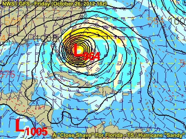
Here comes "Sandy" - October 26, 2012.
Posted: Oct 24, 2012, 5:58 PM
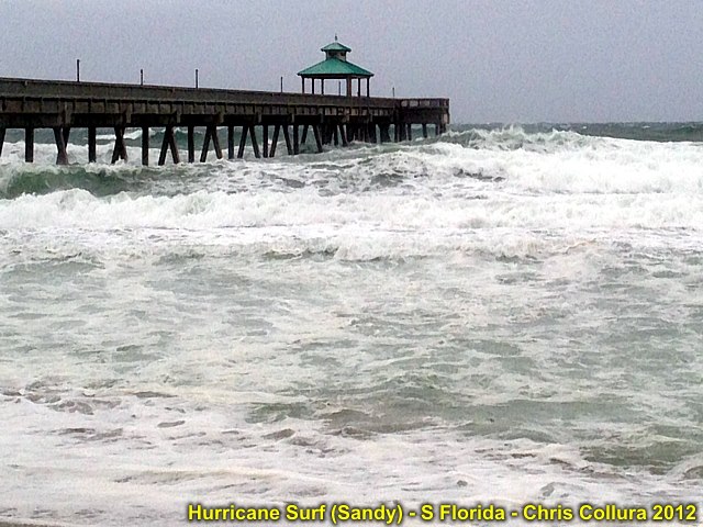
Big waves at Deerfield Beach, FL on October 25, 2012. This was while Hurricane Sandy in the Bahamas.
Posted: Oct 25, 2012, 4:12 PM

Off Boynton Beach ... October 26 2012. Hurricane Sandy surf.
Posted: Oct 26, 2012, 7:25 PM
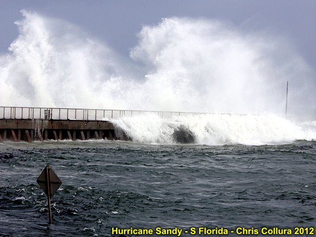
Boynton Inlet ... October 26 2012. Hurricane Sandy surf.
Posted: Oct 26, 2012, 7:25 PM
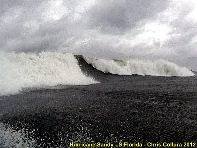
Off Boynton Beach ... October 26 2012. Hurricane Sandy surf.
Posted: Oct 26, 2012, 7:25 PM

Off Boynton Beach ... October 26 2012. Hurricane Sandy surf.
Posted: Oct 26, 2012, 7:25 PM

Posted: Oct 27, 2012, 5:43 AM

Posted: Oct 27, 2012, 5:43 AM
Posted: Oct 27, 2012, 5:43 AM

Posted: Oct 27, 2012, 5:43 AM
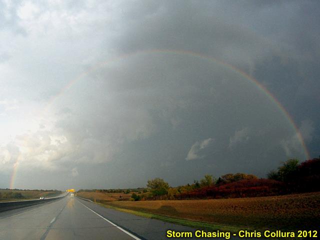
Posted: Oct 27, 2012, 5:43 AM
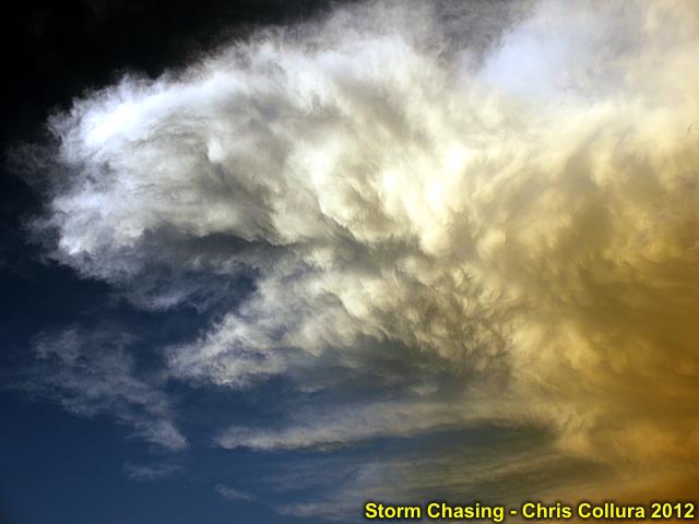
Posted: Oct 27, 2012, 5:43 AM
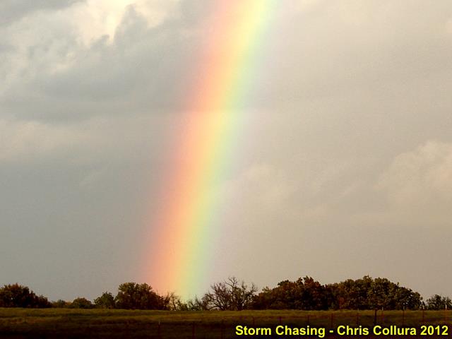
Posted: Oct 27, 2012, 5:43 AM
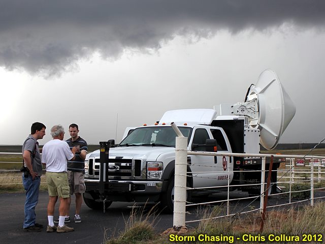
Posted: Oct 27, 2012, 5:43 AM

Posted: Oct 27, 2012, 5:48 AM

Posted: Oct 27, 2012, 3:46 PM

Posted: Oct 27, 2012, 3:47 PM
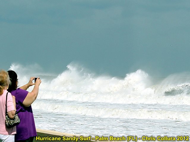
Posted: Oct 27, 2012, 3:47 PM
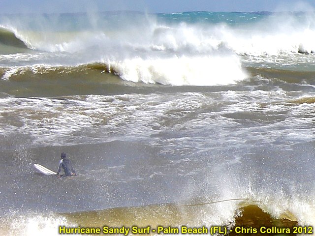
Posted: Oct 27, 2012, 3:47 PM
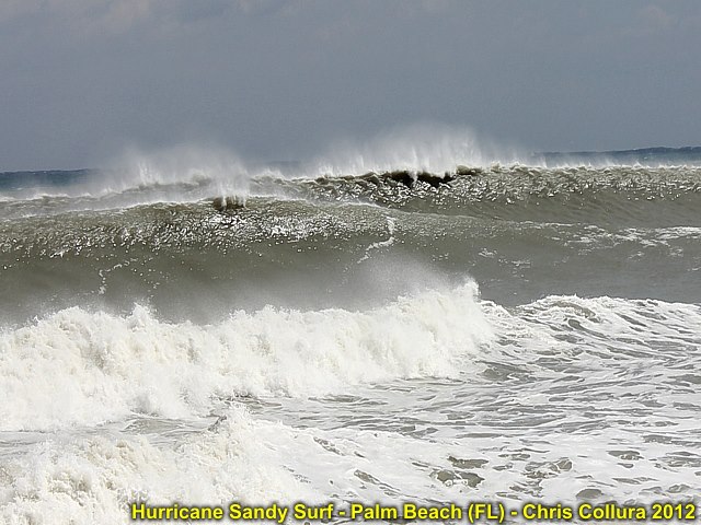
Posted: Oct 27, 2012, 3:47 PM
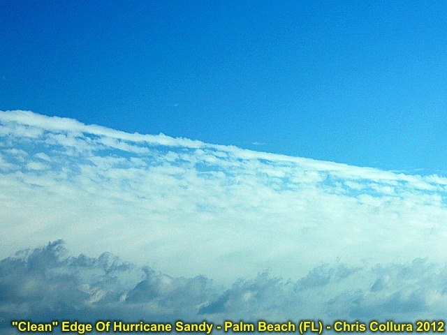
Edge of hurricane Sanady looking NE from Palm Beach, Florida (10/27).
Posted: Oct 27, 2012, 3:47 PM
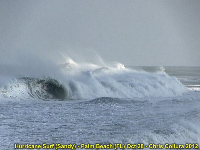
Posted: Oct 28, 2012, 6:37 PM
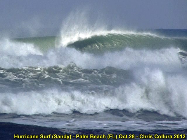
Posted: Oct 28, 2012, 6:37 PM
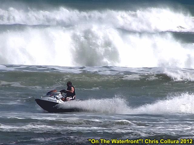
Posted: Oct 28, 2012, 6:37 PM
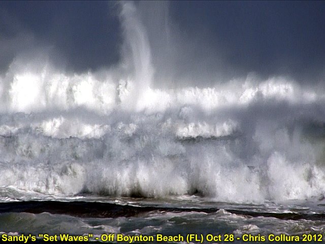
When do you ever see the "ocean" like THIS?
Posted: Oct 28, 2012, 6:37 PM
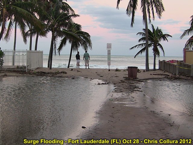
Posted: Oct 28, 2012, 6:37 PM
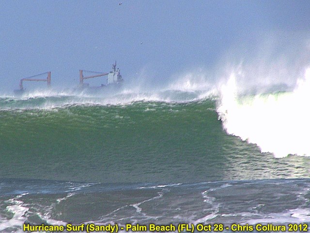
Posted: Oct 28, 2012, 6:37 PM
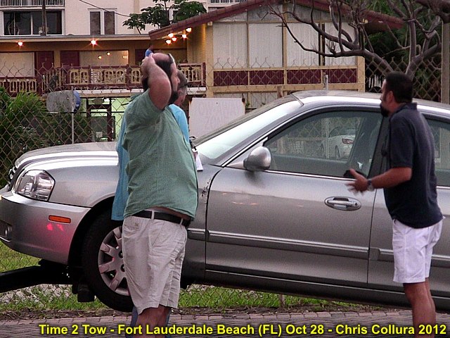
They got towed (hook n' book) in 10 seconds!
Posted: Oct 28, 2012, 6:37 PM
Generated by Chris Collura on Wednesday, April 15, 2020 at 11:31 AM UTC-07:00
HTML File "index29.htm" (Facebook) - Developed By Chris Collura
To Return To The HOME Page Of This Site Click The "INDEX.HTM" Link Here!


