
Facebook Photo Album Storm Chasing 2011
(Storm Chasing 2011 Sky-Chaser Chris Collura Facebook Posts)
[ PARENT INDEX ]
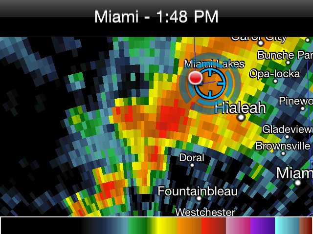
Weakly rotating thunderstorm near Miami on January 21, 2011.
Posted: Jan 21, 2011, 12:43 PM
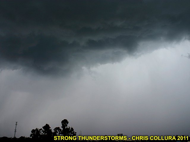
Strong thunderstorm near Miami, FL - January 21, 2011.
Posted: Jan 21, 2011, 12:43 PM
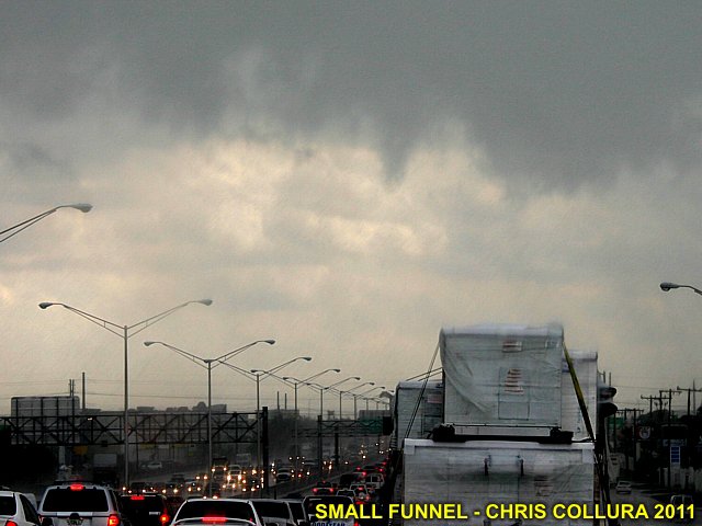
Small funnel on SW side of thunderstorm near Miami, FL - January 21, 2011.
Posted: Jan 21, 2011, 12:43 PM

January 17, 2011 (Near Miami, FL) - Squall line / bow segment.
Posted: Jan 21, 2011, 12:48 PM
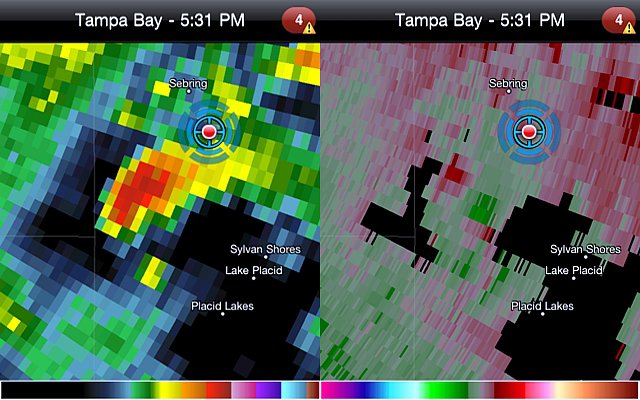
Isolated but intense supercell storm developing SW of Sebring, FL on 1/25/2011.
Posted: Jan 25, 2011, 8:15 PM
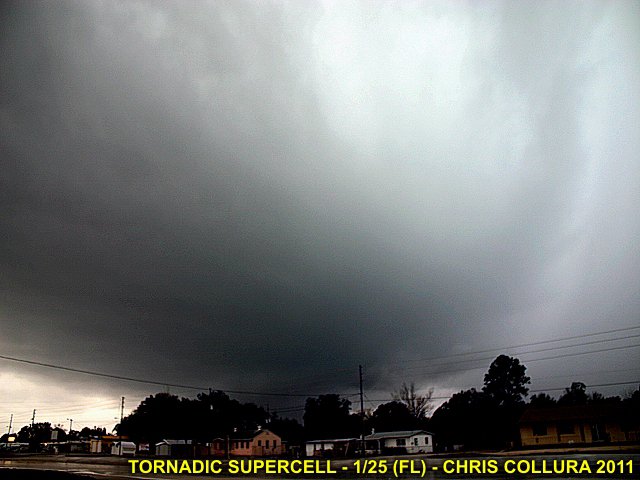
Visual of intense supercell storm developing SW of Sebring, FL on 1/25/2011. View is to the SW.
Posted: Jan 25, 2011, 8:15 PM
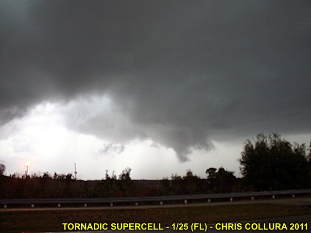
Wall cloud and RFD region of intense supercell storm SE of Sebring, FL on 1/25/2011. View is to the NW.
Posted: Jan 25, 2011, 8:15 PM

Possible tornado associated with supercell storm E of Sebring, FL on 1/25/2011. View is to the NNW. Sorry about the low light!
Posted: Jan 25, 2011, 8:15 PM
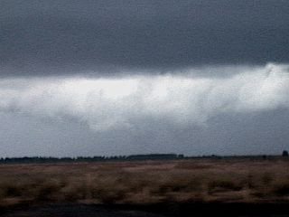
Developing tornado associated with supercell storm E of Sebring, FL on 1/25/2011. View is to the N.
Posted: Jan 26, 2011, 9:43 AM
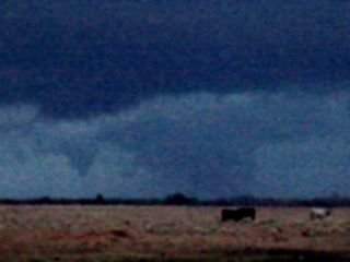
Possible tornado associated with supercell storm E of Sebring, FL on 1/25/2011. View is to the NNW.
Posted: Jan 26, 2011, 9:43 AM

High clouds associated with strong jet stream winds aloft over southern Florida (late January 2011).
Posted: Jan 28, 2011, 9:59 AM
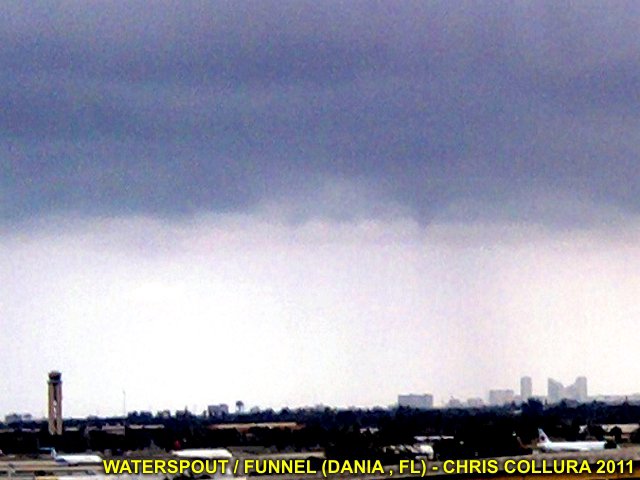
Funnel / waterspout off Dania Beach, FL (looking SE from NE side of Ft Lauderdale airport) on Feb 24, 2011.
Posted: Feb 24, 2011, 4:37 PM

Hatched 15% on Day 2 SPC outlook issued March 30, 2011. Ever see a "hatched" area in Central / South FL?
Posted: Mar 30, 2011, 9:52 AM

Chasing on March 28, 2011 north of Miami, FL with small supercell storm / wall cloud.
Posted: Mar 30, 2011, 9:54 AM
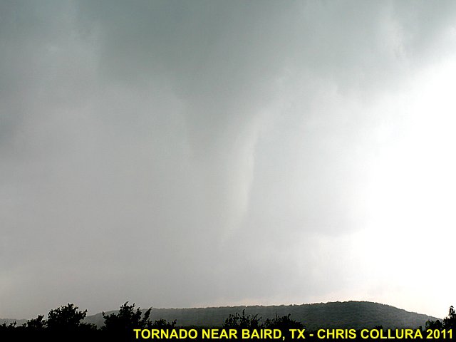
Tornado near Baird / east of Abilene, TX on Apr 24, 2011.
Posted: Apr 24, 2011, 9:28 PM

Tornado near Baird / east of Abilene, TX on Apr 24, 2011.
Posted: Apr 24, 2011, 9:28 PM
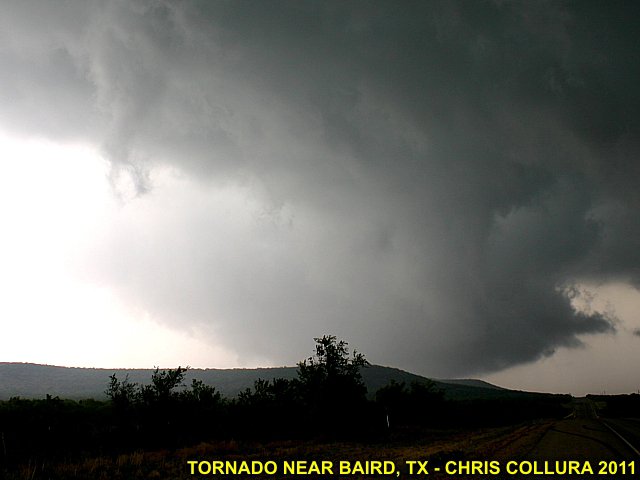
Large wall cloud / tornado near Baird / east of Abilene, TX on Apr 24, 2011.
Posted: Apr 24, 2011, 9:28 PM
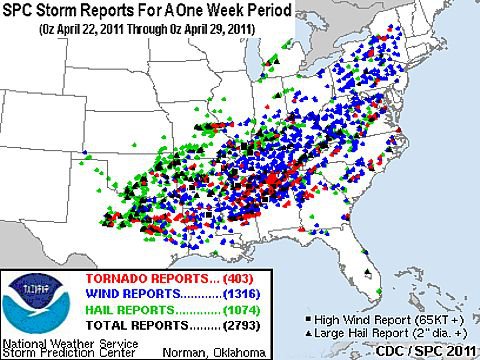
Week's worth of storm reports with April 27 in the middle of that period!
Posted: Apr 29, 2011, 6:20 PM
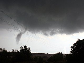
April 24 near Baird, TX.
Posted: Apr 29, 2011, 6:20 PM

Storm chase map for April 24.
Posted: Apr 29, 2011, 6:20 PM
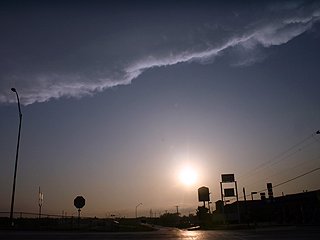
Dryline near Abilene, TX (April 24).
Posted: Apr 29, 2011, 6:20 PM
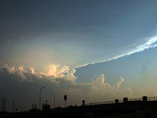
Supercell with back-sheared anvil south of Abilene, TX (April 24).
Posted: Apr 29, 2011, 6:20 PM
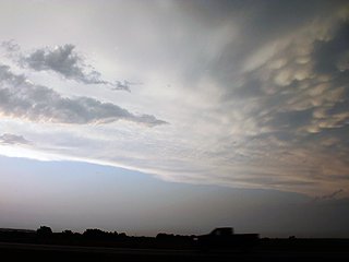
Mammatus north of I-20 in Texas on April 24, 2011.
Posted: Apr 29, 2011, 6:20 PM
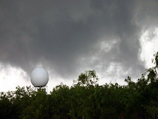
Wall cloud and Dyess AFB radar. April 24 in Texas.
Posted: Apr 29, 2011, 6:20 PM
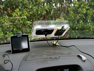
Chase setup in rental car (April 24, 2011) in TX.
Posted: Apr 29, 2011, 6:20 PM
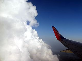
Flying through convective clouds into New Orleans on April 23.
Posted: Apr 29, 2011, 6:20 PM
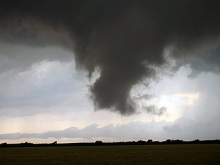
April 24 near Baird, TX. Rotating wall cloud / funnel.
Posted: Apr 29, 2011, 6:20 PM
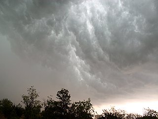
April 24 near Baird, TX. "Whale's mouth" of gust front shelf.
Posted: Apr 29, 2011, 6:20 PM
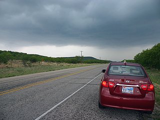
April 24 near Baird, TX.
Posted: Apr 29, 2011, 6:20 PM
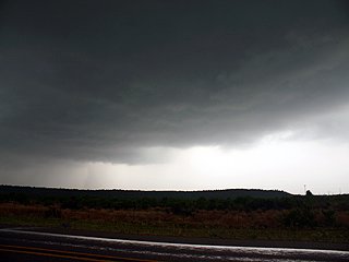
April 24 near Baird, TX.
Posted: Apr 29, 2011, 6:20 PM

Lucky chase vehicle plate!
Posted: Apr 29, 2011, 6:20 PM
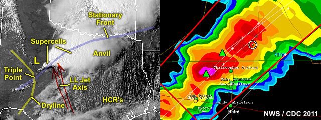
Annotated storm diagram (Apr 24) for TX chase.
Posted: Apr 29, 2011, 6:20 PM
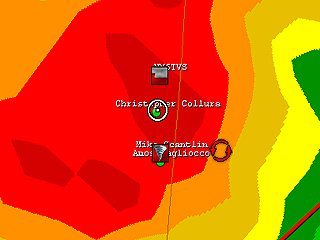
April 24 near Baird, TX. Radar image with my location.
Posted: Apr 29, 2011, 6:20 PM
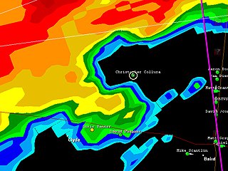
April 24 near Baird, TX. Radar image with me in the "Hook"!
Posted: Apr 29, 2011, 6:20 PM

SPC information for TX chase on May 24.
Posted: Apr 29, 2011, 6:20 PM
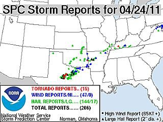
Storm reports for April 24.
Posted: Apr 29, 2011, 6:21 PM
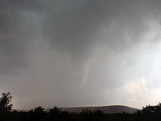
April 24 near Baird, TX. Tornado.
Posted: Apr 29, 2011, 6:21 PM

April 24 near Baird, TX. Tornado.
Posted: Apr 29, 2011, 6:21 PM

April 24 near Baird, TX. Tornado.
Posted: Apr 29, 2011, 6:21 PM

April 24 near Baird, TX. Developing tornado.
Posted: Apr 29, 2011, 6:21 PM
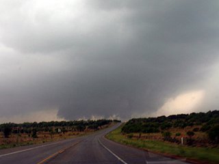
April 24 near Baird, TX. Wall cloud and developing tornado.
Posted: Apr 29, 2011, 6:21 PM
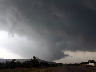
April 24 near Baird, TX. Wall cloud, RFD slot, possible large tornado.
Posted: Apr 29, 2011, 6:21 PM
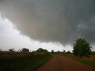
April 24 near Baird, TX. Developing tornado.
Posted: Apr 29, 2011, 6:21 PM
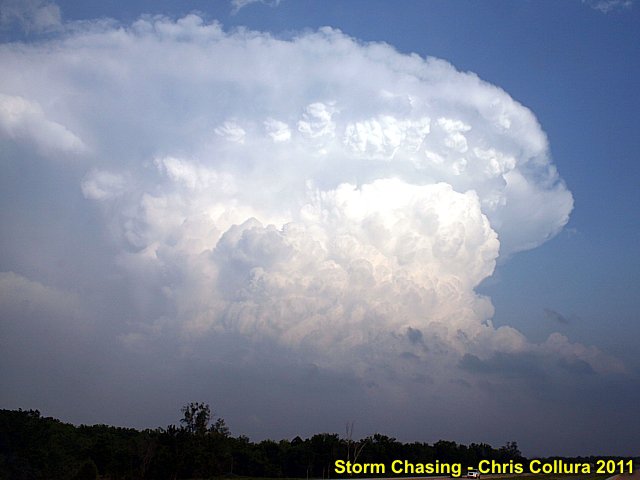
Near Sulphur, OK - May 21, 2011. Supercell.
Posted: May 21, 2011, 10:10 PM

Near Sulphur, OK - May 21, 2011.
Posted: May 21, 2011, 10:11 PM

Near Sulphur, OK - May 21, 2011.
Posted: May 21, 2011, 10:11 PM
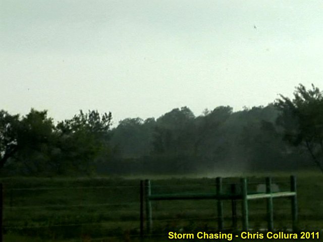
Near Sulphur, OK - May 21, 2011. Tornado contacting ground.
Posted: May 21, 2011, 10:11 PM

Near Sulphur, OK - May 21, 2011. Tornado.
Posted: May 21, 2011, 10:11 PM

Near Sulphur, OK - May 21, 2011.
Posted: May 21, 2011, 10:11 PM
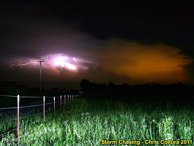
Distant supercell over Oklahoma City (May 22, 2011).
Posted: May 22, 2011, 11:21 PM
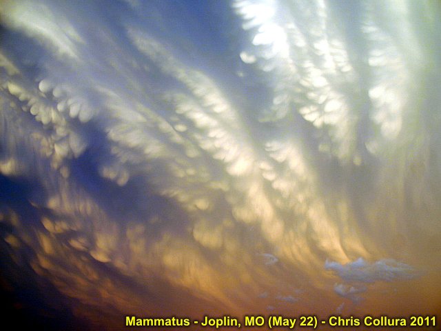
Mammatus over Joplin, MO after violent tornado struck (May 22, 2011).
Posted: May 22, 2011, 11:21 PM
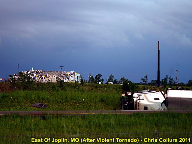
Damage in Joplin, MO (May 22, 2011).
Posted: May 22, 2011, 11:21 PM
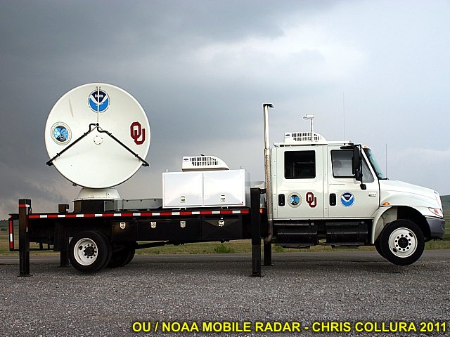
Mobile radar truck in OK (May 23, 2011).
Posted: May 23, 2011, 10:26 PM
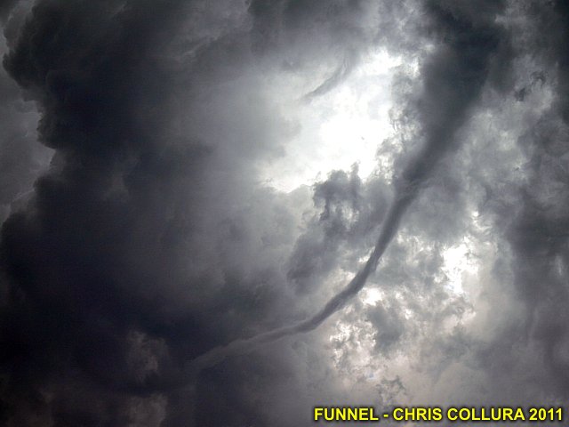
Long narrow funnel on LP supercell near Arapaho, OK (May 23, 2011).
Posted: May 23, 2011, 10:26 PM
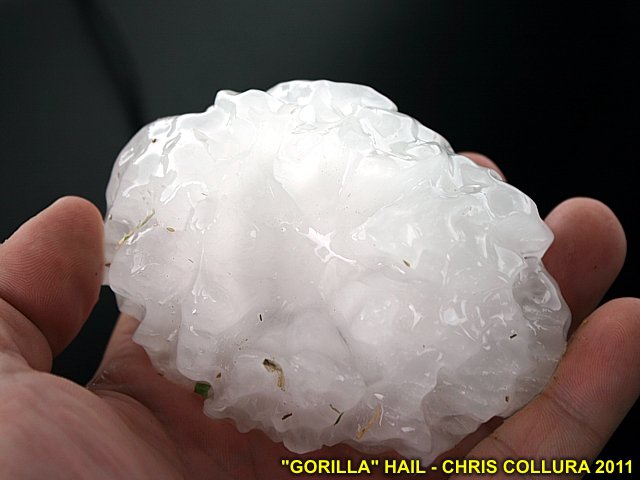
Huge hail in OK (May 23, 2011).
Posted: May 23, 2011, 10:26 PM
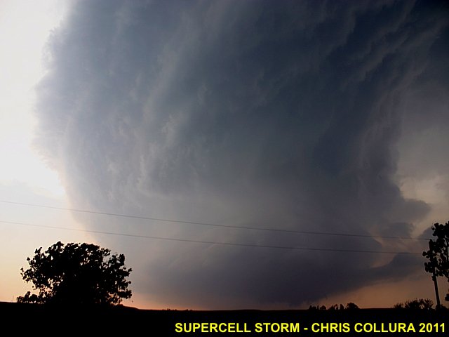
Beautiful "barber-pole" updraft of supercell in OK (May 23, 2011).
Posted: May 23, 2011, 10:26 PM
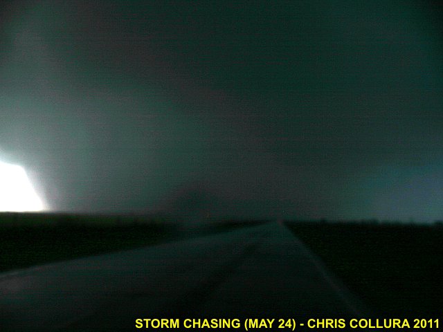
Rain-wrapped large tornado south of Calumet, OK (May 24, 2011).
Posted: May 24, 2011, 11:09 PM
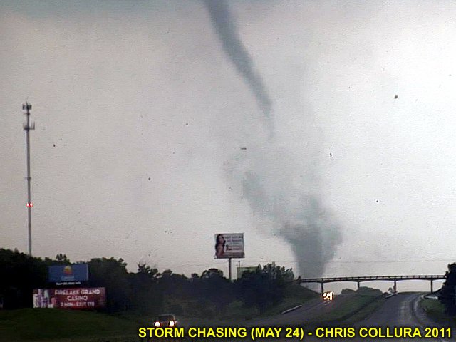
Tornado on I-40 near Shawnee, OK (May 24, 2011).
Posted: May 24, 2011, 11:10 PM

Destroyed truck after tornado near Shawnee, OK (May 23, 2011).
Posted: May 24, 2011, 11:10 PM
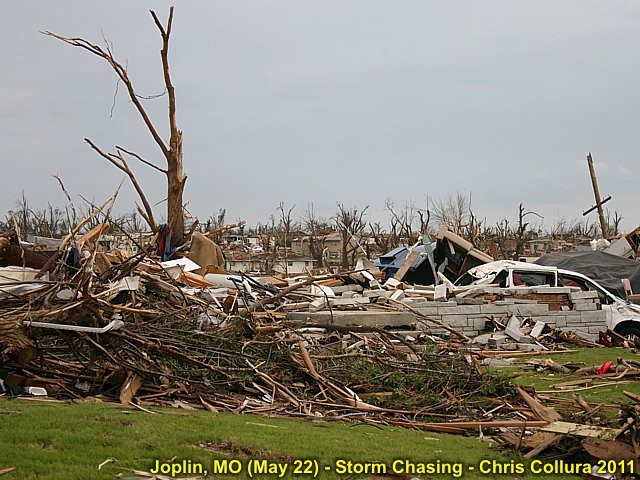
Damage in Joplin, MO from May 22, 2011 EF-5 tornado.
Posted: May 26, 2011, 7:22 AM
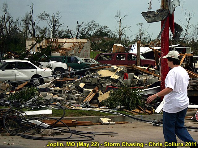
Damage in Joplin, MO from May 22, 2011 EF-5 tornado.
Posted: May 26, 2011, 7:22 AM
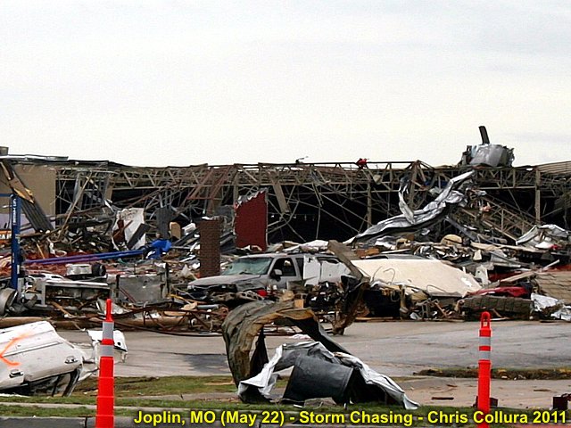
Damage in Joplin, MO from May 22, 2011 EF-5 tornado.
Posted: May 26, 2011, 7:22 AM
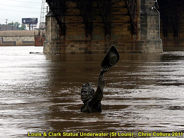
Very high water on Mississippi River near Eads Bridge in St Louis, MO. This is a statue of two men on a boat, only his head is above the water!
Posted: May 26, 2011, 9:02 PM

Damage in Joplin, MO from May 22, 2011 EF-5 tornado. Trees debarked.
Posted: May 27, 2011, 12:01 PM
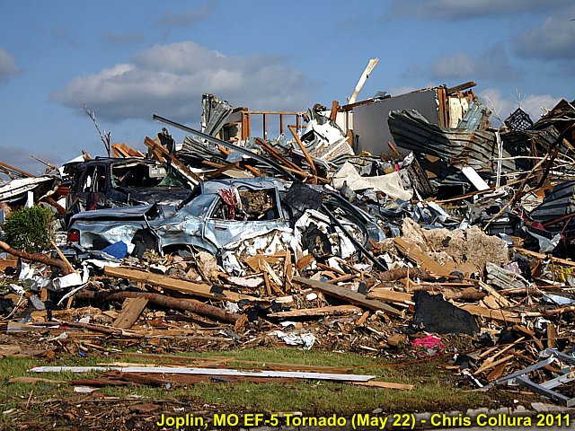
Damage in Joplin, MO from May 22, 2011 EF-5 tornado. 132 dead and 156 missing when this picture was taken.
Posted: May 27, 2011, 12:01 PM
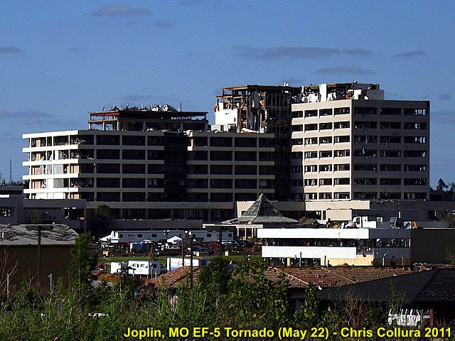
Damage in Joplin, MO from May 22, 2011 EF-5 tornado. St John's medical center destroyed / gutted.
Posted: May 27, 2011, 12:01 PM
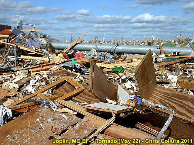
Damage in Joplin, MO from May 22, 2011 EF-5 tornado. Remnants of 2-story home.
Posted: May 27, 2011, 12:01 PM
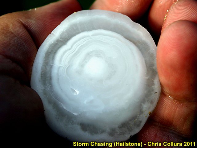
Hailstone from LP supercell storm NW of Tipton, Kansas (May 29, 2011).
Posted: May 29, 2011, 10:09 PM

Weakening LP storm with "green hail color" NW of Tipton, Kansas (May 29, 2011).
Posted: May 29, 2011, 10:09 PM
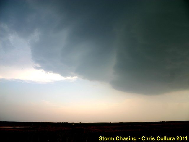
Front (SE Side) of LP storm NW of Tipton, Kansas (May 29, 2011).
Posted: May 29, 2011, 10:09 PM
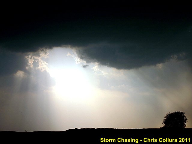
RFD (Rear Flank Downdraft) clear-slot on LP storm NW of Tipton, Kansas (May 29, 2011).
Posted: May 29, 2011, 10:09 PM
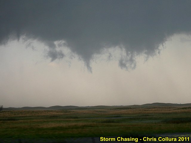
Funnel - May 30, 2011 (Nebraska Sandhills).
Posted: May 31, 2011, 8:12 AM

Hail cracks windshield - May 30, 2011 (Nebraska Sandhills).
Posted: May 31, 2011, 8:14 AM
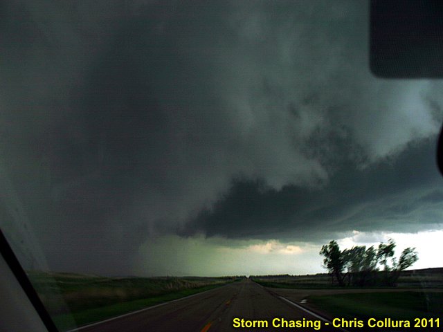
Developing tornado (far lower left, just before losing window to baseball hail) - May 30, 2011 (Nebraska Sandhills).
Posted: May 31, 2011, 8:15 AM

Hp supercell - May 30, 2011 (Nebraska Sandhills).
Posted: May 31, 2011, 8:17 AM

By "battle scars" - May 30, 2011 (Nebraska Sandhills).
Posted: May 31, 2011, 1:36 PM
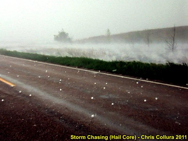
Big hail with spashes in canal / ditch - May 30, 2011 (Nebraska Sandhills).
Posted: May 31, 2011, 1:36 PM
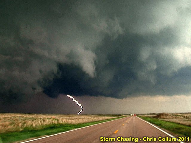
CG lightning strike on tornadic HP supercell - May 30, 2011 (Nebraska Sandhills).
Posted: May 31, 2011, 1:37 PM
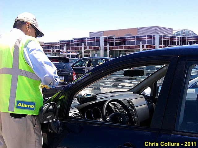
"Wooow ... Holy cow ... At least this is NOT 'your' car!"
Posted: May 31, 2011, 2:09 PM
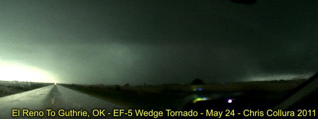
May 24, 2011 ... Canadian County, OK. Yup, this was rated EF-5 too.
Posted: Jun 3, 2011, 3:49 PM
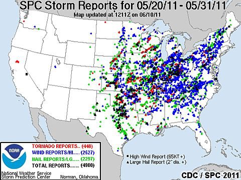
Composite of storm reports from May 20 through May 31, 2011. The red "dots" are tornadoes - Marking tornado alley's central and eastern portions clearly.
Posted: Jun 10, 2011, 5:37 PM
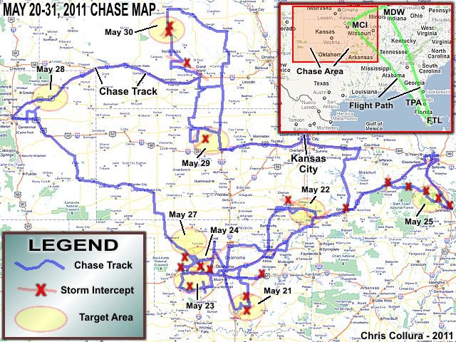
My storm chase map for May 20 through May 31, 2011 ... Nearly 6,000 miles!
Posted: Jun 10, 2011, 5:37 PM
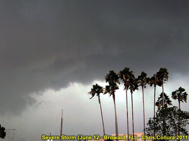
Severe cell approaching Sunrise, FL - June 12, 2011 ~ 4 PM.
Posted: Jun 12, 2011, 6:29 PM
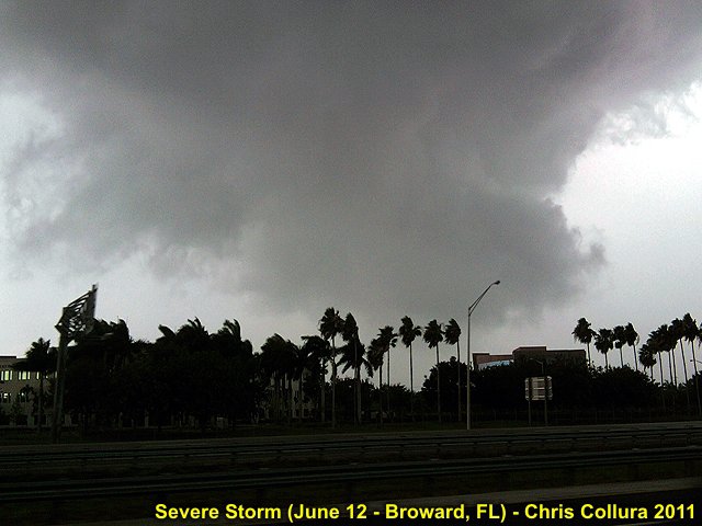
Wall cloud in severe cell near Sunrise / Weston, FL - June 12, 2011 ~ 4 PM.
Posted: Jun 12, 2011, 6:29 PM
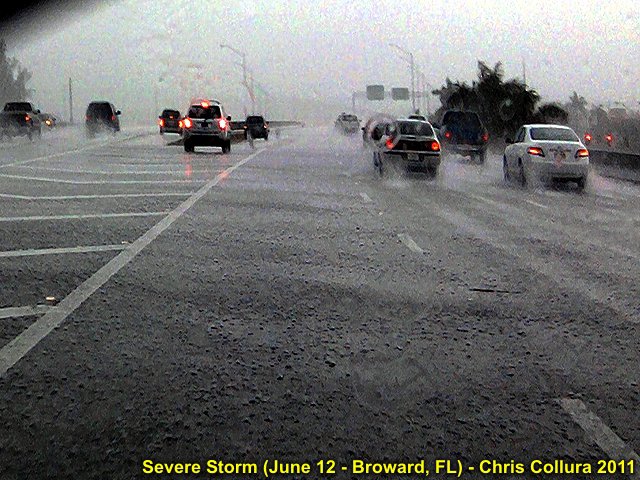
Hail on roadway (at least 1" but melting fast) behind the severe thunderstorm cell along I-595 near Weston, FL - June 12, 2011 ~ 4:15 PM.
Posted: Jun 12, 2011, 6:29 PM
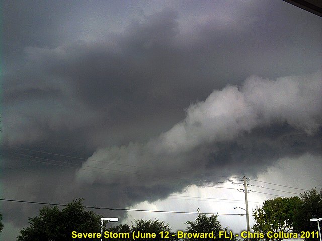
Updraft base of and shelf-cloud of severe thunderstorm cell approaching Sunrise, FL - June 12, 2011 ~ 4 PM.
Posted: Jun 12, 2011, 6:29 PM
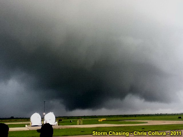
Weakly rotating storm / weak funnels - Clweiston, FL on 7-2-2011.
Posted: Jul 2, 2011, 5:39 PM

Weakly rotating storm - No skydiving today - Clweiston, FL on 7-2-2011.
Posted: Jul 2, 2011, 5:39 PM
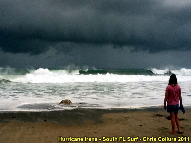
Large waves (10 to 15 feet) at Deerfield Beach, FL on 8-25-2011 from fring-effects of Hurricane Irene (about 200 miles away). Note dark feeder bands as well.
Posted: Aug 25, 2011, 8:14 PM
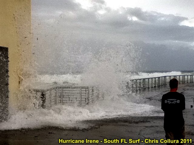
Waves crashing over seawall in Boynton Beach, FL on 8-25-2011 from fringe effects of Hurricane Irene.
Posted: Aug 25, 2011, 8:14 PM
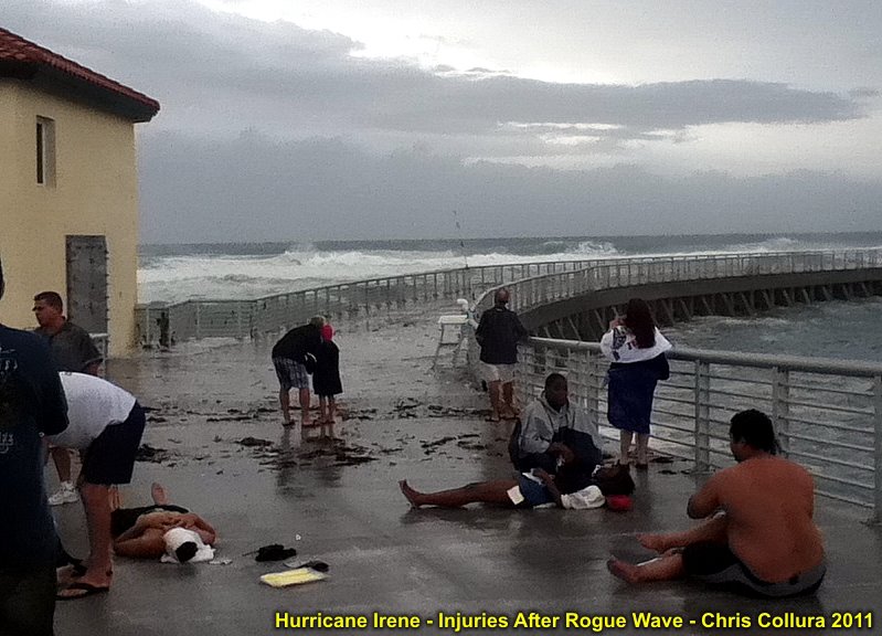
Injured people after large rogue wave overtakes seawall at Boynton Beach Inlet on 8-25-2011 from Irene's hurricane surf.
Posted: Aug 25, 2011, 8:15 PM
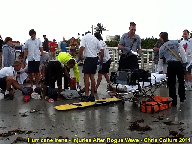
Helping injured people after large rogue wave overtakes seawall at Boynton Beach Inlet on 8-25-2011 from Irene's hurricane surf.
Posted: Aug 25, 2011, 8:15 PM
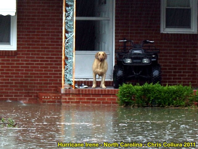
Hurricane Irene in North Carolina on August 27, 2011. Flooded residence along Highway 70 near Symrna.
Posted: Aug 28, 2011, 12:27 PM

Hurricane Irene in North Carolina on August 27, 2011. Flooding even well inland along Highway 264.
Posted: Aug 28, 2011, 12:27 PM
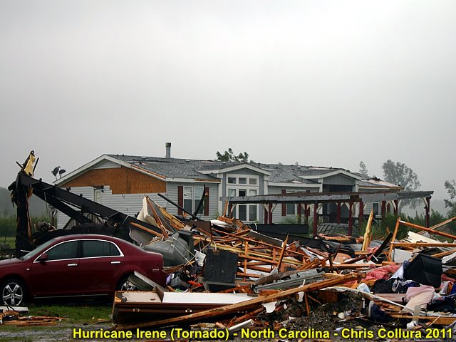
Hurricane Irene in North Carolina on August 27, 2011. Destroyed residence along Highway 64 east of Columbia from tornado spawned by Irene.
Posted: Aug 28, 2011, 12:27 PM
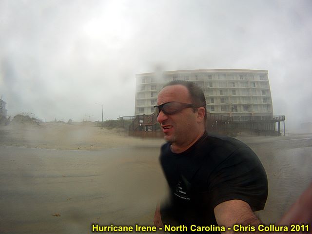
Hurricane Irene in North Carolina on August 27, 2011. Myself in 80 MPH sandblast in Nags Head.
Posted: Aug 28, 2011, 12:27 PM
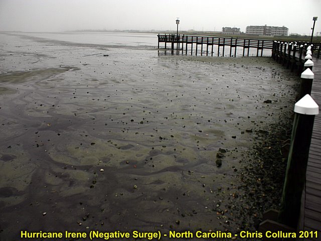
Hurricane Irene in North Carolina on August 27, 2011. Negative surge on Pamlico side of Nags Head (BELOW normal water level).
Posted: Aug 28, 2011, 12:27 PM
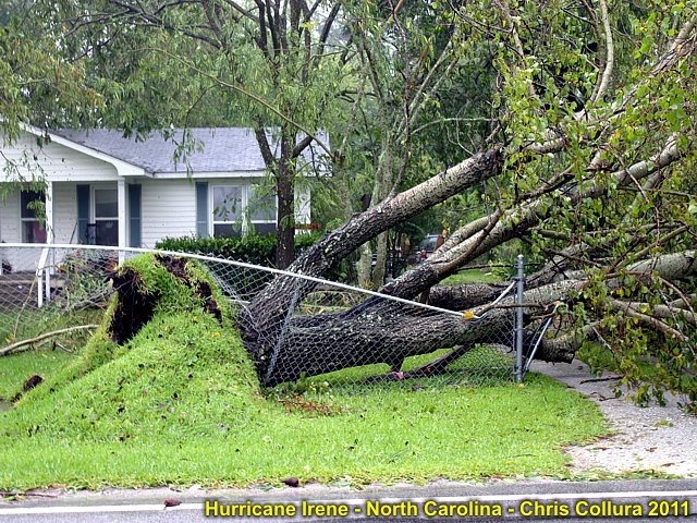
Hurricane Irene in North Carolina on August 27, 2011. Downed tree and destroyed fence along highway 17.
Posted: Aug 28, 2011, 12:27 PM
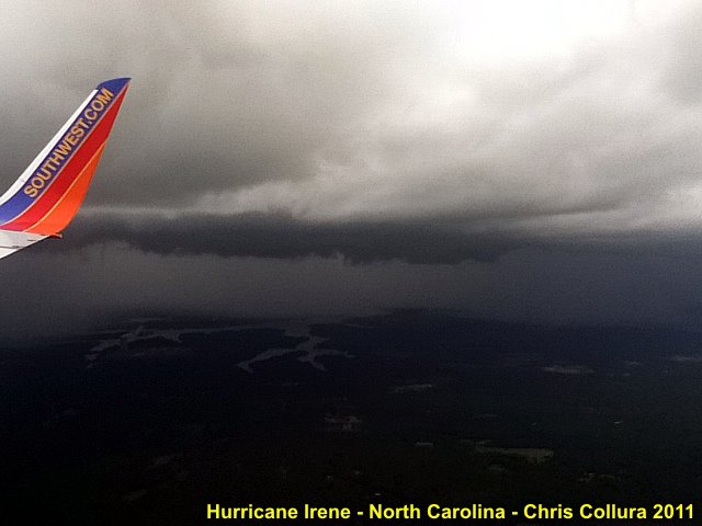
Hurricane Irene in North Carolina on August 26, 2011. Flying into Raleigh Airport (RDU) ahead of feeder bands.
Posted: Aug 28, 2011, 12:27 PM
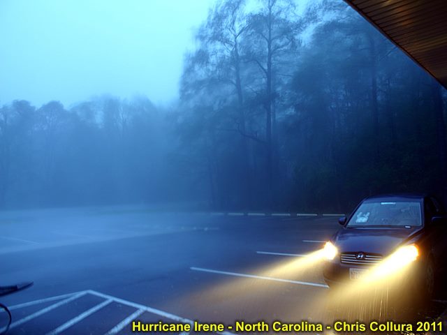
Hurricane Irene in North Carolina on August 27, 2011. Gusts to near 100 MPH near Symrna.
Posted: Aug 28, 2011, 12:27 PM
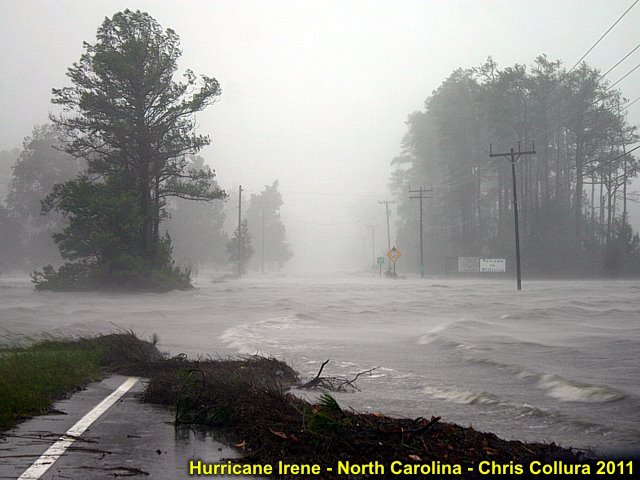
Hurricane Irene in North Carolina on August 27, 2011. Flooded roadway east of Symrna..
Posted: Aug 28, 2011, 12:27 PM
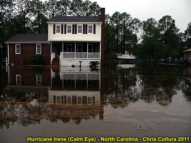
Hurricane Irene in North Carolina on August 27, 2011. Flooded property east of Beufort in calm eye of hurricane.
Posted: Aug 28, 2011, 12:28 PM
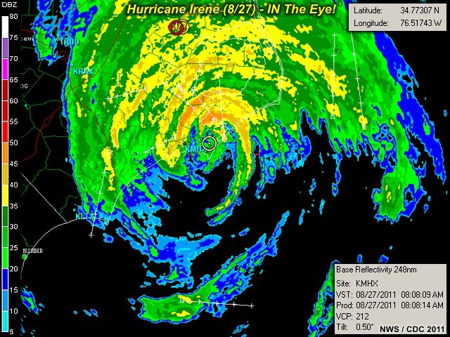
In the eye of hurricane Irene - Aug 27, 2011 in NC. GRLevel3 software showing a hurricane chaser "right where he want's to be"!
Posted: Sep 4, 2011, 12:40 PM
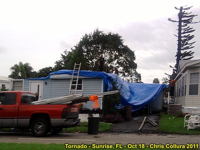
Damage in Sunrise, Florida after tornado on Oct 18, 2011.
Posted: Oct 19, 2011, 2:58 PM
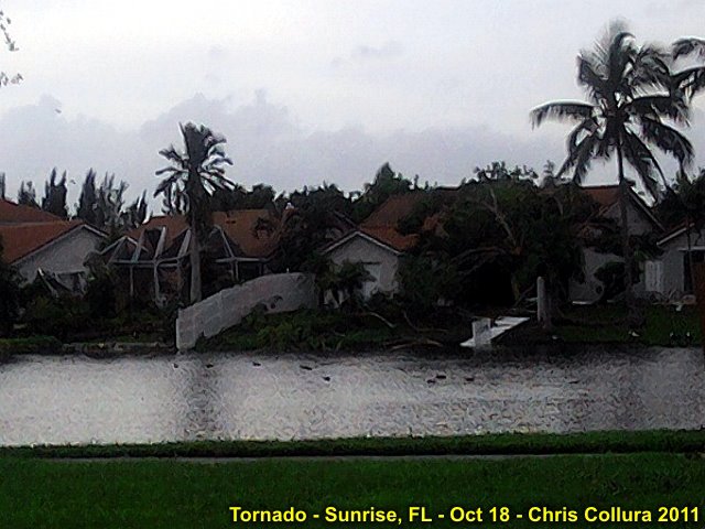
Damage in Sunrise, Florida after tornado on Oct 18, 2011.
Posted: Oct 19, 2011, 2:58 PM
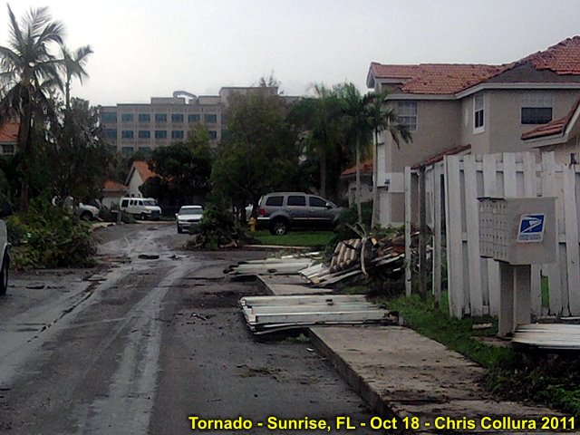
Damage in Sunrise, Florida after tornado on Oct 18, 2011.
Posted: Oct 19, 2011, 2:58 PM
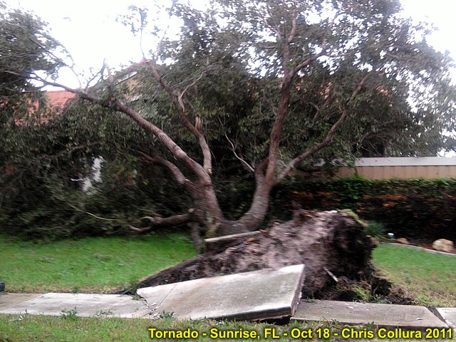
Damage in Sunrise, Florida after tornado on Oct 18, 2011.
Posted: Oct 19, 2011, 2:58 PM
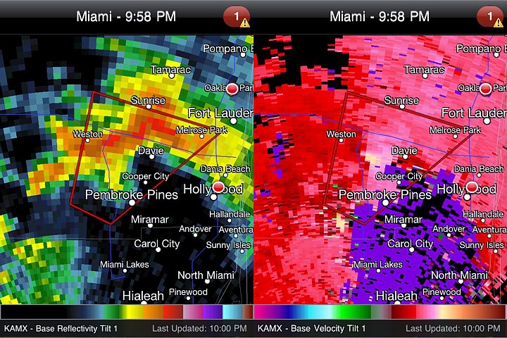
Radar (Reflectivity and Velocity) of a tornadic supercell in South Florida on Oct 18, 2011. Produced EF-2 tornado near Sunrise, Florida.
Posted: Oct 19, 2011, 2:58 PM
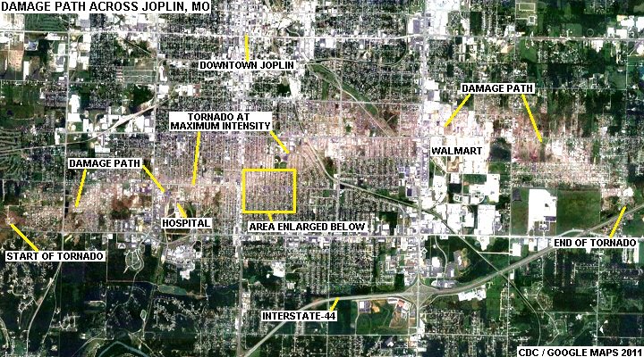
Joplin, MO tornado (May 22) damage path seen from aerial / satellite.
Posted: Oct 21, 2011, 8:13 AM
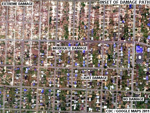
Closeup of Joplin, MO tornado (May 22) damage path showing intense gradient from total damage to no damage and damaged homes (blue tarps on roofs) in between.
Posted: Oct 21, 2011, 8:13 AM
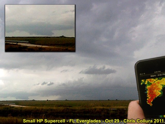
Small supercell storm experienced in Miami Dade county during the early evening of Oct 29, 2011 on the leading edge of the remnants of Rina (upper shear). This storm produced large wall cloud and some small funnels over the everglades.
Posted: Oct 28, 2011, 5:08 PM

Gale center off SE USA and big waves in Palm Beach County, FL on November 6, 2011.
Posted: Nov 6, 2011, 3:31 PM
Generated by Chris Collura on Wednesday, April 15, 2020 at 11:31 AM UTC-07:00
HTML File "index28.htm" (Facebook) - Developed By Chris Collura
To Return To The HOME Page Of This Site Click The "INDEX.HTM" Link Here!


