
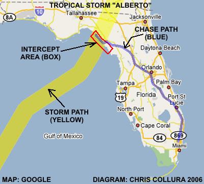
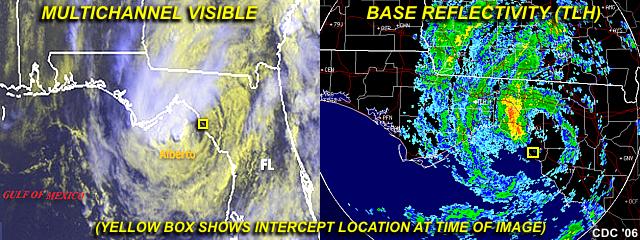
| This area shows pictures taken from the observations of tropical storm Alberto in the Florida Big-Bend Gulf coastal area. This tropical system showed some signs of becoming a hurricane during the night of June 12 to June 13 but managed to be a 65-70 MPH tropical storm as it was fighting wind shear above the system from a shortwave trough. The storm came ashore mid-day on June 13 in central Taylor County in the Big-Bend area of Florida's gulf coast as a 65-MPH tropical storm and a lowest central pressure of 995 MB (996 was measured by our equipment in the storm center). The chase was along the Gulf coastal stretch from Horseshoe Beach through Steinhatchee and about 10 miles northward along Beach Road / Highway 361. The calm center of the storm, although broad and diffuse, was experienced during this interception, along with damage south of where the center made landfall, which was mainly caused by storm surge flooding and 50-MPH+ onshore winds. This was a solo chase involving only myself, but did meet and speak to Doug Keisling, also chasing the storm from Minnesota. The chase trip logged about 1008 total miles! This chase was not bad for a "first chase" of a tropical cyclone for the 2006 Atlantic Hurricane Season. |
| CHASER NAME | HOME CITY | CALLSIGN | OCCUPATION |
| CHRIS COLLURA | MIRAMAR, FL | KG4PJN | COMPUTER ANALYST |
![]() Video Of tropical Storm Alberto
Video Of tropical Storm Alberto
![]() Timelapse Of Center Making Landfall (Cool!)
Timelapse Of Center Making Landfall (Cool!)
|
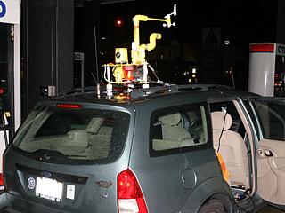
Here is a picture of my vehicle all set up and ready to chase tropical storm Alberto, the first named tropical storm of the 2006 Atlantic hurricane season! Here I am stopped in Ocala, FL (for fuel and data stop) while en-route to the primary target in Florida's Big-Bend area. |
|
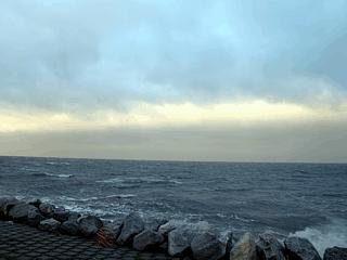
During sunrise, and with tropical storm Alberto still offshore, interesting colors appear in the low-level clouds looking southwest from Horseshoe Beach over the gulf of Mexico. Waves do not get too high ahead of such systems since the water offshore is very shallow. |
|
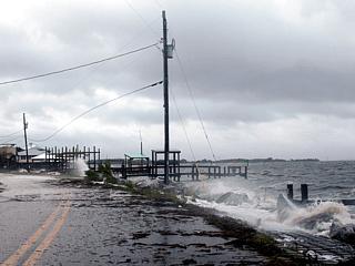
With the onset of tropical storm forced winds (about 40-MPH), some waves begin crashing over docks and onto the roadway at Horseshoe Beach, FL as powerlines whip in the winds. |
|
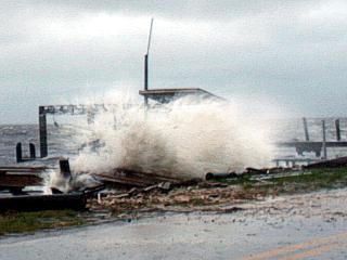
A wave crashes over a dock along the side of the roadway in Horseshoe beach, FL. |
|
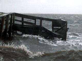
Most damage in Alberto was limited to immediate coastal structures, such as boats and docks. This dock was damaged by wave action in Horseshoe beach, FL. |
|
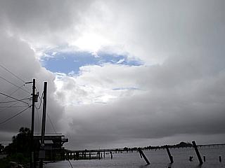
This is a picture taken in the center of tropical storm Alberto as it made landfall in Taylor County, FL around noon on June 13. The low clouds did actually break in the near calm winds of the storms broad "eye", allowing blue sky and sunshine to be seen. The lowest pressure of 996 MB was also measured at this time. |
|
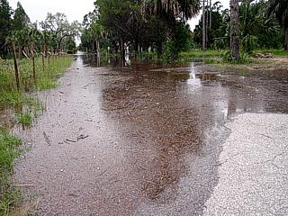
The most of the destructive effects of tropical storm Alberto were from flooding of seawater in storm surge that developed in 50-MPH (or higher) on shore winds south of where the center made landfall. In this picture, a street is completely underwater and storm surge flooding is threatening homes in Steinhatchee, Florida. |
|
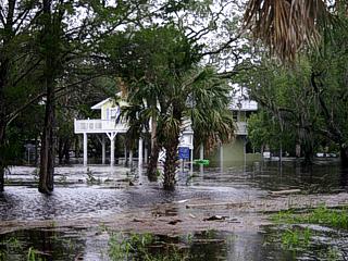
Here is another picture of flooded property in Steinhatchee, Florida. In this case, the home is on stilts, as were many in this flood prone area, and most likely was spared because of the higher elevation the stilts provide to protect the main structure of the home. |
|
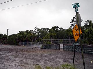
This picture shows more storm surge infiltrating into a roadway in Steinhatchee, Florida during tropical storm Alberto. |
|
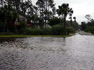
This is another picture of storm surge flooding, about 5 feet above normal water level of the Gulf of Mexico, flooding a street and threatening a home in Steinhatchee, Florida. |
HTML File "alb06.htm" - Developed By Chris Collura
To Return To The HOME Page Of This Site Click The "INDEX.HTM" Link Here!