
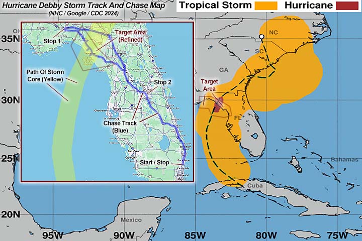
| Hurricane Debby was a category-one hurricane and hit the same area major hurricane Idalia during the Atlantic hurricane season of 2023, less than a year prior. The storm began as a disturbance over the greater Antilles and crossed much of Cuba, emerging into the southeastern Gulf of Mexico around August 3 as a tropical depression. The storm later intensified into a tropical storm, moving north and northwest, and eventually a minimal hurricane late in the day on August 4. Early on August 5, hurricane Debby made landfall in the Florida "Big-Bend" area, with maximum sustained winds of 80 MPH and a central pressure of 979 MB. Landfall was near Steinhatchee, west of Salem and Cross City in Taylor County, Florida. The storm continued to the NNE, now over land, encountering frictional drag and was cut off from the warm Gulf waters. Debby weakened, as it continued to the Georgia late in the day of August 5, to a tropical storm. The tropical storm eventually re-emerged into the Atlantic Ocean off the SE USA on August 6 near South Carolina, meandered offshore, and made a second landfall early in the morning on August 8 near Bulls Bay, SC. By this point the storm structure was large and disorganized, and devoid of any deep convection, due to slight vertical shear, cooler shelf waters, and dry air. Debby quickly weakened on Aug 8, and became a post-tropical low shortly after, and merged with a frontal system the following day. This storm caused some wind damage, severe flooding, and storm surge from Florida "Big-Bend" coastal areas and points northeastwards through the Carolinas and SE USA. Unfortunately, 6 people were killed and damage is unknown at this point. Note - This page may take a while to load on some SLOWER connections! |
HURRICANE DEBBY - AGAIN IN THE FLORIDA BIG-BEND
| CHASER NAME | HOME CITY | CALLSIGN | OCCUPATION |
| CHRIS COLLURA | DEERFIELD BEACH, FL | KG4PJN | COMPUTER ANALYST |
|
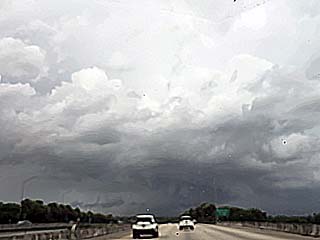
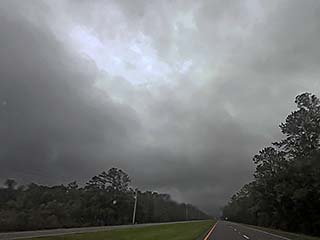
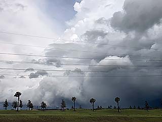
The sky grows more ominous southeast of Orlando, Florida on August 4, 2024 as tropical storm Debby reaches hurricane intensity well west of the area. This is one of a few tornado-warned storms northwest of Fort Pierce during the afternoon. The view is to the north and northwest. |

|
This is the Florida State Capitol building in Tallahassee late in the day on August 4. I was planning to stay there, and move just east and southeast towards the coast by mid morning, but it turned out I had to check out early and head farther east sooner. Also, one of my chase partners, Derek S, was planning on staying there as he was coming west from New Orleans after work, but could not make it with the sooner landfall expected. |

|
Inside of my vehicle during the early morning of August 5, around 5 AM, in Salem, Florida, which is between Perry and Cross City. This was a very good decision leaving Tallahassee and I am waiting for the storm to arrive. |
|
Strong winds pick up outside of the storm eyewall northeast of Keaton, Beach. Unfortunately law enforcement had a curfew in place and a "zero tolerance" for anyone on the road, including media and storm chasers. |

|
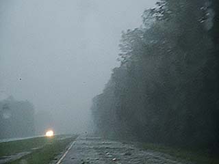
Strong winds arrive (offshore flow, from the east and southeast) and heavy rains with power out in Salem, Florida at around 6 AM, |
|
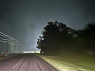
Going south towards Cross-City along highway 19 / 27. Just passed through eyewall and into edge of eye. Rain stops. In the distance, the other side of the eye and eyewall is lit by a power flash. |
|
First light and sunrise in the calmer eye of Hurricane Debby, as it makes landfall near Steinhatchee, Florida around 7 AM. Winds were still gusty and turbulent in the eye, but the rain completely let up, and breaks can be seen through the low cloud layer. |
|
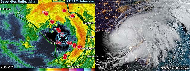
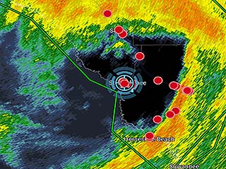
Image of base reflectivity radar product (out of Tallahassee) and my GPS location (blue cross-hairs), in the center of the eye. |
|
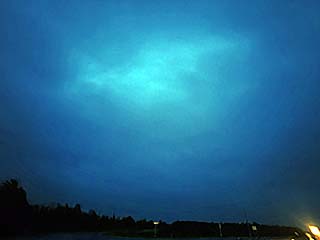
Brief glimpse of hazy blue sky in eye (overhead foreground) and other side (backside eyewall) in the distance (lower right) denoted by darker sky. |
|
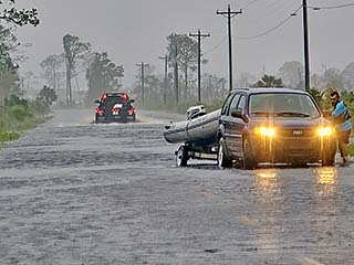
Rescue efforts along the roadway to Horseshoe Beach, Florida as the backside of the hurricane hits. The road is completely covered by the storm surge. This was about 2 miles inland. |
|
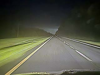
Rear eyewall and backside of the hurricane during the morning of August 5, looking south towards Cross City. Winds are back up, gusting near 80 MPH at times, from the west. |
|
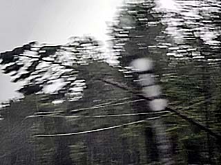
Trees topple (one barely missed my vehicle) on Highway 19 / 27 northwest of Cross City. |
|
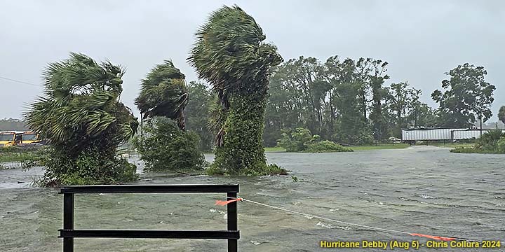
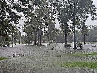
Fresh water flooding in Cross City, Florida. |
|
View of convective band while exiting the hurricane and northwest of Orlando, Florida during the afternoon of August 5. |
HTML File "debby24.htm" - Developed By Chris Collura
To Return To The HOME Page Of This Site Click The "INDEX.HTM" Link Here!